Maps associated with the Trumpington Inclosure Award
For interactive digital maps which incorporate information from all the sources below, click here.
1. The map enclosed with the Award itself. Dated 1804, drawn by Edward Gibbons. A copy of this is also in the archives at Trumpington Hall. Two extracts showing the village at the time:
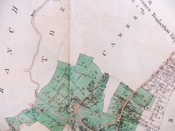
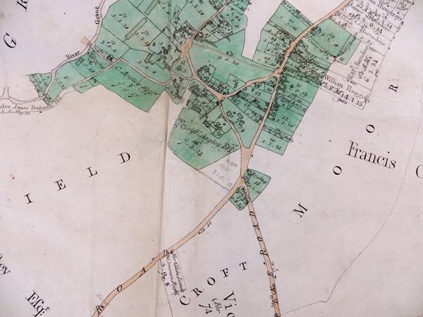
Images courtesy of Cambridgeshire Archives
2. An undated map in the Trumpington Hall archives. This probably pre-dates the Award map, as the original sinuous course of Hobson’s Brook is shown as well as the later “canalised” version that we see today.
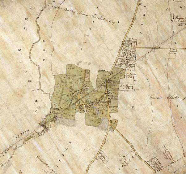
Image courtesy of Antony Pemberton
3. A second map in the Cambridgeshire archives, dated 1804 and signed “Gibbons”. This shows the post-enclosure fields within the Pemberton holdings, including the land tenanted from Trinity College.
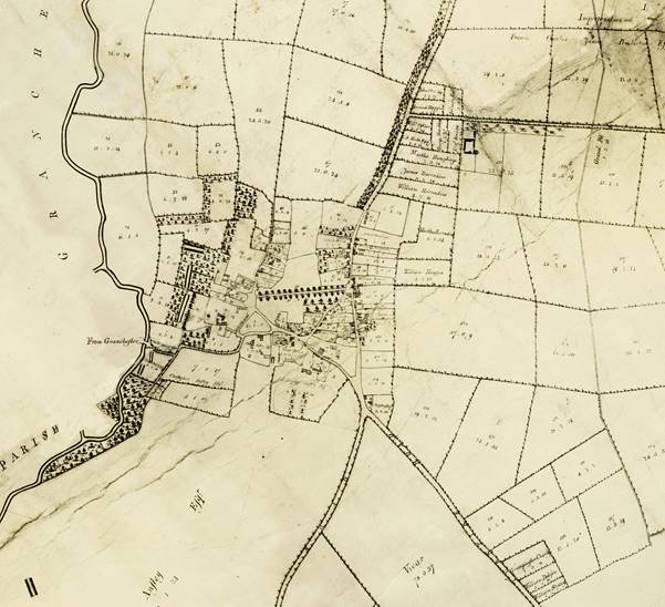
Image courtesy of Cambridgeshire Archives
The numbers of the fields on this map correspond to the details recorded in a “Particular” in the Trumpington Hall archives, of which the first page appears below. A transcription of this Particular can be seen in .pdf format here.
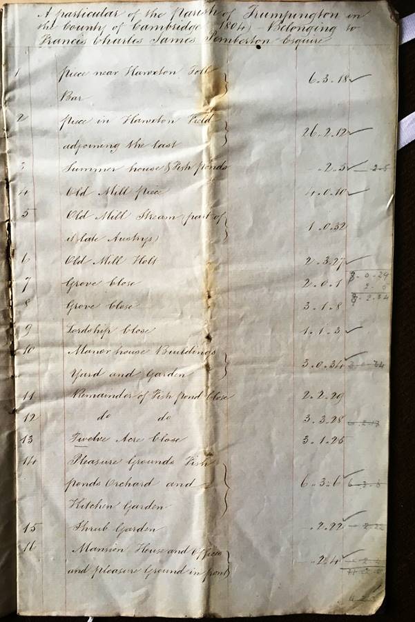
Image courtesy of Antony Pemberton
4. A Tracing by E J Smith of the original Inclosure map, now in the Cambridge University Library. The whole of that map can be seen here .
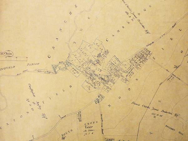
Image courtesy of Cambridge University Library
For interactive digital maps which incorporate information from all the sources above, click here.