
| Trumpington Local History Group Trumpington Meadows Archaeological Visit: 24 May 2011 |
| There were 17 participants on this visit to the latest phase of archaeological excavation on the Trumpington Meadows site, prior to work on the housing development. We are very grateful to Alison Dickens, Project Manager, and Ricky Patten, Site Director, Cambridge Archaeological Unit, who described the evidence from the site. Summary by Andrew Roberts. |
| Copyright © Trumpington Local History Group, 2014. Updated 1 July 2014. Email: admin@trumpingtonlocalhistorygroup.org |
| Alison Dickens introduced the background to this latest phase of work, explaining that the whole of the southern fringe was a rich archaeological resource. The area included evidence from the Neolithic, Bronze Age, Iron Age and Roman periods. There was limited evidence of post-Roman activity until the development of Medieval agriculture following the clustering of settlement in areas that became villages. The investigations in the Trumpington Meadows development started in 2006, with a desktop survey, field walking, geophysical studies and preliminary trenches. This identified three main zones within the area to be directly affected by housing: to the west of the Park & Ride site, between the Park & Ride site and the northern boundary and here, close to the northern boundary within sight of Anstey Hall Farm and Trumpington Church. |
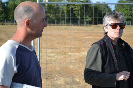
| Ricky Patten and Alison Dickens explaining the background to the three archaeological sites on Trumpington Meadows. Photo: Andrew Roberts, 24 May 2011. |
| Work underway on one of the Neolithic monuments excavated in 2010. Source: © Cambridge Archaeological Unit. |

| There had been an open day in October 2010 in the area near the Park & Ride site, where the team had found evidence of a rare circular Neolithic burial mound and an Early Iron Age settlement including a large number of pits (with further pits identified in an earlier excavation on the Park & Ride site itself). The second area included a small Iron Age enclosure. Work then switched to this third area where there was Late Iron Age and Late Saxon/Early Medieval evidence but no Roman evidence. |

| We started on the south side of the site in an area where Ricky described a Late Iron Age enclosure with a pair of linked oval and rectangular structures, with one possibly for stock and the other for settlement (c. 200 BC - 1st century AD). To the north of this towards the farm buildings and the church, the evidence was from later periods (there had been no Saxon or Medieval structures in the other areas). |
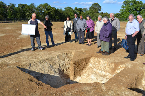
| Ricky Patten describing a Late Iron Age enclosure. Photo: Andrew Roberts, 24 May 2011. |
| Ricky described a number of sub-rectangular structures providing evidence of the foundation of the village of Trumpington. This type of sunken building (grubenhaus) has been recognised in Britain and on the continent and was typically Early Saxon (5th-6th century AD) but here seemed to be Late Saxon/Early Medieval (7th to 8th-9th century AD). These buildings had vertical sides and flat bases with post holes. They would have had joists holding floor planks with a pit or cellar below and a roofed structure above. It was assumed this type of structure was for craft or ancillary work rather than being a dwelling (see West Stow for reconstructions). One possibility was that the pit was used as a drop for loom weights, so that the weavers could work down to the floor level. After use, the pits had been backfilled with later material which had now been excavated to reveal their shape. One of the examples was in the process of being excavated; another larger example was on the western side of the excavated area, with the river valley sloping from here to the west; a third example was more typical, with a large post hole at each end, with the subsurface marl showing white in contrast to the surrounding soil. |
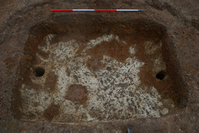
| An excavated grubenhaus in the current research area. Source: © Cambridge Archaeological Unit. |
| Ricky Patten describing one of the Late Saxon/Early Medieval sunken structures. Photo: Andrew Roberts, 24 May 2011. |
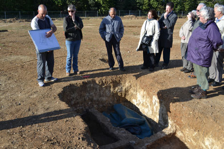
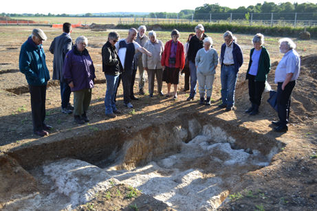
| Participants looking at one of the Late Saxon/Early Medieval sunken structures with the river valley in the background. Photo: Andrew Roberts, 24 May 2011. |
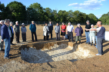
| Participants looking at one of the Late Saxon/Early Medieval sunken structures with trees marking the northern site boundary in the background. Photo: Andrew Roberts, 24 May 2011. |
| Ricky and Alison also described the site of a roughly rectangular building which may have been a dwelling or workshop. This may have been a Saxon hall and was 20m long, with its entrance on the west side, with post holes to support the roof and internal pits. |
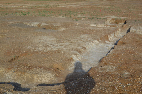
| The southern side of the Saxon building. Photo: Andrew Roberts, 24 May 2011. |
| Nearby, there was a burial pit which had contained two crouched burials, each with a pottery vessel behind the head. The vessels were highly decorated Late Neolithic/Early Bronze Age beaker pottery similar to examples from the late phase of use of the circular monument in the first area that was excavated. The individuals were male and female young adults who had died at different times but been buried at the same time. A short distance away, there was the evidence of another structure and an adjacent ditch where large quantities of worked bone and iron nails, etc., had been found, including worked bone showing Scandinavian influence (9th-10th century). |
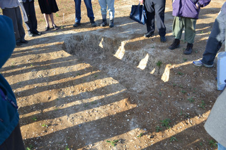
| Late Neolithic/Early Bronze Age burial pit. Photo: Andrew Roberts, 24 May 2011. |
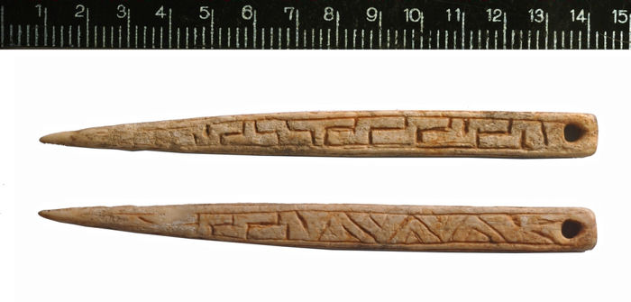
| The Anglo-Scandinavian pin. Source: © Cambridge Archaeological Unit. |
| In the area closer to the church, Ricky and Alison showed us four Anglo-Saxon burial pits, each of which had contained an individual burial. Three of these were aligned and one was offset, with the three containing a young adolescent, young adult and adult female and the other a male. At the time, we were asked to keep confidential the news that one of the pits had contained a bed burial of a young girl who wore a gold cross inlaid with garnets (see latest news). |
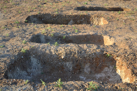
| Four Anglo-Saxon burial pits. Photo: Andrew Roberts, 24 May 2011. |
| Standing just south of the heart of the Medieval village, Alison concluded the visit by saying we were seeing evidence of the beginning of Trumpington as a village. She hoped it would be possible to carry on the research by investigating the origins of the village and looked forward to working with the Local History Group and local residents on this vision. We were keen to get started! |
| Participants at the Trumpington Meadows archaeological site visit. Photo: Andrew Roberts, 24 May 2011. |