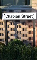
Street sign on Chaplen Street. Photo: Andrew Roberts, 6 December 2014.
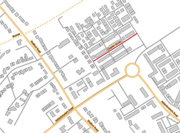
Chaplen Street is part of the Clay Farm (Abode) development, the first road to the left off Hobson Road, between Addenbrooke’s Road and Royal Way.
The land was used as farmland – part of Clay Farm – until the late 2000s, in the ‘Showground’ area which had been used for the Royal Show in 1951, 1960 and 1961.
Chaplen Street. Source: © OpenStreetMap contributors (Howard Slatter).
Andrew Roberts gave a presentation about the origin of the name ‘Chaplen Street’ at the Local History Group meeting on 12 November 2015. It is one of a number of streets named after local personalities, in this case John and Thomas Chaplen, who were lords of the manor of Trumpington in the 16th-17th centuries.
There are separate page s with information about the derivation of street names and Thomas Chaplen .
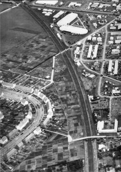
Aerial view of the Royal Show and Trumpington Allotments, 1960 or 1961. Chaplen Street has been built on the land to the lower right of the photograph, near the railway cutting. Source: Antony Pemberton.
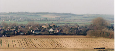
Looking towards Shelford Road from Addenbrooke’s Hospital, with Clay Farm in the foreground. Chaplen Street has been built on the land to the right of the photograph. Photo: Andrew Roberts, 6 January 2008.
After the land was taken out of the Green Belt in 2006, Addenbrooke’s Road was constructed across the fields, opening in October 2010. This was followed by infrastructure work and house building in 2012-13, with homes occupied from mid 2013. Each phase was preceded by a major archaeological excavation which has shown that the area has been farmed for 1000s of years.
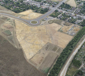
Aerial view of the archaeological excavation on Clay Farm, to the east of Shelford Road, with the new Addenbrooke’s Road and work on the Guided Busway in the railway cutting, with the location of Chaplen Street to the right. Source: Oxford Archaeology East, July-August 2010.
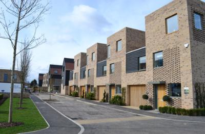
Homes on Chaplen Street, Abode development. Photo: Andrew Roberts, 11 March 2013.
In the Medieval period, there were five manors within the parish of Trumpington. From the late 14th century, the foremost of these manors was held by the De La Pole family. In 1574, John Chaplen, a Trumpington yeoman, purchased the De La Poles manor from Sir John Cutts. When John Chaplyn died in 1602, the manor descended to his son Thomas Chaplyn. (The Chaplen name was also written as Chaplin, Chaplyn and Chapley.)
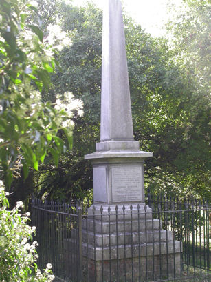
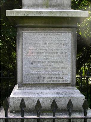
In the early 1600s, the university and town were planning to improve the stream flowing through Trumpington from Nine Wells to Cambridge, as the basis for a water supply into the town. This was intended to provide fresh water and flush out the King’s Ditch which surrounded the town. In 1610, Thomas Chaplyn (written as Thomas Chapley), as chief lord of the manor, granted a wayleave to make the ‘New River’ through Trumpington, to supply water along Hobson’s Brook to Hobson’s Conduit (both names adopted some years after construction). The ‘New River’ goes from south to north across the heart of what later became known as Clay Farm. Chaplin and Thomas Hobson are commemorated on a monument at the Nine Wells Local Nature Reserve, erected in 1861.
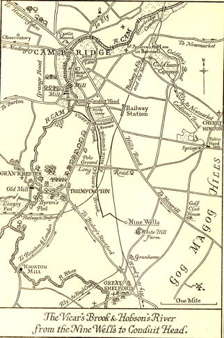
Map of Vicar’s Brook, Hobson’s Brook and Hobson’s Conduit, extracted from Bushell, W.D. (1938). Hobson’s Conduit. The New River at Cambridge Commonly Called Hobson’s River , facing page 5.
The commemorative monument at Nine Wells Local Nature Reserve. Photos: Howard Slatter, October 2010.
In 1615, Thomas Chaplyn sold the manor to his nephew John Baron. In 1785, the manor was sold to Jeremy Pemberton and combined with the main Pemberton estate.
When the Local History Group and the Residents’ Association were proposing street names, it seemed very appropriate to suggest Chaplen as one of the street names for the Clay Farm development.
Additional information
Bushell, W.D. (1938). Hobson’s Conduit. The New River at Cambridge Commonly Called Hobson’s River , page 34.
The Victoria History of the Counties of England (1982). A History of Cambridgeshire and the Isle of Ely, Volume VIII. Armingford and Thriplow Hundreds. Trumpington .
Agreement for the New Water Course: copy at Cambridge University Library, University Grace Books .