Peter Dawson, August 2008
This is the first part of a history of the Chaucer Road and Latham Road area of Trumpington, partly based on information in Rus In Urbe. Chaucer Road and Latham Road: the History of Two Rural Roads in Cambridge . For an introduction, see Chaucer Road and Latham Road Area.
There is evidence of Iron Age, Roman and Anglo-Saxon occupation in the area, including a Roman cemetery near the river and a paved causeway that ran south from the line of Latham Road. Various artefacts are displayed at the Fitzwilliam Museum and the Museum of Archaeology and Anthropology, Cambridge.
On 1 April 1675, this area was included in the transaction when Sir Francis Pemberton purchased the parish of Trumpington for the sum of £500.
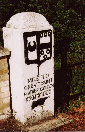
In 1728, Trinity Hall placed a milestone nearby on Trumpington Road, where the road crossed Vicar’s Brook over the Stone Bridge (the former Trumpington Ford).
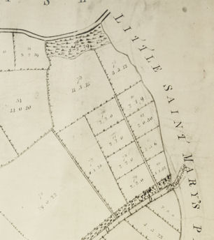
Under the Enclosure Act of c. 1801, the land remained in the Pemberton family and was divided into allotments varying from ½ to 8½ acres. It was crossed by two farm tracks, which later became the line of the two roads, shown on the enclosure map prepared in 1804.
From the 17th to the 19th century, the land was used for clay pipe manufacturing and gravel and coprolite digging.
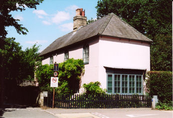
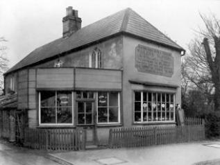
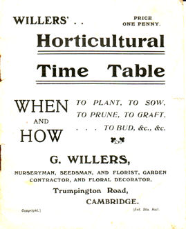
During the 19th century, Cambridge Nursery garden extended along the north side of the Latham Road track, in the area that was later to become Southacre. The house at the entrance to the road (now known as 2 Latham Road) was built at the edge of the nursery around 1825. From the 1870s to the 1930s, it was known as Willers Nursery, selling seeds, flowers and confectionery in the later years. It is now the prominent ‘Pink House’. Baker’s map of Cambridge (1830) shows the nursery and Blackland Farm (now called River Farm) at the end of the track.
Rus in Urbe records that there were many trees and local wildlife in the area in the 1990s, included grass snakes, bats, weasels, deer and 30 species of birds.
Continue with the next part of Peter Dawson’s history of the Chaucer Road and Latham Road area of Trumpington.