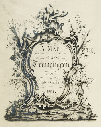
Howard Slatter
This page is an overview of how Trumpington has changed and developed over the 19th and 20th centuries, based on a talk given to the Local History Group by Howard Slatter on 13 October 2022. Howard has also recorded a version on YouTube.
Introduction
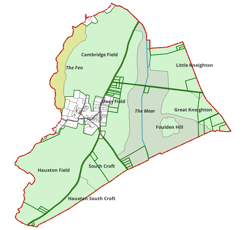
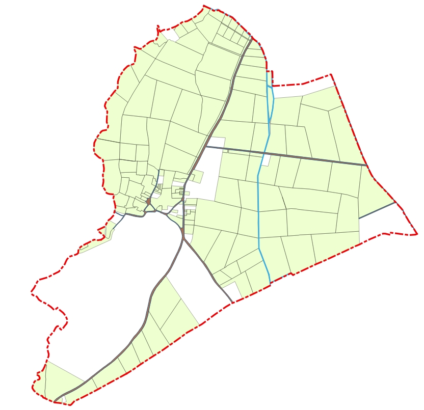
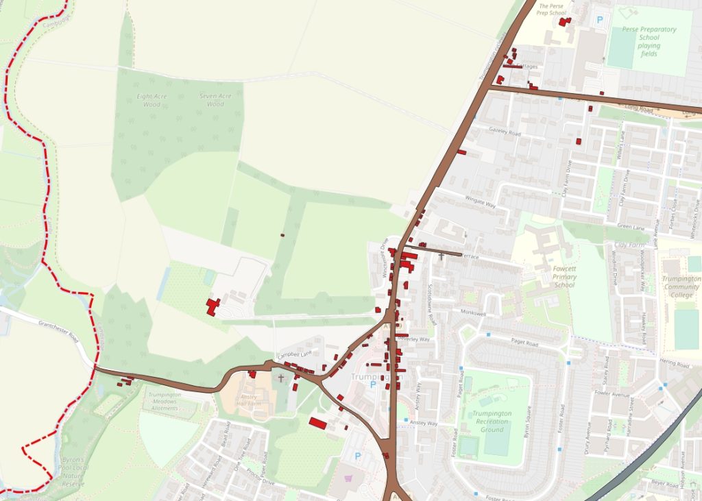
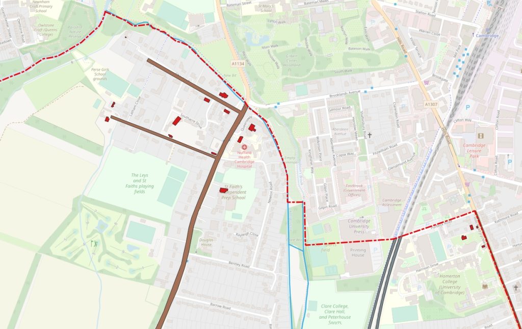
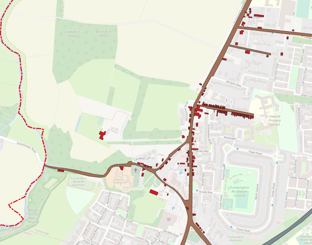
When I refer to “Trumpington”, I mean the ancient ecclesiastical parish, as shown outlined in red on the map. The boundary runs on the west along the River Cam, then along Vicar’s Brook in the north, cutting across to Hills Road, where it runs south-east to beyond the Addenbrooke’s site. The boundary finally runs in roughly a straight line south-west to near Hauxton Mill. The red outline of the original parish boundary appears in most of the maps in this talk.
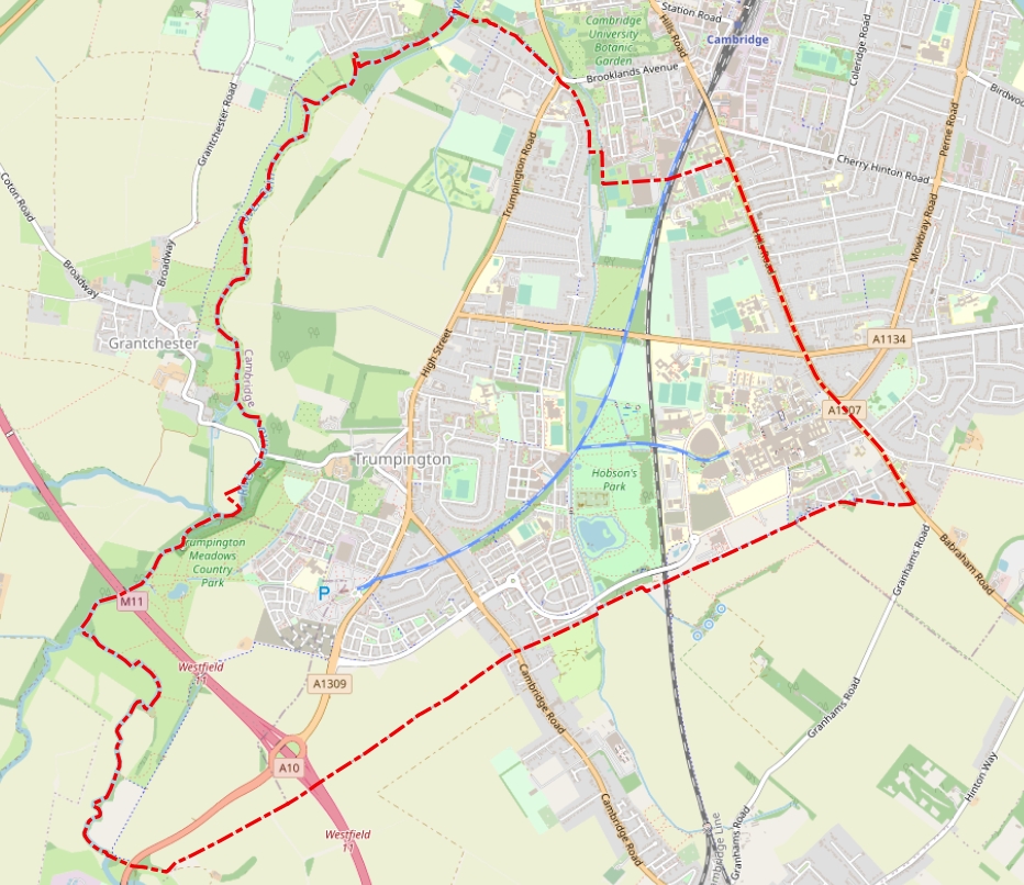
“Trumpington” has meant different things at different times to different people. The Cambridge City Council ward of Trumpington has included an area to the north, including Newtown. The church parish lost the area to the east of the London railway line in the 1890s. And the south-western corner of the old parish was not included when Trumpington entered the Borough of Cambridge in 1934.
Why start this overview in 1801? For three reasons:
1. The clean beginning of a new century.
2. The first year in which the British government ran a full population census. Thereafter, at ten yearly intervals, censuses continued until the present day (with the exception of 1941). So we have population figures for Trumpington, as well as a lot of other detailed information about the people living here.
3. Something momentous happened locally that year. Read on!
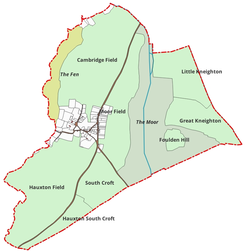
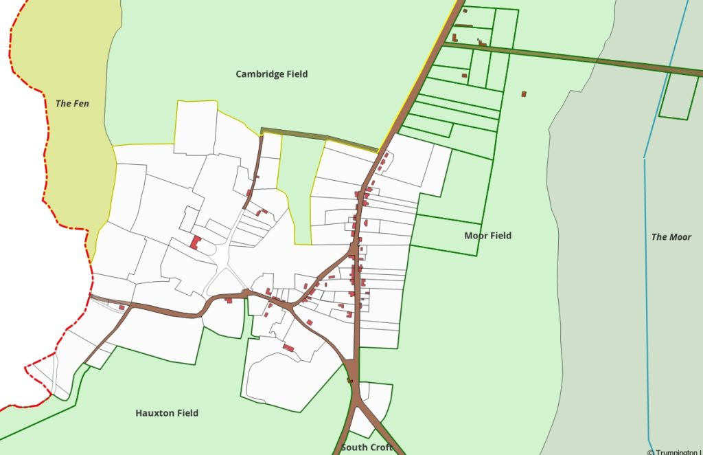
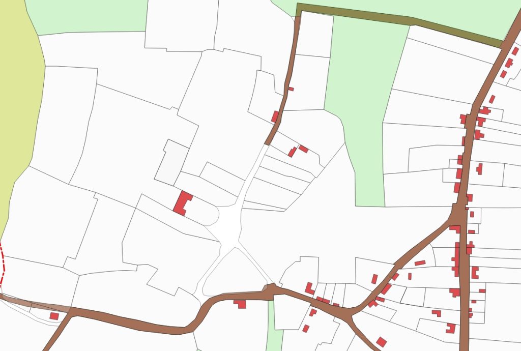
Here are three maps, at different scales, showing the parish in 1801. In the first, of the whole parish, you can see land coloured in four different ways. The main white area is the inhabited “village”, where all the people lived. Surrounding the village are the open fields of the parish, coloured light green. They had various names, such as “South Croft”, “Cambridge Field”, and “Great Kneighton”. Running north-south in the eastern half of the parish is an area coloured grey-green. This is Trumpington Moor, which was common land, being the low-lying ground either side of what we now call “Hobson’s Brook”, unsuitable then for arable cultivation. Finally, the yellow coloured area along the river was Trumpington Fen, which was meadow land, flooded in winter.
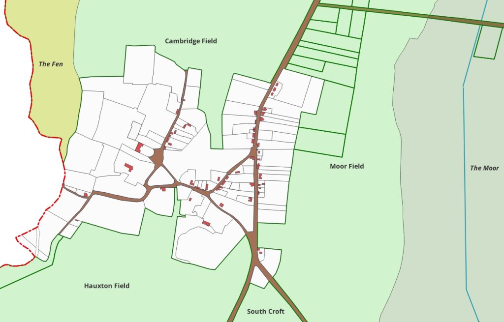
The second map shows the village itself in 1801, with all the inhabited houses appearing coloured red. The land was parcelled up into “ancient inclosures”, land which had up until that time been taken out of the field system, and was in private hands. The population of the parish in 1801 was just 494 people. The road layout (in brown) corresponds closely to what we know today. You can see the two turnpike roads, Trumpington Road-Hauxton Road, and Shelford Road, plus Maris Lane and Church Lane, leading into Grantchester Road.
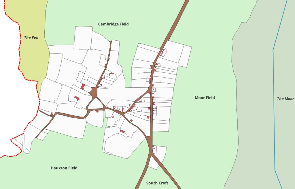
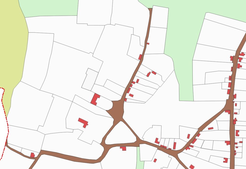
There is one main difference, though (apart from all the newer roads which have been built since then). The third map shows a road off Grantchester Road heading north towards Cambridge Field. Apart from Trumpington Hall (set back from the west of this road) there were about a dozen dwellings in what was known as “Dagling (or Daglen or Dangling) End”, none of which are there today.
Several of the buildings on these maps are still in evidence today. They include smaller dwelling houses such as those on the west side of High Street, in Church Lane and in Grantchester Road.
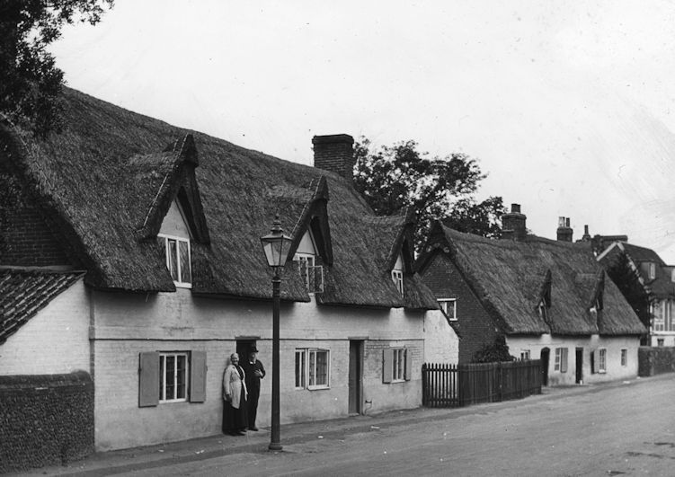
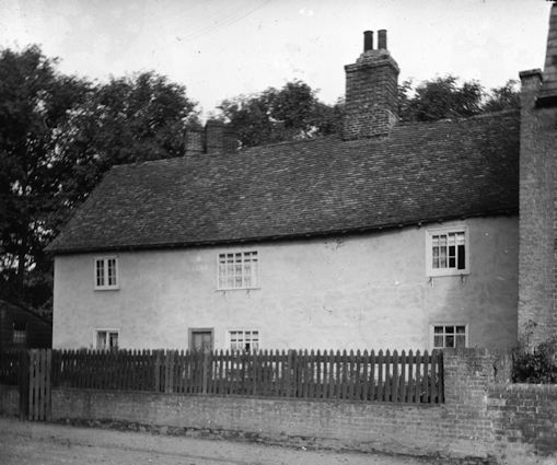
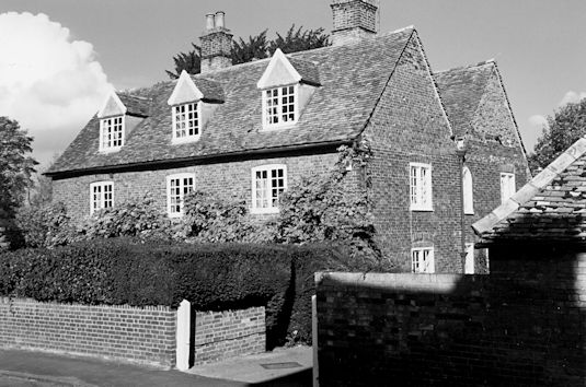
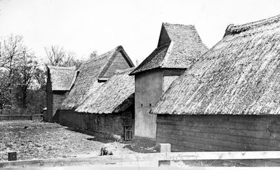
There are also farm houses, such as Maris House in Maris Lane and Anstey Hall Farm, with its various outbuildings, in Grantchester Road.
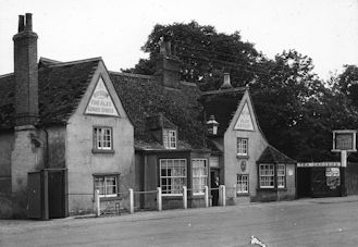
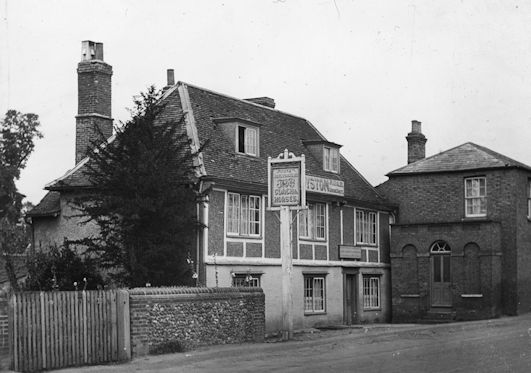
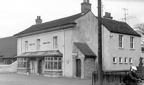
Four of today’s pubs and restaurants appear on the map. The Green Man and the Coach and Horses (now the Sole and Duck) were the two main inns. The Duchess of Cambridge (formerly the Tally Ho and then the Hudson’s Ale House) was there, but as a baker’s shop. The Lord Byron (formerly the Unicorn) was also there, but was still a private dwelling house, owned by Trinity Hall.

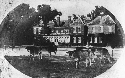
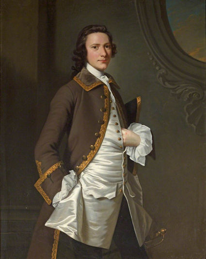
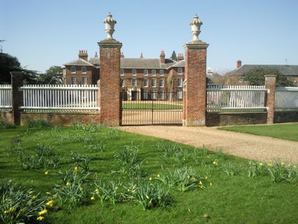
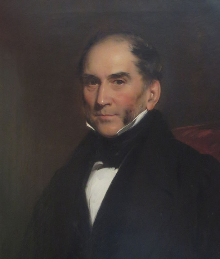
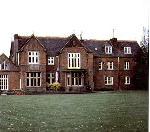
There are also the two “big houses” in Trumpington. Anstey Hall was owned at this time by Christopher Anstey, but he was living in Bath, and rented out the house and associated land. Trumpington Hall and its land was owned by Francis Charles James Pemberton (“FCJP”, later Colonel of the Cambridgeshire Militia), who had inherited it the previous year from his grandfather.
One building which does not appear in red on the digital maps (as it had no one living there) was the parish church, which has been there since before the 14th century. The advowson of Trumpington had been held by the nuns of Hanwell Priory in Middlesex, but after the dissolution of the monasteries Henry VIII granted it to Trinity College, Cambridge, who still hold it today. As the “impropriators”, Trinity took the great tithes from the parish; the Vicar received the small tithes.
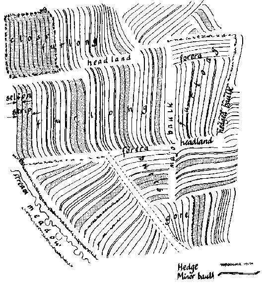
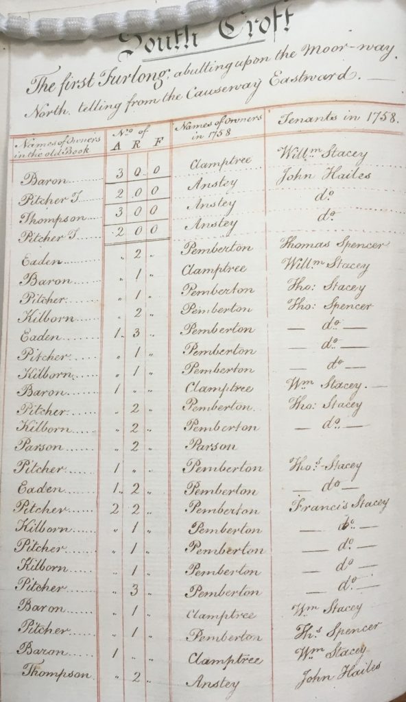
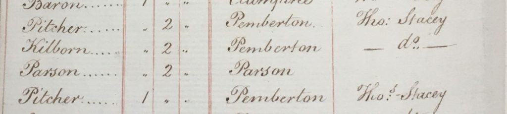
The open fields of Trumpington were still farmed in 1801 using the old medieval system of strips of land held by different owners and scattered across the various fields. No map survives of how these strips were distributed in Trumpington; the diagram (drawn by Dr Oliver Rackham of Corpus Christi College) shows a generic arrangement of such strips, or selions. Note that the strips are arranged in bundles called “furlongs”, with headlands or baulks between them, and the various furlongs fit together to make a whole field.
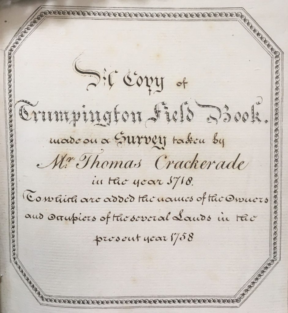
Although no map survives, there is, in the Trinity College Archives, a part-copy of the “Trumpington Field Book”, originally made in 1718, but updated to show the ownerships in 1758. A typical page shows some of the various strips in a field, furlong by furlong, with their areas, owners and occupiers. The close-up of the first furlong in South Croft shows some 1758 owners as Pemberton (at that time FCJP’s great-grandfather Francis Pemberton) and the Parson (i.e. the Vicar).
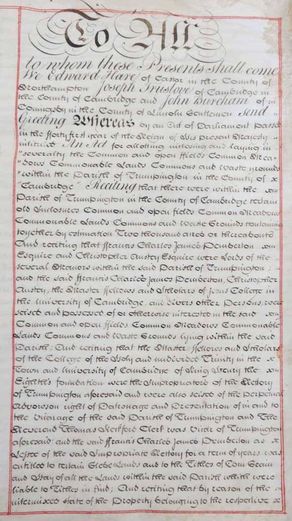
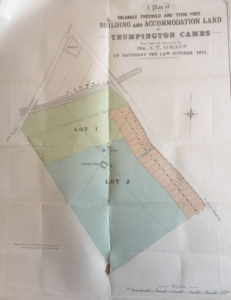
This was the Trumpington where FCJP inherited over half the parish in 1800, at the age of just 22. He, like other landowners up and down the country at the time, regarded this as a very inefficient way of using the land, and quickly set about trying to change it. The mechanism for doing so was to introduce a parliamentary bill for the “Inclosure” of the parish, which would allow the various lands – fields, commons, meadows etc. – to be reallocated into blocks owned by individuals or bodies, which could then be farmed in a more modern, efficient way. The Victoria County History (VCH) tells us that he introduced the Trumpington Inclosure bill “with the reluctant acquiescence of Trinity College and of the Ansteys”. The Inclosure Act duly became law in 1801.
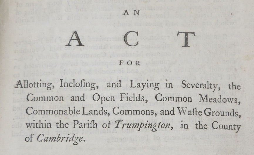
The Act provided for the setting up of an inclosure commission of three men, who were tasked with the detailed allocation of land according to the terms of the Act itself, and publishing those decisions in the Inclosure Award.
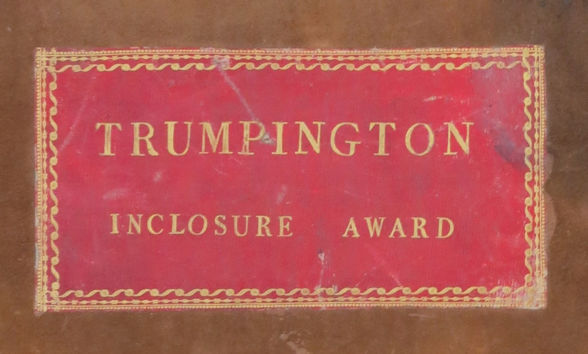
Copies of both the Act and the Award are in the Cambridgeshire County Archives in Ely. There are also full transcripts of both on our web pages. The Award was not published until 1809, but according to the VCH the land was actually divided up after the 1802 harvest.
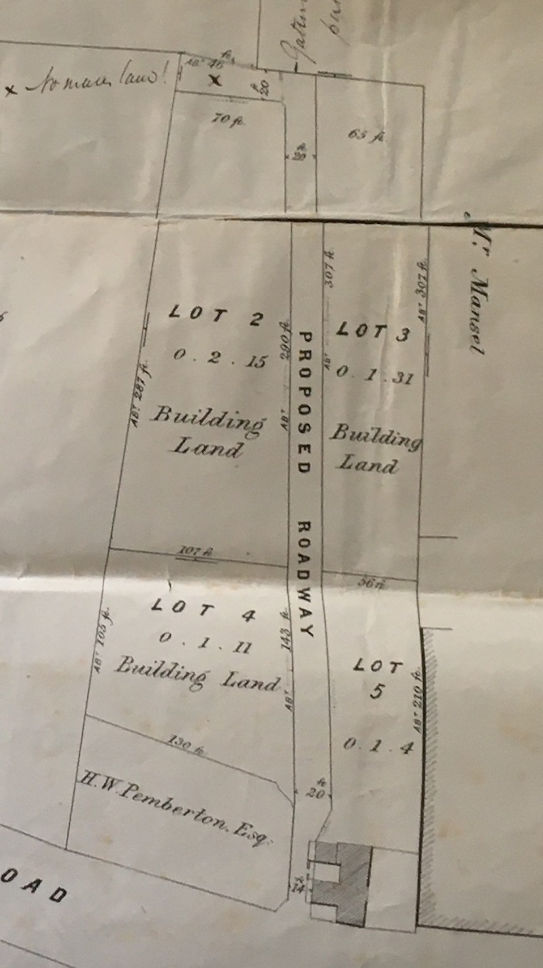
The opening page of the Award gives us the names of the three Commissioners: Edward Hare, Joseph Truslove and John Burcham. It then goes on to describe in detail what land should be allotted to whom, and why. At the end of the book there is a large map showing all these new “allotments”, as well as the ancient inclosures already occupied.
A digitised version of the Inclosure Map shows the new arrangement more clearly. The green lines mark the boundaries of the new allotments. Note that one of those boundaries is a brand new road running east-west across the parish between Trumpington Road and Hills Road, referred to then as “New Road” and now as Long Road. There are four large new allotments. In the north-west, covering the old Cambridge Field and the Fen, is land granted to the Pembertons. The north-east, to the north of New Road, now belongs to Trinity College. South of New Road, straddling most of the Moor, is more Pemberton land. Most of what was Hauxton Field was allocated to the Ansteys.
In addition, there are many smaller allotments. Between Hauxton Road and Shelford Road the north-eastern half of the old South Croft was allotted to the Vicar, and south-west of that to the Pembertons. The next map shows some of the smallest new allotments, mainly to individual householders.
These new allotments were made for a variety of reasons. Most were in compensation for land lost from the old open fields. But some were for the loss of common rights to graze animals and collect fuel; all the common land disappeared with inclosure. And the land allotted to Trinity and to the Vicar was mainly because the inclosure process also did away with the old system of tithes, so land was granted in lieu of tithe income.
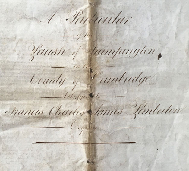
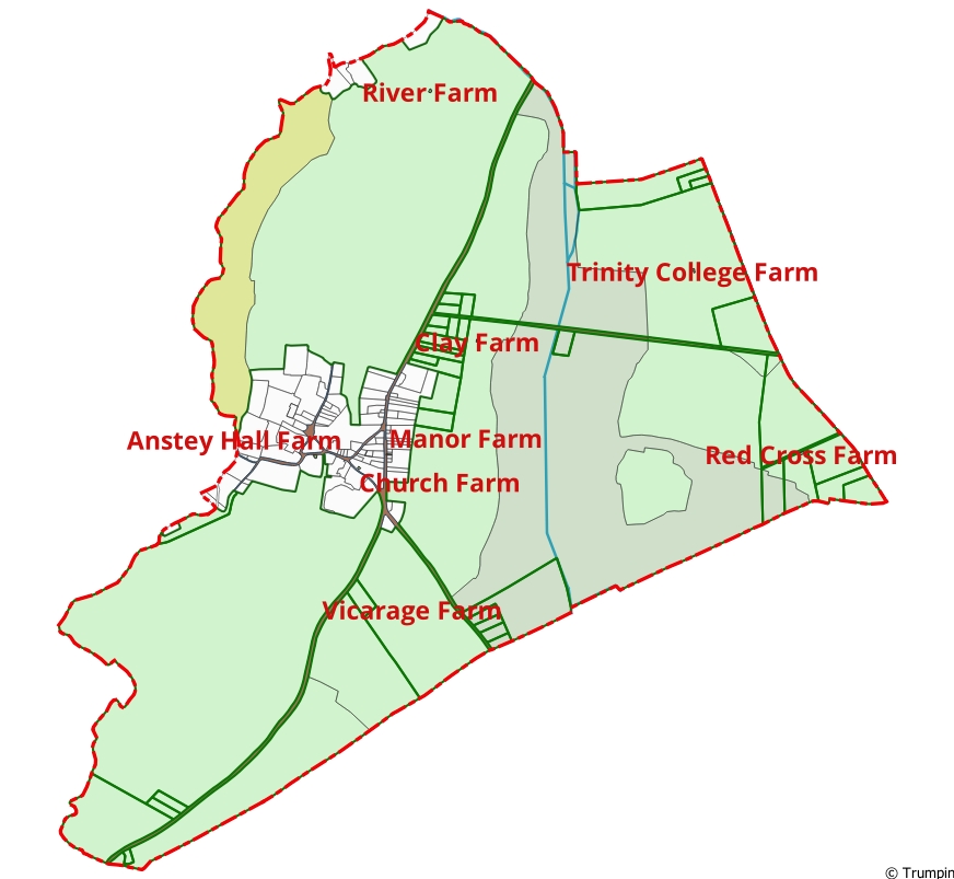
In 1804, a map was drawn up showing the new Pemberton land, and the way it was then subdivided into smaller fields. The corresponding “Particular”, specifying these new fields, survives in the Pemberton Archives at Trumpington Hall. The next digital map shows these fields, and serves to emphasize how much of the parish was by then in the control of the Pemberton family. This includes all the Trinity land north of New Road, which was leased to them.
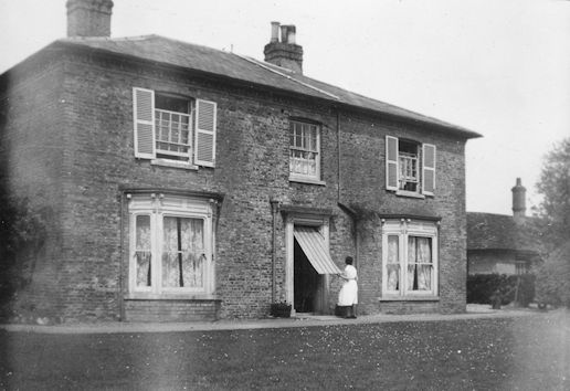
By 1820, all this newly organised farmland was managed from a number of new farmhouses, as well as the older ones at Church Farm (Maris House) and Anstey Hall Farm. Of these, the houses at Trinity College Farm, Red Cross Farm, and Manor Farm have now disappeared. But the other houses are still there, though now all as private residences. The Clay Farm house is now surrounded by new housing.
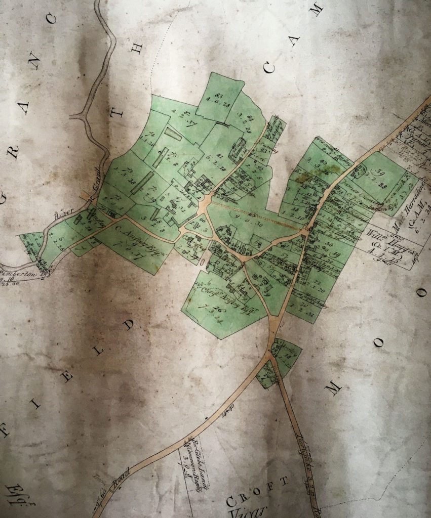
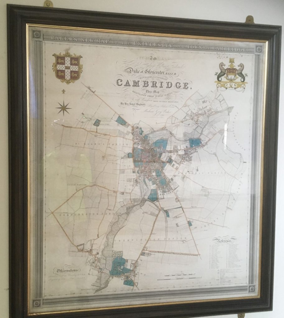
There is a framed copy of Richard Baker’s 1830 map of Cambridge on the wall of Trumpington Village Hall. We are fortunate that this map extends far enough southwards to include Trumpington village and much of its farmland. An excerpt from this map shows how much detail it contains.
The digitised version shows, not surprisingly, a similar position to that just after inclosure; the population had now risen to 722.
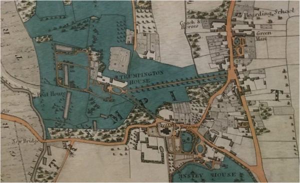
The close-up of the area around Trumpington Hall reveals that Dagling End had started to dwindle; access to it was now from the north, off High Street, rather than from Grantchester Road. Over the next forty years Dagling End disappeared completely. As properties came up for sale, the Pembertons bought them up, and absorbed the associated land into the park around the Hall. In compensation they built some new houses, mainly in High Street.
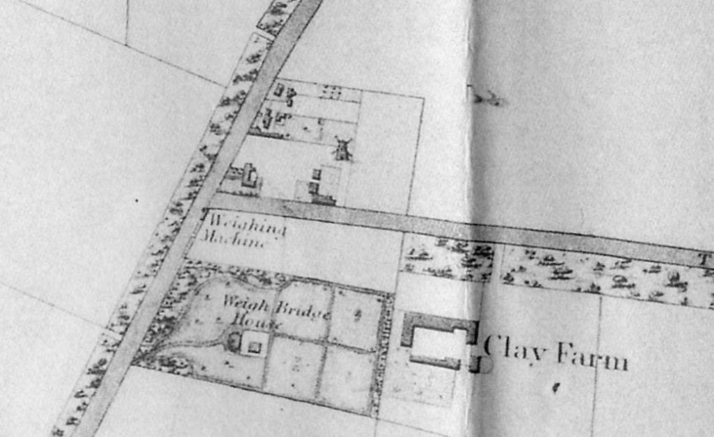
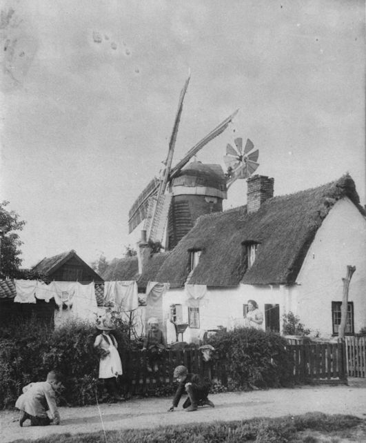
Baker’s map includes some other fascinating features. The extract from the western end of New (Long) Road shows a few of the smaller allotments from the Inclosure Award. By now these were starting to be built on. To the south of the junction with Trumpington Road is a Weighing Machine with its associated Weigh Bridge House. After the opening of the New Road, traffic started using that to avoid passing the turnpike tollgate on the Hauxton Road. So the Turnpike trustees built a new weighbridge to intercept that traffic. And to the north of the junction can be seen a windmill. This had been built at about the time of the map, and survived until at least the 1880s. It stood on what was the highest point of the parish, and for some time, before becoming Long Road, New Road was known as “Mill Road”. The photograph shows the windmill in the 1880s, as seen from Mill Road.
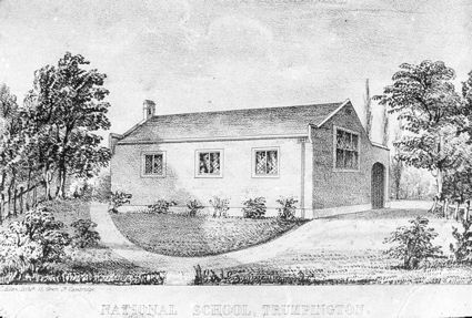
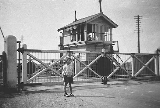
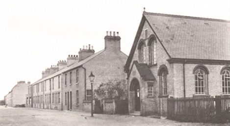
Moving on through the next 50 years of the 19th century, the development of Trumpington took place slowly. Some of the buildings from then still survive, for example the old nursery garden cottage on the corner of what is now Latham Road, and the village school built in 1843, now the Rainbow Nursery, opposite the parish church. The railways came to Trumpington in 1845, with the opening of the Northern and Eastern (later Great Eastern) Railway from London to Cambridge. Initially this crossed Mill Road at a level crossing; the modern bridge was only built to replace this in the 1930s. The Bedford and Cambridge line (now the Guided Busway) opened in 1862.
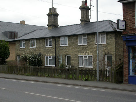
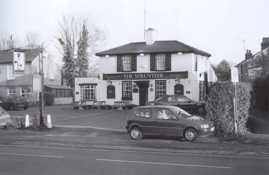
Some older houses were replaced with new ones: 42–46 High Street were built in the 1860s. A smithy was built on the corner of Church Lane and High Street, surviving until the 1980s when it was pulled down, to the disgust of many local residents, to make way for what was then Bidwells Stone Cross building, now Ashcroft. In the 1870s a new pub appeared: The Volunteer was built on the Cambridge side of North Cottages, eventually becoming a restaurant and now replaced by flats.
In 1879 a piece of land came up for sale on the High Street, almost opposite the Coach and Horses. This had been owned by the Cuming family; James Cuming and his son Charles had run a boarding school there since the 1780s, and James had built “Alpha Cottage” as his own residence. The land was sold in several lots, with the site of the school itself going to the Cambridge draper Robert Sayle, who already lived in Trumpington at Leighton House, north of the Volunteer. Sayle knocked down the old school and built St Mary’s, still there, for his daughter Frances. Most of the rest of the land was sold as building plots, and later formed the beginnings of Alpha Terrace.
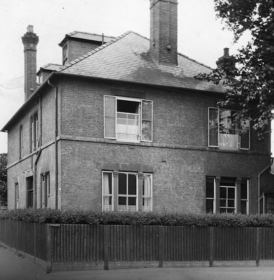
In 1878 the Revised Statutes of Cambridge University had been passed, which for the first time allowed fellows of Colleges to marry, and by 1882 all colleges had to allow this. This created a booming demand for suitable accommodation for married fellows and their families, within easy striking distance of the centre of Cambridge. The landowners of Trumpington were not slow to take advantage of this, and the Pembertons and Trinity College, in particular, started to sell leases on parcels of land just south of the boundary with the town. One of the first of these was Southacre, built for the master of Trinity Hall, Rev. Henry Latham, in the road which now bears his name. Southacre itself was demolished in the 1980s, to be replaced by flats.
The map of the village in 1881 shows little substantial change from that of fifty years earlier.
The northern end of the parish, though, is starting to see the building of large houses either side of Trumpington Road, as well as extending along Hills Road into Trumpington. The population now stood at 849.
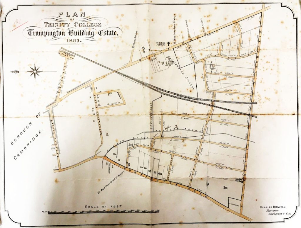
In 1897 Trinity College published a grand plan for how they might develop all of their Trumpington land. Much of the detail there never happened, and it took another seventy years for the land to become fully built on.
By the time of the 1911 census, the village was starting to expand more obviously, and the population had now grown by 50% since 1881, to 1270.
Much of Alpha Terrace had now been built, and the first few houses had appeared at the northern end of Shelford Road, on what had previously been a small parcel of Anstey land. This set the scene for more houses along Shelford Road and that same year the church sold 20 building plots on the land allotted to the Vicar at the time of inclosure.
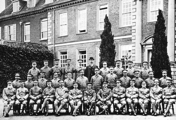
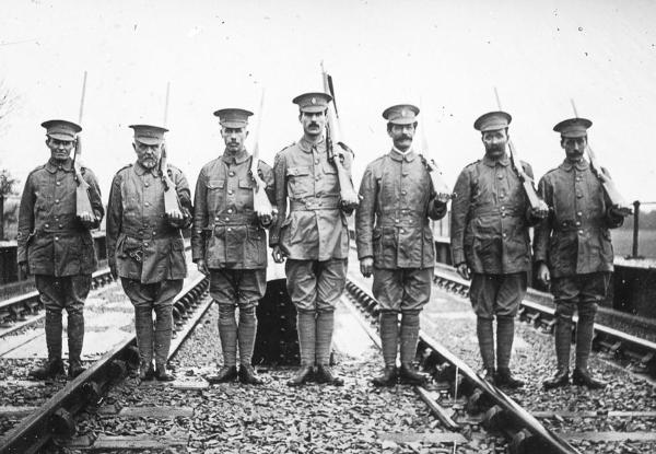
Most of this activity was halted by the First World War. Many of the men remaining in Trumpington during the war joined the Trumpington Volunteer Corps, and the two photographs show the Corps assembled outside the front of Anstey Hall, and one of its sections defending the Bedford line railway bridge over the Cam. The man in the middle is Sergeant Percy Robinson, the village schoolmaster; the bridge is no longer there, but the approach embankment still runs across Trumpington Meadows.
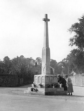
After the war things slowly returned to normal, with the War Memorial being dedicated in 1921.
By 1931, house building was well under way.
Alpha Terrace was complete, but the big change was the further development to the south of the old village, with Shelford Road (now on both sides, including Pemberton land on the east) and the new Bishop’s Road, together with Hauxton Road, housing about a third of the population, which now stood at 1731.
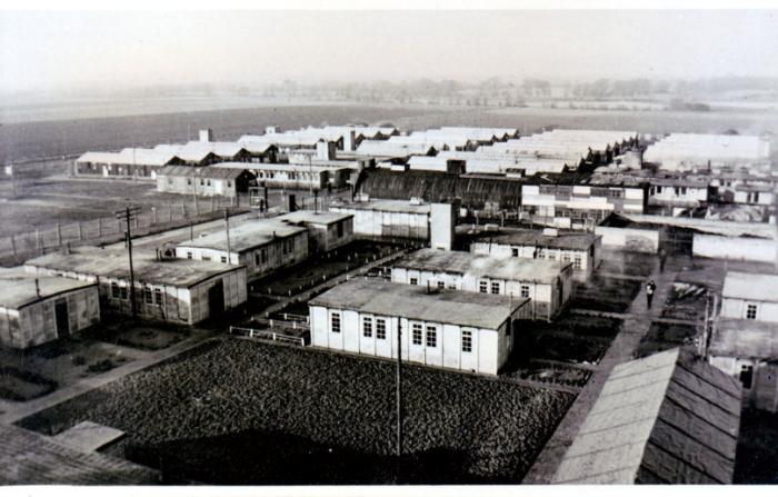
During the Second World War, a Prisoner of War camp was built on the farmland west of Hauxton Road, just south of the modern Trumpington Meadows housing development. It housed over 1000 PoWs, initially Italians and later Germans. It survived into the 1950s as a “National Service Hostel”, and was then completely demolished.
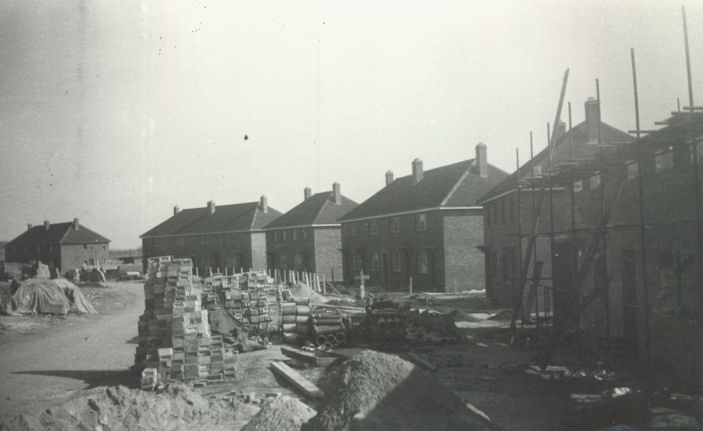
Trumpington had been taken into the Borough of Cambridge in 1934, and plans were soon made to provide some much needed Borough Council housing here for people from across Cambridge. The war prevented this from happening as originally planned, but in 1946 building started on the new council estate on former Pemberton land to the east of the High Street. On completion, the new estate had 360 houses and flats, mainly family units, together with the King George V Memorial recreation ground and over 130 allotment plots. This came close to doubling the population of Trumpington in less than three years, though we cannot find actual census population figures for the old parish after 1931.
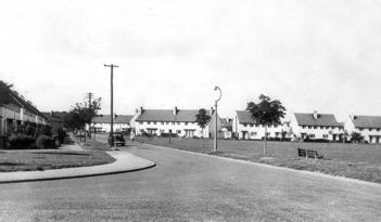
The new council estate was the most obvious change to the map in 1951.
By 1971, many of the modern smaller side roads had been constructed, including Beverley Way, Scotsdowne Road, Cranleigh Close and Lantree Crescent.
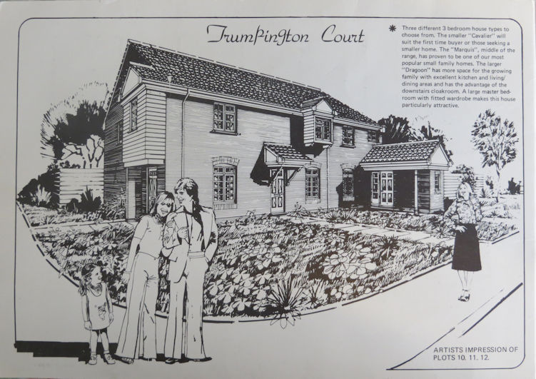
In 1971, a new development of neo-Georgian houses, with the marketing name “Trumpington Court” was built to the east of High Street, on land formerly occupied by Manor Farm and the Red Lion pub (which had been opposite the War Memorial).
The next thirty years saw further in-filling of the built-up areas of the parish, including the flats of Monkswell and Ely and Salisbury Places, on land which had been allotments.
Since the end of these 200 years, particularly since 2011, there have been more huge changes, with the new housing on Trumpington Meadows, Glebe Farm, Clay Farm and Ninewells, as well as the enormous development of the Cambridge Biomedical Campus alongside Addenbrooke’s Hospital, to the east of the railway but all within the ancient parish of Trumpington. In 2011, the population of Trumpington City Council ward was 8034; after a decade of growth, in 2021 the figure was 17,394.