The Local Plans of Cambridge City Council and South Cambridgeshire District Council have had a significant impact on Trumpington. This note describes the 2006 and 2018 plans.
Andrew Roberts
2006 Cambridge City Council Local Plan
The Cambridge Local Plan adopted in 2006 allowed the release of land around Trumpington for house building, taking Clay Farm and Glebe Farm out of the Green Belt and including the Monsanto ‘brown field’ site (Trumpington Meadows).
The development of the 2006 Local Plan began in 2001, following the publication of the Cambridgeshire and Peterborough Structure Plan which specified that 12,500 homes should be built in Cambridge between 1999 and 2016, of which 6500 were to be built within the built up area of Cambridge and a further 6000 on the edge of Cambridge on land to be released from the Green Belt (2006 Local Plan, p. 13-14).
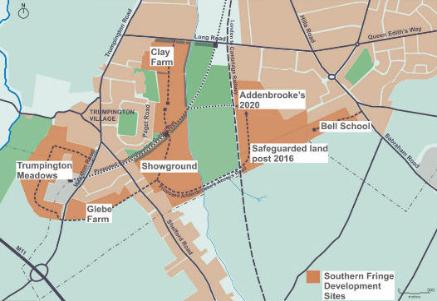
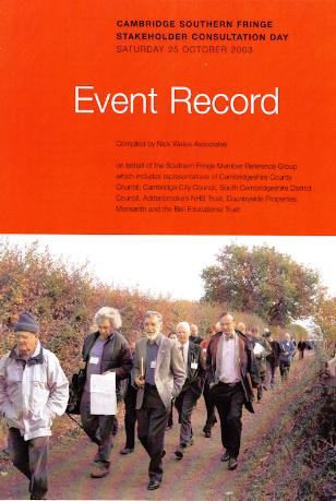
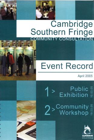
By 2003, the land around Trumpington and Queen Edith’s was being described as the Cambridge Southern Fringe. The Council consulted on the scope of an Area Development Framework, including at a workshop on 25 October 2003 attended by local groups, local residents, councillors, officers and developers. This was followed by an exhibition and workshop on 10 and 19 March 2005. The areas being discussed included housing on the Clay Farm/Showground, Glebe Farm, Monsanto/Trumpington Meadows and Bell School sites, the development of the Addenbrooke’s site and issues around green spaces, community integration, education and community facilities, sustainable development and transport.
[Sources:
Nick Wates Associates for the Southern Fringe Member Reference Group (2003). Event Record, Cambridge Southern Fringe, Stakeholder Consultation Day , Saturday 25 October 2003.
Cambridge City Council (2005). Event Record, Cambridge Southern Fringe Community Consultation, April 2005.]
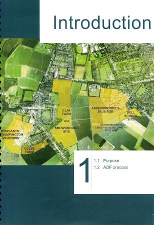
Plan from the report on the exhibition and workshop in April 2005.
One of the main inputs into the ADF was a report by the Trumpington Residents’ Association in September 2004, which stressed the need for a community centre, medical practice, schools and the protection of the local environment.
[Source: Trumpington Residents’ Association (2004). Trumpington. Future development of an historically important parish. Cambridge: TRA.]
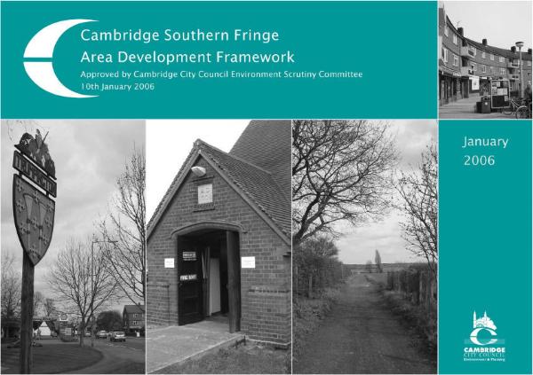
The Southern Fringe Area Development Framework (ADF) was approved on 10 January 2006. It provided the basis for the subsequent developments. A summary of the ADF was incorporated in the consultation on the 2018 Local Plan.
[Source: Area Development Framework.]
The ADF fed into the 2006 Local Plan, approved in July 2006. This included the sites around Trumpington as an Area of Major Change, with land to be removed from the Green Belt to facilitate the development of Addenbrooke’s Hospital and the new residential communities, including a new Addenbrooke’s Access Road and Guided Busway (p. 18, para. 2.6, map on p. 19, infrastructure details on p. 102). The housing developments totalled 3320 homes in the City and another 629 homes in the District (p. 106-111).
[Source: Cambridge City Council (2006). Cambridge Local Plan , July 2006. Cambridge: City Council, see the 2006 Local Plan.]

The developments of housing, the Cambridge Biomedical Campus and transport links have complied with this 2006 Local Plan.
2018 Cambridge City Council and South Cambridgeshire District Council Local Plans
The development of the current Cambridge Local Plan and South Cambridgeshire Local Plan began in 2011 and after a protracted consultation and inspection process the documents were finally approved in September and October 2018. The plans are designed to cover the period to 2031. There are two separate plans, although they are closely linked. Throughout the process, the Trumpington Residents’ Association (TRA) gave detailed responses to the proposals.
In June 2012, the City Council carried out an Issues & Options consultation, when the TRAs main concern was whether the plans would allow further development around the edges of the city or maintain the separation between the city and the villages and concentrate development further afield, in Northstowe, etc. The options for additional housing on the edges of the city included land to the west of Trumpington Road (River Farm), land west of Hauxton Road (Trumpington Meadows), land south of Addenbrooke’s Road (south of Glebe Farm) and land between Shelford Road and Babraham Road. The TRA was also concerned about proposals for a sports stadium, with Grosvenor promoting the move of Cambridge United from its current stadium to a new complex on Trumpington Meadows. In the TRA response in July 2012, there was a strong argument against any major changes to the Green Belt, any further large-scale housing developments around Trumpington and against the Trumpington Meadows site as the location for the sports stadium.
In January 2013, there was another round of consultation on the sites that might be developed on the edge of Cambridge and within the City. This was particularly significant to Trumpington, as the Councils maintained the position that the majority of the remaining Green Belt close to Cambridge was fundamentally important and should not be developed and that proposals for further growth south of Trumpington Meadows and Glebe Farm should be rejected.
[Sources:
Cambridge City Council (2012). Cambridge Local Plan – Towards 2031. Issues & Options report, June 2012.
Cambridge City Council (2013). Cambridge Local Plan – Towards 2031. South Cambridgeshire Local Plan. Issues & Options 2. Part 1 – Joint Consultation on Development Strategy and Site Options on the Edge of Cambridge; Part 2 – Site Options Within Cambridge , January 2013.]
The Councils developed the Local Plans in the next two years and issued a Proposed Submission in July 2013. the TRA was very relieved that the Councils adopted a development strategy (spatial strategy) that was firmly against further major housing developments close to the city and the Councils did not support development on the local areas listed above. During the long process when the Government Inspectors have been interrogating all the details in the plans, the Councils have maintained their position, against ongoing criticism by developers who argued against the overall spatial strategy and in favour of their specific projects. In May 2015, the Inspectors asked the Councils to carry out further work and this resulted in a Modifications Report in December 2015. The TRA made further responses to this report and was very relieved to see that the additional work strengthened the Councils position that the Green Belt around Trumpington was crucial to the setting of the city and there should be no further development. However, there was concern at a proposal in the District Council plan to remove an area from the Green Belt to the south of the Cambridge Biomedical Campus and designate this for the further expansion of the Campus. The TRA argued hard against this modification but it became part of the final plans.
[Sources:
Cambridge City Council (2013). Cambridge Local Plan 2014: Proposed Submission, July 2013.
Cambridge City Council and South Cambridgeshire District Council (2015). Cambridge Local Plan. South Cambridgeshire Local Plan. Proposed Modifications. Joint Consultation Report, December 2015.]
After 4 years of assessment, the Inspectors who analysed the City and District Local Plans at last found them ‘sound’ in September 2018. The plans went through a final approval process within the Councils and were adopted in September and October 2018. In the City Local Plan, Policies 17 and 18 refer to the development of the Cambridge Biomedical Campus and the Southern Fringe (p. 67-73). A summary of the ADF was incorporated in the Plan (Appendix D, p. 303). In the District Local Plan, Policy E/2 refers to the further extension of the Cambridge Biomedical Campus (p. 174-77).
[Sources:
City Council: Cambridge City Council (2018). Cambridge Local Plan, October 2018, see background page and the 2018 Cambridge Local Plan.
District Council: South Cambridgeshire District Council (2018). South Cambridgeshire Local Plan , September 2018, see background page and the 2018 South Cambridgeshire Local Plan.
After 2018: the next Local Plan
After this long process, the Councils have been committed to developing the next Local Plan, a joint plan for the City and District. This review started in 2019 and should have been completed by 2022 but was still ongoing in late 2025. Hopefully, the forceful evidence about the importance of the local Green Belt will be a crucial factor influencing the spatial plans in the next round. To be updated!