Howard Slatter
May 2017
Howard Slatter was one of two speakers at the Local History Group meeting on 30 March 2017, talking about historic maps of Trumpington and up-to-date technology. See also Tim Glasswell’s talk on the Ordnance Survey mapping of Trumpington. For subsequent work, see Trumpington Maps: Decade by Decade.
Pre-1800
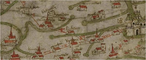
The Gough Map of Great Britain, in the Bodleian Library, Oxford, from about 1360 shows the road from London to Cambridge via Ware and Barkway, so Trumpington is there by implication, if not by name!
Trumpington begins to appear on published maps in the early 1600s, when several series of county maps appeared, including those made by Christopher Saxton and John Speed. Trumpington is named on both of these, but at the scale of such a map, no detail is provided.
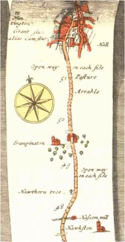
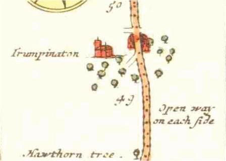
The first map which I have seen showing anything more than simply the position of the village is in a collection by John Ogilby, published in 1675. His Britannia: an Illustration of the Kingdom of England and Wales by a Geographical and Historical Description of the Principal Roads Thereof is essentially a series of strip-maps showing various major road routes across the country.
One page from this book shows the road from Puckeridge to King’s Lynn. South of Cambridge it passes through “Hawkston” and Trumpington, an open way past pasture and arable land. In Trumpington itself, we can see the houses in the village and the church to the west of the road, though the arrangement of side roads is difficult to interpret in the light of what we are familiar with today.
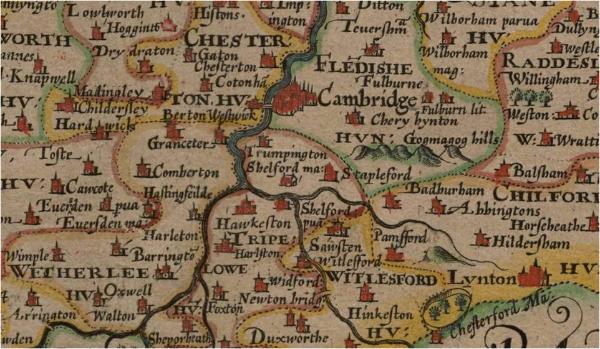
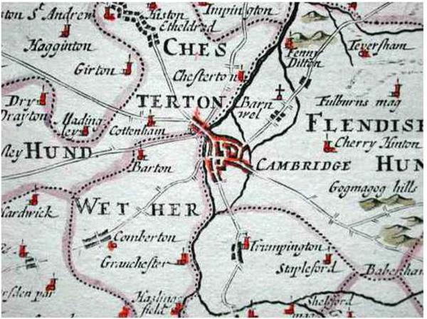
A slightly later county map by Robert Morden, published in William Camden’s Britannia, purports to show a similar level of detail. Although the roads look more like those on a modern map, the church is shown to the east of the village, so we should not try to read too much into these early representations.
Enclosure
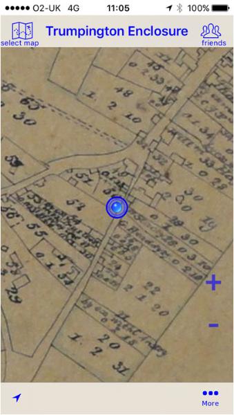
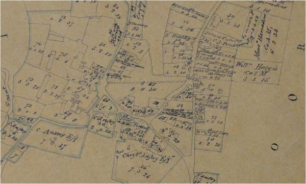
The great leap forward came with the enclosure maps of 1804 that accompanied the Trumpington Inclosure Act. These have a high level of detail, befitting the purpose in showing individual buildings and parcels of land, and who owned them after enclosure. There are thought to be three versions of the map, including an overview with the fields as they were prior to enclosure, a copy with the new field layout (Cambridgeshire Archives) and a more detailed copy with information about the recipient of each parcel of land and the reference numbers used in the award schedule (at the University Library). The maps cover the whole of the parish; the image shown here is of what we now sometimes refer to as the “historic centre”.
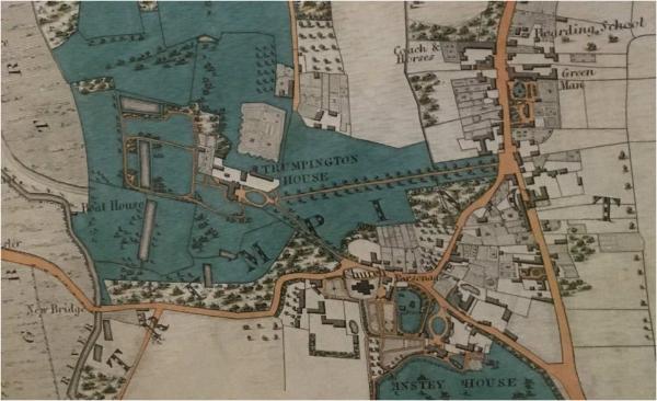
Baker’s Map of Cambridge
In 1830, Richard Baker published a detailed map of Cambridge, stretching far enough south to include most of Trumpington. An example of that map hangs on the wall of Trumpington Village Hall (courtesy of Antony Pemberton), from which comes this image of the historic centre.
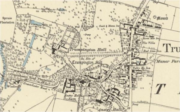
Ordnance Survey
The first Ordnance Survey (OS) map showing Cambridge and Trumpington was published in 1836, but being at the familiar scale of one inch to one mile, showed nothing like the level of detail that the enclosure or Baker’s maps provided. Larger scale OS maps started to appear in the late Victorian period. The “6 inch” (scale 6 inches to a mile) map from 1885 shows a good level of detail.
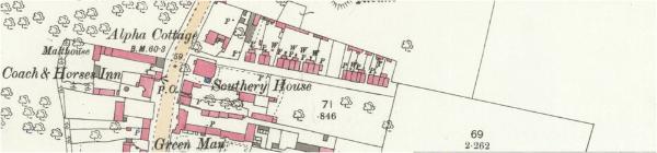
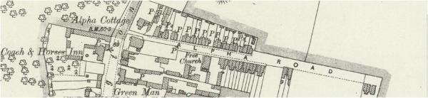
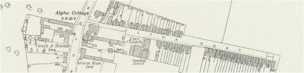
But the finest of all were the 25 inch maps, which showed individual buildings and land boundaries, much as had the enclosure map from 80 years previously. This series of images shows the development of Alpha Terrace from 1886, through 1903 to 1927. Note, however, that the Ordnance Survey did not always get it right – Alpha Terrace has never been called Alpha Road!
Linking the old with the new
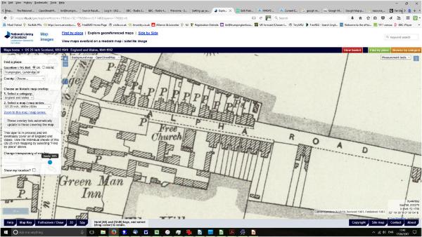
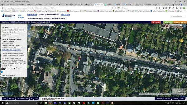
Many old maps are now available online. A particularly valuable resource is the National Library of Scotland’s (NLS) collection. Here you can see “georeferenced” maps, which have been precisely tagged to correspond with positions on a modern digital map. These two images show Alpha Terrace on both the 1903 25 inch and the equivalent satellite map; you can toggle between them and see them overlaid on one another on the NLS website.
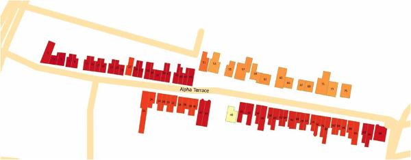
Modern digital mapping techniques also allow the amateur to produce new versions of the old. This image shows my map of Alpha Terrace where the individual houses are colour-coded by date of building.
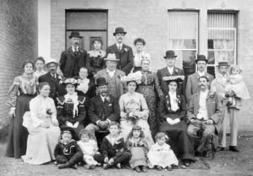
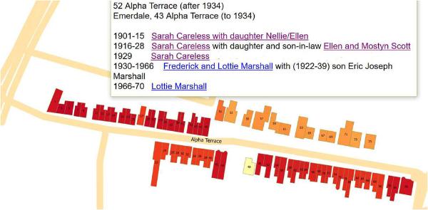
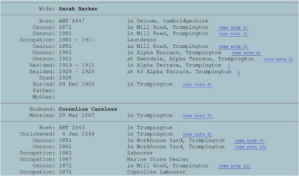
The photo shows a wedding party outside 52 Alpha Terrace in 1903. The older lady near the middle of the picture in the spotty dress is Mrs Sarah Careless, whose house this was. Clicking number 52 on my actual map shows a brief history of who lived in the house, and when. If you click on an individual name you are taken to their history on the People in Trumpington database.
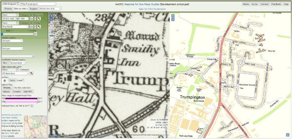
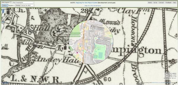
None of this mapping is yet online – it is very much a work in progress. However, an online resource which we hope to take advantage of is the Maps for One-Place Studies project (M4OPS), developed by Peter Cooper. These two images give a flavour of what can be seen there at present: side-by-side and “spyglass” views of the georeferenced OS One Inch and modern maps of the village. We hope that 25 inch maps from NLS will also soon be available there, and eventually tailored maps for Trumpington itself.
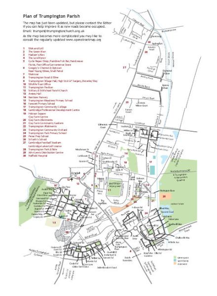
A modern map of Trumpington, designed by Sheila Betts and based on Openstreetmap, appears every two months in The Trumpet, the Trumpington parish magazine. Here is the version from May 2017, but as it is currently changing so rapidly you should refer to the most recent version.
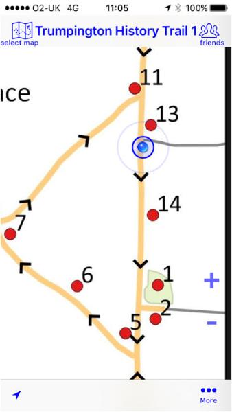
Finally, you can now load georeferenced versions of the enclosure map and the Trumpington History Trails onto your smart phone. Free apps are available. Here are two screenshots taken while I was outside the Village Hall.