Howard Slatter
Howard Slatter gave a presentation about the history of the western end of Long Road and the surrounding area at the Local History Group meeting on 27 September 2018. See also the presentation about the wider area by Andrew Roberts.
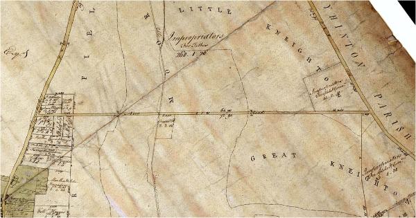
This map was drawn about 1800, and is in the archives at Trumpington Hall. It shows the whole of ‘New Road’. The map shows no buildings at all before Inclosure. One interesting feature is the original course of Hobson’s Brook, before it was “canalised” into the straight stream that we see today. We are grateful to Antony Pemberton for permission to use the map, and to Stephen Brown for the photograph.
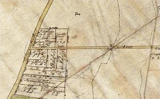
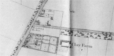
When we look at Baker’s map 30 years later, we can see some buildings: cottages, Clay Farm, Weigh Bridge House and Weighing Machine (associated with the Turnpike Road), Mill House and the Volunteer public house.
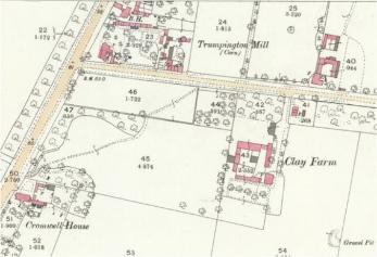
The area was further developed by the 1880s and early 1900s.
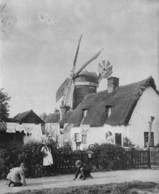
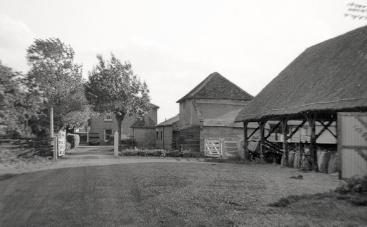
There was a windmill north of the western end of Long Road. This photo was taken by Ralph Lord in 1880. The mill was built in 1812, on (relatively) high ground. Alfred Moore, who rented it in 1836, then bought it, was born in Grantchester; his father had worked at Grantchester mill. He died in 1897; his daughter Bertha continued to live in one of the adjoining cottages until she died in 1931. The mill stopped working in the 1880s. In 1888 it was sold to John Peile (Master of Christ’s College, see below) who had it pulled down. The thatched cottages in the photograph were also pulled down before 1901.
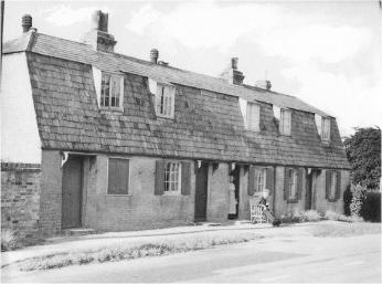
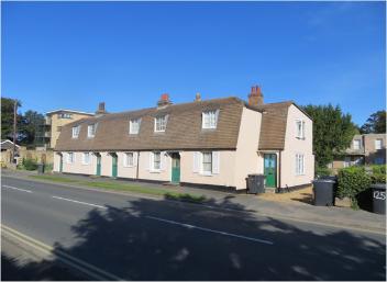
Mill Cottages appear on Baker’s map. Two photographs, taken in 2018 and in the 1930s, the older one showing Eli and Elizabeth Northrop (as in Northrop Road in the Clay Farm Aura development).
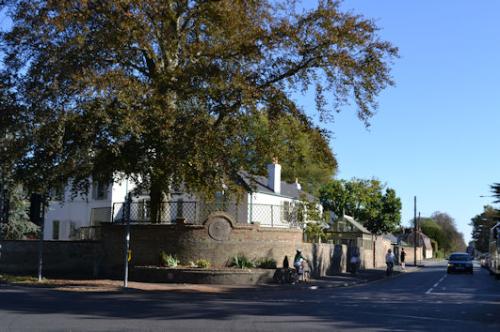
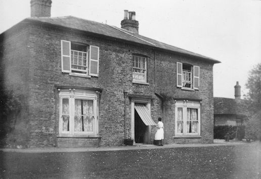
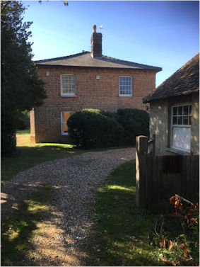
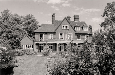
Mill House was built by 1830, but was quite separate from the mill and the cottages.
Former owners of Mill House include:
John Peile (1838-1910). Classicist and Philologist, Fellow at Christ’s College. Lived here 1871 to 1887 with his wife Annette and three children (plus twins who died as infants; there is a touching memorial in Trumpington churchyard). In 1887, he was appointed Master of Christ’s College. He and Annette are also buried in Trumpington.
Hugh Newall (1857-1944). Astronomer, fellow of Trinity College, Prof of Astrophysics. Lived here in 1891, with wife Susannah (nee Arnold), granddaughter of Thomas Arnold (Headmaster of Rugby School)).
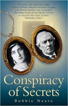
Louis and Jean Stanley (1912-2004 and 1912-2002). Jean lived here from 1949 with her first husband, Rev. Leslie Baber, and their four children. They were divorced in 1955, and Jean remarried to Louis Stanley that year. He was a larger than life figure, and became chairman of BRM (British Racing Motors). Jean was the sister of Sir Alfred Owen, the owner of BRM. Jean had four children with Leslie Baber. One of them, now Bobbie Neate, has written a book in which she claims that Louis Stanley was the illegitimate son of Prime Minister Henry Herbert Asquith and his mistress Venetia Stanley. His birth certificate apparently shows him as born 6 Jan 1912, son of Louis Thomas Stanley and Mary Ann Applegate, in Liscard on the Wirral, but Bobbie Neate writes that this was a fiction designed to cover up the truth. She says that no Louis Thomas Stanley (senior) ever existed.
Bobby Neate evidently had a very difficult relationship with her stepfather, and an indication of his character can be seen in various other accounts about him. For example, the following from someone who had professional dealings with him: “I must be honest. I used to detest Louis Stanley. Big, blazered and blimpish, pompous to a fault, seemingly possessed of a king-sized superiority complex, publicly dismissive of those he plainly regarded as ‘common workers’, he seemed from a distant viewpoint like a definitive cartoon villain . . .”
(Motor Sport Magazine)
Bobby Neate also tells of shady business regarding her mother’s burial. Although Jean died in Cambridge in 2002, two years before her husband, she was apparently buried in Birmingham. After Louis’s death, her body was brought back here and she is now buried in Trumpington, as is Louis’s mother, or more likely his adopted mother, Mary Ann Stanley, who also lived at the Old Mill House and died in 1963. To discover all the details, you will have to read Bobby Neate’s book ‘Conspiracy of Secrets’ (ISBN 1843583720).
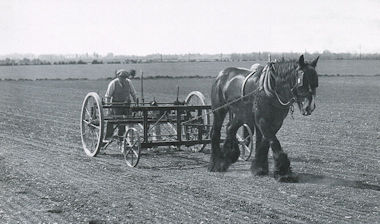
Clay Farm was known also, confusingly, as Manor Farm at times (the better known Manor Farm was in Trumpington High Street). This was a post-inclosure farm on Pemberton land, with various tenant farmers. The last were the Cornwell family: Reg Cornwell took over in 1931 and farmed here until 1970, when it was taken back into Pemberton hands.
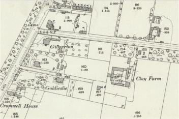
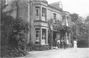
Gilmerton, on the southern corner of Long Road and High Street, was built in 1888. The first residents were Stephen Mansfield and his daughter Louisa with her husband Smith Nutter. Mansfield was a native of Chesterton, who left money in his will (1905) for almshouses there. The Nutter family were millers, both in Cambridge and Grantchester. They were followed by David and Catherine Munsey; David was a Cambridge jeweller and silversmith, with a shop on Market Hill (now Mappin & Webb). Then Sidney and Ethel Miller lived there until World War 2; Sidney was a solicitor, and founded what is now Miller Sands, operating from Impington. The house was turned into flats in 1948, and the last residents were recorded there in 1963. Gilmerton is the name of a village outside (now a suburb of) Edinburgh; it is not known why the house was given that name.
The Beeches, next door to Gilmerton, had been built by 1901. The first residents were Harold and May Vinter, up until 1915; Harold, though trained as a lawyer, was a director of coal and timber companies. Then Edwin and Annie Jackson; Edwin was a silversmith. Like Gilmerton, The Beeches was turned into flats in 1948, and the last residents were there 1963.
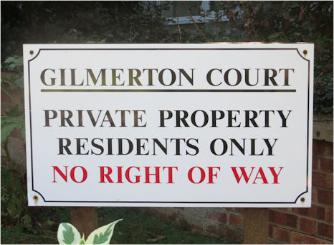
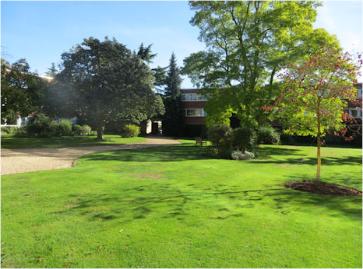
The Gilmerton Court flats were built on the site of these two houses; the first residents moved into the flats in 1968.
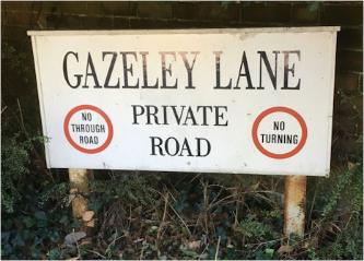
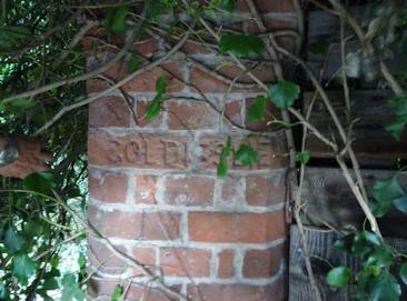
Goldieslie (later Gazeley) was built by 1890, with its first residents Richard and Mary Wright. Richard was a barrister, but was also appointed as Secretary to the Syndics of the University Press in 1892. Mary, as Mary Kennedy, was one of the first five Newnham College students who lived with Miss Annie Clough in 1871 before the building of the college itself. She was a talented artist, studying at the Slade and in Paris. In about 1915 the house was bought by John and Kate Collin; John was a solicitor, and Kate was from Gazeley in Suffolk. They changed the name of the house, but the gate pillar with the name “Goldieslie” remains. After World War 2, the house belonged to Charles and Mary Trevelyan. Charles was a lecturer in German, and was son of the historian G.M. Trevelyan.
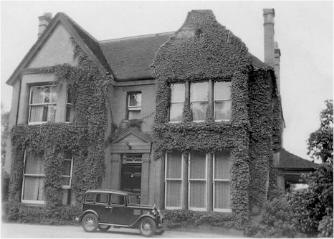
Borough Councillor Ernest Saville Peck, his wife Rachel and two children lived in Hills Road, on the Trumpington side, then in Newton Road, until 1935, when they built a new house in Long Road. This house, Friarswood, 102 Long Road, incorporated various materials including Tudor half-timbering, bricks and tiles from some shops being demolished to make way for the then new Cambridge Guildhall on Peas Hill. They lived there until Ernest died in 1955 and Rachel in 1967. Ernest was a pharmacist with a shop on the corner of Fitzwilliam Street (still there), and was an alderman of the borough and mayor in 1937. He was also active in World War 1. Soon after the outbreak of war, he was commissioned as a Lieutenant in the Cambridgeshire Regiment. He rose to the rank of temporary Major, second in command of one of the Territorial Battalions based in Cambridge. Then the Army decided to use his talents as a chemist and in 1917 he was seconded to the Anti-Gas School, later becoming an instructor, making visits overseas, including advising the US Army on anti-gas measures.
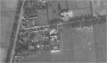
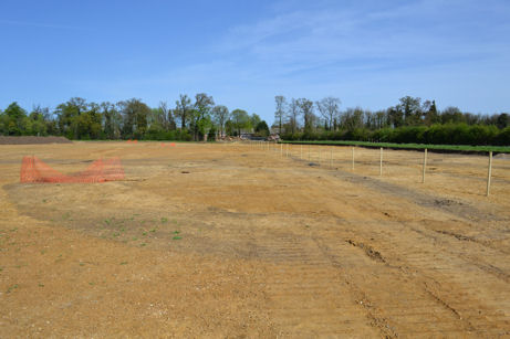
This aerial photograph from 1947 shows a number of rings in the field east of Clay Farm, with a few buildings just visible on the southern edge of the plantation. This photograph shows the same bit of ground over sixty years later. Here’s an extract from Andrew Roberts’s report on the TLHG site visit in April 2011 to the archaeological excavations on Clay Farm. “Further into the field, there were circular markings which Richard Mortimer explained were the site of a searchlight battery. Tom Phillips described the remains of a Second World War searchlight battery – on plan and on the ground looking for all the world like a group of Bronze Age barrows or enormous Iron Age ring gullies. Some of the finds they contained were even remarkably similar to those that you would expect to find in their prehistoric counterparts. Richard said they dated from 1942 and the evidence included a paint tin and baked bean tin!”
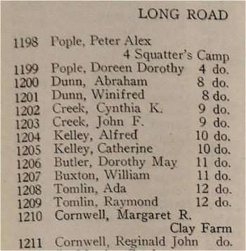
After the war the old buildings used to house the searchlight personnel became a ‘Squatters Camp’ occupied from 1948 to 1954. The extract from the 1949 electoral register shows mainly young couples recently married, clearly desperate for somewhere to live. They spanned all social classes; their occupations ranged from Boiler Fitter to Solicitor.