Clay Farm Archaeology Site Visit, 7 April 2011

Samian cremation bowl dated to 10-30 AD from the cremation pit. Source: Oxford Archaeology East, 10 February 2011.

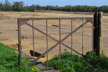
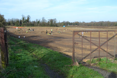
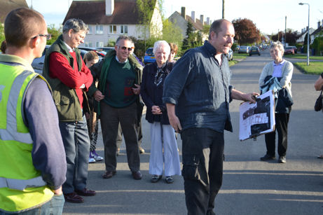
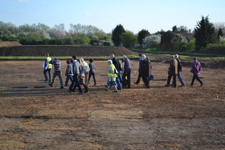
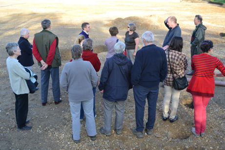
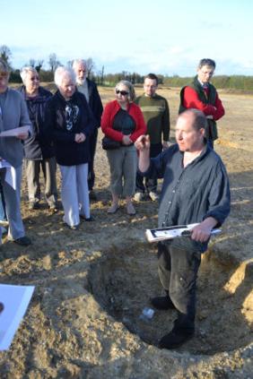
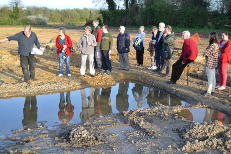
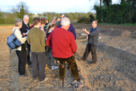
There were 40 participants on this visit to the latest archaeological excavation on Clay Farm in advance of housing development. We are very grateful to Richard Mortimer and Tom Phillips of Oxford Archaeology East, who led the groups around the site. Tom Phillips also sent a briefing note in advance of the visit (extracts included below) and has provided additional photographs. Report by Andrew Roberts.

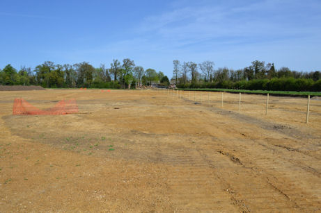
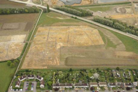
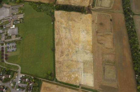
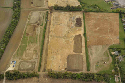
The visit was to an excavation on Clay Farm which Richard said covered 12 ha (38 acres): the fields to the east of Foster Road and the Cambridge Professional Development Centre/Fawcett School (CPDC) and the fields between Wingate Way, the east-west tree belt and Long Road. This phase of excavation follows earlier work to the east of Shelford Road where there was an Open Day in August 2010. Work had been underway for some months, starting in the field behind CPDC, then the field behind Foster Road, before moving on to the area south of Long Road and eventually the field to the east of Wingate Way near Clay Farm House. This phase began on site in late 2010 and continued until mid May 2011. Tom said that the post-excavation and publication work will then take approximately 3 years to complete.

Aerial view of the archaeological excavation on Clay Farm, looking south from Long Road, to Addenbrooke’s and Trumpington with excavations underway in the fields to the east of Wingate Way, Fawcett Primary School and Foster Road. Oxford Archaeology East, 13 April 2011.
Oblique aerial view of the archaeological excavation on Clay Farm looking east from Trumpington to Long Road and Addenbrooke’s, with excavations underway in the fields to the east of Wingate Way, CPDC and Foster Road. Source: Oxford Archaeology East, 13 April 2011.
Archaeological work on the field behind CPDC. Photo: Andrew Roberts, 24 February 2011.
Clearing top soil from the field behind Foster Road prior to archaeological work. Photo: Andrew Roberts, 24 February 2011.

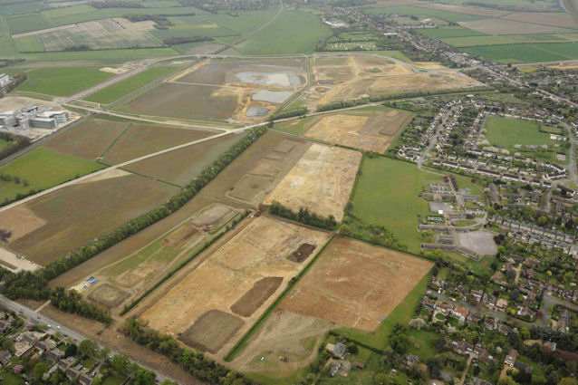
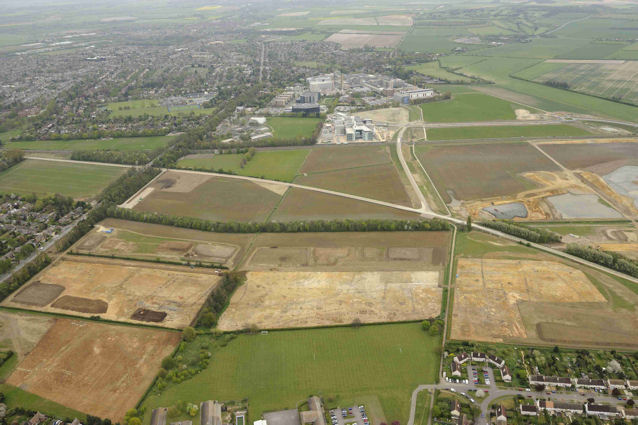
This site is one of a series to have been excavated across the southern fringe since the early 2000s, from the Park & Ride site and Trumpington Meadows, through Glebe Farm and Clay Farm to Addenbrooke’s Hospital and the Hutchison site. This is revealing a rich archaeological heritage. On this site, Richard and Tom described evidence from the Middle Bronze Age (1500-1200BC), Middle to Late Iron Age, Roman period, 19th and 20th century farming and the Second World War. The Middle Bronze Age evidence was particularly important: Richard said that this was the period when semi-nomadic inhabitants started to establish land divisions, with this practice spreading rapidly across southeast England. Tom said that one of the most surprising finds has been the extent of the Middle Bronze Age field system covering several hectares. Rather than consisting of roundhouses, pits and waterholes, the settlement survives through a large accumulation of domestic rubbish thrown into one of the ditches of the field system. Richard said that the Iron Age settlement was on the gravel terrace near the western edge of the site and that the valley had been too wet to be settled but would have been used as pasture. The valley was a residual course of the River Cam, with waterlogged ground underlain by clay. The densest area of Roman settlement was probably on the higher ground under the houses of the post-War estate and the playing field.

Richard Mortimer (Oxford Archaeology East) welcoming participants to the Local History Group visit to the archaeological excavation on Clay Farm. Photo: Andrew Roberts, 7 April 2011.

We split into two groups, one of which started in the field behind Foster Road. When the second group finished their visit in this area, Richard explained that there was evidence of Bronze Age occupation reaching towards a similar area around Addenbrooke’s Road.

Oblique aerial view of the archaeological excavation on Clay Farm looking east from Foster Road, to the Guided Busway with excavations underway in the field to the east of Foster Road. This area is now crossed by Lime Avenue and Hobson Avenue, with the Clay Farm Centre and Hobson Square built in the centre of the view, surrounded by the Aura, Virido and Cala housing developments. Oxford Archaeology East, 13 April 2011.
A group led by Tom Philipps walking onto the field to the rear of Foster Road. Photo: Andrew Roberts, 7 April 2011.

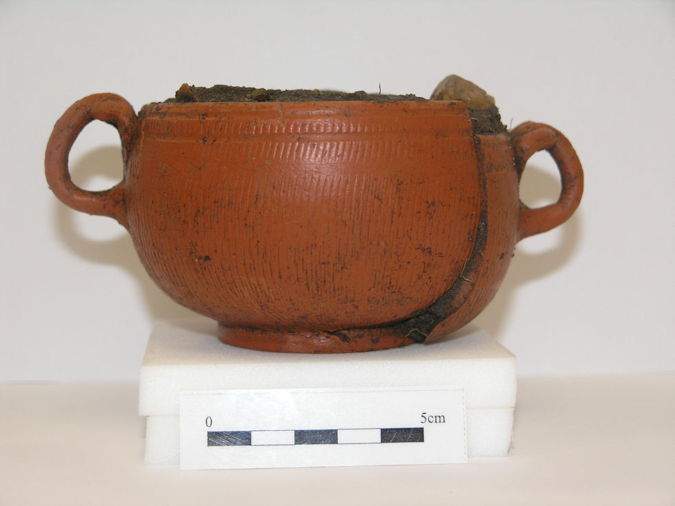
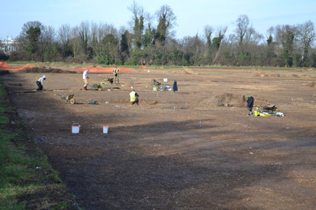
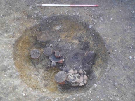
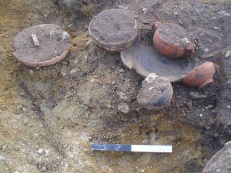
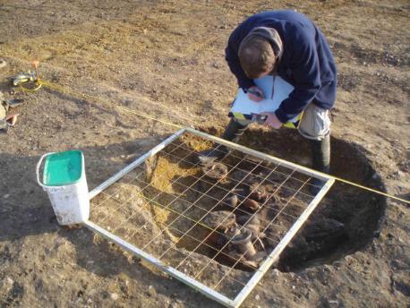
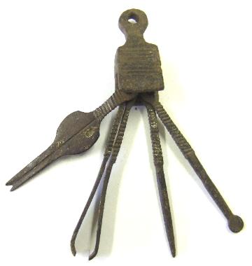
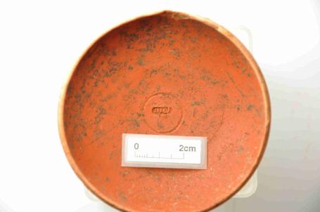
The second group started in the field behind CPDC, immediately to the left of the path from Paget Road to Addenbrooke’s Hospital. A thick layer of top soil had been removed prior to the work, leaving a high track alongside the CPDC perimeter. Richard described the Middle Bronze Age settlement and a Late Iron Age enclosed area with a cremation pit. Tom said one of the most spectacular finds has been a high status cremation pit dating to directly before the Roman invasion, approximately AD30-40. The pit contained 10 pottery vessels, a glass vessel, a toiletry set and the remains of a wooden box, inside of which was the cremated bone. The Late Iron Age and Early Roman settlement here was clearly one of particularly high status.

Aerial view of the archaeological excavation on Clay Farm, looking east from the green corridor to CPDC and Wingate Way, with Long Road to the right and Clay Farm House upper right. Source: Oxford Archaeology East, 13 April 2011.
Vertical aerial view of the archaeological excavation on Clay Farm looking at the field to the east of CPDC and Paget Close. Source: Oxford Archaeology East, 13 April 2011.
One of the groups in the field to the rear of CPDC, with Richard Mortimer describing the site. Photo: Andrew Roberts, 7 April 2011.
Richard Mortimer at a Late Iron Age cremation pit which contained burial goods. Photo: Andrew Roberts, 7 April 2011.
Looking across the field to the rear of the CPDC during the Local History Group visit to the archaeological excavation on Clay Farm. Photo: Stephen Brown, 7 April 2011.
Finds in situ in the cremation pit. Source: Oxford Archaeology East, 9 February 2011.
Recording the finds in situ in the cremation pit. Source: Oxford Archaeology East, 9 February 2011.
Toiletry set dated to 30-50 AD from the cremation pit. Source: Oxford Archaeology East, 10 February 2011.
Samian cremation bowl dated to 10-30 AD from the cremation pit. Source: Oxford Archaeology East, 10 February 2011.
Stamped Samian dish from the cremation pit. Source: Oxford Archaeology East, 11 February 2011.

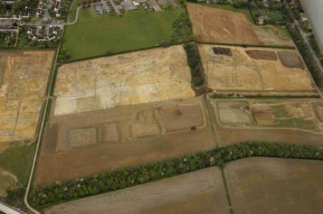
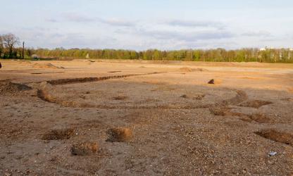
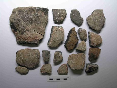
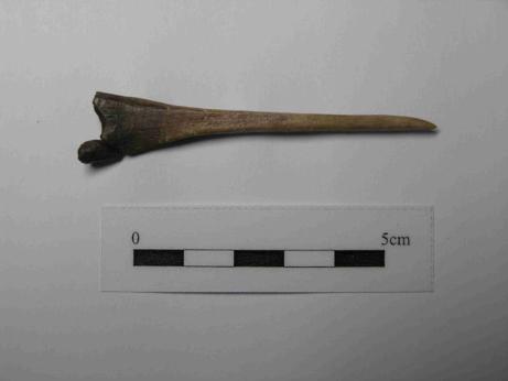
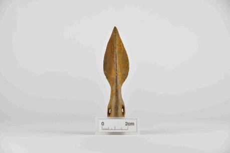
In the field to the north of the tree belt, Richard described a Middle Bronze Age settlement area with rectangular enclosures and ditches. The waterlogged ground had been ideal as it had preserved wood which was now being dated and pollen and seed evidence including elder pips from an early hedgerow. At the south eastern end of the field, there had been an occupation area where rubbish was tipped into ditches. This included pottery, bone, a chape, a bronze spear head and flint arrow heads.

Aerial view of the northern area of the Clay Farm archaeological excavation, with evidence of the Middle Bronze Age field system (OAE Areas A and B, Settlement 1). The view is from the north, from over Long Road, with Clay Farm House lower right, Fawcett Primary School upper right and Hobson's Brook hidden in the tree belt to the left. There were extensive finds in the area parallel with the tree belt upper centre, still to be excavated at this point. The Aura and Halo developments now cover this area, with Lime Avenue constructed to the right of the north-south hedgerow. Source: Oxford Archaeology East, 13 April 2011.
Aerial view of the northern area of the Clay Farm archaeological excavation, with evidence of the Middle Bronze Age field system (OAE Areas A and B, Settlement 1). The view is from the north, from over Long Road, with Clay Farm House lower right, Fawcett Primary School upper right and Hobson’s Brook hidden in the tree belt to the left. There were extensive finds in the area parallel with the tree belt upper centre, still to be excavated at this point. The Aura and Halo developments now cover this area, with Lime Avenue constructed to the right of the north-south hedgerow. Source: Oxford Archaeology East, 13 April 2011.
Richard Mortimer describing Middle Bronze Age enclosures and ditches in waterlogged ground. Photo: Andrew Roberts, 7 April 2011.
Richard Mortimer describing an occupation area where rubbish was tipped into ditches. Photo: Andrew Roberts, 7 April 2011.
Pottery from the Middle Bronze Age ditch. Source: Oxford Archaeology East, 2011.
Broken bone needle from the Middle Bronze Age ditch. Source: Oxford Archaeology East, 2011.
Small bronze spearhead from the Middle Bronze Age ditch. Source: Oxford Archaeology East, 9 December 2010.

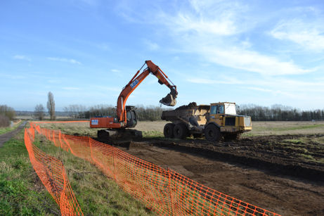
The area was crossed by land drains which Antony Pemberton remembered from its more recent farming history. Further into the field, there were circular markings which Richard explained were the site of a group of searchlight batteries. Tom described the remains of a Second World War searchlight battery – on plan and on the ground looking for all the world like a group of Bronze Age barrows or enormous Iron Age ring gullies. Some of the finds they contained were even remarkably similar to those that you would expect to find in their prehistoric counterparts. Richard said they dated from 1942 and the evidence included a paint tin and baked bean tin! This was in the area soon to be crossed by the Clay Farm spine road.

Looking north across the Clay Farm field towards the rear of Long Road, with the circular markings of a World War II searchlight battery and fencing marking the line of the spine road. Photo: Andrew Roberts, 10 April 2011.
Looking across Clay Farm through the old gate, from the path between Foster Road and Addenbrooke’s. Photo: Andrew Roberts, 10 April 2011.