From railway to Busway, south of Long Road bridge:
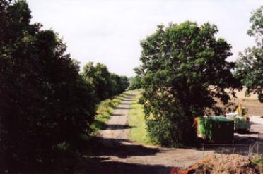
Footpath along the route of the Cambridge-Bedford railway (closed 1968), looking south from Long Road bridge, before work starts on the Guided Busway. Andrew Roberts, Jul 2007.
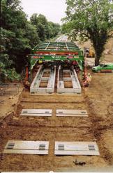
Laying the Busway track, south of Long Road bridge. Andrew Roberts, Jul 2009.
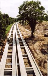
The completed Busway track. Andrew Roberts, Aug 2009.
Local passenger train from Cambridge to Bedford, passing under Long Road bridge (now the Busway route). Middleton Press.
Welcome to The Changing Face of Trumpington . This is one of a series of pages showing how Trumpington has changed over time, with this page about the Busway, railways, Hobson’s Brook and Hobson’s Park. The information is on display in the Clay Farm Library at The Clay Farm Centre. See the Introduction for a link to other pages.
From railway crossing to Busway bridge, the Addenbrooke’s Busway spur:
Initial work on the route of the Guided Busway, constructing a bridge across the main railway line, where the track from Paget Close to Addenbrooke’s Hospital crossed the railway at a level crossing. Andrew Roberts, Aug 2007.
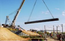
Swinging a bridge beam across the railway line, with Addenbrooke’s Hospital in the background, from the west side of the track. Andrew Roberts, Oct 2007.
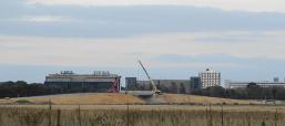
Looking towards the Guided Busway bridge from the south west, with cranes on the embankment and the hospital in background. Elizabeth Rolph, Sep 2008.


From footpath to Busway (Foster Road stop) and housing:
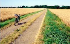
Footpath along the old railway route, looking north east from the crossing point with the track from the allotments to Addenbrooke’s Hospital, before work starts on the Busway. Andrew Roberts, Aug 2007.
Looking north along the Guided Busway at the Foster Road stop, before the start of construction of housing and Hobson Square. Andrew Roberts, Oct 2011.
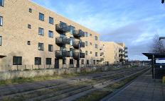
The Busway, bus stop and completed homes on Harradine Street and Hartree Lane, Virido development. Andrew Roberts, Dec 2017.

Hobson’s Brook through Clay Farm:
Hobson’s Brook, looking north near the track from the Foster Road allotments to Addenbrooke’s Hospital and Nine Wells, with crops on Clay Farm, and the track from Paget Close to Addenbrooke’s in the distance. Andrew Roberts, Aug 2007.
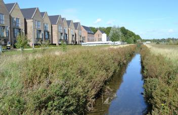
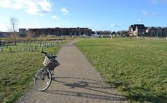
Looking along Hobson’s Brook to newly completed homes on Pinnington Close, Cala development. Andrew Roberts, Sep 2017.
From farmland to Hobson’s Park and housing:
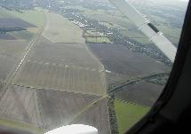
Aerial photograph of Clay Farm looking south, before the development of Addenbrooke’s Road and housing, with the main railway line to the left, Hobson’s Brook centre, Shelford Road upper right. Howard Slatter, 2002.
Looking west across Clay Farm to the shelter belt along the line of the old railway, looking along the track from the Foster Road allotments. Andrew Roberts, Aug 2007.
Looking along the current track across Hobson’s Park, on the line of the old track, with houses in the Abode and Cala developments. Andrew Roberts, Jan 2018.
Hobson’s Park:
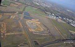
Aerial photograph of Clay Farm looking north, with infrastructure work in the green corridor including the construction of the lake. Tamdown (Patrick Squire)/Countryside, Feb 2011.
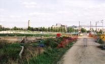
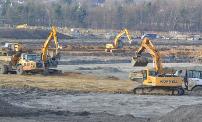
Looking across the Clay Farm green corridor with work underway to construct the lake, from the approach to the Addenbrooke’s Road bridge. Andrew Roberts, Feb 2011.
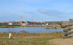
Hobson’s Park lake and the Cala development. Andrew Roberts, Dec 2016.