Alpha Terrace:
Family group standing in Alpha Terrace, looking east with the Free Church on the right, postcard c. 1908. Cambridgeshire Collection. Cambridge Central Library.
Alpha Terrace. Andrew Roberts, Jan 2018.
Sheldrick’s saw mill, to the rear of St Mary’s House, Alpha Terrace, c. 1900. There is a large pile of logs in the foreground and three people standing in front of the building. Cambridgeshire Collection, Cambridge Central Library.
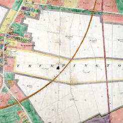
East of Trumpington village centre, Land Value map for Trumpington, 1910-11 , Cambridgeshire Archives, file 470/047, sheet XLVII.10.
Welcome to The Changing Face of Trumpington . This is one of a series of pages showing how Trumpington has changed over time, with this page about the area to the east of the village centre including Clay Farm. The information is on display in the Clay Farm Library at The Clay Farm Centre . See the Introduction for a link to other pages.

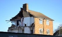
Anstey Way:
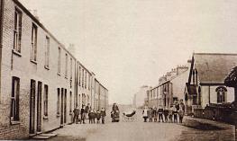
The Anstey Way shops, 1956. Cambridgeshire Collection. Cambridge Central Library.
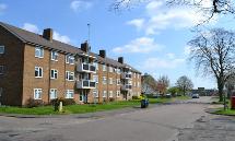
The flats on Anstey Way. Andrew Roberts, Apr 2017.
The flats being demolished. Andrew Roberts, Dec 2017.
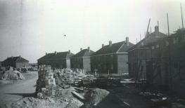

Foster Road and Trumpington Pavilion:
Construction of homes in Foster Road, c. 1946. Cambridgeshire Collection, Cambridge Central Library.
The 1950s Pavilion entrance, before the start of renovation work. Andrew Roberts, Sep 2008.
Trumpington Pavilion frontage, after rebuilding in 2009. Andrew Roberts, Apr 2017.
Clay Farm archaeology:
Aerial view of the archaeological excavation on Clay Farm looking east from Foster Road to the Guided Busway, with excavations underway in the field to the east of Foster Road. Oxford Archaeology East, Apr 2011.
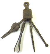
Roman period toiletry set from a cremation burial. Oxford Archaeology East, Feb 2011.
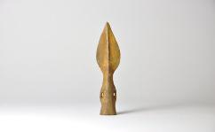
Middle Bronze Age bronze spearhead. Oxford Archaeology East, Dec 2010.

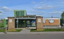
Hobson Square/Clay Farm Centre:
Preliminary work on Hobson Square, from the Busway. Andrew Roberts, Jun 2014.
Progress with the construction of Hobson Square. Andrew Roberts, Nov 2014.
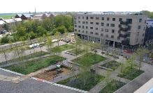
Hobson Square and the Clay Farm Centre, nearing completion. Andrew Roberts, Dec 2017.

Hobson Square/Clay Farm Centre:
The Centre under construction, from Hobson Square. Andrew Roberts, Jul 2017.
Looking from the roof of the Clay Farm Centre, onto Hobson Square and the Busway, Cala and Virido, with foundations being dug for the art work. Andrew Roberts, Apr 2017.
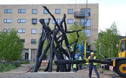
Erecting the ‘Bronze House’ sculpture in Hobson Square. Andrew Roberts, May 2017.
Clay Farm north:
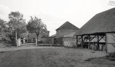
Clay Farm, farm buildings and house, 1950s. John Banks (Dr Stephen Brown).
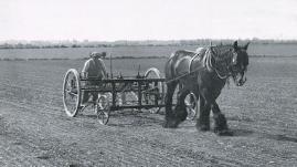
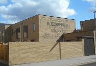
Reg Cornwell drilling sugar beet on Clay Farm, 1940. Rachel Tarry (Dr Stephen Brown).
The Cornwell art work, Forbes Close, Aura development. Andrew Roberts, Apr 2016.
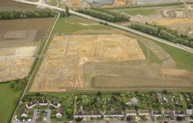
From Paget Close to Addenbrooke’s Hospital, looking right:
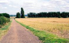
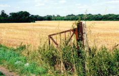
Looking along the track from Paget Close to Addenbrooke’s Hospital, at the rear of Paget Close, across farmland to the tree shelter belt and the old railway in middle distance. Andrew Roberts, Aug 2007.
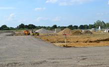
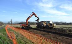
Clearing top soil from the field behind Foster Road prior to the archaeological excavation. Andrew Roberts, Feb 2011.
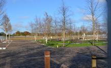
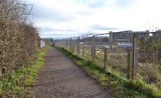
Looking along the path to Lime Avenue, with the final parcels of building land and the Clay Farm Centre to the right. Photo: Andrew Roberts, Dec 2017.
From Paget Close to Addenbrooke’s Hospital, looking left:
Harvested fields at Clay Farm, to the north of the track from Paget Close to Addenbrooke’s Hospital. Andrew Roberts, Aug 2007.
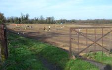
Archaeological excavation in the field to the north of the track. Andrew Roberts, Feb 2011.
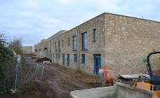
Homes in Hawkey Road (Aura development) under construction. Andrew Roberts, Dec 2017.
Northern spine road (Lime Avenue), Clay Farm:
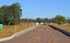
Looking along the spine road while it is under construction, towards Long Road. Andrew Roberts, Oct 2011.
Lime Avenue, in an early stage of the Halo and Aura developments, with the community college site to the right. Andrew Roberts, Dec 2014.
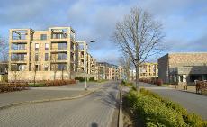
Completed apartments on Lime Avenue, opposite Trumpington Community College. Andrew Roberts, Dec 2017.
Clay Farm south, the Showground:
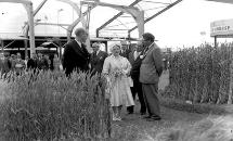
The Queen Mother at the Royal Show, 5 July 1961. Cambridge Evening News.
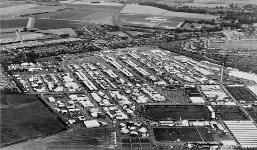
Aerial view of the 1961 Royal Show, on the farmland between the London railway line and Shelford Road, with the railway cutting and the estate to the right. Antony Pemberton.
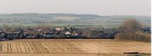
Looking towards Shelford Road from Addenbrooke’s Hospital, with Hobson’s Brook and Clay Farm in the foreground. Andrew Roberts, Jan 2008.
From farmland to Clay Farm development:
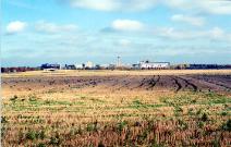
Looking across the harvested Showground fields towards Addenbrooke’s Hospital. Andrew Roberts, Nov 2007.
Aerial view of the archaeological excavation on Clay Farm, looking towards Shelford Road and the new Addenbrooke’s Road with Glebe Farm and Bishop’s Road in the distance. Oxford Archaeology East, Jul 2010.
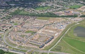
Aerial photograph of the southern part of the Clay Farm development (Seven Acres, Paragon and Abode), Hobson’s Brook and Hobson’s Park to the right and Trumpington village in the background. Countryside Properties, Jun 2016.
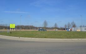
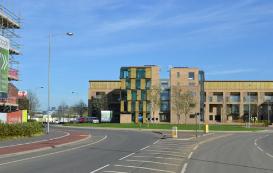

Addenbrooke’s Road roundabout:
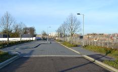
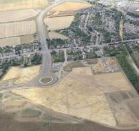
The start of house construction at the Addenbrooke’s Road roundabout, Abode development. Andrew Roberts, Feb 2012.
The newly-completed Cherry Building. Andrew Roberts, Oct 2013.
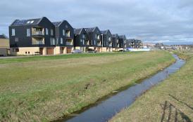
Hobson’s Brook:
Harvesting the Showground fields, Clay Farm, with Hobson’s Brook in the foreground. Andrew Roberts, Aug 2007.
New homes on Southwell Drive beside Hobson’s Brook, Paragon development. Andrew Roberts, Feb 2017.