People have lived and farmed in our local area for over 5000 years, with recent archaeological excavations finding remarkable evidence of this activity. The parish of ‘Trumpington’ was established before 1000 AD, with Trumpington village developing at its core. The parish extended from Vicar’s Brook in the north to Hauxton Mill in the south, from the River Cam in the west to Hills Road in the east. In 1086, there were just 37 households (around 185 people) living in the parish. By 1811, the population had grown to 508 people, still concentrated in the village. Much had changed by 1911, when the population had grown to 1269, with houses spreading from the village centre and from Cambridge in the north. In the next 100 years to 2011, the population soared to around 7000 people, but the greatest change is happening in the current decade, with the new housing developments resulting in growth to around 17,000 people by 2021. With so much changing, we hope you will agree with us that Trumpington still has a distinct identity.
If you would like to find out more about the history of Trumpington, please look at the other pages under this theme and the corresponding panels in Trumpington Library at The Clay Farm Centre. There is a lot of information on this website and do come to our meetings. Please take a set of Trumpington History Trails, 10 walking and cycling routes around Trumpington and the surrounding area from The Clay Farm Centre Reception Desk or Trumpington Pavilion.
The green by Anstey Way. Andrew Roberts, Apr 2015.
Welcome to The Changing Face of Trumpington . This is one of a series of pages showing how Trumpington has changed over time.
The information is on display in the Clay Farm Library at The Clay Farm Centre.
See the Introduction for a link to the other pages.

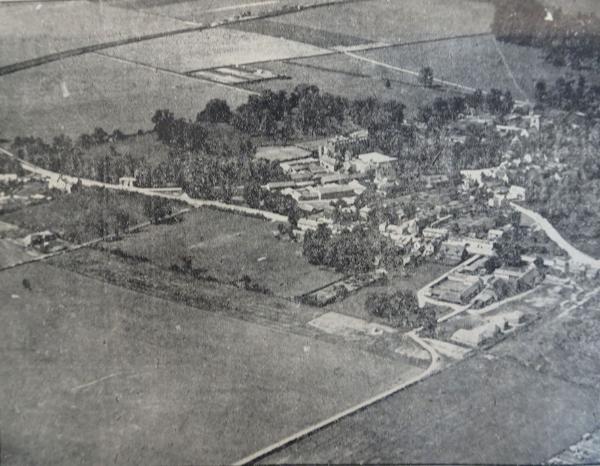
Trumpington from the north east, photograph, Cambridge Chronicle , 6 August 1919, p. 9, from the newspaper original, Cambridgeshire Collection. Cambridge Central Library.
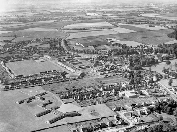
Aerial view of Trumpington from the north east, 1955. Includes the village core, High Street, Church Lane, Shelford Road, Bishop’s Road, Hauxton Road, Anstey Hall, Church, PBI headquarters building and grounds, Cambridge-Bedford railway line, Anstey Hall Farm shepherd’s cottage and hay stacks, former PoW Camp, the Estate and King George V recreation ground (with bowling green), Anstey Way with shops under construction, Alpha Terrace, Fawcett School, allotments, Wingate Way under construction, The Red Lion, Manor Farm with hay ricks, Village Hall, blacksmiths. Dr Stephen Brown (Mr W. Stanion) and Cambridgeshire Collection, Cambridge Central Library.
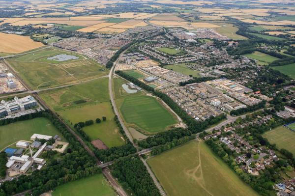
Aerial photograph of Trumpington from the north, including the Clay Farm development, Hobson’s Park, Trumpington Community College, the busway, Long Road, Long Road Sixth Form College, LMB, the village and countryside. Countryside Properties, July 2017.
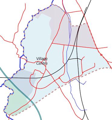
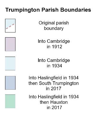
Trumpington Parish Boundaries: changes to Trumpington parish, March 2018. Howard Slatter.
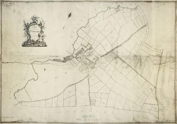
Inclosure Map: A Map of the Parish of Trumpington in the County of Cambridge, 1804 . Cambridgeshire Archives, R60/24/2/70(a).
Trumpington section of the coloured copy of Baker’s Map of Cambridge , 1830, Trumpington Village Hall. Photo: Andrew Roberts, 10 June 2016.
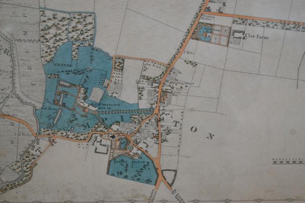
Land Value map: Extract from the Inland Revenue Land Value map for Trumpington, 1910-11 , Cambridgeshire Archives, file 470/047, sheet XLVII.10.
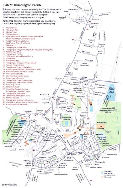
Updated map from The Trumpet , Dec 2017. Sheila Betts, Editor, The Trumpet/Parish Church.
The Clay Farm Centre logo.