Anstey Hall Farm, Archaeology Open Day, 10 May 2015

Poster for the Anstey Hall Farm open day, 10 May 2015. Oxford Archaeology East.

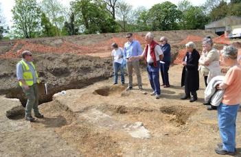
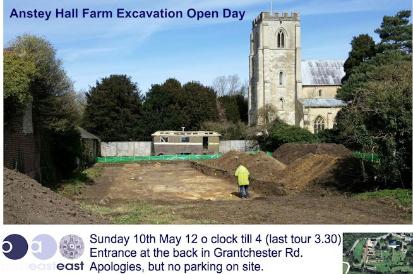
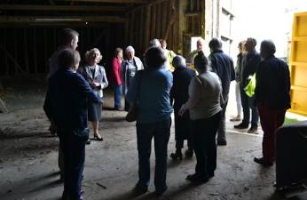
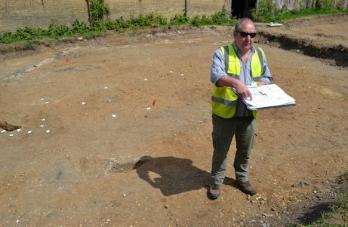
There was an open day at the archaeological excavation at Anstey Hall Farm on Sunday 10 May 2015, with visitors having an opportunity to hear about progress on site. Groups were shown around by Richard Mortimer and Stuart Ladd, Oxford Archaeology East , and we are very grateful to them and their volunteers for a fascinating afternoon. Visit report by Andrew Roberts.

Background

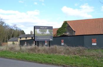
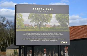
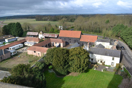
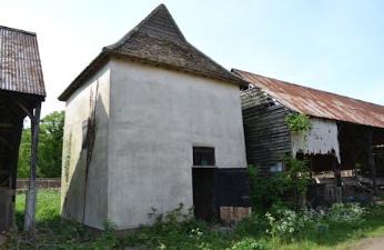
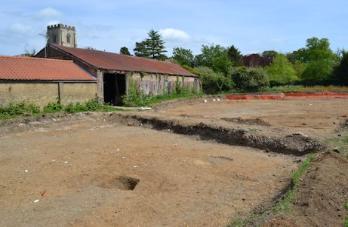
The excavation is an area to the rear of Anstey Hall Farm, where Hill Residential has planning permission to convert a range of barns, stables and other farm buildings into eight homes and build a further four homes on part of the farmyard. The farm is in the historic centre of Trumpington, close to the parish church. The barns have been out of agricultural use for some years. Parts of the range date from the 17th-18th centuries, including a Grade II listed weather-boarded barn and a dovecote. The archaeological site is immediately north of the area excavated in 2011, where evidence was found of the Early Saxon settlement, including the bed burial with a gold and garnet cross.

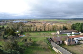
In 2012, before the main phase of development work at Trumpington Meadows and any proposals at Anstey Hall Farm, the layout of the site could be seen from the church tower.

Development sign at Anstey Hall Farm (Anstey Hall Barns). Photo: Andrew Roberts, 27 March 2015.
Looking from Trumpington church tower south west over Anstey Hall Farm towards Byron’s Pool, with Trumpington Meadows park to the left and the grounds of Trumpington Hall to the right, towards Haslingfield. Photo: Andrew Roberts, 7 April 2012.
Looking from Trumpington church tower south over the outbuildings of Anstey Hall Farm, across Trumpington Meadows, with the field examined during the archaeology excavation in the foreground, the first homes to the left, the John Lewis building, the area for the primary school and the higher part of the park, towards the motorway and Hauxton. Photo: Andrew Roberts, 7 April 2012.

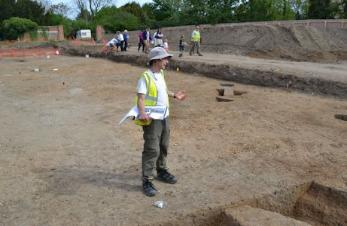
At the start of the tours, Richard Mortimer and Stuart Ladd gave a brief background about the site and its chronology. We were standing in the area of the original Saxon settlement of Trumpington. As was typical on this kind of site, there were very few pottery finds, so it was difficult to date the features. However, there was evidence of Early Saxon use on the south side of the site (5th-7th century AD) and Middle Saxon (late 7th century-10th century), Late Saxon (10th-11th century) and Medieval features across the site. Stuart added that there was an evolution in this region from small farmsteads to more structured settlements in the Middle Saxon period.
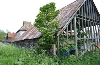
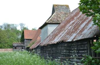
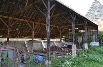
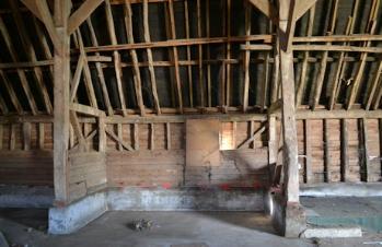
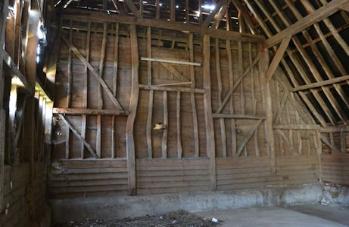
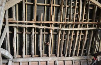
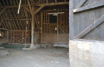
Barns and dovecote

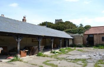
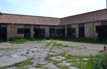
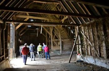
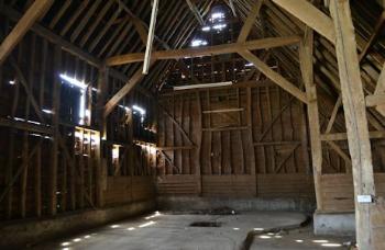
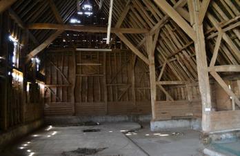
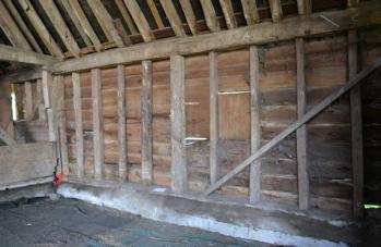
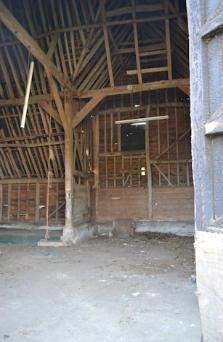
We were able to walk past the barns and dovecote and into the main weather-boarded barn. The barn seemed to have doorways on opposite sides which suggested it had been used as a threshing barn. Stuart Ladd thought it would not have been a tithe barn. The dovecote had been renovated in 1984 and had a faded sign recording this work. The stables and surrounding buildings were being cleared of accumulated rubbish while we were there.
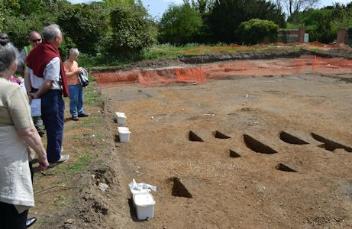
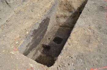
The barns and dovecote at Anstey Hall Farm. Photo: Andrew Roberts, 10 May 2015.
Outbuildings being cleared at Anstey Hall Farm. Photo: Andrew Roberts, 10 May 2015.
The dovecote, Anstey Hall Farm. Photo: Andrew Roberts, 10 May 2015.
Looking from outbuildings towards the church tower. Photo: Andrew Roberts, Anstey Hall Farm, 10 May 2015.
Outbuildings and stables being cleared at Anstey Hall Farm. Photo: Andrew Roberts, 10 May 2015.
The interior of the main barn, Anstey Hall Farm. Photo: Andrew Roberts, 10 May 2015.
Richard Mortimer talking to a group in the interior of the main barn, Anstey Hall Farm. Photo: Andrew Roberts, 10 May 2015.
The interior of the main barn, Anstey Hall Farm. Photo: Andrew Roberts, 10 May 2015.
The roof of the main barn, Anstey Hall Farm. Photo: Andrew Roberts, 10 May 2015.
Looking across the threshing floor? in the main barn, Anstey Hall Farm. Photo: Andrew Roberts, 10 May 2015.
Looking across the threshing floor?, Anstey Hall Farm. Photo: Andrew Roberts, 10 May 2015.

Excavated area

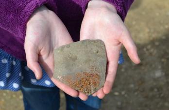
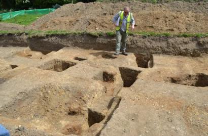
The main excavated area had a rectangular shape, with the outer stable wall on its north side and a walkway along its south side. Before work began, the area had been overlaid by demolished farm buildings. The excavation to the right of the walkway (south) had already been backfilled with soil from the excavation to the left. This right hand area had included Early Saxon evidence, closest to the location of the Trumpington Meadows excavation. Stuart said that very little pottery had been found in the Early Saxon features.

The excavated area at Anstey Hall Farm, with white tags marking Late Saxon post holes. Photo: Andrew Roberts, 10 May 2015.

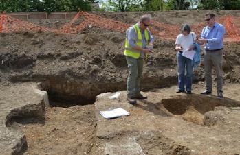
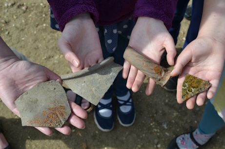
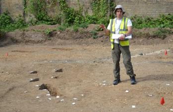
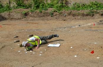
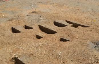
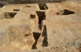
The area to the left of the walkway had a number of post holes in a regular pattern and lines of ditches. These features had been dated to Middle to Late Saxon, 8th-10th century. Stuart reached down into one of the excavated post holes to demonstrate its depth. He said that there was an average of one piece of pottery in a post hole. Other post holes were marked by white tags and would be excavated in the remaining weeks of the project. The linear ditches included pottery and animal bone. The evidence probably related to agricultural buildings and the development and reuse of east-west land divisions, rather than indicating a settlement in this specific location.

Richard Mortimer talking to a group at the excavation, with white tags marking Late Saxon post holes, Anstey Hall Farm. Photo: Andrew Roberts, 10 May 2015.
Stuart Ladd talking about the Middle to Late Saxon excavated features, Anstey Hall Farm. Photo: Andrew Roberts, 10 May 2015.
Stuart Ladd demonstrating the depth of a Middle to Late Saxon post hole, Anstey Hall Farm. Photo: Andrew Roberts, 10 May 2015.
Stuart Ladd talking about the Middle to Late Saxon excavated features, Anstey Hall Farm. Photo: Andrew Roberts, 10 May 2015.
0th-11th century Saxon pot, Anstey Hall Farm. Photo: Andrew Roberts, 10 May 2015.

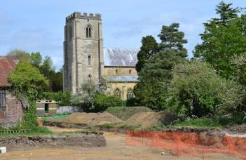
From this position, we could see the Early Medieval church, immediately to the east of the farm, and a further area of excavation at right angles to the walkway.

View across the excavated area to the church, Anstey Hall Farm. Photo: Andrew Roberts, 10 May 2015.

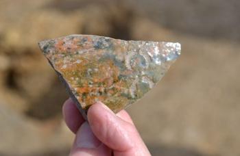
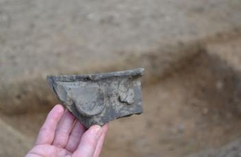
On the north side of the rectangular area, near the stables, there was a group of pits which had been 50% excavated and a few post holes. The work done so far had uncovered a sherd of St Neots ware (a Late Saxon shelly ware), showing trade links to the west of here, and a large quantity of split and butchered animal bone. The remaining parts of the pits would be excavated before the project was completed. The pits may have been middens which were infilled after use.

Part-excavated Late Saxon pits, Anstey Hall Farm. Photo: Andrew Roberts, 10 May 2015.

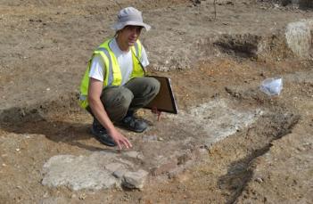
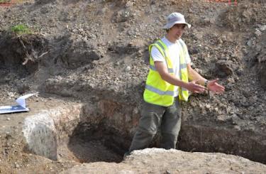
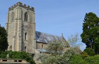
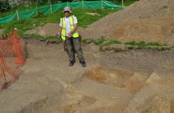
We continued along the further part of the excavated area towards the church. The evidence here included a series of post holes which appeared to be the remains of a timber palisade fence forming a defensive feature. This may have been 9th century, Middle Saxon, as the post holes were cut by 10th-12th century ditches and overlaid by a gravel roadway. They were arranged in a curving alignment, a different alignment from other features in the area. Stuart said that the development of the palisade ditch would have been a major undertaking. Richard thought the palisade may be evidence of an oval area surrounding a manor or a wooden church predating the current church, which has surviving features dating from 1200 AD. Stuart said that no burials had been found in the area that was included in the excavation.

Walking past the excavated area towards the church, Anstey Hall Farm. Photo: Andrew Roberts, 10 May 2015.
View to the church, Anstey Hall Farm. Photo: Andrew Roberts, 10 May 2015.
Richard Mortimer describing archaeological features, including the line of a Middle Saxon palisade fence, Anstey Hall Farm. Photo: Andrew Roberts, 10 May 2015.
Archaeological features including the line of a Middle Saxon palisade fence, Anstey Hall Farm. Photo: Andrew Roberts, 10 May 2015.

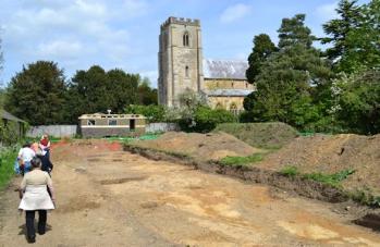
The Medieval gravel or cobble roadway near the palisade had a north-south alignment. It may have been going towards the site of an earlier church. Richard and Stuart said that more work was needed on the landscape evidence and the possibility that this was part of a more extensive north-south route. No comparable north-south alignment had been found during the Trumpington Meadows excavation, but this roadway was east of that site and matched well with the boundary of the current park of Anstey Hall.

Beyond the post holes, there was a partly excavated area which was a Medieval quarry pit. It may also include a well up to 3 m deep, possible Middle Saxon, which was still to be excavated.

Taken together, these features suggested the church or a landowner was active in the area between the farm and the current church at this early date, Middle Saxon.

Stuart Ladd describing archaeological features including the Medieval roadway, Anstey Hall Farm. Photo: Andrew Roberts, 10 May 2015.
The Medieval roadway near the church, Anstey Hall Farm. Photo: Andrew Roberts, 10 May 2015.
A Medieval quarry pit and Middle Saxon? well, Anstey Hall Farm. Photo: Andrew Roberts, 10 May 2015.

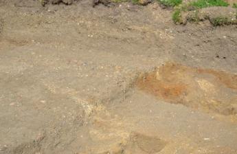
We returned to the eastern part of the site where there was evidence of Medieval industrial activity. The features included a clay working surface which may have been for metalworking or grain processing and a series of ovens, overlapping each other. A number of pieces of glazed pottery had been found in the backfill which would have been added to these pits when they went out of use.

Medieval ovens, Anstey Hall Farm. Photo: Andrew Roberts, 10 May 2015.
Looking at Medieval pottery from the ovens, Anstey Hall Farm. Photo: Andrew Roberts, 10 May 2015.
Stuart Ladd describing the Medieval clay working surface, Anstey Hall Farm. Photo: Andrew Roberts, 10 May 2015.
Stuart Ladd describing the Medieval ovens, Anstey Hall Farm. Photo: Andrew Roberts, 10 May 2015.
Medieval glazed pot from one of the ovens, Anstey Hall Farm. Photo: Andrew Roberts, 10 May 2015.
Medieval pot from one of the ovens, Anstey Hall Farm. Photo: Andrew Roberts, 10 May 2015.
Medieval pottery sherds from the ovens, Anstey Hall Farm. Photo: Andrew Roberts, 10 May 2015.