Report by Andrew Roberts
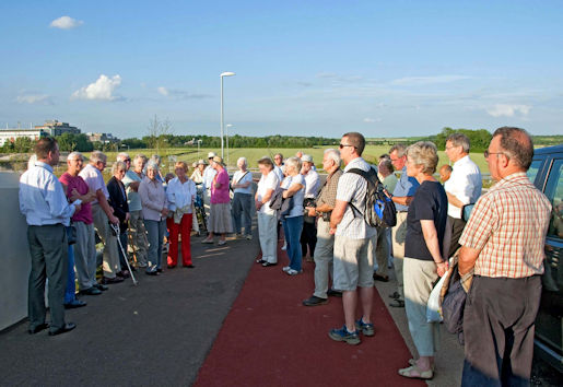
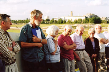
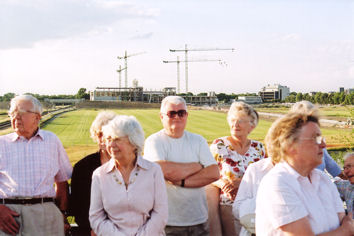
Around 40 participants gathered at the east end of the new Addenbrooke’s road bridge over the railway line to hear four presentations about the surrounding area. The date turned out to be a good choice, a beautiful summer evening. The ‘correct’ name for the bridge is ‘Nine Wells Bridge’.
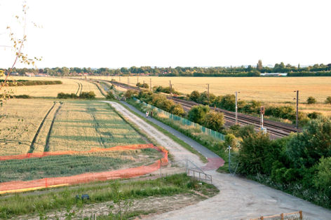
Howard Slatter, Chairman of the Local History Group, introduced the speakers and set the context. We were looking across Clay Farm towards Hobson’s Brook, which flows in a shallow valley which used to be the route of the River Cam itself. There was a Roman Villa south west of the bridge, with evidence of a Roman settlement and an east-west road to the north, under the current site of Addenbrooke’s Hospital. The area was enclosed in the early 19th century and then cut by the new railway line in the 1840s. Addenbrooke’s Hospital began to develop in the 1960s and is now expanding towards the railway line.
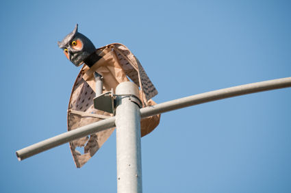
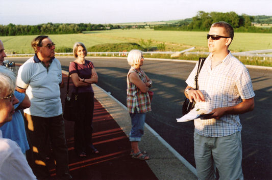
Mike Davies, the Cycle Cambridge Programme Manager and the former Project Manager for the Access Road, described the process of constructing the new road from Hauxton Road to Shelford Road and Addenbrooke’s Hospital. The road would be opening in a few months (August 2010). The need for the road came from the growth of the Southern Fringe, particularly the expansion of the Addenbrooke’s site for hospital and biomedical purposes (from a current figure of 7000 people working on site to up to 17,000 in the future) and the development of new housing on Clay Farm, Glebe Farm and Trumpington Meadows. The final cost was £24.8 million, including contributions from the Growth Area Fund (£6 million) and S106 agreements with developers (£12.8 million). The work included upgrading the M11 junction and planting 12,000 new trees. Planning consent was given in January 2007 and work started in October 2007, using funds as they became available. The railway bridge was 10 metres high, made of reinforced concrete, with 1 in 20 approach roads. The railway line had to be closed when the main spans were lifted into place and the rail possession had to be booked two years in advance. The road had excellent cycling provision, including an off-road lane and markings on the road itself and linked with the Great Shelford-Addenbrooke’s cycle route. The stretch from Shelford Road to the hospital was 30 mph and from Hauxton Road to Shelford Road was 40 mph. Mike mentioned that a number of model owls had been placed on top of some of the lighting columns, to discourage other birds. There would be traffic controls to restrict the use of the road as a through route beyond the hospital.
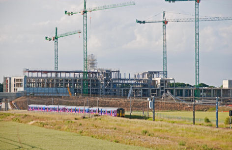
Antony Pemberton talked about the use of the area for farming. He said that it had been farmed since at least Roman times. The fields had been part of the Trumpington estate since 1675, when the land was bought by his ancestor, although there were few surviving records until the 1740s. The estate archive had the original documents for the sale of land to the railway company. Looking towards Trumpington, Antony remembered when the old Bedford to Cambridge railway line was closed on 1 January 1968. About 25 years ago, he had planted the tree belt that crosses Clay Farm, close to the old railway (now the route of the Guided Busway). Clay Farm itself was farmed by two generations of the Cornwell family until 1970, when it was taken back in hand by the estate. A number of buildings around the farmhouse were demolished at that time, including a World War II searchlight battery. Antony had brought a large aerial photograph showing the part of Clay Farm to the west of our viewpoint, dating from one of the Royal Shows that were held on the farm in 1960 and 1961. When he started work in 1964, the effects of the Royal Show were still apparent, including poor crops where there had been dirty straw and lots of punctures due to discarded nails! Further archaeological excavations were now underway to the east of Shelford Road (to look for Iron Age and Roman evidence), in preparation for the Clay Farm development. Turning to look north east, Antony remembered the high chimney being built at Addenbrooke’s Hospital, when the engineers poured concrete continuously for 10 days as the chimney increased in height. He went to the top of the chimney when it was finished, and could feel the heat from the cooling concrete. To the north, we were looking across two fields where grass had been planted to keep the ground clean while development was underway. Beyond the new railway bridge for the Guided Busway, we could see progress on the new Laboratory of Molecular Biology (Medical Research Council) building which was the first development in the ‘MediPark’ (Cambridge Biomedical Campus) that would reach to the railway line. It was also planned to extend the hospital itself, including moving Papworth Hospital to the site. The area immediately to the east of the bridge would include a helipad for the hospital, with provision for further expansion in the future.
Howard Slatter explained that he had been recording birds in the area for 30 years and had also been one of the trustees of Hobson’s Conduit Trust for the last 2 years. On the way to our viewpoint from Shelford Road, we would have crossed a new bridge over Hobson’s Brook. There was originally a natural watercourse from the springs at Nine Wells and near Granham’s Road, Great Shelford. In the early 17th century, the university and town decided to clean the King’s Ditch which ran around Cambridge, using the water course as the basis for a New River. By 1610, more work was needed to maintain the flow of water, when the university and town reached agreement with the landowner to have access rights to the stream, with a 1000 year lease. Thomas Hobson was not directly involved with the project, but provided money to maintain the water course in his will of 1631. He is remembered by the names Hobson’s Conduit and Hobson’s Brook, given to the fountain and the water course. Birds around the brook include kingfishers, which are most common in winter. When the fields were being actively farmed, the arable crops attracted skylarks and yellow wagtail in summer and overwintering flocks of golden plover and lapwing (1000s of birds at some times). Passage birds included regular wheatears and, up to ten years ago, whinchats. Winter visitors included snipe, merlin and peregrine, and among other occasional species he had recorded osprey, red kite and little egret. Otters were starting to explore the brook, but not breeding in the area. Antony added that there were enormous numbers of pigeons and rabbits.
Ellis Selway, Community Reserves Officer for Cambridge City Council, turned our view to the south, to Nine Wells. He said that this was one of 12 nature reserves in Cambridge. The site had been purchased in 1835, to protect the supply of water to the brook. It had been a Site of Special Scientific Interest (SSSI) due to the rare invertebrates in the water, but had lost this status, although the chalk stream was still a priority habitat. The springs flowed from the junction between the chalk and clay strata, at a constant temperature throughout the year of 10.2 degrees, but the water levels had dropped, particularly in the drought of 1976 when the springs dried up. The species had included a flatworm ( Crenobia alpina) which was a relic of the last glaciation, but this had not been seen recently (although it may have survived in the rocks). He had been implementing a management plan in recent years to improve the site and restore the flow in the springs. This included replacing the footbridges into the site, cutting back brambles, excavating the spring heads and removing eight of the beech trees which had been dominating the ground since they were planted in the early 1960s. These had been creating shade and acidic leaf litter which had been damaging the water. Local species included bullhead fish (Miller’s thumb), violets and stinking iris, a spindle tree near the monument and spindle ermine moths. He had seen a grass snake and water shrews. He was now updating the management plan and hoped the site would be supported by S106 funding when the local developments began.
After the visit, most of the participants had refreshments at Trumpington Pavilion. There was a display of maps and plans about the new road, the Clay Farm development and the green corridor between Hobson’s Brook and the railway line, Nine Wells and Byron’s Pool and Mike Davies’s work to encourage cycling in Cambridge.