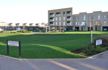
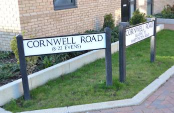
Street signs on Cornwell Road, looking across the play area. Photo: Andrew Roberts, 20 November 2015.
Cornwell Road is one of the roads in the Clay Farm development in the south of Trumpington. Part of the Abode and Paragon developments, Cornwell Road is the first turn to the right off Hobson Avenue, continuing from the Abode development into the Paragon development and forming the western and northern sides of the central play area. The road has a number of arms, forming a sort of inverted F shape. The homes were constructed in 2012-14 and occupied from 2013.
Cornwell Road. Source: © OpenStreetMap contributors (Howard Slatter).
Randall Evans gave a presentation about the origin of the name ‘Cornwell Road’ at the Local History Group meeting on 12 November 2015. It is one of a number of streets named after local families, in this case the Cornwell family that was involved with farming in Trumpington from the 1930s to the 1970s.
There is a separate page with information about the derivation of street names .

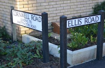
Street signs at the junction of Cornwell Road and Ellis Road. Photo: Andrew Roberts, 20 November 2015.
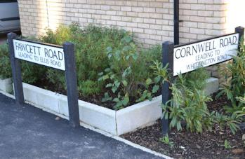
Street signs at the junction of Fawcett Road and Cornwell Road. Photo: Andrew Roberts, 20 November 2015.
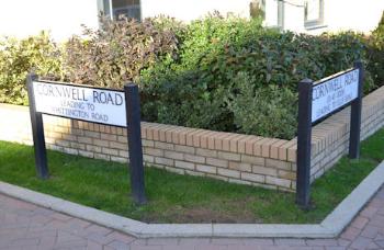
Street signs at the junction of Cornwell Road near the play area. Photo: Andrew Roberts, 20 November 2015.
The name Cornwell was not uncommon for a farmer (presumably, if they grew corn well!), for example, the Wendens Ambo entry in the 1874 Post Office Directory of Essex lists Thomas Cornwell, farmer, Wenden Hall, and William Cornwell, farmer, Wenden Place.
When the parish of Trumpington was enclosed in 1804-09, the farmland to the east of the village on both sides of Hobson’s Brook and south of Long Road was awarded to F.C.J. Pemberton, and known as Manor Farm and Clay Farm.
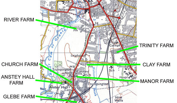
Manor Farm, Clay Farm and Trinity Farm, 1950s.
The Cornwells remembered in the name of the road were two of Trumpington’s tenant farmers. Reginald John Cornwell worked on his father Robert Ephraim Cornwell’ s farm at Lode near Newmarket. He and his father took over the tenancy of Manor Farm in 1929. The core of Manor Farm was developed as housing and the King George V playing field and Fawcett School in the mid 20th century and some of the earliest residents who moved in to new houses still live in the village. Manor Farm House was near the Village Hall; it was demolished in 1968-71 and Beverley Way constructed across the site.
In 1931, Robert Ephraim and Reg Cornwell also took over the tenancy of Clay Farm. Clay Farm was in the east of the parish, either side of Hobson’s Brook, limited to the east by the Great Northern railway line. The farm was also cut by the Cambridge to Bedford part of the London & North Western railway line, the railway route now used by the busway. The farm extended to the south beyond the line of Addenbrooke’s Road. Clay Farm house had been built in the 19th century, after enclosure, to the south of Long Road.
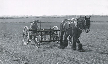
Reg Cornwell drilling sugar beet on Clay Farm, 1940. Photograph from Rachel Tarry, Trumpington Past & Present , p. 25.
Unfortunately Cornwell senior died in late 1932 and Reg carried on working both farms. During World War II, Reg Cornwell supplied milk to the soldiers in the army camp just off Long Road. By renting more land from the Pemberton estate, Trinity Farm, Reg was able to farm right up to Hills Road and as far as the railway line on the north side. Reg Cornwell died in 1973.
When the Local History Group and the Residents’ Association were proposing names for streets in the Clay Farm development, it seemed very appropriate to include the name Cornwell.
One of the hazards of farming was the threat of crop fires caused by unwanted emissions from steam trains. Writing in November 2010, David Stubbings added his memories of lineside fires, which “were a danger in the era of steam locomotives, as these engines could belch out red hot cinders, especially when working hard, and ignite wayside vegetation. I recall two periods in the 1940s when conflagrations occurred in the Parish of Trumpington. The situation concerning the LNER (ex GE) mainline was different. Fires here occurred generally at the height of the harvest. The fields to the west of the line were at that time, entirely arable, this was before the showground was established, and wheat and barley were among the crops grown. It seemed to be a hazard which farmers accepted that their corn could catch fire from the trains, and which did happen. One I remember in particular was when, to the south of the farm trackway (also a public right of way) from the High Street, next to the Village Hall to the Red Cross on Hills Road (no Paget Road, Foster Road or Addenbrooke’s then), a field of barley next to the line was extensively burnt. Once the farmer, possibly Mr Cornwell, had given permission, those villagers with poultry, etc., including myself, descended on the charred field to glean the heads of barley lying scorched on the ground. But burnt wheat crops were preferred! Many of us kept hens at that time, as eggs in the shops were rationed, and enough little-damaged grain could be gleaned to last several months. Presumably the railway company compensated the farmer. That is how I remember the lineside fires.”
As well as Cornwell Road, the Cornwell family is commemorated in a public art installation in the Aura development, just south of Long Road. This has been designed by artist Sean Edwards and installed in autumn 2015 with the help of Wayne Tanswell, a signwriter from Sudbury who did some of the sign writing for the Lovejoy series on television. The work has been designed as a reminder of the previous use of the land that the development is built on. It has been painted on the wall to appear already aged, strangely predating the building it is on. The first image was overwritten by a second, updated image, also suitably aged. The gleaning is remembered in the second image. In this way, the Cornwell name will continue on the land they used to farm. The sign is on the side of a building in Forbes Close, which is parallel with Lime Avenue, to the right of the southern arm of Plantation Avenue (November 2015: just visible beyond building hoardings.) It will be visible from the main road but not intrusive.
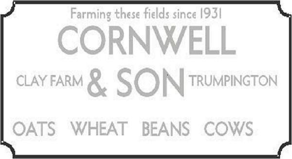
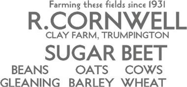
Designs for the Cornwell sign, lower layer and upper layer. Source: Sean Edwards, 2015.
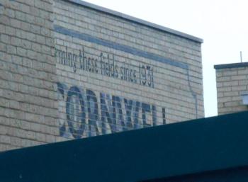
The ‘Cornwell’ sign, just visible on the side of a building in Forbes Close. Photo: Wendy Roberts, 21 November 2015.