Howard Slatter
April 2011
The roads and houses informally known as the Estate were built after the War, but when and how? This history of the housing development is based on a contribution given at the On the Street Where You Live meeting of the Local History Group on 31 March 2011. See also the introduction to The Estate.
Much of the early history of the Estate can be pieced together from the minute books of the Borough of Cambridge Housing Committee (Cambridgeshire Archives). Trumpington and Cherry Hinton only came into the Borough in 1934, and the first mention I have been able to find of council housing in Trumpington was in 1936. On 9 July it was resolved that the Borough Surveyor should be instructed to prepare lay-outs of the under-mentioned sites:
Bungalow Farm, Newmarket Road
Land opposite the Cement Works, Coldham’s Lane
Land at the junction of Coldham’s Lane and High Street, Cherry Hinton
Land at the rear of the Recreation Ground, Trumpington
In 1936, the Borough Surveyor was instructed to prepare a scheme for the development of some 55 acres of land situate at the rear of the Recreation Ground in Trumpington, for the erection of 280 houses, a Recreation Ground and land for allotments. It was resolved that the Town Clerk should enquire of Messrs Bidwell & Sons as to whether the land, which belonged to the Pemberton Trust, was for sale, and if so for how much.
Yes, the Pemberton trustees were willing to sell, but in February 1937 the Town Clerk reported that they were not willing to do so at a price in accordance with the District Valuer’s valuation. The council resolved to make a Compulsory Purchase Order for the land. This was duly approved by the Ministry of Health (MoH), which in those days was responsible for overseeing all Local Authority housing.
In September 1938, the Town Clerk served formal notice upon the owners and occupiers of the land of the intention of the Corporation to enter upon the land in October. The Pemberton Trustees would receive £9150 in compensation.
January 1939 saw the Borough Surveyor submit plans for the siting of roads, sewers and surface water drains, which were then approved by the MoH. The contract for this work was awarded to Balls & Partners of Cuffley, Hertfordshire, and they prepared to start the work. But they could not agree on the detail of the contract: Balls & Partners wanted to insert two clauses covering the risks in case of war and the Council would not agree to this.
Then events overtook them all. War was declared on 3rd September, and immediately the MoH issued Circular 1866, which prohibited the erection of further houses by Local Authorities unless there were “exceptional circumstances which rendered the work of importance in the national interest”. In November 1939, the land was let to Mr Tebbitt, the farmer at Glebe Farm. January 1940 saw Balls & Partners settle with the Council for expenses incurred by them in transporting certain plant to and from the site. They were that close to starting when war broke out.
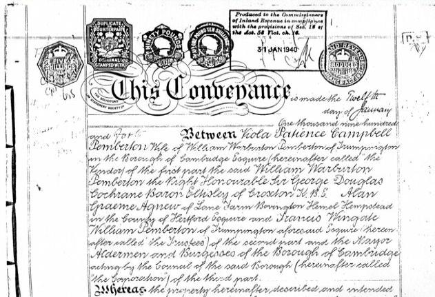
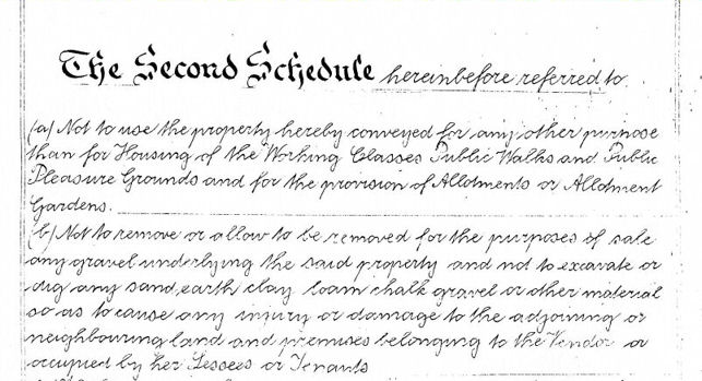
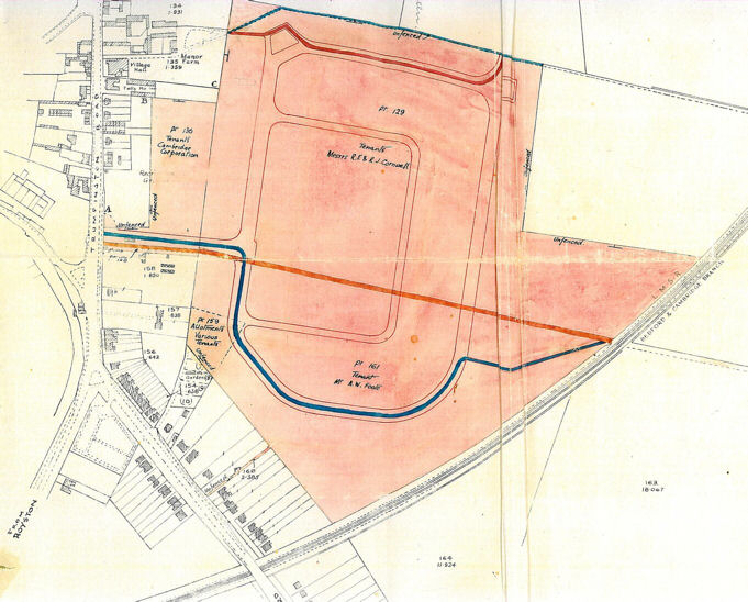
Despite the war, there were still things to sort out. In January 1940, the conveyance was signed between Mrs Viola Pemberton, the Pemberton Trustees and the Borough, transferring the land to the Council. The Second Schedule attached to the conveyance bound the Council and their successors “not to use the property herby conveyed for any other purpose than for Housing of the Working Classes, Public Walks and Public Pleasure Grounds, and for the provision of Allotments or Allotment Gardens”. The Plan attached to the conveyance showed the land involved, the layout of the roads and the existing rights of way together with their proposed replacements. Note the existing Recreation Ground at the western edge of the site.
Although the War was far from over, in 1944 preparations were beginning to be made for starting up house building once the end of the War did come. The new contract for what we would nowadays call the infrastructure (roads, sewers, surface water drains) was awarded to E.H. Burgess Ltd of London, for £19,000. The original 1939 plans for the house lay-out were submitted to the MoH, with an intimation that they were being reconsidered in detail in the light of recent developments in house construction.
In 1945 the new plans showed 360 houses and flats. These included the suggestions of the Housing Committee and the various women’s organisations in the Borough. By September 1945 the tender was accepted for the construction of 10% of these, the first 36 houses. These were to be built by the Cambridge Building Trades Employers’ Association for £34,840.
In February 1946, the tender was agreed for the second allocation of houses, with the same builders, for £68,694. The Committee submitted suggestions for the names of the new roads to the Council:
Anstee Way [sic]
Byron Square
Selby Road
Kelso Crescent
Paget Road
Things were gathering pace. In early 1946, an application was made for 62 steel-framed prefabricated houses to be erected at Trumpington, at a price of £1314 each. There was a government grant available to help with these, as they were more expensive than traditional houses. Building was well underway for the first 36 houses and rents were fixed at 11/- per week for a 2-bed house and 15/- for a 4-bed.
The Council did not favour the original list of road names, so the committee resubmitted this list, which was then approved:
Anstey Way
Byron Square
Foster Road
Paget Close
Paget Road
By April 1946, work had started on the second allocation, and the contract was awarded to R. Thompson for the third allocation of 98 houses, for £104,000. Costain Ltd of London would erect the fourth allocation of steel-framed houses; the cost would include an extra £2000 for additional footings on account of the nature of the subsoil. In May 1946, building was in full flow; the first 11 of the first allocation were handed over, and those houses were being completed at the rate of approximately three per week. Eighteen bases were now complete for the steel framed houses.
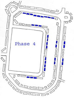
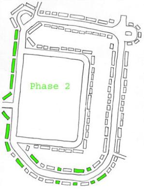
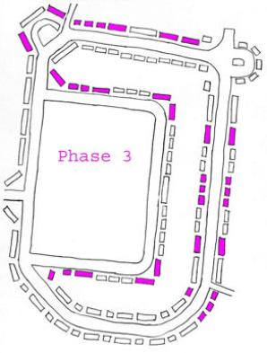
So where were all these houses to go? I have produced a series of sketch plans showing the locations of each allocation or “phase”.
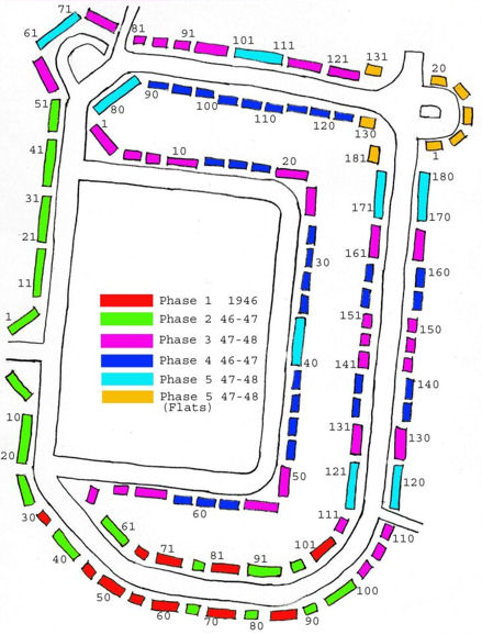
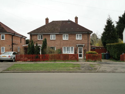
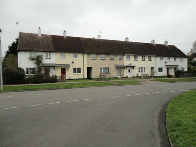
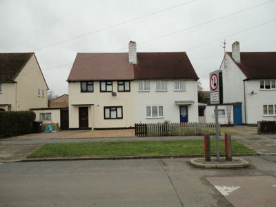
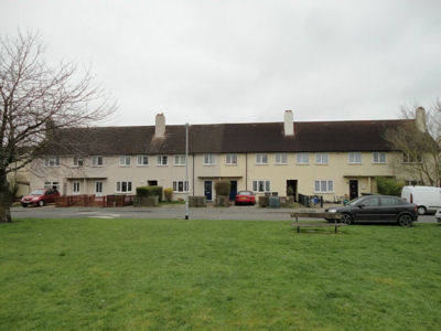
First allocation, distinguished by unpainted brickwork and hipped roofs: 42-44 Foster Road , 81-87 Foster Road.
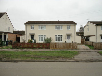
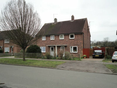
Steel Framed houses, set back further from the roads, possibly to allow space to lay down the prefabricated sections during erection: 41-42 Byron Square , 153-155 Foster Road , 57-58 Byron Square.
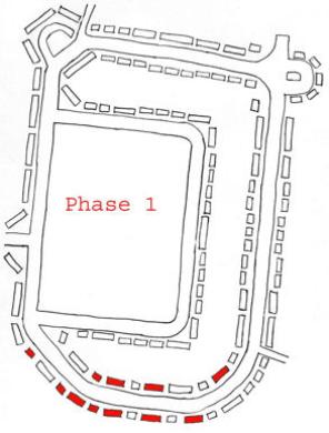
The Council must have been finding it difficult to fill the 4-bedroom houses, because in July 1946 they reduced the rents to 13/-. The Electoral Register of October 1946 shows that most of the first allocation of houses, all in Foster Road, were by then occupied.
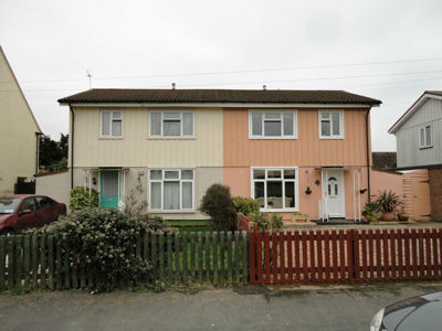
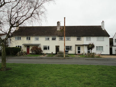
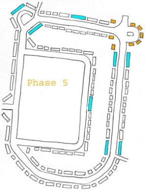
Contracts for the fifth allocation (48 houses and 32 1-bed flats for older persons) were awarded to Thompsons and Sindalls (houses, at £1200 each) and to Rattee & Kett and Coulsons (flats, at £700 each).
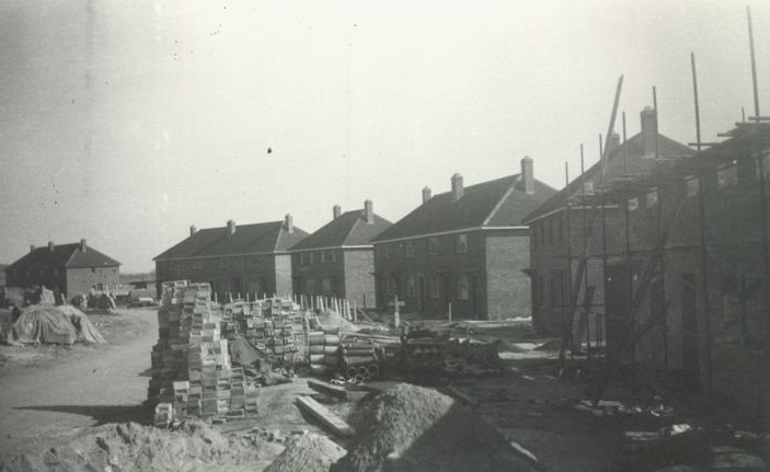
I have only found one photograph of building work. It shows even-numbered houses in Foster Road, with the first allocation numbers 42 to 64 and 70 to 76 complete, and second allocation 34 to 40 in the foreground still being built. Note the gap still remaining for numbers 66 and 68. This was probably taken in late 1946.
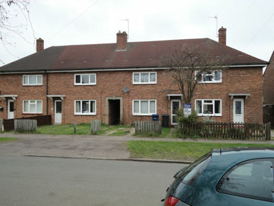
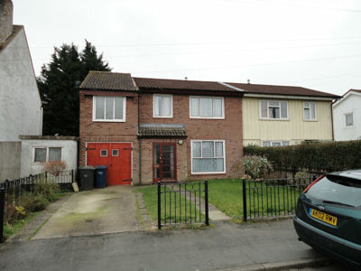
Second allocation: 10-20 Foster Road and 66-68 Foster Road (this pair of houses is unique in that they were not painted white, unlike all others on the estate except the first 36).
Third allocation: 63-66 Byron Square and 89-91 Paget Road.
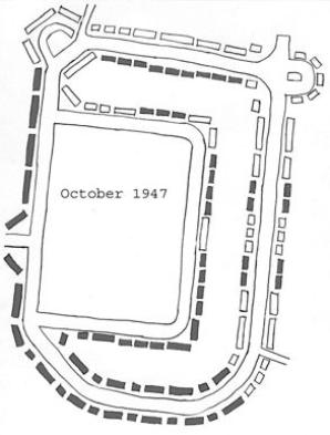
The next electoral register was for October 1947 and the plan shows which houses were by then occupied (all the first and second allocations and the steel framed houses, as well as a few of the third allocation on the south side of Byron Square).
During 1948 the building of the final allocation was completed, and by the electoral register of October all the houses and flats were occupied.
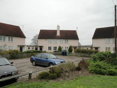
Fifth allocation (48 houses in blue, 32 flats round Paget Close in orange): 35-40 Byron Square and Paget Close flats.
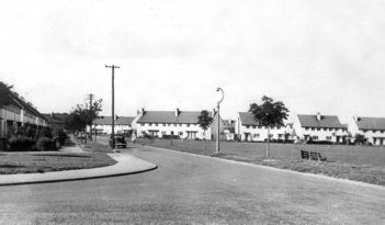
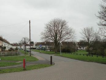
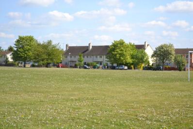
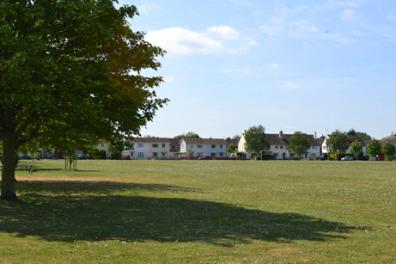
View from the eastern end of Anstey Way soon after all the work was completed and the same view in 2011.