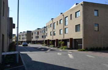
The western arm of Glebe Farm Drive. Photo: Andrew Roberts, 28 October 2014.
Glebe Farm Drive is the main road within the western part of the Glebe Farm (Novo) development, from the junction with Addenbrooke’s Road.
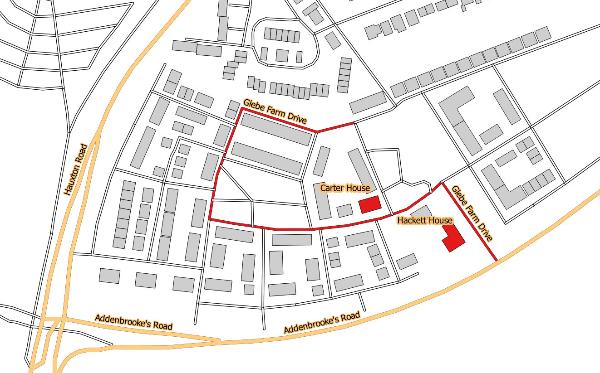
Glebe Farm Drive. Source: © OpenStreetMap contributors (Howard Slatter).
Andrew Roberts gave a presentation about the origin of the name ‘Glebe Farm Drive’ at the Local History Group meeting on 12 November 2015. It is one of a number of streets named after local farming and landscape, in this case the farm that predated the Glebe Farm (Novo) housing development.
There is a separate page with information about the derivation of street names .
When Trumpington parish was enclosed in 1804-09, over 80 acres of land between Hauxton Road and Shelford Road was awarded to the Vicar in lieu of the tithes that had been received prior to this. The farmland was later known as Vicarage Farm or Glebe Farm and a farm house was built within the area. In the 1851 census, John and Pheby Careless, agricultural labourer and laundress, were listed as living at ‘Vicarage Farm, Shefford Road’ [Shelford Road], while in 1861 the entry was for John and Phebe Careless of ‘Holben’s Farm House’. In 1871, John Careless was a widower, a farm bailiff living with his daughter at an unnamed farm on Shelford Road. In 1881, the farm was occupied by Joseph and Sarah Parker; Joseph Parker was a shepherd and the farm was named ‘Parson’s Farm’. By 1891, the Parkers were living at the Shepherd’s Cottage on Anstey Hall Farm, and had been succeeded by David and Emma Allgood at ‘Glebe Farm’, where David Allgood was the farm bailiff. Charles and Mary Pratt were at ‘Glebe Farm’ in 1901; Charles Pratt was described as a ‘horse keeper on farm’. By 1911, the listing described ‘Glebe Farm Cottages’ with Charles and Mary Ann Pratt, with Charles still a horse keeper, and also Arthur and Sarah Ann Plummer, with Arthur Plummer working as a shepherd. The extended families included two farm labourers, a gamekeeper and a milkman.
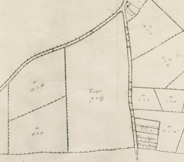
Extract from the enclosure map of Trumpington, with the land allocated to the Vicar to the east of Shelford Road turnpike. A Map of the Parish of Trumpington in the County of Cambridge, 1804 . Cambridgeshire Archives, R60/24/2/70(a).
The land was taken out of the Green Belt in 2006 and Addenbrooke’s Road was constructed across the fields from Hauxton Road to Shelford Road, opening in October 2010. The area between the new road and Bishop’s Road was then developed for housing. Glebe Farm Drive was constructed from early 2012 to autumn 2014 and the first homes occupied in late 2012. During the first phase of house construction, the marketing suite was located on the left near the beginning of the road, where numbers 5-7 were built in 2015.
Glebe Farm from Bishop’s Road, looking towards Shelford Road, before work starts on the Addenbrooke’s Access Road. Photo: Stephen Brown, October 2007.
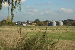
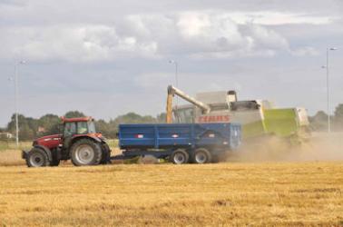
Harvesting on Glebe Farm, looking towards Bishop’s Road, with Addenbrooke’s Road in the background. Photo: Stephen Brown, 11 August 2008.
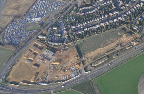
Glebe Farm from above, with Hauxton Road to left and Addenbrooke’s Road from left to right. Source: Tamdown, 1 December 2011.
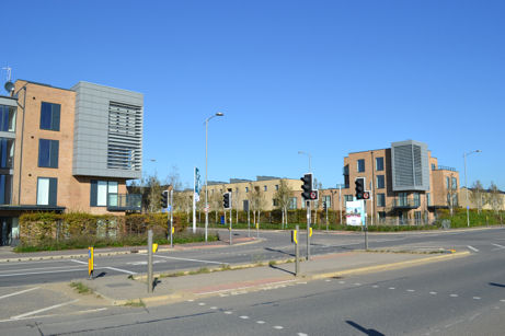
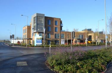
The marker buildings at the entrance to the Novo development at the Glebe Farm Drive/Addenbrooke’s Road junction. Photo: Andrew Roberts, 28 October 2014.
When the Local History Group and the Residents’ Association suggested names for the development, Glebe Farm Drive was an obvious name. Other roads and apartments within the Glebe Farm development were named after church and farming connections, local personalities and countryside terms. For example, Hackett House at the entrance to Glebe Farm on Glebe Farm Drive was named after John Hacket (1592–1670). He was Vicar of Trumpington in 1620- 22, later the Bishop of Coventry and Lichfield, 1661-70. The nearby Carter House was named after Thomas Herbert (Bert) Carter (1893-1979) who founded the garage and petrol station on Shelford Road and ran it from the early 1930s to the late 1950s (now the Buckingham & Stanley garage). Bert Carter was listed in the Spalding’s Directory from 1935-1939 as an automobile engineer at 156/158 Shelford Road.
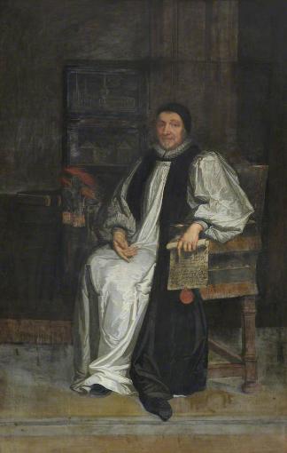
Portrait of Bishop Hacket , by Valentine Ritz, Trinity College, TC Oils P 79, Public Catalogue Foundation.
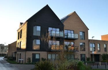
Hackett House at the entrance to the Glebe Farm development. Photo: Andrew Roberts, 7 November 2012.
Carter House, Glebe Farm Drive. Photo: Andrew Roberts, 7 November 2015.