Portrait of Thomas Hobson, in The Guildhall, Cambridge. Photograph with permission of Cambridge City Council.
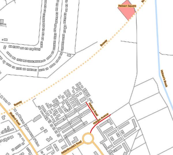
The ‘Hobson’ name has been used for two roads in the southern part of the Clay Farm (Abode) development and as the name for the local square at the heart of Clay Farm. Hobson Avenue is the first part of the spine road through Clay Farm from the Addenbrooke’s Road roundabout towards Hobson Square. The first homes on the right hand side of Hobson Avenue as far as Cornwell Road were constructed and occupied in 2013; homes beyond Cornwell Road and on the left hand side of the road were constructed from 2015. Hobson Road is the first turning to the left off Hobson Avenue, initially providing the link road into the development, with homes on the right hand side of the road constructed from 2015. Hobson Square is close to the junction of the busway and the spine road (Hobson Avenue/Lime Avenue), with surrounding buildings including the Clay Farm Centre opening in 2016.
Hobson Avenue, Hobson Road and Hobson Square. Source: © OpenStreetMap contributors (Howard Slatter).
Howard Slatter and Sheila Glasswell gave a presentation about the origin of the names ‘Hobson Avenue’, ‘Hobson Road’ and ‘Hobson Square’ at the Local History Group meeting on 12 November 2015. These are among a number of streets named after local personalities, in this case the Cambridge carrier Thomas Hobson (1544/45-1631), who left land in his will to support the maintenance of the conduit and brook which now bear his name.
There is a separate page with information about the derivation of street names .

Why ‘Hobson’? In their talk, Howard Slatter and Sheila Glasswell described Hobson’s Brook as a central feature crossing the Clay Farm development and open space. ‘Hobson’s Brook’ is used as the name for the open part of the watercourse bringing water from Nine Wells in Great Shelford into Cambridge, with the overall system being known as Hobson’s Conduit. (Howard Slatter discussed Hobson’s Brook in more detail in 2010.)
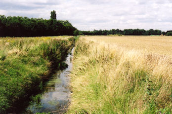
Hobson’s Brook, looking north near the track from the allotments to Addenbrooke’s Hospital, while the land was still farmed. Photo: Andrew Roberts, August 2007.
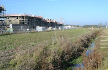
Construction work on homes alongside Hobson’s Brook, from Addenbrooke’s Road. Photo: Andrew Roberts, 1 November 2015.
The watercourse was originally a natural stream meandering through a shallow valley, and entering the River Cam upstream from Newnham. In the early 17th century, it was straightened and an artificial branch constructed to divert the water into Cambridge. Some of the water was fed into the market place, where a fountain made it available to the townspeople. Moved in 1856, the fountain now stands at the corner of Lensfield Road and Trumpington Road.
The Conduit Head at the junction of Trumpington Road and Lensfield Road. Photo: Howard Slatter, October 2010.
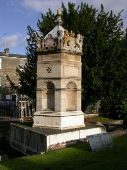
Again: why Hobson? Go to Nine Wells and you will see a monument, erected in 1861. One face has inscribed on it the names of Thomas Chaplin and Thomas Hobson.
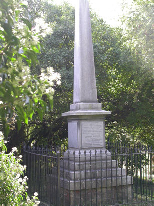
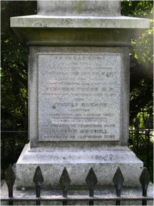
The commemorative monument at Nine Wells Local Nature Reserve. Photos: Howard Slatter, October 2010.
There is a portrait in The Guildhall, Cambridge, showing Thomas Hobson on the road somewhere between Cambridge and London. He was a Cambridge carrier, with stables for his horses near St Catharine’s College. The phrase ‘Hobson’s Choice’ refers to his habit of allowing you to hire any horse you wanted, as long as it was the one he decided on.
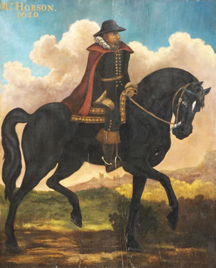
Portrait of Thomas Hobson, in The Guildhall, Cambridge. Photograph with permission of Cambridge City Council.
When Hobson died in 1631, he left land in his will to be used to provide income for the upkeep of the fountain in the marketplace. Since then his name has been associated with the watercourse, even though there is no actual evidence that he was involved at all in its construction.
When the Local History Group and Residents’ Association proposed names for the Clay Farm development, Hobson was an obvious choice.