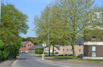
Maris Lane from the High Street, with Bidwell’s to the right. Photo: Andrew Roberts, 22 April 2011.
Maris Lane goes a short distance from Trumpington High Street to Grantchester Road. It is a long-established route which may follow the line of a prehistoric east-west track to the river crossing to Grantchester. Its western end at the junction with Grantchester Road and Church Lane is at the heart of the early village, including the church, vicarage, manor houses, private houses and school.
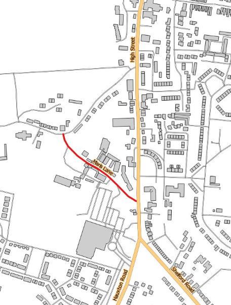
Maris Lane. Source: © OpenStreetMap contributors (Howard Slatter).
Andrew Roberts gave a presentation about the origin of the name ‘Maris Lane’ at the Local History Group meeting on 12 November 2015. It is one of a number of streets named after local personalities, in this case the Maris family who lived in Maris House and farmed Church Farm from the late 18th century to the late 19th century.
There is a separate page with information about the derivation of street names .
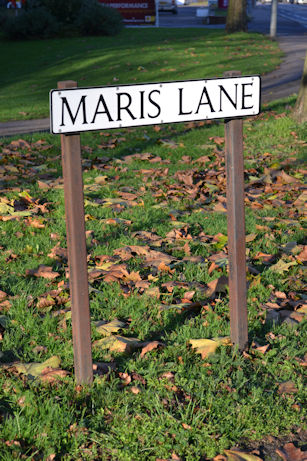
Maris Lane street sign at the High Street and Church Lane junctions. Photo: Andrew Roberts, 6 December 2014.
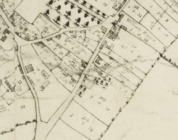
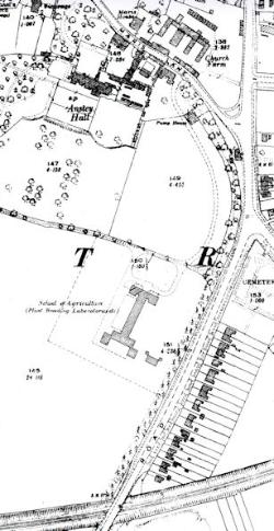
At the time of the enclosure of Trumpington parish in 1804-09, the lane was one of a triangle of roads, with most of the land within the triangle laid out with separate boundaries. There is an unnamed group of buildings in a large plot on the north side of the lane, Church Farm, and another unnamed group on the south side surrounded by open land, Anstey Hall and its outbuildings and estate. The land on the north side was owned by F.C.J. Pemberton and on the south side by Christopher Anstey.
Extract from the enclosure map of Trumpington, with Maris Lane on the left. A Map of the Parish of Trumpington in the County of Cambridge, 1804 . Cambridgeshire Archives, R60/24/2/70(a).
Three generations of the Maris family were tenant farmers who lived at the farm house, variously known as Church Farm House, Home Farm or Maris House, from c. 1770s to 1867. The current house dates from c. 1800. Church Farm was one of three farms centred in the village at this time, the others being Manor Farm and Anstey Hall Farm. The first generation of the family was John Maris, born in Great Shelford in 1734, and Elizabeth Stacey, born in Trumpington in c. 1740, who married in Trumpington on 30 September 1765. John Maris was a farmer living in Great Shelford at the time of their marriage. John and Elizabeth Maris had four children, all born in Trumpington. Elizabeth died in 1775 and John married Mary Collier in Trumpington in 1781, and John and Mary Maris had a further seven children. By 1800, John Maris was known as a yeoman. John and Elizabeth Maris’s first child was also named John Maris, born c. 1765, who married Mary Stonebridge on 23 September 1788, and they had four children, including John, born 1791, and Sarah, born 1796. The first generation John Maris died in 1814 and the farm was presumably then farmed by the second generation John Maris who died in 1850, aged 87, when he was termed a ‘Gent’. In the 1851 census, the third generation John Maris and his sister Sarah Maris were listed as living at ‘The Hall Lane’ (presumably meaning the farm house across the lane from Anstey Hall), while in the 1861 census the description changed to ‘Maris Farm’. None of the four children married and Sarah Maris died in 1862 and the third generation John Maris died in 1867. (For more information about the individuals, see the People in Trumpington database and the churchyard walk description by Howard Slatter.)
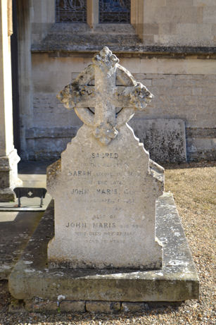
There is a Maris family grave and headstone in the main churchyard, west of the south porch, with a text in memory of the second generation John Maris and Mary Maris and their children John and Sarah.
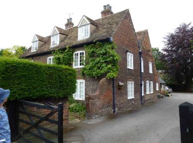
Maris House, Maris Lane, Local History Group walk. Photo: Martin Jones, 1 July 2012.
Headstone to the Maris family, mid 19th century, near the south porch, Trumpington Church. Photo: Andrew Roberts, 22 October 2011.
Although the Maris family involvement with the farm ended in the 1860s, the connection was sufficiently firmly established for the name to be reintroduced later as the name of the farm house and the road. In the 1871 census, the farm house was occupied by Martin Slater and known as ‘Slater’s Farm’. It was still known as this in 1881. It was unnamed in the census return in 1891, with William Martin as the farmer. He was still there in 1901, now named ‘Home Farm’, and in 1911, now listed as ‘Farm House’. In 1910, the Ordnance Survey map referred to the farm as ‘Church Farm’, on an unnamed road. Given these changes of name, it is remarkable that the Maris name returned into use. In the 1930s, the Electoral Registers included ‘Maris House’ in an unnamed road, while the 1935 Spalding’s Directory referred to ‘Maris House’ in ‘Maris Lane’. In the 1950s, the road was marked on the Ordnance Survey map as ‘Maris Lane’.
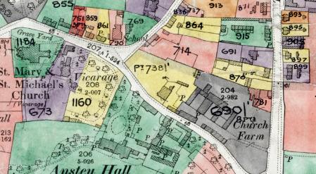
Extract from the Inland Revenue Land Value map for Trumpington, 1910-11 , showing Maris Lane and Church Farm. Cambridgeshire Archives, file 470/047, sheet XLVII.10.
Ordnance Survey map, 1954, with the new PBI headquarters and access from Maris Lane.
From 1950, the Plant Breeding Institute (PBI) developed a major plant breeding centre on the land to the south of Maris Lane, with its main access road entering the site a short distance along Maris Lane from the High Street junction. The main building at the PBI was later named the Maris Centre and a number of the crops developed at the site used ‘Maris’ as the first element in their name, such as Maris Piper, Maris Otter and Maris Osprey. (For background, see the separate history of the PBI and the origin of some of the street names on the Trumpington Meadows development, by Stephen Brown.)
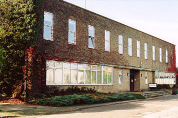
The Maris Centre on the former PBI/Monsanto site. Photo: Andrew Roberts, 18 October 2007.
It is very pleasing that the Maris name lives on in the street name and the crop names.