See also the page “Foster Road Allotments and the Trumpington Allotment Society” from 2011.
2022 saw the celebration of 75 years of the Trumpington Allotment Society. The following information formed a display at the Open Day held on 9th July that year on the Foster Road allotment site.
Over that time the allotment site has both grown and shrunk again. At its maximum extent in the mid-1950s there were 137 full-size vegetable plots, three times as big as the equivalent 45 plots today (which are mainly subdivided).
Most of the earlier additional plots were on the city council land on the other side of the chicken plots, now mainly built on by the Hills Residential Virido development.
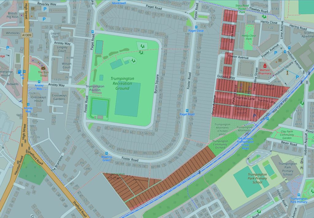
You can visit an online plan showing where all these plots have been over time. By zooming in and then clicking on an individual plot you can see who the plot-holders were, and then a bit of biography of many of them.
Here’s some of the history, divided into three 25-year periods.
1947 to 1972
On 27 March 1947 there was a meeting of the Trumpington Horticultural Society committee. The Committee agreed that the Society should call and bear the cost of a public meeting on 14 April to discuss the proposal that a registered allotment society should be formed. The Society was then inaugurated at that meeting in the Village Hall, and a Committee was elected.
In September 1947 the Society took over the existing Alpha Terrace allotment site. This had been privately owned by the Red Lion Inn (on High Street opposite the War Memorial) and had been operating from at least 1925; it was not a statutory allotment site. The County Council had recently acquired the land as a possible extension to the Fawcett Schools, which were then planned but not yet built.
9.4 acres were to be staked out on the “Shelford Road allotments”, but this included 1.7 acres unsuitable for cultivation, later to become the chicken plots and the community orchard. There were originally 116 plots on the site: approximately the 45 (numbered up to 50) which exist today, and then the rest the other side of the hedge from the chicken plots, where some of the Virido development (up as far as Dobson Way) stands today.
There was no water on the site at this point, nor any communal storage or trading hut.
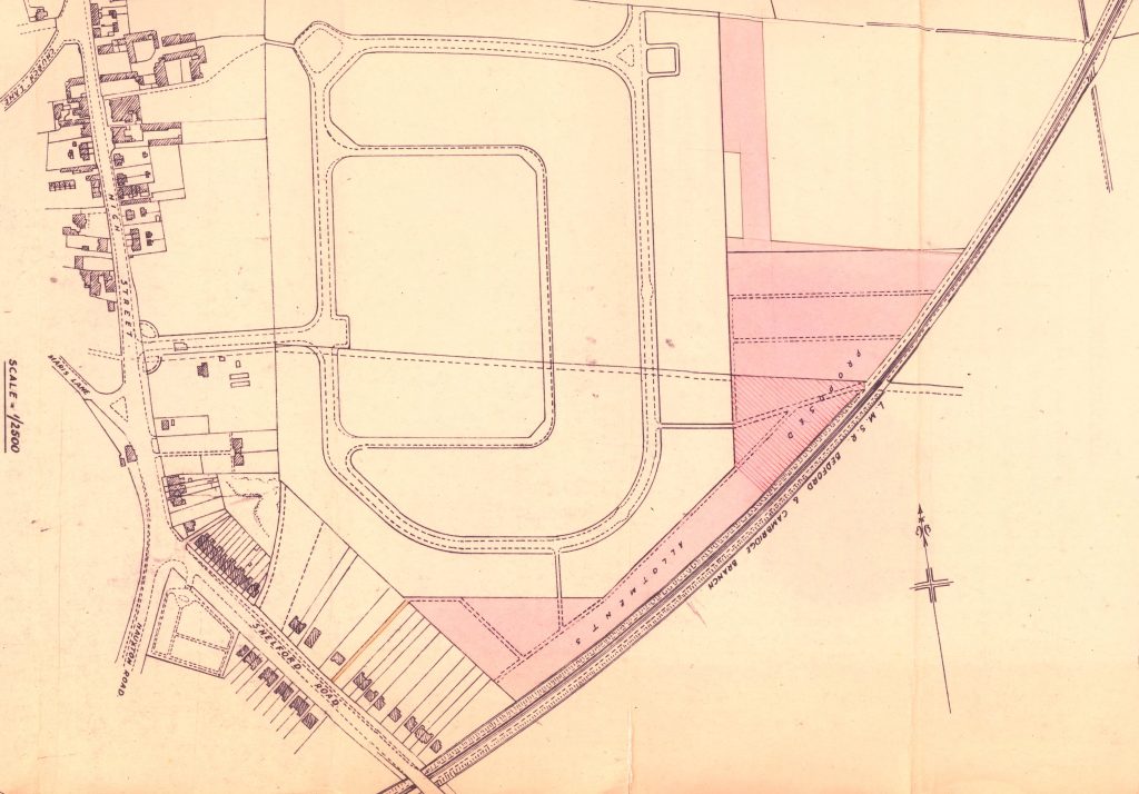
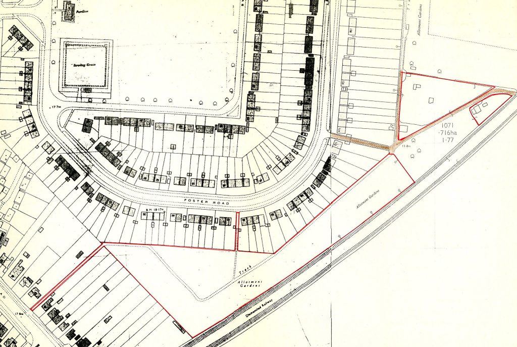
1947 PLAN
From the original lease in 1947.
Vegetable plots at the north and south ends of the site; the “land unsuitable for cultivation”, the hatched area on the plan, in between them, later to become chicken plots.

In 1949 a second-hand hut was purchased from the Ministry of Works in Brooklands Avenue; this was then erected on the land in the corner of the chicken plots nearest to what is now the entrance to the community orchard. It was initially used for storage and distribution of seed potatoes (more than three tons had been ordered the previous year and stored elsewhere in the village).
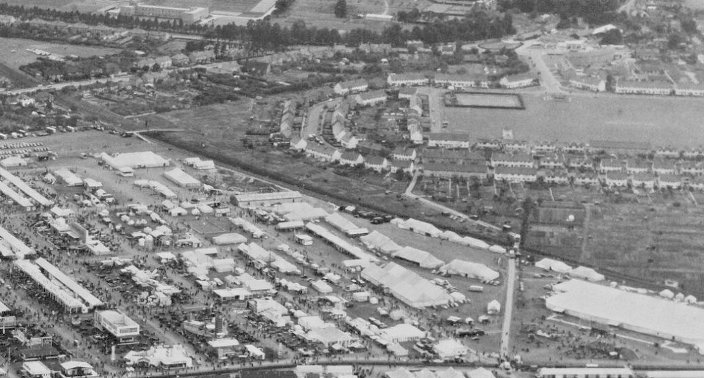
In 1951 the track coming in from Foster Road (past the present trading hut) was extended, with a pedestrian bridge over the railway (now the guided busway) cutting to give access to the Royal Show that year. Compensation was given to the two tenants whose plots were affected (27 and 28).
In 1952 more plots were set out along the back of Foster Road on the land adjoining the access track there, right up to the Fawcett school corner. In 1957 most of those were handed back to the City Council, and the rest in 1970.
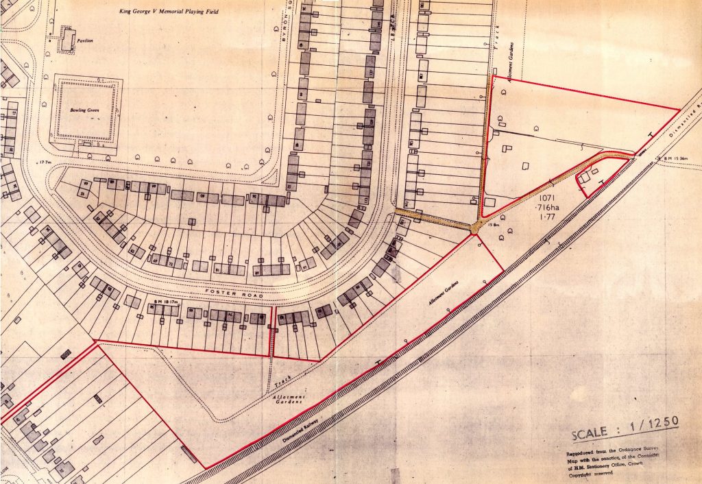
1957 PLAN
This shows the greatest extent of the cultivated land used by the Allotment Society. Note the large area to the north of the chicken plots, and the strip further north along the back of Foster Road.
In 1960 a bridge was put up again (as in 1951) for the Royal Show that year and 1961. Compensation was paid again for plots 27 and 28.
In 1961 most of plots 69 to 116 were handed back to the council, leaving just the first row behind the chicken plots, with a few along the Foster Road track.
In 1969 those remaining plots alongside Foster Road were handed back.
1973 to 1997
In 1973 part of the Alpha Terrace site was sold by the County Council to the City Council for housing. Monkswell was then built there.
In 1976 a mains water supply was laid on for the first time. Two railway wagons were ordered to replace the original, now dilapidated, hut. One of those can still be seen on David Parr’s chicken plot.
1981 PLAN
By then most of the land north of the chicken plots had been returned to the council, reflecting a reduction in demand since the 1950s, despite more than half the Alpha Terrace site having been sold to build Monkswell. The area destined to become the Community Orchard was no longer managed by the Allotment Society.
In 1982 the rest of the Alpha Terrace site was sold to the City Council for residential development (which became Ely and Salisbury Places).
In 1989 the remaining plots behind the chicken plots (51 to 68) were handed back to the Council.
1992 PLAN
All the land beyond the chicken plots had been returned to the Council, after a further reduction in demand for plots. This was despite all the Alpha Terrace site having been sold by then.
1992. The footpath through the site (following the course of the present grassed track) had originally been made for allotments access only. As a result of various problems with the public using it (theft, litter, dog excrement and particularly disturbance by motorbikes) the Society asked the City Council to lock the gate giving access at the Shelford Road end. As it was not a right of way the Council agreed and locked it. However a number of local residents complained that it had become a right of way by having been continually used as a route to Fawcett School and the hospital. The County Council agreed and declared it a right of way.
In 1993 the Society appealed against the footpath decision. There was a public enquiry, which the Society lost.
In 1995 the new trading hut was built with £8000 of City Council money, coming from the sale of allotment land at Histon Road.
1998 to 2022
In 1999 a wildlife area was created using the back halves of plots 33 to 36. It was managed for chalk grassland as advised by the City Greenways project, later with assistance from the National Trust’s Black Gold project.
In 2000 the public right of way through the site was diverted to follow its present route along the backs of the Foster Road gardens. The grassed track through the site then reverted to being for allotments use only. The new right of way was later surfaced and designated as a “shared use” foot and cycle path.
Also in 2000 permission to keep bees on the site was granted by the City Council. The first hive arrived in 2004. Since 2006 all hives are in a dedicated apiary within the wildlife area. A living willow screen was planted around the apiary in 2011.
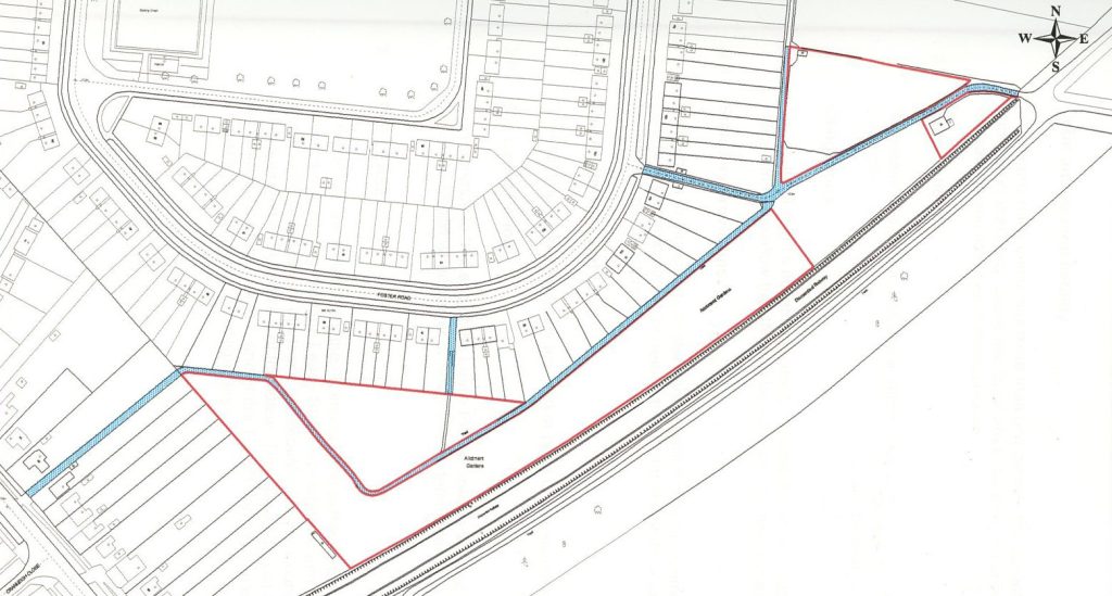
2000 PLAN
Much the same as in 1992, except that the (by now) public footpaths and tracks had been taken out of allotments ownership.
This is much as we see the site today, except that, later that year, the public right of way was diverted so that it now runs along the back of the Foster Road gardens and not through the middle of the site.
In 2001 a new fence, hedge and gates were installed and extra water points were created, using money from the sale of allotment land at Nuffield Road and Newmarket Road.
In 2003 the first Open Day event was held, followed by others in 2005, 2007 and 2017.
In 2008 the society organised a community seed swap at the Village Hall. This continued yearly, with help from Transition Cambridge, as Trumpington Seedy Sunday until 2020. Covid restrictions prevented the event from being held in 2021 and 2022.
In 2010 the Community Polytunnel was installed on the wildlife area.
In 2013 a water trough was installed in the chicken plots.
In 2021 a large rainwater butt and dip tank were installed at the Trading Hut.
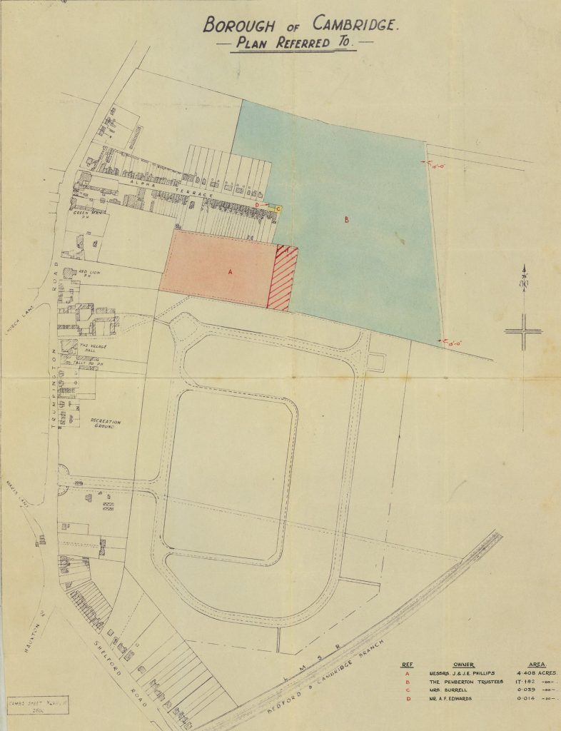
1947 PLAN of
ALPHA TERRACE
The blue shaded area B is the land bought by the County Council for building the Fawcett Junior and Infants schools.
The pink area A is the allotment land bought by the County Council at the same time. The hatched section was initially reserved for a future extension of the schools, but in the end reverted to allotment land.
The western two-thirds of of the site was sold to the City Council in 1973 to build Monkswell, and the remainder sold in 1982 to build Ely Place and Salisbury Place.
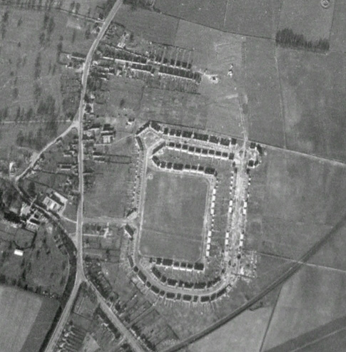
1948
The newly-built council estate and allotments.
The Foster Road site is just beginning to be cultivated. The Alpha Terrace site is well established.
1951
The Royal Show under way.

1961
Another Royal Show.