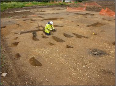
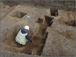
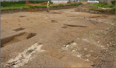
At the Local History Group meeting on 29 September 2016, Stuart Ladd ( Oxford Archaeology East) gave an update on the excavation at Anstey Hall Farm, Trumpington. There had been an open day at the site on 10 May 2015, while the excavation was underway. Report by Andrew Roberts, with thanks to Stuart Ladd and to OAE for the photographs.
Stuart Ladd introduced the archaeological research by explaining that the barns to the rear of Anstey Hall Farm were being redeveloped for housing. Stuart thanked Hill Residential and John de Bruyne and family for their support during the project.
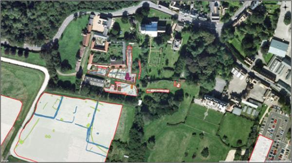
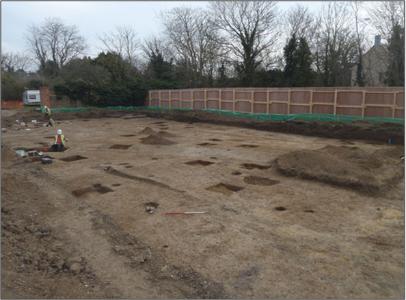
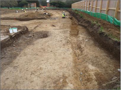
Oxford Archaeology East had done trial trenches in December 2013 then the full excavation in 2015. This followed earlier excavations in the area, including at Trumpington Meadows, Waitrose and Clay Farm. The Trumpington Meadows excavation to the south of Anstey Hall Farm had identified Middle and Late Saxon enclosures, and the evaluation prior to the Anstey Hall Farm excavation suggested that ditches continued into the Anstey Hall Farm area. The latest work at Anstey Hall Farm then found evidence of the Middle and Late Saxon settlement.
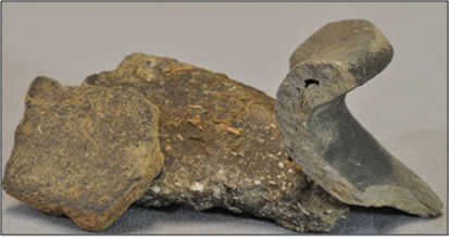
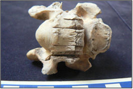
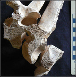
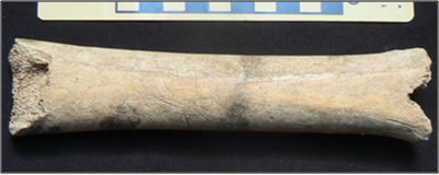
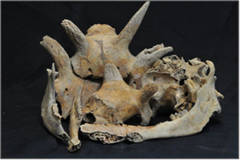
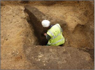
Finds from the Anstey Hall Farm site included animal bone and pottery. There was Roman pottery but this was found in Saxon features (there were no Roman features). Although there was Early, Middle and Late Saxon pottery, it was difficult to use this for dating as there was limited evidence from c. 800 to c. 900 AD, and the land was reused and pottery could become buried in earlier features. Much of the animal bone had been butchered, including cattle and a horse. There was also a horse bone that had been used as a skate.
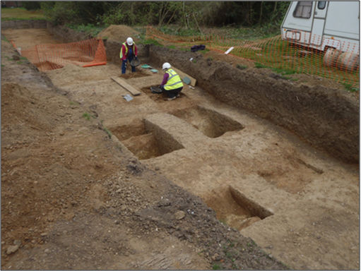
There were a few Middle Saxon structures indicated by post holes, probably earlier 8th century, but no enclosures from this period. Similar structures had been found nearby during the Trumpington Meadows excavation. There were reconstructions of this type of structure at the archaeological exhibition at West Stow.
![West Stow workshop, reconstructed in 1991. Source: Wikipedia image taken in summer 2012. [https://commons.wikimedia.org/wiki/File%3AWest_Stow_workshop.jpg]](http://trumpingtonlocalhistorygroup.org/wp-content/uploads/WestStow_workshop_2012-407x238-1.jpg)
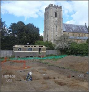
As a wider context, Stuart said that in the Middle Saxon, 8th century, Christianity was being adopted and pagan cemeteries were being succeeded by organised Christian burial grounds. At Anstey Hall Farm, there was evidence of the Middle Saxon settlement, c. 750-850 AD, although the centre of the settlement was to the north of the site. There were regular ditch divisions and fence enclosures in the southern part of the site, probably for livestock. There was evidence of a north-south boundary ditch to the south of the current cemetery, across the line of the new access road from Anstey Hall to the development. There was also a palisade trench in the north of the site, near the current church. This palisade would probably have had fence posts 2-3 m high. It was c. late 8th century and may have delimited a defended part of the settlement or an early church. The palisade was removed in the 9th century.
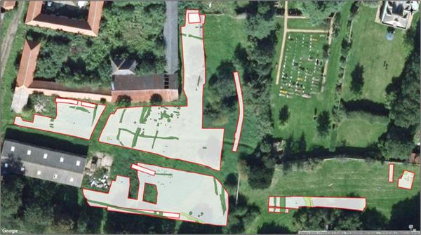
In the Late Saxon period, the settlement may still have been centred to the north of the excavated area. There was a ditch on the same line as the Middle Saxon ditch. The north-south ditch seemed to line up with a ditch found during the Trumpington Meadows excavation. Everything in the excavated area seemed to be related to livestock. There was a pit with a lot of waste bone, including the remains of a feast.
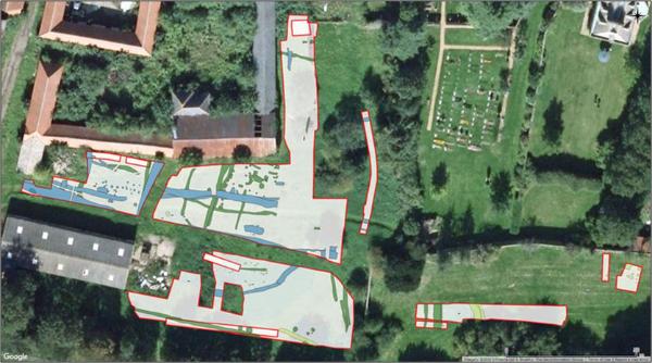
By the 12th century, there was a reorganisation of land use. Although post-Norman, this may not be due to Norman influence. The land had been given to the Abbot of Ely in 991 and this may have been a deciding factor. The church site would have been in use and there was a track going north-south towards the church. The enclosure ditches were no longer in use and had been replaced by open fields, which continued in use until the enclosure process in the early 19th century.
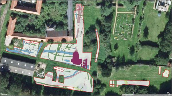
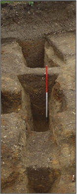
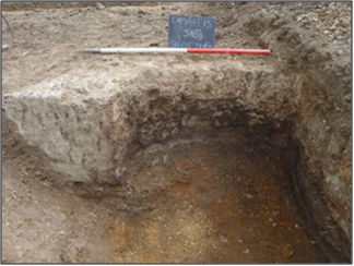
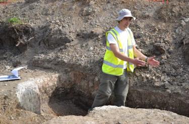
The only continuity within the site from Late Saxon into the Medieval may be a large barn. There was a pit at the northern end of the site about 20 m from the early church, perhaps a cess pit or cold storage pit, with steps down into the space. Changes through the 12th century included a quarry pit at the southern side of the site, where there was an industrial area including an oven which would have been 3-4 m in diameter, with charred wheat and oats. Stuart said that this might be evidence of centralise manorial or ecclesiastical authority.
Looking more broadly across the area of Trumpington village, Stuart referred to consistency in the Late Saxon evidence from the Anstey Hall Farm, Trumpington Meadows and Waitrose sites, with similar patterns in the landscape. He noted that the western end of Grantchester Road was on a similar alignment to the Late Saxon boundary ditch and that this route may be related to the ford to Grantchester. (Stuart added that there had been another east-west route to the north of the current village, again orientated towards a ford.) He said that other alignments such as the boundary of Anstey Hall were similar to the alignment of the Late Saxon enclosures. The boundary was apparent on Baker’s 1830 map and could still be seen today. There was documentary evidence for an ‘Anstey Hall’ manor house as early as 1279 and it was possible this was built on a Saxon site. Stuart summarised the overall evidence as suggesting that the core of Late Saxon ‘Trumpington’ was in the area of the church and the houses on Maris Lane.
One question was about the synthesis of the results from the patchwork of excavations across the area. Stuart replied that the report on the Anstey Hall Farm excavation was being finalised and he understood the Cambridge Archaeological Unit was publishing a report on its work.
Another question was about water supplies. Stuart mentioned that deep wells were found in the Trumpington Meadows excavation (Early Saxon).
He was asked about the likely size of the local population. Stuart commented that there was a problem that the excavation was on the edge of the settlement area. Andrew Roberts added that the information in the Domesday Book gave a population of 37 households (about 185 people) in 1086.
Stuart was asked why there were so few finds in the Saxon ditches. He explained that there was less pottery production in the Saxon period than in the Roman period, with more use of organic material that had not survived.