Michael Hendy
September 2016
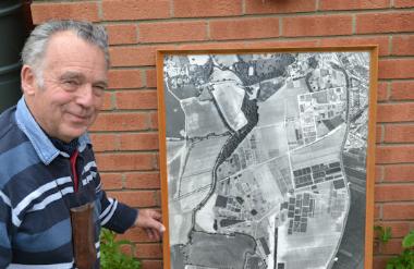
Michael Hendy was one of two speakers at the Local History Group meeting on 29 September 2016 . Michael talked about factors that would have influenced the farming activities on Anstey Hall Farm. He had been Farm Manager, later Agricultural Manager, of the Plant Breeding Institute and its successors from 1971-2003.
The need for more food
In the Roman period, the population of England was c. 5.7 million. There was a similar total in the 13th century and the mid 17th century, but by 1850 it had increased to 16.6 million. More land needed to be farmed in a more productive manner.
Factors that would have helped to achieve this:
A Better systems, better varieties
4 course rotation, mechanisation
Fallow land in 1700, 29%: fallow land was needed to control weeds before more intensive
rotations were introduced
Fallow land in 1871, 4%
B The Trumpington Inclosure Act, 1801
Christopher Anstey was awarded 378 acres
Enclosure meant land would be farmed more efficiently
Trumpington up until fairly recently was always considered to be an agricultural community.
Ownership
The Anstey family sold the farm to the Fosters in 1838. Ownership would have affected the farming system.
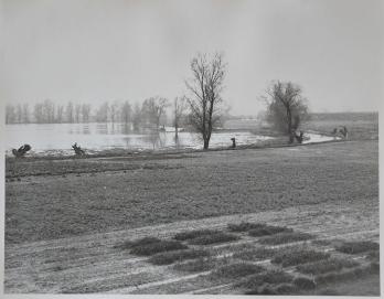
The Fosters were mill owners, bankers and businessmen and looked for a return on the land. They were not farmers, so they appointed a tenant, first Mr Toller and in 1871 Mr Parsons. We do not know the exact cropping but I would expect there to have been wheat, barley, oats, fodder roots for livestock, possibly a few potatoes to supply Anstey Hall, plus a significant livestock enterprise as one third of the farm was down to grass or clover pastures.
The house in the middle of the farm was called Shepherd’s Cottage and was unlikely to have that name unless there were sheep around. Land alongside the River Cam would have been subject to winter flooding, but would have provided summer grazing.
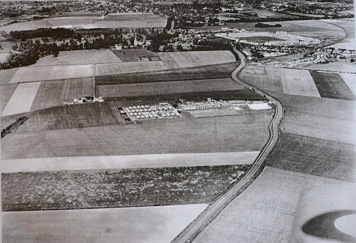
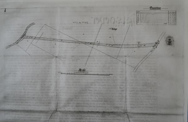
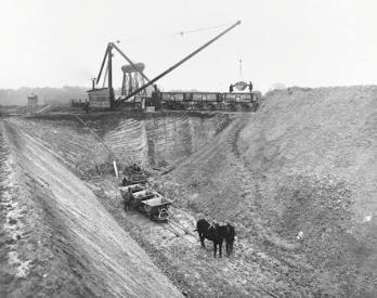
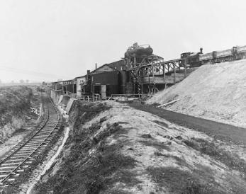
But, there was a setback for Mr Foster and Mr Parsons. In 1861, Mr Foster sold to the Bedford and Cambridge Railway Company: 6 acres, 1 rood and 4 poles of land, across which the Cambridge to Bedford railway was to be constructed. This imposed a physical restriction on the farming operation and introduced a previously unknown hazard – fire from the steam trains. A gated crossing was erected at the ‘level point’ in the middle of the farm, the railway was fenced and all access to the south had to be through one point. It is possible that the restriction encouraged the building of the ‘Shepherd’s Cottage’ as it is likely that the majority of the grazing land was south of the railway.
It is probable that the farm continued in a traditional way until the early 1900’s.
In addition to the land farmed, there was a walled garden bigger than the size of a standard football pitch. I suggest that the Fosters did not go hungry!
The farm had largely escaped the mid-1800s coprolite digging. I suspect the Fosters did not need the extra cash gained from coprolites. But the First World War brought a change. Pits were dug to provide phosphates for the manufacture of munitions for the war and this had an enormous impact on the farming operations. A large part of the farm was now uncropable. I have no evidence that compensation was paid for this disturbance but it would have had a significant impact on the farm income.
It is likely that between the wars the farm continued in the traditional manner, certainly Mr Parsons was a traditional farmer and there is no evidence that the Fosters invested in farm buildings or introduced more intensive farm systems. They did construct a cattle fattening yard at Shepherd’s Cottage that was still in use in 1970 (by the Parsons). Cropping most likely stayed the same, fodder roots would have partly been replaced by sugar beet.
The Second World War would have brought changes that affected the farming activities. The ‘Cambridgeshire War Agricultural Committee’ demanded that Mr Parsons plough up 9.9 acres of permanent pasture and the land sown to an approved crop for the 1940 harvest. (The country was again hungry, due to the destruction of merchant shipping bringing in food supplies.) Also in 1942, the Commission of his Majesty’s Works and Public Buildings took possession of 17 acres of land on which to build a Prisoner of War camp. These two factors would have had a differing but significant impact on the farming system.
At this point, let me summarise the land in terms of value of use and tenants value:
Waste land 11 acres
Damage by excavation 28 acres
Rough grass (described as not suitable for cattle fattening) 32 acres
Drought prone land 26 acres
Prisoner of war camp 17 acres
Total 114 acres
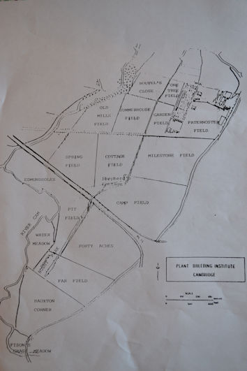
So after the Second World War and all the issues I have described, we are left with a farm of which one third is of little agricultural value. At this point, the Government bought Anstey Hall farm buildings and land. The hall was to be used as a training centre of agriculturalists. The farm was to be retained by the existing tenant, who would release 30 acres (less than 1/10 of the total area), to be used as a Plant Breeding Station. But on the understanding that in the unlikely event of plant breeding being successful, more land would be released by the tenant, as and when required by the plant breeding activity.
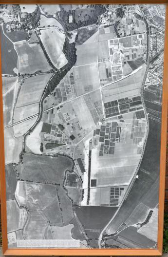
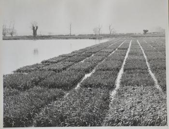
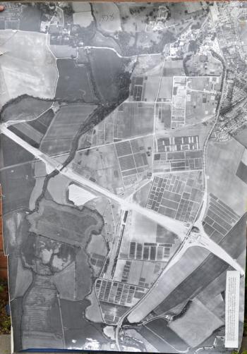
In 1971 the Plant Breeding Station (Plant Breeding Institute, PBI) activity took over the whole farm, selling the farm buildings and 5 acres to the tenant to establish an extensive pig enterprise. A traditional mixed arable and livestock farm became an intensive arable plant breeding station with the football pitch size walled garden transformed into a highly intensive glasshouse site. The land provided annually a base for 84,000 plots, and at the height of its activity the Plant Breeding business employing over 250 people. (See the history of the Plant Breeding Institute.)
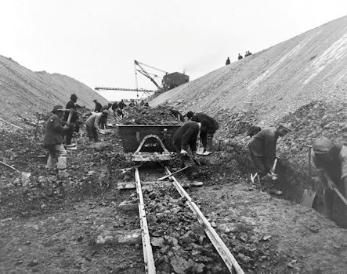
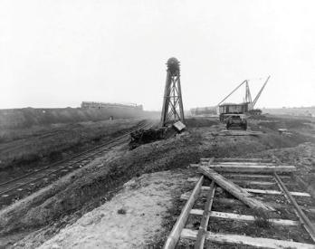
Just to round off the story, the PBI did have the opportunity to right some of the past changes. The railway cutting was a problem as pollen from seeding grasses would affect the grain breeding programmes. After the railway line closed in 1968, when Addenbrooke’s Hospital was constructed spoil from the digging of the foundations was used to infill the railway cutting free of charge. Then when the M11 was constructed across the farmland in the late 1970s, the contractors agreed to remove a large tree-covered mound dating from the coprolite digging, to spread this poor soil over a large area and cover it with a layer of peat and top soil from the motorway route, including the deep foundations of the river bridge.
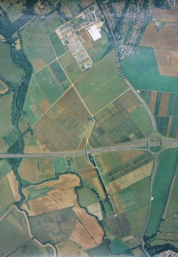

The latest role of the land is of course for the Trumpington Meadows housing development and the Trumpington Meadows Country Park and Nature Reserve, plus continued agricultural use.