November 2011
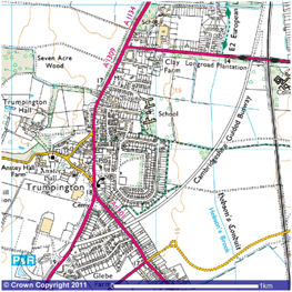
Ordnance Survey map showing the route of the Busway, November 2011.
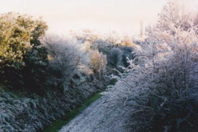
The former railway cutting in hoar frost, looking east from Shelford Road bridge, 1995.
Photos: Peter Dawson.
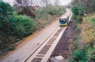
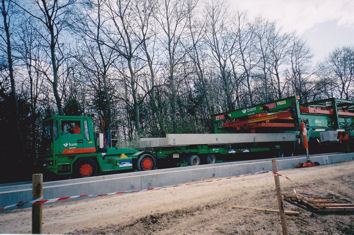
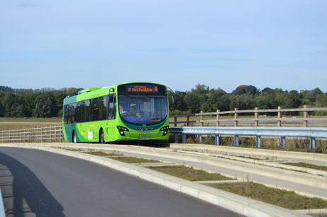
A test run on the Busway, early 2011.
Hailed by its promoters, Cambridgeshire County Council, as a vital contribution towards easing traffic congestion, especially on the A14, the concept of the Cambridgeshire Guided Busway was first presented in 2003 to a surprised and somewhat sceptical public, many of whom regarded it as a “white elephant” and the “misguided busway”.
The longest dedicated concrete guideway in the world, it was intended to provide rapid, comfortable and affordable transport between Huntingdon and Cambridge, utilising old railway tracks, except through Cambridge, and terminating at Trumpington Park & Ride.
Following the demise of the proposed Cambridge Rapid Transit System in 2000, Cambridgeshire County Council commenced public consultation on its scheme for a Huntingdon to Cambridge Guided Busway (CGB) in 2003. The concrete guideway would run 12 miles along the old railway track from St Ives to north Cambridge, then from the railway station to Trumpington Park & Ride, utilising the old Cambridge to Bedford rail line, with a spur into the Addenbrooke’s complex. There would be a track for maintenance, cycle and pedestrian use alongside the guideway.
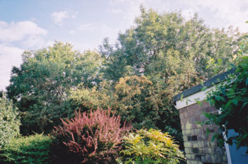
Looking over the railway cutting from the garden of 7 Cranleigh Close, summer 2006.
Despite further objections by residents, the Council voted to proceed with the Busway scheme and served Compulsory Purchase Order notices to acquire the embankments and the ends of gardens.
All residents along the deep cutting, except one, agreed to be represented by TEAG at the forthcoming Public Inquiry and throughout ongoing liaison with the Councils and constructors.
Formal objections from TEAG and individuals were submitted to the Secretary of State in March 2004 without the help offered by the County Council. A draft Agreement on land purchase was rejected on TEAG’s advice at a residents’ meeting on 1 September 2004, with guest speaker County Councillor Anne Kent present. It was agreed to appoint a legal representative in matters leading to a compensation payment.
Costing £2.2m, the Public Inquiry into the Busway began in St Ives on 28 September 2004, later transferring to Cambridge where it ended on 1 December 2004. TEAG made representation through its chairman, Ken Fletcher, on five key topics: needs and transportation; engineering; construction and capital cost; Public Rights of Way; ecology and landscape and environment.
Throughout the Inquiry, Ken Fletcher emphasised the concerns of residents about possible damage to property through vibration, risk of damage to the high pressure gas main beneath the trackway, loss of screening, seclusion and safety caused by the removal of trees and other growth, impact on the green character of the area and drop in property values. Destruction of the important wildlife green corridor and loss of habitat would cause a drastic reduction in the wildlife population and the status of the cutting as a County Wildlife Site would be jeopardised as a result. The proposed land-take, involving in some cases the removal of sheds, greenhouses, etc., would diminish the amenity value of the smaller gardens. Single-track restriction through the cutting rendered impossible the target of four minutes for buses to run between the Park & Ride site and Cambridge railway station (when the line opened in 2011, this was timetabled as 13 minutes via Addenbrooke’s Hospital).
Having received the Inspectors report in June 2005, the Secretary of State, Alistair Darling, approved the scheme in December that year. The suggestion by residents to use the proposed Addenbrookes Access Road as an alternative to the cutting had been rejected, partly because delivery of the road was expected to be later than completion of the Busway. (In fact, the road was delivered nine months before the Busway opened.)
In January 2006, residents met to agree that the acquisition of land should be by a new Agreement, rather than through statutory enforcement. This was on the advice of their appointed legal representative, Jonathan Stiff of Chartered Surveyors, Smiths Gore.
In August 2006, the Council announced the Busway would cost £116.2m and open at the end of 2008.
TEAG submitted comments on the Ecological Management Plan and gas main protection proposals. Residents were being kept informed of developments through TEAG newsletters.
As construction of the southern section of the Busway was about to begin, the first of a series of Local Liaison Forum (LLF) meetings was held on 6 December 2006, chaired by Councillor Anne Kent and attended by Ken Fletcher, Peter Dawson, other residents and – from 2007 – representatives of the Trumpington Residents’ Association, with Council and constructor’s representatives present.
In December 2006, the Busway construction company, Nuttalls (later BAM Nuttall), began building their site compound and factory near Longstanton.
In early 2007, designs for the Long Road side track underpass and the main line rail bridge were received and comments returned. Work on these began later in the year.
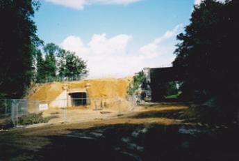
Constructing the tunnel for the busway cycle path beside the Long Road railway bridge, September 2007.
Constructing the busway bridge to Addenbrooke’s Hospital over the main railway line, autumn 2007.
In August 2007, after 21 active years, TEAG closed down, its functions now being performed by the Trumpington Residents’ Association (TRA). Ken Fletcher and Peter Dawson continued to act as residents’ representatives on Busway matters, the latter being a member of TRA.
In October 2007, Savills, for the Council, conducted independent surveys of properties as part of the compensation process. Survey details were sent to residents in 2008.
Confusion about clearance of the cutting, extent of land-take and alignment of fencing were voiced and the County’s responses received.
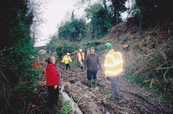
Initial clearance of the lower part of the embankments began in February 2008 but was stopped by City Councillor Philippa Slatter when residents strongly protested about the nature and extent of the work. A meeting of all parties concerned was held in the cutting. Smiths Gore sent details to residents plus a notice about a meeting in the Village Hall on 21 February. At this acrimonious meeting, residents expressed their dismay to Council and constructors representatives in strong terms.
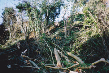
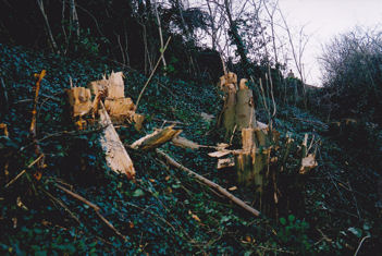
Initial clearance of the railway cutting embankment, February 2008.
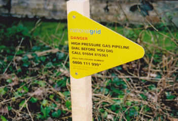
Work on protecting the gas main came to a halt in January 2009 when National Grid decided further inspection and pipe wrapping were necessary. This was not completed until March 2010, causing a serious delay to Busway construction in the cutting.
Warning sign for the gas pipeline through the cutting, spring 2008.
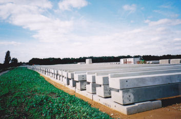
Construction of the busway track, looking north and south from the Long Road bridge; beams in hand for the construction of the busway track, spring 2009.
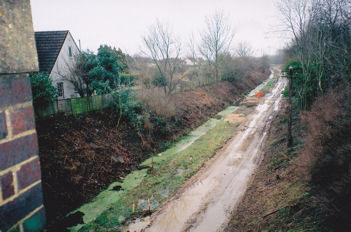
Further clearance of the railway cutting, spring 2009.
On 15 April 2009, Ken Fletcher and Peter Dawson experienced a short demonstration trip in a guided bus.
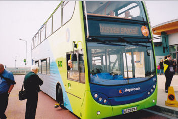
Demonstration trip by the busway buses, 15 April 2009.
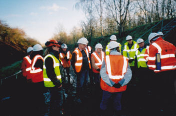
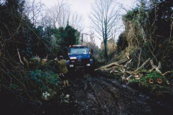
Site visit to the railway cutting, 26 November 2009.
From March to June 2010 gas main protection slabs were laid and the cutting drainage system installed.
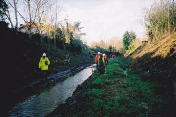
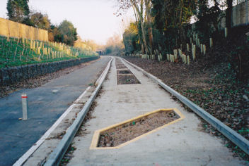
Looking east along the railway cutting from Shelford Road bridge, after clearance, January-February 2010.
Laying slabs along the railway cutting to protect the gas main, looking east from Shelford Road bridge, January-February 2010.
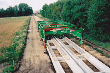
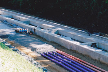
Laying the busway beams through Clay Farm, spring 2010.
On 20 May 2010, the Cambridge News reported that the cost of the Busway was expected to reach £161m.
In May and June 2010, with all parties represented, each garden was surveyed to settle disputes over land-take and to identify structures to be moved or removed. Copies of the resulting reports were vetted by Peter Dawson, corrected and finally signed by residents as being acceptable.
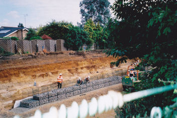
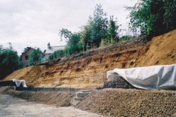
Restructuring the embankment and constructing the gabion wall on the north side of the railway cutting, summer 2010.
Unstoppable water flowing from a mysterious pipe emerging under Hauxton Road bridge from the Park & Ride site had to be fed into the new drainage system to prevent continued flooding in the cutting.
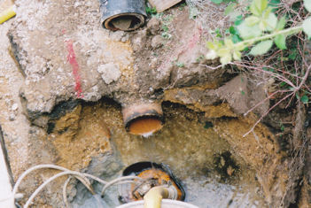
A mysterious water pipe in the railway cutting under Hauxton Road bridge, June 2010.
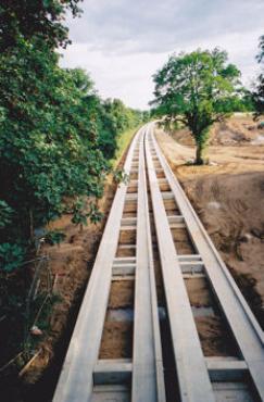
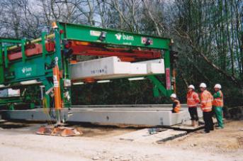
The giant gantry was slimmed from its double to single guideway format and its height reduced in order to squeeze through Shelford Road bridge and continue its work along the deep cutting.
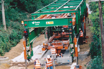
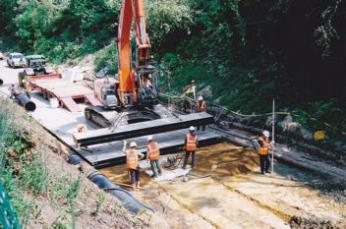
![Laying the busway beams in the railway cutting, under the west side of the Shelford Road bridge, September 2010.]](/wp-content/uploads/CGB_history_2010_27-346x232-1.jpg)
Laying the busway beams in the railway cutting, looking east from the Shelford Road bridge and under the west side of Shelford Road bridge, September 2010.
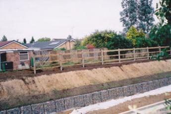
The boundary fence was erected along the top of both embankments according to an alignment agreed by residents. A new chain-link fence was erected along the footpath leading from Shelford Road.
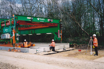
Laying the side track base in the railway cutting, looking from Cranleigh Close, September 2010.
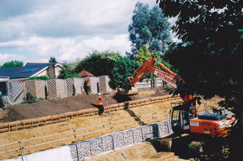
Erecting the boundary fence on the north side of the railway cutting, September-October 2010.
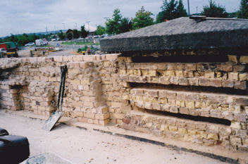
Remedial work on the brickwork of Hauxton Road bridge, September 2010.
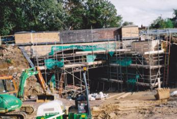
Extensive work to construct the end of the Busway from Hauxton Road bridge up to the Park & Ride site was completed.
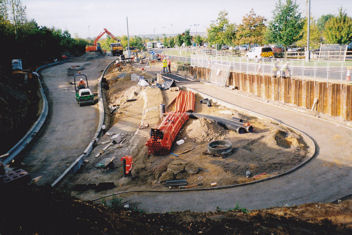
Constructing the exit from the busway to the Trumpington Park & Ride site, under Hauxton Road bridge, September 2010.
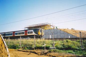
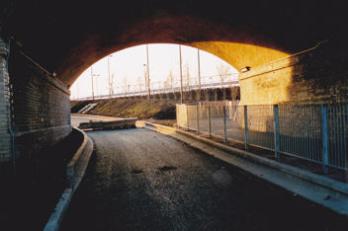
The completed busway under Hauxton Road bridge, early 2011.
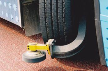
The completed busway through the former railway cutting, looking east from under Hauxton Road bridge, with a the car trap to prevent illegal or accidental use of the guideway, early 2011.
On 10 January 2011, an independent safety audit of the entire Busway was undertaken.
The Local Liaison Forum on 20 January 2011 received notification that the public art time capsule, filled with Trumpington artefacts collected by Peter Dawson, had already been placed beneath the north side village bus-stop platform without the ceremonial event promised by the authorities. It is marked by a slab bearing the image of a stylised ‘green man’.
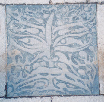
A slab covering the time capsule buried under the east-bound platform of the Trumpington bus stop on the guided busway, early 2011.
In January 2011, the final tree-work was carried out in the cutting.
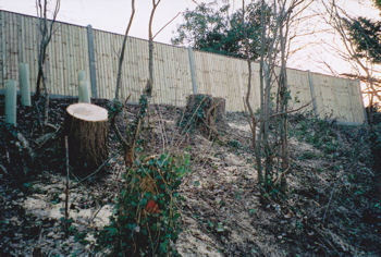
The final phase of tree clearance in the railway cutting, early 2011.
The Busway was officially handed over to the County Council by BAM Nuttall on 21 April 2011. Certain unfinished work, including defects and black-topping the side track, would be undertaken by the County Council.
The dispute between the County Council and BAM Nuttall over cost of lateness and a budget overspend of £9.0m remained unresolved.
Driver training took place in early 2011 and in the build up to the opening.

A test run on the guided busway, looking east along the railway cutting from Shelford Road bridge, early 2011.
Howard Slatter
During 2010, negotiations took place between the Trumpington Allotment Society and Trumpington Community Orchard Project with BAM Nuttall about the effects of construction work along their hedgerow boundary with the Busway.
After a number of site visits, including a series of fortnightly liaison meetings, it seemed that the hedgerow and trees contained within it were substantially unaffected by the excavation works for drainage and the maintenance track. Monitoring would continue to take place over the next two years; BAM Nuttall agreed to replace any trees or shrubs which suffered from their works.
Security along the boundary became a problem, as all the brambles were removed from the edge of the cutting. A section of old fencing was replaced and chestnut paling was provided to help fill gaps in the hedge until new planting could grow up in its place.
At the request of the Allotment Society, the cycle shelter beside the Trumpington stop was moved away from the allotment boundary to the other side of the approach track.
By early 2011, when BAM Nuttall had completed this section of the Busway, the Allotment Society was happy that their interests had been safeguarded as far as possible, and they sent a formal letter of thanks to John Ely, Construction Manager, recognising this.
Items included in the time capsule buried under the east-bound platform of the Trumpington bus stop
Trumpington Parish Church
Poster, Easter 2009
Booklet, St Mary and St Michael, Trumpington , The Church, 2006
Church Magazine, The Trumpet , March 2009
Leaflet, New View 2009 , Reverend Andy Chrich
Poster from the meeting A Trip Through Trumpington , based on lectures by Percy Robinson, 2005
Trumpington Hall
Copy of deeds, Grant and Confirmation , dated 1582, with note and synopsis
Postcard photograph of Trumpington Hall, building notes and description in the Victoria County History , 1982
Extract from the description by the Royal Commission on Historical Monuments , 1959
Trumpington Local History Group
Book, 20th Century Trumpington , Trumpington Local History Group, 2000
Book, Trumpington Past and Present , Trumpington Local History Group, 2003
Extract, Spalding’s Directory of Cambridge , 1939
Personal memories, Trumpington – Fifty Years Ago , W.E. Dring, 1974
DVD, 100 Years of Change , Trumpington Local History Group, 2008
Leaflet, Who was Henry Fawcett? , Trumpington Local History Group, 2009
Booklet, Henry Fawcett, Man of Vision , Trumpington Local History Group, 2009
Leaflet and Invitation Card, Trumpington Village Hall Centenary Exhibition, 2008
Leaflet, Trumpington War Memorial , Trumpington Local History Group, 1997
Home page and meetings page from Website, 2009
Meetings posters, Trumpington Local History Group:
Trumpington Worthies , 2001
A Century of Childhood in Trumpingto n, 2004
Were You There? What Did You Wear? , 2005
Toys, Games and Pastimes of Yesteryear , 2007
A Hundred Years of Change , 2008
A Trip Around My Dining Room Walls (Trumpington Hall), 2008
Trumpington Village Hall Centenary Exhibition , 2008
On the Street Where You Live , 2008
Along the High Street , 2009
Trumpington Residents’ Association (TRA)
Poster
Membership Card
Home page, Web site, 2009
Leaflet, Information for Members, 2009
Rules of the Association, 2008
Minutes of members’ meeting held 24 September 2008
Trumpington Elderly Action Group
Cards, programmes for 2009 and 2010
Trumpington Tuesday Group
Leaflets, programmes for 2005 and 2007
Trumpington Fish Scheme
Window card, gate-post metal sign, lapel badge
Trumpington Gardening Society (TruGS)
Card, programme for 2009
Trumpington Environmental Action Group (TEAG)
Booklet, Protecting the Cambridge Scene , 1986
Leaflet, A Walk around Trumpington Village , 1997
Leaflet, Anstey Hall , 1997
Leaflets, number 1-3, 1986
Trumpington Community Orchard Project
Leaflet, Membership information and aims
Anstey Way Events
Programme, Trumpington Christmas Fair, 2008
Southacre, Latham and Chaucer Residents’ Association (SOLACHRA)
Book, Rus In Urbe. Chaucer Road and Latham Road: the History of Two Rural Roads in Cambridge , SOLACHRA, 1996
Plant Breeding Institute (PBI)
Booklets:
The Plant Breeding Institute, 75 Years, 1912-1987 , PBI, 1987
Cereals, A Guide to Varieties , PBI
Wheat, Yesterday, Today and Tomorrow , PBI, 1991
Wheat, A Guide to Varieties from the Plant Breeding Institute , NSDO
Trumpington Allotment Association
Posters, Allotments to Let, Grow Your Own Vegetables, picture of produce
Site plans, 2001-02, 2007-08, 2008-09, plus information sheet
Photograph, members at the Village Hall Centenary Exhibition, 2008
Posters, Open Day, 2007
Poster and newspaper article, National Allotment Week, 2009
Postscript
For information about the Cambridgeshire Guided Busway, see the Cambridgeshire County Council and Busway web sites. These including details of the project and the timetable.
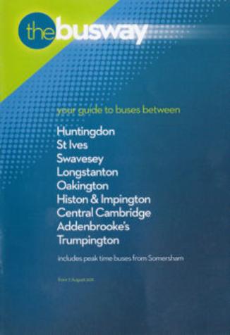
Cover of the Busway timetable. Cambridgeshire County Council, August 2011.
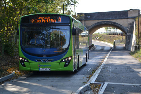
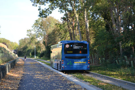
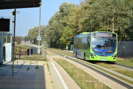
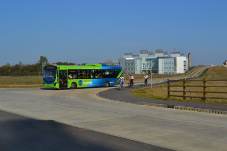
Services on the Busway through Trumpington, October 2011. Photos: Andrew Roberts.
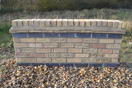
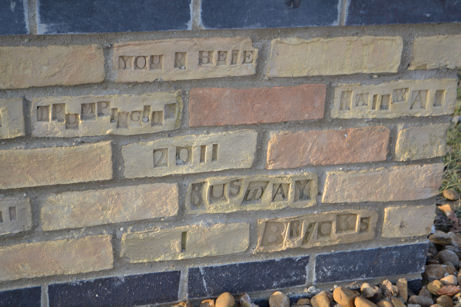
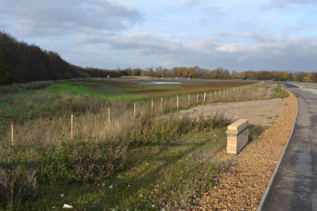
The ‘brick wall’ on the Busway, at the junction of the railway route and the Addenbrooke’s spur, 24 November 2011. Photos: Andrew Roberts.