This is one of three pages about the agricultural revolution and the enclosure (or inclosure) of Trumpington. See also the introductory page, the background to farms and farming and a separate section by Howard Slatter with full details about the Inclosure Act and Award.
The authoritative source for the agricultural history and the enclosure of Trumpington is the Victoria County History (VCH), which has details of farms and agricultural practices from the Norman Conquest to the 20th century, and has been used as the basis for these notes. The agricultural land in Trumpington was being consolidated into a few large holdings long before the parish was formally enclosed.
From the 16th century, the VCH records that the agricultural population was increasingly polarised between a few substantial farmers and numerous labourers. By 1720, there were probably only five large farmers. By the late 18th century, most of the parish was owned by the Pembertons (Trumpington Hall) and Ansteys (Anstey Hall). In the 1780s, the Pemberton estate was divided into four farms. In c. 1800, the village included 7 farmhouses, 29 other houses, 11 cottages. At this time, F.C.J. Pemberton claimed c. 1400 acres and the rectory lease, including four sheepwalks for 1000 sheep, with the largest farm carried 280 West Country sheep, while the Ansteys had another two sheepwalks for 720 sheep. (A sheepwalk was a tract of grassland used for pasturing sheep.)
The enclosure of the parish was instigated by F.C.J. Pemberton in 1801. Parliament ha d accepted privately-promoted acts since the 1760s, and he procured such an Inclosure Act with the reluctant agreement of Trinity College (the ‘rector’) and the Ansteys. The land was divided after the 1802 harvest, but the inclosure award was delayed until 1809.
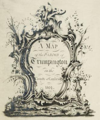
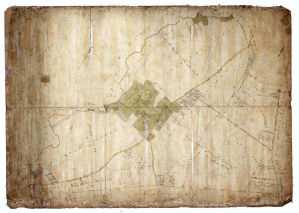
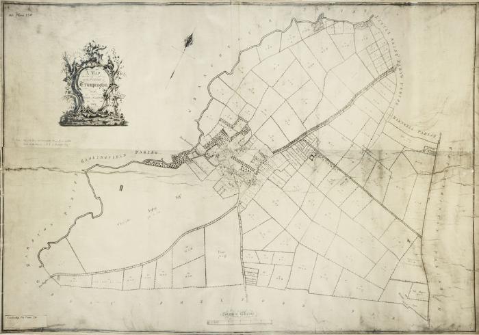
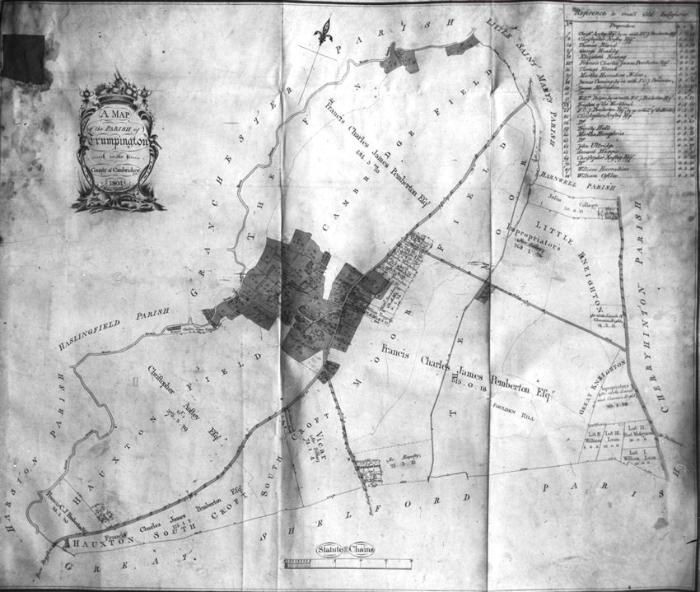
One map of Trumpington parish is in the Pemberton Archive and probably dates to the beginning of the enclosure process, c. 1800-01. Another map was produced in 1804, a copy of which is held at the Cambridgeshire Archives (reference R60/24/2/70(a)) . This seems to have been supplemented by a more outline map which had field names as well as a confirmation of the major allocations of land.
The award included 2062 acres of open fields and wastes and 152 acres of old inclosures, decisions which still affect the layout of the village 200 years later:
• the Pemberton estate was allocated 1163 acres plus 268 acres as rectorial lease (Trinity College) (c. 70% of the parish)
• Christopher Anstey was allocated 378 acres (c. 20% of the parish)
• the next largest lay owner was allocated 15 acres (the village blacksmith) and other smallholders were allocated just 18½ acres
• the vicar and parish and Colleges were allocated c. 106 acres
The nearby parishes were enclosed at a similar time: Hauxton and Harston in 1802, Grantchester in 1803, Cherry Hinton in 1810. In Cambridge, Coe Fen Leys was enclosed in 1803 (the site of the Leys School) and St Andrews in 1811. The exception was Great Shelford, where the Inclosure Act was not obtained until 1834.
In the years after the enclosure award, some farmsteads were built away from the village, including River Farm and Clay Farm. The parish continued to be divided into a few large farms until the 1930s:
• four Pemberton farms: Blackland (later River) Farm (c. 307 acres in the 1840s), Manor Farm (c. 291 acres), Church Farm (350-400 acres) and Clay Farm (c. 400 acres in the 1850s)
• Anstey Hall Farm, c. 390 acres after 1815
• Great Tithe Farm (Trinity Farm), c. 246 acres, leased by the Pembertons from Trinity College until the 1860s
Sources
Trumpington Inclosure Map, c. 1800. Pemberton Archive, Trumpington Hall.
Trumpington Inclosure Map: A Map of the Parish of Trumpington in the County of Cambridge, 1804 . Cambridgeshire Archives, R60/24/2/70(a).
Carr, Edith (1973). Trumpington: a Cambridgeshire Village . In People and Places. An East Anglian Miscellany. Pages 8-67. Lavenham: Terence Dalton Ltd. SBN 900963-24-7.
Kirby, Tony and Oosthuizen, Susan (eds.) (2000). An Atlas of Cambridgeshire and Huntingdonshire History . Cambridge: Anglia Polytechnic University. Map 58.
Victoria History of the Counties of England (1982). A History of Cambridgeshire and the Isle of Ely, Volume VIII. Armingford and Thriplow Hundreds. Edited by C.R. Elrington. Oxford: Oxford University Press for the Institute of Historical Research. ISBN 0-19-722757-0.