Howard Slatter
October 2010
This page takes a tour along the length of Hobson’s Conduit and beyond into the heart of Cambridge. This is based on a talk given to a meeting of the Local History Group in October 2010, when Howard Slatter was Chair of the Group and one of the Hobson’s Conduit Trustees. See also a 2017 update and an earlier introduction to Hobson’s Brook and Conduit.
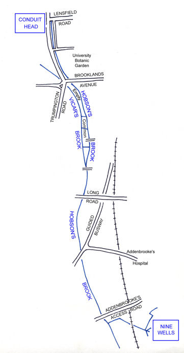
The route of Hobson’s Conduit can be traced in this sketch map, rising at Nine Wells, joined by another stream from Great Shelford which rises further south, flowing north, and dividing into two streams half way into Cambridge. At that point the original Vicar’s Brook flows on to the river Cam, and the “new” man-made structure takes the water to the Conduit Head at the corner of Lensfield Road and Trumpington Street.
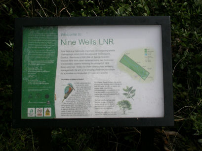
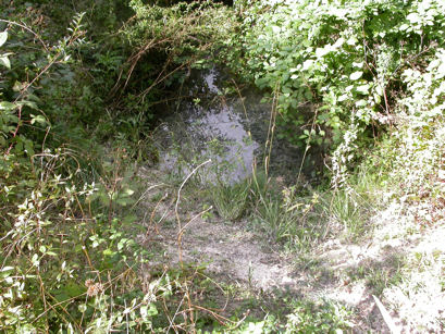
The Nine Wells Local Nature Reserve is in the parish of Great Shelford. A visit is highly recommended – there is much to see and lots of work has been done recently by Ellis Selway and his team from Cambridge City Council to improve the reserve. This area was purchased jointly in 1835 by the University and Town, after the Great Shelford Inclosure Act of 1834.
A walk round the reserve reveals four of the “wells”, springs issuing fairly gently from the chalk. The rate of flow nowadays is not what it used to be, particularly because of water abstraction by the Cambridge Water Company from their borehole at Babraham on the Gog Magog hills.
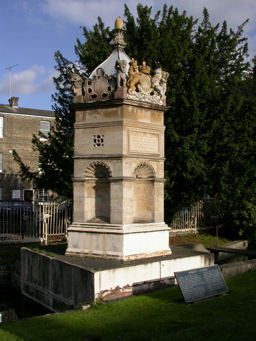
Eventually you come, rather unexpectedly, to a monument, or obelisk, erected by public subscription in 1861.
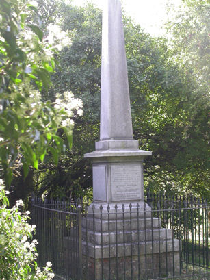
The monument bears inscriptions outlining some of the early history of the Conduit. Among those mentioned are three men:
Andrew Perne, Master of Peterhouse, who first (in 1574) suggested taking water from here into Cambridge, in order to clean out the King’s Ditch, on the southern and eastern edges of the town. The filthy state of the King’s Ditch was seen as being responsible for recent outbreaks of plague in Cambridge.
Thomas Chaplin, Lord of the Manor of Trumpington in 1610, who signed a “tripartite agreement” with the town and the university giving them rights over the newly made watercourse and the soil either side in order to maintain it in good order.
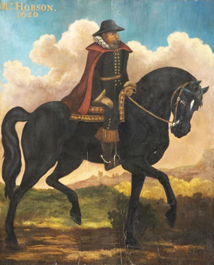
Thomas Hobson, the well known Cambridge carrier (referred to in the phrase Hobson’s choice). When Hobson died in 1631 he bequeathed land so that its income could be used to maintain the supply of water to the market place, for in 1614 some of the water from the original stream had been diverted to the market place where it was used as a public water supply. This splendid portrait of him hangs in the Guildhall in Cambridge.
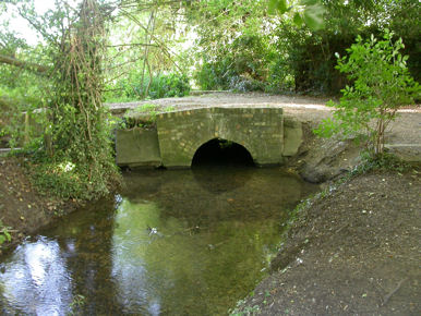
The water flows from Nine Wells northwards through the parish of Trumpington, under the new Addenbrooke’s Road, the Cambridgeshire Guided Busway (formerly the route of the London & North Western Railway line from Bedford to Cambridge) and then under Long Road.
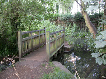
A bridge connects the north end of the Emmanuel College field adjoining Long Road with a footpath from the end of Porson Road. This is a boundary point in two ways: it marks the start of the footpath which now runs along the side of the brook and it is also the point at which the man-made section begins.
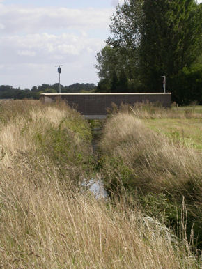
Another bridge crosses the main overflow from Hobson’s Brook to Vicar’s Brook, which in times of plenty, can carry a lot of water over the weir. Known as the Memorial Bridge , it was erected by the Hobson’s Conduit Trustees to mark the 300th anniversary of Hobson’s death and bequest.
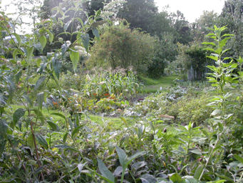
As you walk further north along what is known as Finch’s Walk , you soon come to the Empty Common allotment site on your left. The presence of the brook alongside the allotments is a two-edged sword as far as the users are concerned; they incur occasional minor flooding and a bit of seepage into the site, but they have an unofficial ready supply of good water for their watering cans.
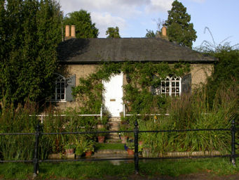
Brooklands Lodge, as it is now called, was formerly known as “Mr Foster’s Gardener’s Cottage” when Richard Foster lived in Brooklands House. As its garden is below the level of the conduit itself, it has been a source of complaints to the Trustees for 150 years about water entering the premises.
The next feature is the former entrance to the University Botanic Garden, which moved here in 1846; Hobson’s Conduit supplies water to the pond in the Garden.
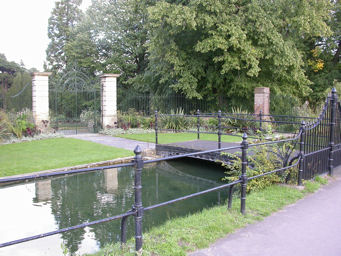
The stream continues to flow north and reaches Conduit Head at the junction of Trumpington Road and Lensfield Road. Two hundred years ago this was an empty stretch of water. The structure, confusingly sometimes itself called “the conduit head” originally stood in the Market place where, from 1614 onwards, it delivered Hobson’s water to the residents of the town. Usually called just The Conduit or sometimes Hobson’s House, it served that purpose for well over 200 years, until a fire in the market place prompted a redesign, and in 1856 the conduit was moved to its present position.
From the Conduit Head the water goes underground and originally followed four routes. Two of them are now effectively defunct: one route ran to the old Botanic Garden via old Addenbrooke’s Hospital – now the university’s Judge Institute – and Pembroke College; and another route ran to the Market Place. Two others still operate:
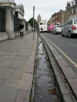
Route 3 was originally an open watercourse, constructed in about 1630. It runs down Lensfield Road, across Hills Road and Gonville Place, down the edge of Parker’s Piece and then along under the pavement of Regent Street and St Andrew’s Street, heading for Emmanuel College. A branch into Emmanuel feeds two of their ponds and the overflow then continues underground under Drummer Street to Christ’s College, where it fills the Master’s fish pond. Another branch continues along St Andrew’s Street, and then, just after Emmanuel Street, used to come up to the surface on either side of the road and form two runnels one down either side, as mentioned in the plaque at the Conduit Head. There are traces of this former route alongside St Andrew’s Street, but for technical reasons the water is not yet (in 2010) flowing here.
Route 1 was originally the very first course of Hobson’s Conduit, before even the fountain in the market place was built. It used to be a single stream running the length of Trumpington Street until it emerged into the Kings Ditch in an attempt to flush it out. It seems that it never really had the desired effect and very soon other uses were found for the water. Nowadays, this too is divided into two runnels, passing the fronts of Pembroke College and the Fitzwilliam Museum and Peterhouse.