Update on the development of ‘Hobson’s Park’ on the former farmland between Hobson’s Brook and the Cambridge-London railway line in Trumpington.
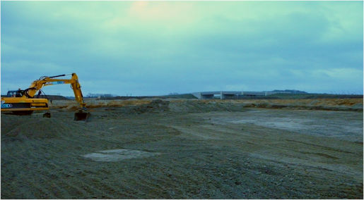
In 2011, excavations started on the four balancing ponds which now receive the surface drainage water from the Clay Farm residential development. That water comes under Hobson’s Brook, settles in the ponds and is then allowed to drain back into the Brook at a controlled rate.
Howard Slatter
September 2017
Howard Slatter gave a talk about the history of Hobson’s Conduit and
Hobson’s Brook and the development of the new Hobson’s Park, at the Local History Group meeting on 28 September 2017 . As part of the talk covered similar ground to the meeting in October 2010 , this page focuses on the recent development of Hobson’s Park.
Excavating the large pond. Richard Wells, February 2011.
Large pond looking from the east. Howard Slatter, August 2017.

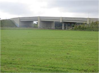
The two new bridges over the railway have now been open for some years: the Cambridgeshire Guided Busway bridge beside the former level crossing to Addenbrooke’s Hospital, and the Addenbrooke’s Road bridge at the southern end of the park.

Busway bridge and Laboratory of Molecular Biology. Howard Slatter, August 2017.
Addenbrooke’s Road bridge. Howard Slatter, August 2017.
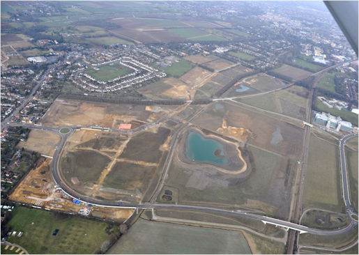
The large pond between the two bridges takes the water from all the Glebe Farm development, as well as about one quarter of Clay Farm. It has been designated as a bird reserve, and a good variety of bird species have been seen there since it was excavated. The outflow to Hobson’s Brook is monitored continuously, with the flow rates being sent telemetrically for reading by various bodies.
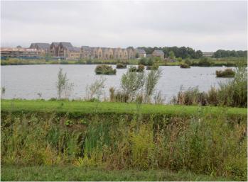

Above left: Large pond looking from the south- east.
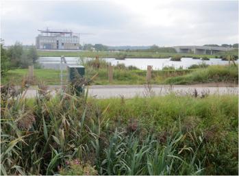
Above right: Bird screen.
Left: Large pond looking from the west, with monitoring equipment.
Howard Slatter, August 2017.
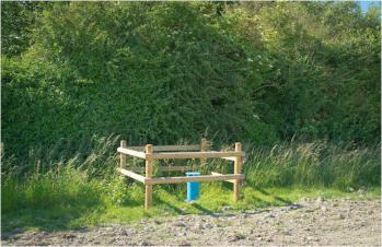
Part of Hobson’s Park is laid out for new allotments, but these have not yet (September 2017) been made available to tenants.

Allotment site, Hobson’s Park. Howard Slatter, August 2017.
Another recent development is an initial investigation by South Staffordshire Water (formerly Cambridge Water) into the feasibility of augmenting the water supply to Nine Wells during the summer months by water piped underground from the borehole at Babraham. Four exploratory injection boreholes have been dug on the uphill side of the Nine Wells Local Nature Reserve. It is hoped that within the next three years water will be fed to them when needed, to stop the levels in Hobson’s Brook becoming dangerously low.
Injection Borehole, Nine Wells. Richard Fraser, June 2017.
The Cambridge Biomedical Campus (CBC) on the east side of the railway is growing apace. Most of that surface water also enters Hobson’s Brook. There is a proposal by South Cambridgeshire District Council to extend the CBC beyond its present southern boundary, which would take it very close to Nine Wells. There is much local disquiet about this proposal; it has not yet been announced whether this variation to the Local Plan will be allowed.
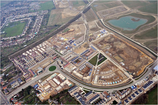
Hobson’s Brook and Park from the south. Countryside Properties plc, April 2011.
Clay Farm and pond from the south-west. Countryside Properties plc, March 2014.
There were a number of questions after Howard’s presentation.
Q: the Ordnance Survey map shows another watercourse to the south of Nine Wells.
A: there is another stream, rising from Granham’s Road, Great Shelford.
Q: development concerns?
A: in addition to the growth of CBC, there are proposals for a railway station at CBC and the doubling of the tracks from 2 to 4, plus a bus route parallel with the railway line.
Q: historic water flow rate on the Brook?
A: the flow rate is currently about a third of that before abstraction started; given the system where drainage from the new housing developments goes into the balancing ponds, the flow should be no greater than in the past.
Q: quality of water in the Brook?
A: the water from the Babraham borehole should be high quality, the water is taken from the source aquifer. The current quality in the Brook is good, although there is some run-off of agricultural chemicals. There is a delay of at least six months in the flow through the chalk aquifer.
Q: access to the Brook through Trumpington?
A: informal access was possible in the past but it is more difficult to follow it at present; the stretch from Addenbrooke’s Road to Long Road will be accessible within Hobson’s Park once adopted by the City Council.
Q: the King’s Ditch and the runnels in Trumpington Street?
A: there is limited evidence for the early history of the King’s Ditch. The runnels are the visible face of the Conduit in the city and are a Grade I listed monument.