Tim Glasswell was one of two speakers at the Local History Group meeting on 30 March 2017 , full of information and stories about working for Ordnance Survey on the mapping of ever-changing Trumpington.
As a surveyor for Ordnance Survey (OS), I have been keeping the mapping for Trumpington up-to-date for the past 13 years. I grew up in Bishops Road, so it’s an area I know very well! I went to school at Fawcett Juniors, Sawston Village College and then Long Road 6th Form College, and I have always had a love of maps. I studied Geography with History at the University of Kent at Canterbury in the mid-90s, and went on to be a cartographer for a nautical publisher. In 2004 I saw an advert in the Cambridge Evening News for a surveyor for Ordnance Survey in the Cambridge area, and I have been here ever since!
A little bit of background on OS. Founded in June 1791, with the French Revolution happening on the other side of the channel, the Board of Ordnance set about surveying the south coast for potential military use. Using triangulation, trigonometry and theodolites, the first highly accurate map was produced in 1801. At 1 inch-to-the- mile, this map of the county of Kent took 3 years to produce. It wasn’t until the 1870s that the first series of the entire country was produced.
Ordnance Survey logo. Reproduced by kind permission of Ordnance Survey.
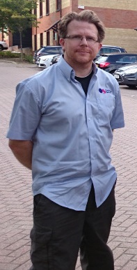
Tim Glasswell.
Back to today… I am one of 250 ‘Field Surveyors’ around the country, and I’m responsible for the city of Cambridge, most of South Cambridgeshire, and the area around Haverhill. We make 10,000+ changes to the National Mapping Database every single day. This includes houses, fences, schools, roads, paths, tracks and much, much more. The main tools of my job are a ‘Toughbook’ handheld computer and a GNSS (GPS) satellite receiver. This GPS sits on top of a pole, and is Bluetooth-ed to my computer, providing accuracy down to centimetres. I also use a digital laser meter, and an old-fashioned tape measure every now and then!
Ordnance Survey is probably best known for the pink and orange leisure maps, but this is only 10% of what we do! Most of our products are in the form of digital datasets that can be used with a modern GIS (Geographical Information System). The data is separated into ‘layers’ (e.g. topographic linework, road information, water features and addresses) that can be used for a myriad of purposes in this modern, connected world we live in. Our data is used by Land Registry, and underpins every property sale in the country. Our road-routing information is in most Sat Navs in Britain. The emergency services rely on our large scale data, which helps them respond faster to calls.
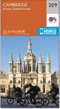
The local Ordnance Survey Explorer map. Reproduced by kind permission of Ordnance Survey.
You only have to look at the skyline of Cambridge to see how much building work is going on in the city, and this keeps me busy. I have been working on building sites in Clay Farm, Glebe Farm and Trumpington Meadows every month or so since they started. I do get the chance to add the smaller developments to the mapping too: single houses, ‘demolitions and rebuilds’, name changes and minor alterations to existing features. Throughout the year, I also keep an eye out for changes and additions to the paper maps (e.g. the blue ‘tourist features’), which is another important part of my day-to-day mapping.
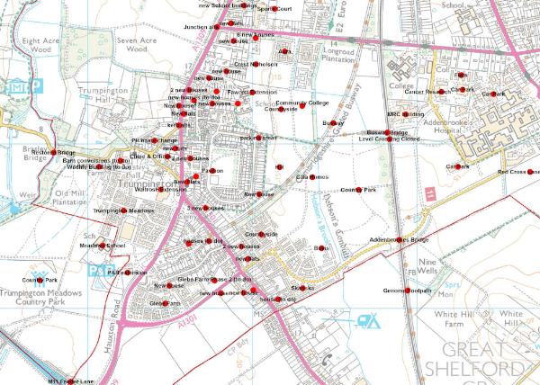
“All the jobs I can remember surveying in Cambridge since 2004”. Image reproduced from Ordnance Survey mapping by kind permission of Ordnance Survey.
It’s a very enjoyable job. I’m out and about almost every day, and I generally get to manage my own work. I have met some interesting people along the way, and I get to see hidden places you never knew were there! I’ve been involved in a number of large projects over the years, including surveying 25 km of the Guided Busway. There’s more to come too, with the upgraded A14 and housing developments at Northstowe and Waterbeach barracks.
If you see me out and about in Trumpington, please stop me and I’ll show you what I’m up to!
For more information on OS, please visit the website .