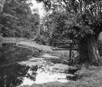
The River Cam at Paradise, at the back of River Farm. Percy Robinson collection.
T R U M P I N G T O N.
—— oOo ——
If we endeavour to picture to ourselves Trumpington in pre-historic times, we should be able to divide it roughly into two parts, (a) the high lands, (b) the valley near the river, most probably a vast swamp. The high land one would expect to be covered with thick forests through which were tracks made by animals and those who journeyed through in pursuit of them. Whether Trunipington could be approached from the south or west is doubtful until fords were made. The best approach was no doubt from a road Wort’s Causeway leading from the Icknield Way crossing the Hills Road. The road has now disappeared but came across the Trumpington Road almost at right angles, and near to the Gamekeeper’s Cottage probably crossed to a ford in Grantchester Meadows, the road running behind Grantchester School.
The lower land would probably consist of a vast swamp with a sluggish stream of water running through it, but which at times became a raging torrent. This region was inhabited by countless aquatic birds and creatures, and this is evidenced by the coprolites that may be found through this area. The land at the south end of the Village near to Hauxton was dug over for coprolites about 1870, as also the land at the northern end from opposite the Volunteer to River Farm.
Possibly pre-historic creatures wandered about these parts, for the fossilised remains of a mammoth’s tooth, (or similar creature) have been found in the bed of sand just over Hauxton Road Railway Bridge.
As the Romans made a settlement at Grantchester it is quite possible that Trumpington became an outpost, and no doubt a Roman fort guarded the approach to the fords, Camping Close may have obtained its name from the fact that it was a camping ground.
In the time of the Britons this district was supposed to belong to the tribe of the Iceni, who under Boadicea rebelled against the Romans.
As there appears some doubt as to the exact meaning of the name of the town Cambridge, so also it is hard to find the exact meaning of Trumpington, spelt in a large number of ways Trumperton etc. If I may be allowed to suggest a meaning it is to the effect “the town where the trumpet may be heard”, for, assuming that a Roman fort was at Trumpington, it is possible that by means of a trumpet the attention of those in the fort could be attracted. Saxon Ton = town, so Town of Trumpings.
In the Anglo-Saxon Chronicle of 875 the name of Grantebryg appears, and in 1010 in the Chronicle it is entered as Granta-bryg- shire .
Later as settlements were formed in this part, one would expect to find a collection of huts or houses with a clearance from the forest lands. Near to the settlement the land would be divided into (1) ploughland in the form of strips or balks; outside this would be (2) the meadows for grazing, and beyond, the moorland or forest.
At the annual meeting of the folk at the Moothill the officials for the year were appointed, viz:- herdsman, shepherd, swineherd, hayward. Others of importance were the pedlar, who was always welcomed as the bringer of news, the Leech or blood-letter, and the miller, who was generally in a flourishing position.
Scanned from Percy Robinson’s original typescript by Howard Slatter.
Following his appointment as Head Teacher of the Church School in 1908, Percy Robinson built up an extensive knowledge of Trumpington’s history.One of his individual notes from the 1920s is a rather fanciful and inaccurate introduction to Trumpington, reproduced below.