Clay Farm, Hobson’s Park and Nine Wells
The Valley to the East of Trumpington
Walk or cycle 5 miles/8 kms: walk on pavements and footpaths; cycle on roads and dual use paths
This is one of a series of history trails about Trumpington and its links to surrounding villages and Cambridge. We hope that long-established and new residents will find the trails to be a fascinating way to discover more about the history of the area.
The trails have been developed by the Trumpington Residents’ Association and the Trumpington Local History Group, with support from Cambridge City Council. The project is led by Andrew Roberts and Howard Slatter.
Printed copies available free of charge from The Clay Farm Centre and Trumpington Pavilion.
Contact the Local History Group with feedback: admin@trumpingtonlocalhistorygroup.org .
Download a PDF version of the trail or continue with the route …
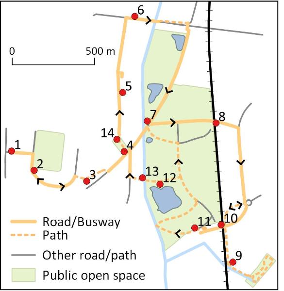
1. Start at the green by the shops, Anstey Way
2. The 1940s Estate
This estate was built in the 1940s. The playing field was dedicated to King George V in 1951 and Trumpington Pavilion was rebuilt in 2009 (Trail 4). Go along Foster Road, named after the Foster family, owners of Anstey Hall, 1838-1941. Take the path to the right beside number 112 and go on to where the path divides.
3. Allotments and Community Orchard
The Foster Road Allotments to the right were developed at the same time as the estate, with the Allotment Society first meeting in 1947. The Community Orchard to the left was founded in 2007 and planted with apple and plum trees: all are welcome and there are picnic tables. It includes a Swift Tower, installed in June 2014 to encourage nesting swifts. Go forward past the orchard and chicken plots to the Busway, on the route of the Cambridge-Bedford railway, opened in 1862 and closed in 1968 (Trail 3). Go left along the Busway path to Hobson Square, past new apartments in the Virido development.
4. Clay Farm and Hobson Square
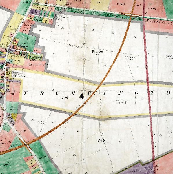
Clay Farm extended from Long Road to Shelford Road (see 1911 map), land awarded to F.C.J. Pemberton at the enclosure of the parish in 1804-09. Work on the Clay Farm development was approved in 2008, coordinated by Countryside Properties, with individual areas developed by Countryside and other builders. Hobson Square opened in late 2016 as a focus for the area. Go across the square, past the sculpture, The Bronze House, by Heather and Ivan Morison, installed in 2016, which commemorates the Bronze Age community that lived in this area (Feature C). Go to the right of the Clay Farm Centre and along Lime Avenue, with trees planted in late 2011.
The Community College opened in September 2016, with a capacity for 750 students plus community sports facilities. Go on along Lime Avenue through the Aura and Halo developments, built from 2013. The tree belt to the left at right angles to the road dates from the farming use of the land. The archaeologists found a Middle Bronze Age settlement area immediately to the north of the trees. Turn right into Plantation Avenue and look for the sign high on the wall to the right in Forbes Close. This commemorates the Cornwell family who had the tenancy of Clay Farm from 1931-73, created by Sean Edwards in 2015. Continue on Lime Avenue to Long Road and cross the road.
Clay Farm house is further along Long Road (Trail 2) but go to the right. Cross Rutherford Road and Hobson’s Brook (marked by green railings), turn left then immediately right onto the footpath parallel with Long Road (Trail 2). Go to the Busway: the land to the left of the path was the site of the Royal Show in 1922, when the land across the Busway, between the Cambridge- Bedford and the Cambridge-London lines, was used as a railway station. The Busway bridge is the original railway bridge; the tunnel used by the footpath was added in 2007. Go right through the tunnel and continue along the Busway path, with the playing fields of the Community College to the right, to the Busway junction.
7. Busway junction
When the Clay Farm housing was approved, the land from Long Road to Addenbrooke’s Road, between Hobson’s Brook and the main railway line, was retained in the Green Belt for public use. The triangle of land to the right is being developed as a skate park and play area, while the land across the Busway will be an active recreation space, with a running circuit. There is low brick wall beside the Busway path, placed here as an art feature when the Busway was built. Cross the Busway and go to the railway bridge.
8. The Busway and Biomedical Campus
The Busway bridge was constructed in 2007-10, parallel with the former farm track from Manor Farm to Red Cross Farm (Trail 4). The bridge is a good viewpoint over the main part of Hobson’s Park, including trees in the foreground near the railway line, planted by Fawcett School children in 2012. Hobson’s Brook forms the edge of the park, with new houses beyond. On the far side of the bridge, the Laboratory of Molecular Biology is to the left, AstraZeneca ahead and to the right (Trail 10). Continue down the slope and go right along Francis Crick Avenue, past Papworth Hospital and AstraZeneca. At the roundabout, take the path to the right, go under the road bridge and continue beside the railway to the bridge over Hobson’s Brook.
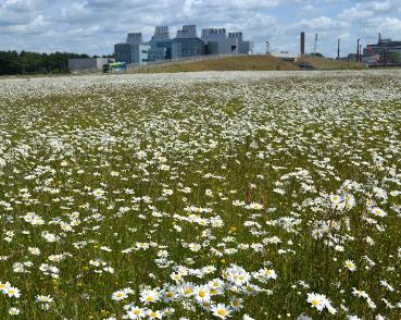
9. Hobson’s Brook and Nine Wells
The path ahead goes to Great Shelford, with artwork commemorating DNA (Trail 8). Hobson’s Brook flows from springs at Nine Wells through Trumpington into Cambridge (Feature D, Trails 2, 8, 10). Do not cross the bridge but go on the path to the left beside the brook to the entrance to Nine Wells. Go into the wood and follow the path to the left and then back on the further side of the stream. The monument to Hobson’s Conduit is at the southern corner of the wood (Feature D). Leave the wood and return under the road bridge to the roundabout, go on the path onto the bridge.
10. Addenbrooke’s Road bridge
Addenbrooke’s Road opened in 2010, to improve access to the expanding Biomedical Campus and the new housing developments. The bridge is another viewpoint over the park and lake and Clay Farm housing. The Biomedical Campus has permission to expand up to the railway line. The railway is the route from Cambridge to London: Cambridge to Liverpool Street had opened by 1845 and was joined by the line from Cambridge to Kings Cross in 1851. Continue over the road bridge and take the path to the right into the park.
11. Hobson’s Park
The former farmland has been developed as a park by Countryside on behalf of the City Council, with this southern area opened in 2016-17. Follow the path ahead towards the brook. There will be new bridges across the brook, made from trees that had grown on the farm (in use when the haul road has been removed). Go on the path to the right past the first bird screen and on around the lake to the further bird screen.
The lake is one of four balancing ponds which take surface water from the housing area. It has been developed as a bird reserve, with wildfowl, breeding terns and migrant waders. The bird screen was installed in 2014, designed by Nils Norman, also made with wood from local trees. The adjacent allotments open in 2017.
13. Hobson’s Brook and Community Gardens
If the path ahead is open, go to the brook, on the line of an old farm track which was a much- used path by residents going from Trumpington to Addenbrooke’s. Continue over the brook, where a Community Garden is being created. At Hobson Avenue, turn right to the Busway and Hobson Square. If the path is not yet open, go on the alternative route back on the path alongside the allotments, turn left then left again to the Busway junction and back to Hobson Square.
14. The Clay Farm Centre
The Clay Farm Centre on the far side of the square opens in 2017, with a library, hall, community rooms, café and health centre (Trail 4). To return to the starting point, reverse the route along the Busway, past the Community Orchard to Foster Road and Anstey Way.
A. Farming on Clay Farm
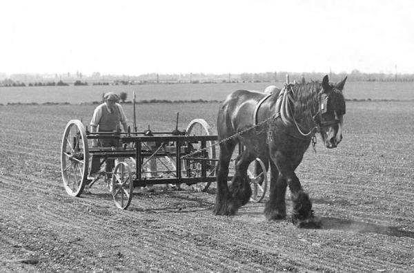
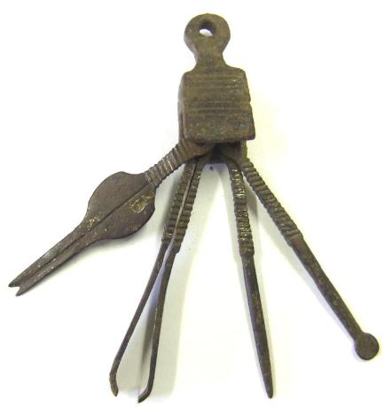
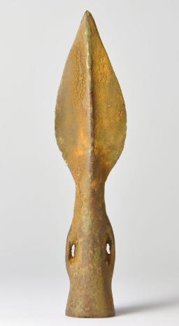
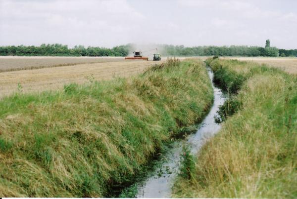
Bronze Age farmers exploited the drier slopes of the shallow valley either side of the brook. By the Medieval period, the parish was mainly arable land, growing crops such as barley, wheat and rye, with sheep pasture on the low ground along the brook (the Moor). After the enclosure of the parish in 1804-09, the land to the east of the village was farmed in three units totalling over 1000 acres: Church Farm and Manor Farm (farmhouses in the village itself, Trails 1, 4) and Clay Farm (farmhouse on Long Road). Forming part of the Pemberton estate, the farms had tenant farmers, including the Cornwell family on Clay Farm until the 1970s. The Clay Farm fields were cut by the two railway lines in 1845 and 1862 (see map). They were also crossed by two farm tracks, used by walkers as well as the farms. Around 1980, Antony Pemberton planted the long tree belt that runs parallel with the old railway route (now the Busway) and the brook. The main period of farming lasted until the land was designated for housing development in 2006-08, ending 4000 years of food production.
B. Birds of Clay Farm and Hobson’s Park
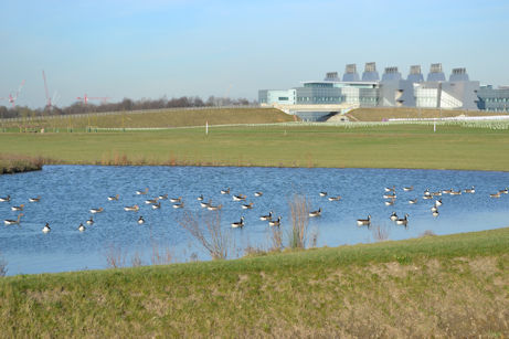
When Clay Farm was still farmed in the late 20th century, wintering birds included large (up to 5000) flocks of golden plover and lapwing. Breeding species included skylarks, of which a healthy population is still present, and several pairs of yellow wagtails. Wheatears were (and still are) quite common in spring and autumn, as were whinchats, which are now, as on a national scale, much rarer. Flocks of finches could be seen in the months following harvest. Today, the largest of the ponds, excavated to take surface water from the developments on Clay Farm and Glebe Farm, is designated as a bird reserve. In the winter, good numbers of geese, duck, coot, grebes and gulls can be seen. Spring and autumn bring a variety of wading birds coming through on migration, and in the summer several species of wildfowl and waders have bred, as well as common terns on the specially provided rafts. Swifts, swallows and house and sand martins can often be seen feeding over the water.
C. Hobson Square and Archaeology
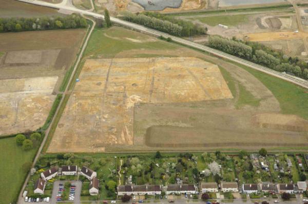
When archaeologists were excavating Clay Farm in 2010-11, they found evidence that the land had been farmed for over 4000 years, from the Bronze Age to the present. During the Middle Bronze Age (1500-1200 BC), much of lowland southern Britain was divided into fields for the first time, particularly along major river valleys such as the Ouse and its tributaries. This set the pattern for subsequent land use, including the construction of networks of ditches and field boundaries. When Hobson Square was designed, the architects and artists respected the evidence found by the archaeologists. The diagonal rill across the square and the alignment of the front and rear entrances of the Clay Farm Centre match a Bronze Age field boundary and the sculpture in the square is designed to reflect a Bronze Age round house, with the footings in positions similar to those of a circle of post holes found during the excavations.
D. Nine Wells and Hobson’s Brook
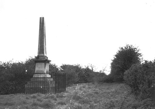
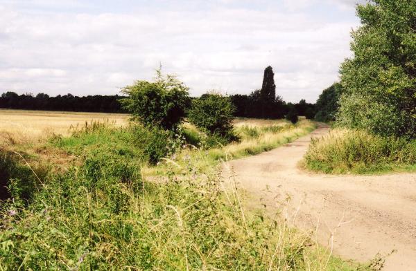
Nine Wells is a Local Nature Reserve managed by Cambridge City Council (although outside the City boundary, in Great Shelford). The wood has springs which rise from an impervious band of chalk at the foot of White Hill. These merge into the small brook which flows north through Trumpington to the River Cam. The flow from the springs varies from year to year and can be low in the summer. In the 1970s-80s, the flow was very poor and overhanging trees affected the water quality, to the detriment of small fish such as bullhead (or ‘miller’s thumb’) that lived in the water, but the flow and conditions have improved in the 2010s. Kingfishers are regularly seen along the watercourse. The brook was a natural stream until about 1610, when it was converted into a straight channel along much of its route and some of the water was diverted to a fountain in the market square, providing fresh water for the population of Cambridge (Trail 2). The monument has the names of some of the individuals responsible for the project.
Additional information
trumpingtonlocalhistorygroup.org
trumpingtonresidentsassociation.org
Nine Wells Local Nature Reserve: http://lnr.cambridge.gov.uk/nature_reserve/nine-wells/
© TLHG and TRA, September 2016.