Trumpington to Hauxton and the Shelfords
Local Villages and the River Granta
Walk or cycle approximately 6.5 miles/10.5 km: walk on pavements and footpaths, including grass paths which can be muddy, but there are tarmac alternatives; cycle on roads and dual use paths.
Return route can be combined with Trail 8
This is one of a series of history trails about Trumpington and its links to surrounding villages and Cambridge. We hope that long-established and new residents will find the trails to be a fascinating way to discover more about the history of the area.
The trails have been developed by the Trumpington Residents’ Association and the Trumpington Local History Group, with support from Cambridge City Council. The project is led by Andrew Roberts and Howard Slatter.
Printed copies available free of charge from The Clay Farm Centre and Trumpington Pavilion.
Contact the Local History Group with feedback: admin@trumpingtonlocalhistorygroup.org .
Download a PDF version of the trail or continue with the route …
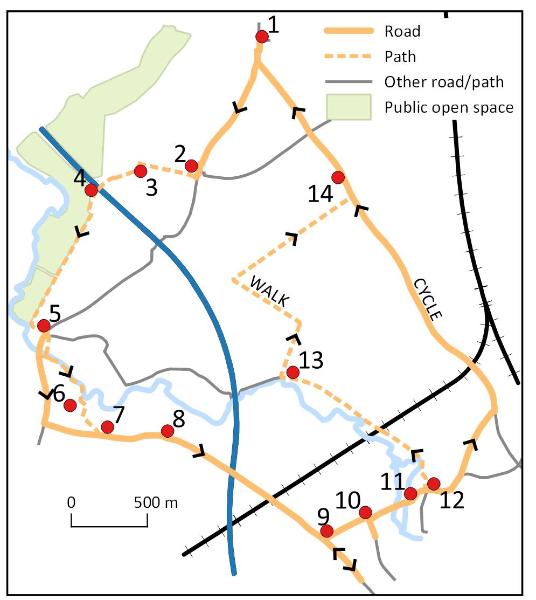
1. Start at the green by the shops, Anstey Way
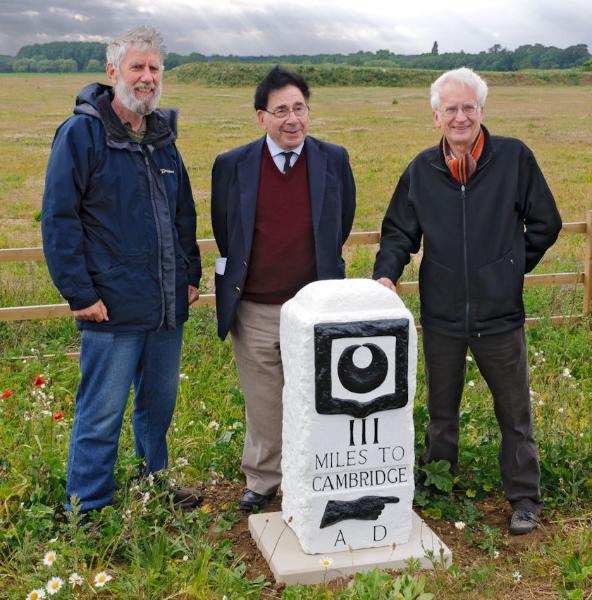
2. Turnpike milestone III, 1729
The milestone is the third in a series erected by Trinity Hall along the turnpike from Cambridge to Barkway. ‘Cambridge’ was removed during World War II and recut later; and the date below ‘AD’ was lost when the stone was damaged by a vehicle (‘MDCCXXIX’, 1729). The milestone was renovated in 2011 when the road was realigned. Go on to the junction and take the cycle path to the right. Now part of the Trumpington Meadows development, the area to the left was a Prisoner of War Camp in World War II (Trail 3). Continue to the left turn.
When Trumpington parish was enclosed in 1804-09, most of the field between Hauxton Road and the river was awarded to Christopher Anstey. It had been known as Hauxton Field or Church Field. It became Anstey Hall Farm, which was taken over by the Plant Breeding Institute in 1950 (Trail 3), although the tenant (the Parsons family) continued to farm most of the land until 1971. The copse was the site of a Shepherd’s Cottage, where there were cattle yards until the 1960s. Continue on the cycle path to the bridge over the M11, which opened in 1979.
4. Trumpington Meadows Country Park
To the left, the fields both sides of the M11 are an important area of farmland; to the right, the fields are part of the Nature Reserve managed by the Wildlife Trust and trees from left to right line the banks of the River Cam (Trail 6). Continue down the slope to a pond which is the remains of a site where fertiliser (coprolites) was dug in World War I. Go on the cycle path to the road.
5. Milestone IIII, River Granta, Hauxton Mill
Turn right to the brick bridge over a stream, the southern extent of the historic parish of Trumpington. The fourth milestone is alongside the bridge parapet, with the crest of Trinity Hall and the text ‘IIII miles to Cambridge, MDCCXXIX’. Go on to the bridge over the River Granta for a view to Hauxton Mill. The bridge was rebuilt in 1956-57. Return to the milestone, cross the busy road and take the footpath to the right, over the river and mill stream: Hauxton Mill is on the left, Riddy Brook and Old Mill House to the right of the mill, and Hauxton Bridge nearby (Feature A). Look out for grey wagtails around the river.
6. Hauxton Meadows housing development
Cyclists should return to the far side of the main road, turn left and follow the cycle path to the junction signed Hauxton and Shelfords, cross and continue on the side road to Hauxton Church. Walkers can take the same route or go on the path to the right of the mill and follow a possibly muddy footpath along the river bank then to Hauxton Church. Both routes go around the Hauxton Meadows housing development, on the site of an agrochemical works (Feature A).
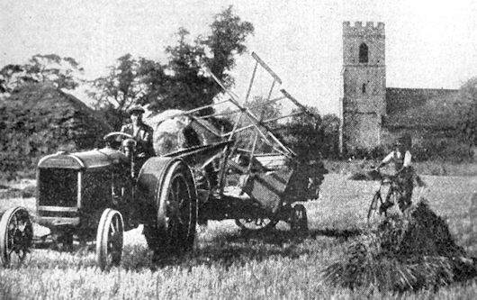
7. St Edmund’s Church, Hauxton
The church is built with flint, pebble, clunch and freestone dressings, dating from around 1100. The tower was added and the nave extended in the 1400s (church interior, Feature B). Continue along Church Road through Hauxton village.
8. Hauxton village
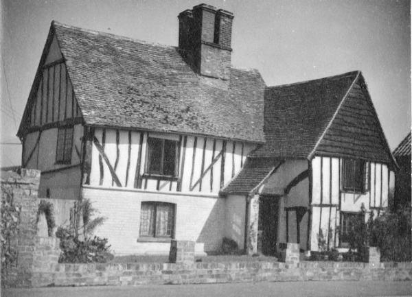
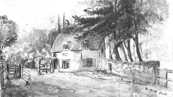
Go past the Little Manor House and the Village Hall (converted from the village school in 1977) to the green, with the Tudor House to the left. Cross to the village sign then continue along the High Street past The Old House, hidden behind a high hedge (Feature B). Go under the motorway to Little Shelford and the level crossing, over the Cambridge to King’s Cross line, opened in 1851.
Continue to the junction with Church Street (Feature C). The house to the left on the corner was formerly the Prince Regent pub then a restaurant. Go on along the left side of High Street, past the former bakery shop (now the Old Bakery) with the Old Chapel to the rear. This was the Congregational Chapel, founded in 1823 and rebuilt 1881. Continue past King’s Farmhouse and King’s Yard to The Navigator pub (formerly The Plough). Turn back along the other side of High Street where there is a sculpture in a garden ( The White Horse of Hanover ). Continue to the telephone box at the junction, now used as a community library. Turn right along Church Street, past the Memorial Hall commemorating World War I, erected in 1925, rebuilt in 2000. Go on to the church.
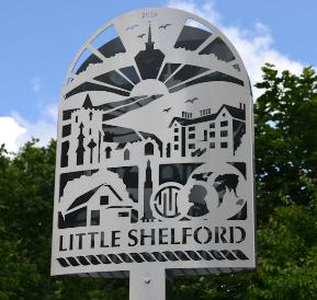
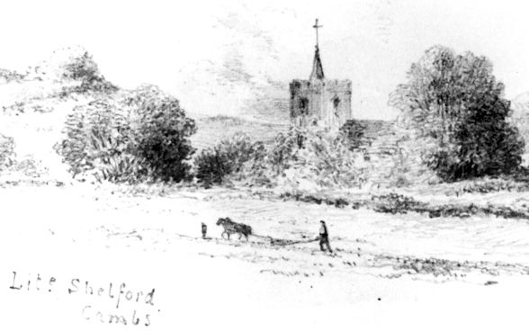
10. Little Shelford Church and village sign
All Saints Church dates from the 1100s, altered in the 1300s, 1400s and the mid 1800s (Feature C). Continue to the nearby junction with another turnpike (Shelford to Whittlesford). The green triangle to the left was dedicated as a village green in May 2016 (the smallest in England?), when the village sign was also unveiled. Go a short distance along Whittlesford Road, past Milestone Cottage projecting onto the pavement, to a 19th century cast iron milestone. Turn back to the junction, with cottages and paddocks (Camping Close) to the left and the Lodge and grounds of the former Shelford Hall to the right. At the junction, go right along Bridge Lane.
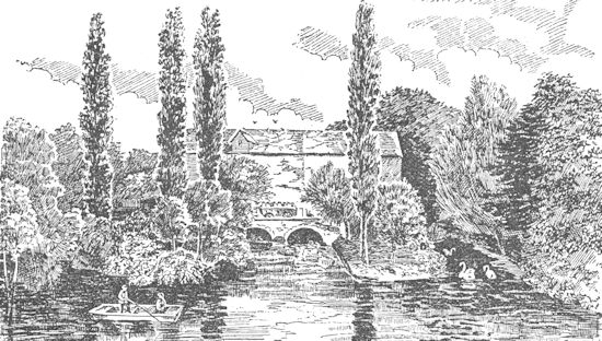
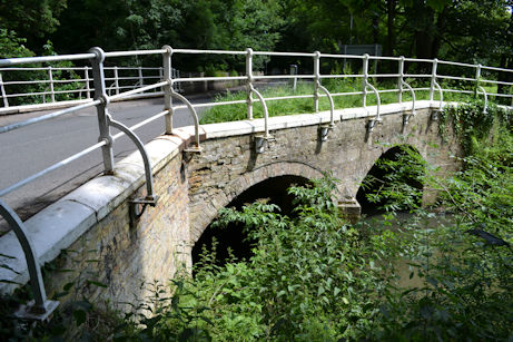
The high wall to the left is the boundary of Little Shelford Manor House and park. Go on to the short causeway and two bridges over the River Granta, the site of the ‘shallow ford’, with meadows to the right (Feature D). There was a hermitage here in the 1300s and a turnpike tollhouse from 1814. The first bridge with two brick arches dates from the 1800s. The second bridge with three round brick arches was rebuilt in 1782, on the site of earlier wooden and stone bridges which dated back to the 1300s. Continue into Great Shelford and on along Church Street.
King’s Mill Lane to the right goes to Shelford watermill; St Mary’s Church is straight ahead (Trail 8). Cyclists continue on Church Street, then the High Street to High Green and the main road to Trumpington (to stop 14, details in Trail 8). Walkers follow the same route or take the permissive footpath to the left at Rectory Farm, opposite King’s Mill Lane.
13. Permissive footpath to Hauxton (walkers)
The footpath follows the river valley (Feature D). Before the railway, take the left hand path under the line. Go on, with views over meadows to the left and towards Shelford Rugby Club to the right and the houses of Glebe Farm on the horizon. At the second hedge to the right, an alternative route forks left, under the M11 where a Roman farm was excavated, to Hauxton Mill (stop 5). The main route goes right: follow the field boundaries ahead then left then right, where the hedge on the far side of the field is the historic parish boundary between Great Shelford and Trumpington. This goes in a straight line to Hauxton Mill and may follow the route of a prehistoric trackway. Glebe Farm is visible beyond the hedge and the Biomedical Campus straight ahead. Go to Cambridge Road, turn left.
14. Parish boundary and Milestone
The cycle and walking routes merge here. Continue to the Cambridge sign where the modern city boundary follows the historic parish boundary. A short distance beyond the sign, there is another milestone: the second on the turnpike from Cambridge to Great Chesterford (Trails 2 and 8). Continue along Shelford Road to the junction and turn right to return to Anstey Way.
A. Hauxton Bridge and Mill
The river crossing at Hauxton Bridge has been an important communications link for 1000s of years. The ford was used by a prehistoric trackway going from the south west to the north east, the Mare Way. There were Bronze Age and Iron Age settlements and a Roman cemetery nearby. The first bridge was built in the 1300s, including a chapel, and a small settlement developed near the crossing, called Mill Street or Mill End. By the 1700s, the bridge was part of the Cambridge to Barkway turnpike, with a toll bar. At this time, there were two alehouses serving travellers, The Ship and Chequers. Hauxton Mill was listed in the Domesday Book. From the late 1700s, it was a corn mill and oil mill (rapeseed). The current mill was built in 1851 as a corn mill, closed in 1974. An agrochemicals factory developed nearby from 1939. By the 1950s, this extended both sides of the A10, known as Fisons, later Bayer Crop Science. After the site closed in 2004, the contaminated land had to be cleaned before it could be developed for housing from 2016.
B. Hauxton Parish and Village
The parishes of Hauxton and Newton have been closely associated with each other since 975 AD, when the principal manor passed to the Abbot of Ely. Hauxton village developed as a nucleated settlement along a street parallel to the river. In the Domesday Book, it was named Hauochestun. The parish church is dedicated to St Edmund, the East Anglian king killed by the Danes in 870. The current church dates from around 1100 (100 years earlier than the current Trumpington Church). To the right of the massive chancel arch, there are red wall hangings covering a fresco of Thomas à Beckett, from the early 1200s, rediscovered in 1860. The high-pitched nave roof, pulpit and blocks of seating probably date from the 1400s, while the plain octagonal font is 1200s. The village has a number of grade II listed timber framed houses, including the Little Manor House near the church (late 1500s and early 1600s); the Tudor House, formerly the King’s Head public house (1400s, with 1500s and 1900s alterations); and The Old House (c. 1500, altered c. 1600, extended c. 1950).
C. Little Shelford Parish and Village
There was a shallow ford across the river where it flows through the Shelfords. Little and Great Shelford villages developed as nucleated settlements to the west and east of the ford, in a similar pattern to Grantchester and Trumpington. In the churchyard of All Saints Church, there is a restored Medieval cross. The church is flint and pebblestone with limestone dressings. The porch was rebuilt in 1878-79, with two stone coffin slabs incorporated in the side walls. In the 1500s-1900s, the heart of the village had cottages, public houses and a number of farms (Hall Farm, White’s Farm, King’s Farm). Grand houses and estates included Little Shelford Manor House, north east of the church. The original house was the seat of the Freville family, replaced by a new house in the early 1600s and again in the 1750s, with the east and south sides of its park bounded by the river and a high brick wall along Bridge Lane. There was also Shelford House or Hall, south east of the church, partly demolished in the 1850s and partly burnt down in 1928.
D. The River Granta
The River Cam has two main branches, the Rhee and the Granta, with the Granta separating Trumpington and Great Shelford parishes from Hauxton and Little Shelford parishes. The landscape is formed from alluvium and river gravels plus chalk. The river valley and slopes are an important part of the Green Belt between Cambridge and the surrounding villages. Much of the low land near the river is managed in stewardship by the Trumpington Farm Company, grazed by cattle and with wildlife including roe deer. There is an attractive walk near the river between Great Shelford and Hauxton Mill, with a path making a link to Trumpington (stops 12-14). The valley has been farmed for 1000s of years, including a string of Roman farms along the river, and the water power was exploited by a network of mills. Trumpington parish was enclosed in 1804-09, the other parishes later than that: Little Shelford, 1813-15, Great Shelford, 1834-35, and Hauxton, 1851-54.
Additional information
trumpingtonlocalhistorygroup.org
trumpingtonresidentsassociation.org
Wildlife Trust: http://www.wildlifebcn.org/reserves/trumpington-meadows
Hauxton Parish Council: http://hauxton.net/
Little Shelford Local History Society: http://www.littleshelfordhistory.com
Trumpington Farm Company: http://www.trumpingtonestate.com/
© TLHG and TRA, September 2016, updated April 2022.