Archaeology of Clay Farm: 4000 Years of Settlements and Burials
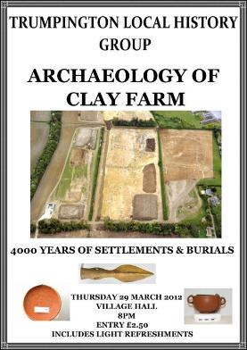
There were 50 participants at the Local History Group meeting on 29 March 2012, when Richard Mortimer, Senior Project Manager, Oxford Archaeology East, gave a talk about the archaeology of Clay Farm. Report by Andrew Roberts, with thanks to Richard Mortimer and Andy Robinson. There is also a video of the talk, organised by Andy Robinson, Futurecity, as part of the background for the artists involved with Clay Farm and Glebe Farm.
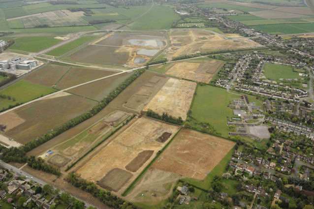
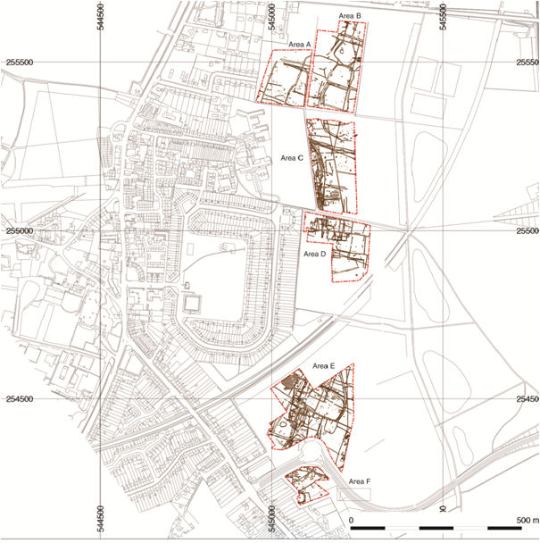
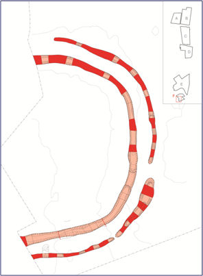
Howard Slatter introduced Richard Mortimer, who talked about the discoveries during the excavations across six areas of Clay Farm. The site varied from gravel terraces on the west to the fen and valley to the east. The team had found evidence of activity from the Early Neolithic (4000BC) up to the present, including Middle Bronze Age (1500-1200BC) and Early Iron Age-Roman (800BC-200AD).
The results from the Middle Bronze Age were particularly important, with three distinct settlement areas. (Richard mentioned that previous archaeological work had identified just a few comparable areas in Cambridgeshire, Norfolk and Lincolnshire.) This was the period when society changed from being hunter-gatherers to a settled farming community which set the pattern for subsequent land use, including constructing networks of ditches and field boundaries. The environment had already been changed from woodland to open countryside and there must have been earlier phases of agriculture for which no evidence survives. In the Middle Bronze Age, the excavation found extensive evidence of strip fields, enclosures and settlements across large areas of the site on the edge of the fen. The enclosures may have been for cattle which would have been a valuable resource that needed to be retained and protected from wild animals and rustlers. These enclosures were about 60-90 m x 50 m, bounded by large deep ditches.
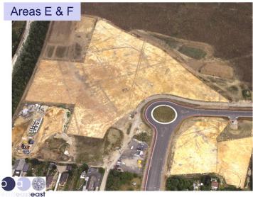

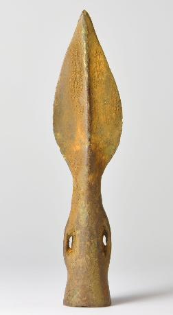
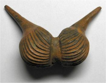
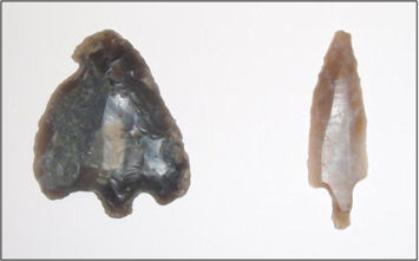
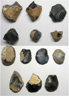
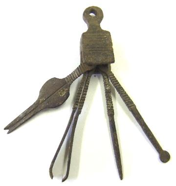
The excavation in the northern area (near the current tree belt to the east of Fawcett School) found ceramics, bonework, metalwork including a bronze spearhead and bronze scabbard chape, flint cutters, scrapers and arrowheads. The results from two southern areas (near the Addenbrooke’s Road roundabout) had included bonework, a musical instrument and amber beads from the Baltic. There was a large volume of quern stones, burnt hearth stones, loom weights, animal bones and crops which was evidence of permanence. It was possible the three areas were consecutive settlement sites, dating from c. 1450-1375BC, 1400-1300BC and 1300-1200BC. There were irregularly shaped structures in these two areas, with post holes spread over about 10 m (not round structures, as in the Iron Age), plus four U-shaped enclosures. There were bones indicating the remains of perhaps 50 humans but no cremations as would have been expected.
Later in the Bronze Age, the area became waterlogged, preserving evidence of elder and wheat, barley, flax. The people would have made bread and beer.
There was more evidence of buildings from the Early Iron Age, including roundhouses, enclosures and large-scale pits. This was contemporary with the construction of hill forts at sites such as Wandlebury.
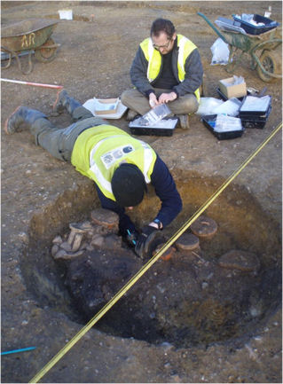
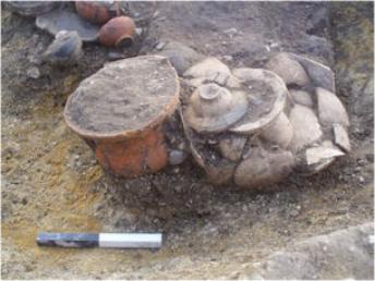
In the Late Iron Age, there was a high-status burial (north of the path from Paget Close to Addenbrooke’s Hospital, close to the edge of the CPDC grounds). This has been dated to c. 35-40AD and included two bodies which had been cremated. They were accompanied by grave goods from overseas, including pottery vessels and a fine toiletry set. The people would have been trading with the Roman Empire, just before the Roman invasion. About 40 years later, the grave seems to have been surrounded by a circular enclosure, which may have been a memorial garden (reminiscent of a garden in Tuscany described by Pliny the Younger).
In the Late Roman period (350-420AD or later), there was a large circular enclosure at the southern end of the site (between the gardens to the rear of Shelford Road and the Addenbrooke’s Road roundabout). The double circular ditches included a number of dispersed bodies and five bracelets. It is possible there was a Roman cemetery to the west of the site (under the Shelford Road gardens).
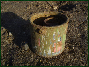
The archaeological evidence with the most recent date was from the northern part of the site (near Long Road, close to the line of the new spine road), where there were seven searchlights from World War II. The finds included plates dated 1942 and a baked-bean tin inside a green paint tin!
In terms for continuity, Richard mentioned that there had been a trackway across the site in the Bronze Age on a roughly east-west alignment (just north of the path from Byron’s Square to Addenbrooke’s Hospital and Alpha Terrace). It was possible a similar alignment was followed by a later Roman road which joined up with the Colchester-Cambridge route and crossed Trumpington to Grantchester.
The archaeological work was commissioned for Countryside Properties as part of the preparatory work for house building.
Further information
Reports on previous site visits:
Clay Farm Archaeology Open Day, 11 August 2010.
Clay Farm Archaeology Site Visit, 7 April 2011.
See Mortimer, Richard and Phillips, Tom (2012). ‘Clay Farm’s evolving landscape’, Current Archaeology, 264, March 2012, pages 32-37.
Contacts: Richard Mortimer and Tom Phillips, Oxford Archaeology East.