Andrew Roberts
At the meeting of the Local History Group on 21 November 2013, Andrew Roberts discussed evidence about the early history of Trumpington, from Prehistory up to the early 1800s. See also other sources of evidence. With updates.
Structure
This paper concentrates on the main evidence and sources for the early history of Trumpington, arranged under the following headings:
Trumpington Parish and Trumpington Village
Archaeological evidence: development from Prehistory to the Medieval period
Archival evidence: Medieval to later
What sources?
Where are the sources?
In addition to this page, there is extensive information on the rest of the Local History web site, including the Timeline pages.
Parish Origins
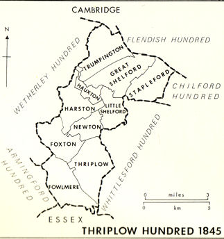
First, a definition of the ‘Trumpington’ area. By the late Anglo-Saxon period, East Anglia was organised into Counties, Hundreds and Parishes. A Hundred was a division of Saxon England below the level of the shire, the origins of which are uncertain (Muir, 2000). Thriplow Hundred and Trumpington Parish were established before 1000 AD. ‘Trumpington’ is the name of the parish and the nucleated village within the parish.
A key source is the Victoria County History (VCH), including an excellent chapter on Trumpington (Victoria History of the Counties of England, 1982a and b).
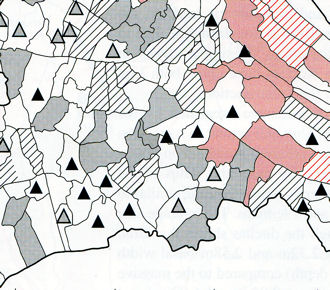
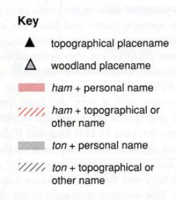
Most place names in Cambridgeshire are Anglo-Saxon in origin. Names ending in ‘ton’ tend to have formed later than those ending in ‘ham’. The ‘ton’ suffix is more common in the Mercia area west of the Cam. Trumpington appears to be one of a number of parishes to the south of Cambridge with names formed from a personal name and ‘ton’. The ending ‘-ton’ (OE tūn) = small estate or a lord’s enclosure; ‘–ham’ (OE ham) homestead, settlement or meadow (Muir, 2000). A key source is An Atlas of Cambridgeshire and Huntingdonshire History (Kirby and Oosthuizen, 2000), including maps 26, 31.
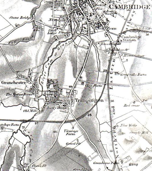
Trumpington parish was bounded by the River Cam to the south west and west and Vicar’s Brook to the north. Extent and topography of the parish, from west to east: River Cam on the western edge of area; pronounced slope up from river valley immediately to the east of the river valley in the Trumpington Meadows area; current village centre and the area to the north west of the current main road on a low ridge running from south to north; lower land to the east of the village with the Vicar’s Brook (Hobson’s Brook) running through it in a trough, poorly drained; further slope up to the east towards and beyond the current railway line, Clay Farm; low downlands to the south. Note that this original parish incorporated the land between Hobson’s Brook and Hills Road, including the area now developed as Addenbrooke’s Hospital and the Cambridge Biomedical Campus, and also land to the south of the current village as far as Hauxton Mill.
There is significant continuity in land use, field patterns and road patterns from Prehistory through the Anglo-Saxon and Medieval period and up to present.
Archaeological Evidence
There is a substantial amount of archaeological evidence from the Trumpington area, including early archaeological finds and work by local antiquarians, museum collections, interpretations and the results of a number of major excavations since the 1970s.
Early archaeological finds from ‘Dam Hill’ (Chaucer Road area) and elsewhere
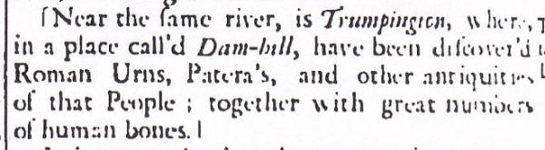
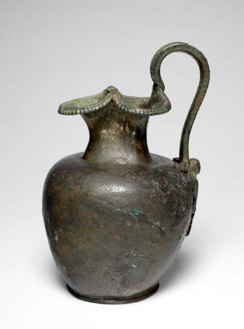
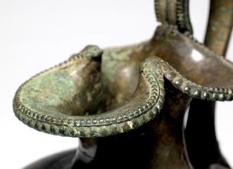
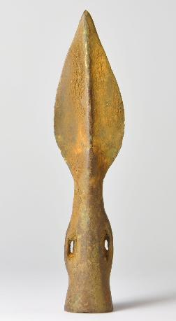
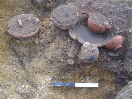
One of the most important early find spots was land to the rear of 19 Chaucer Road, now a tennis court, named as ‘Roman burial ground’ on early Ordnance Survey maps. In 1709, labourers found a group of Iron Age/Roman objects, including a bronze jug (oinochoe), bronze bowl and handle (patera), bronze hinged gaming board, pots and a wine amphora. The objects were acquired by James Thompson, the owner of Anstey Hall. In 1717, Thompson wrote a letter about the finds to Dr Cox Macro, who was accumulating information for Edmund Gibson who was preparing the second edition of William Camden’s Britannia . The discovery was taken up by Dr Warren, Bowtell and other early writers. The main finds were donated to Trinity College before 1740 and eventually loaned to the Fitzwilliam Museum. Dr Lucilla Burn has related the loan to this early history and some of the objects are on display in the Fitzwilliam Museum (Gallery 21, Greece and Rome, Case 12, Roman Empire and Wealth). Dated to 30-70 AD, they are almost certainly from the burial of a member of a wealthy family.
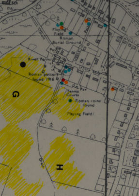
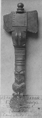
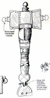
Other items found in the 18th and 19th centuries were acquired by the Cambridge Antiquarian Society and eventually deposited in the Museum of Archaeology & Anthropology. These include Anglo-Saxon metalwork, probably from Dam Hill.
Interpretation of local archaeology
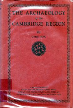
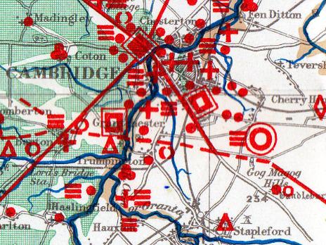
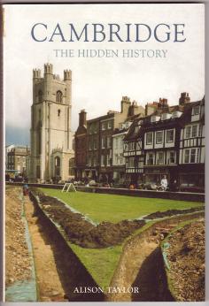
The first rigorous attempt to understand the archaeology and landscape history of the Cambridge region was by Cyril Fox, who produced an impressive survey in 1923 (Fox, 1923). There was limited progress until the 1960s, when work on the new Addenbrooke’s Hospital site showed that this was an important Iron Age settlement. There was also an excavation on the Plant Breeding Institute (PBI) land near the river. The next regional assessment was in 1975, when Haigh produced detailed distribution maps (Haigh, 1975). Alison Taylor wrote a fresh analysis of the archaeology of Cambridge and the surrounding area in the late 1990s, just before the main phase of excavations (Taylor, 1999).
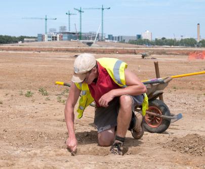
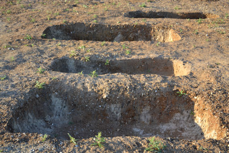
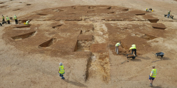
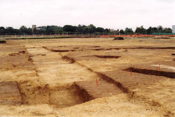
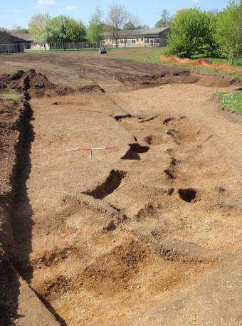
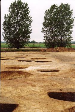
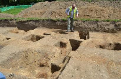
Excavations since 1970s
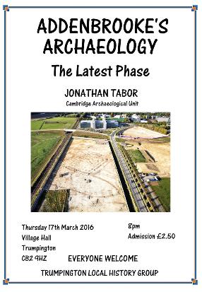
The planning decisions to allow the development of the Park & Ride site, the John Lewis building and Waitrose, housing on Clay Farm, Glebe Farm, Trumpington Meadows and the Bell School site, the development of Addenbrooke’s Hospital and the Cambridge Biomedical Campus (CBC) and infrastructure such as Addenbrooke’s Road, have led to a series of archaeological surveys and excavations. The majority of these have been undertaken by the Cambridge Archaeological Unit (CAU) or Oxford Archaeology East (OAE). At a meeting of the Cambridge Antiquarian Society in February 2017, Chris Evans, Head of the Cambridge Archaeological Unit, said that the density of archaeological work in the Cambridge area was probably second only to that in London, an unprecedented level of research where it will take another generation to sort out the interpretation.
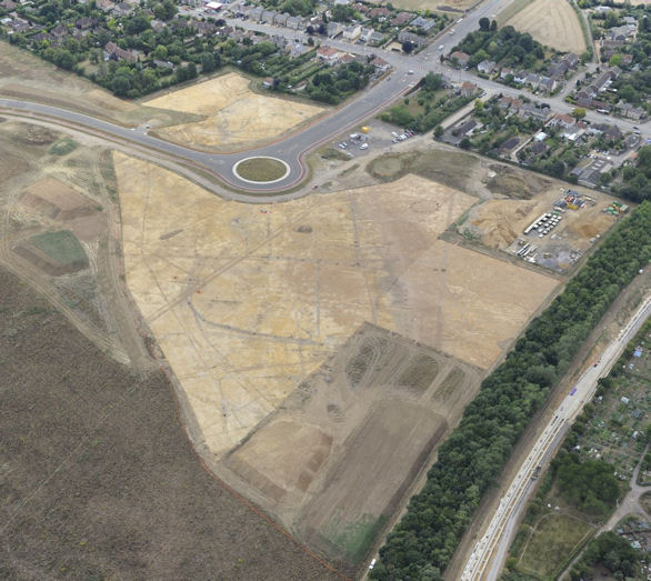
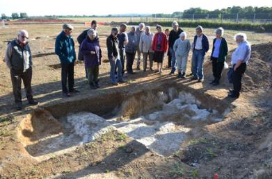
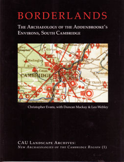
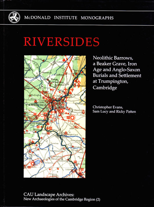
This work is resulting in an updated interpretation of our early history. The key sources for this include publications by the archaeological units, particularly the excavation reports, and the work of the Cambridgeshire Historic Environment Record (CHER), searchable through the national Heritage Gateway. After some of the main excavations on the Cambridge Biomedical Campus site, CAU published an interpretation of The Archaeology of the Addenbrooke’s Environs, South Cambridge (Evans, 2008). A companion Riverside volume on the Trumpington Meadows and Glebe Farm excavations was published in 2018 (Evans, Lucy and Patten, 2018).
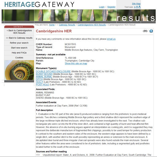
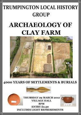
The Local History web site includes reports on site visits and talks about a number of specific excavations and the Timeline summarises some of the evidence. See the Archaeology of Trumpington checklist on the Subjects page and the Timeline pages. There is also a checklist of the main excavation reports.
Examples of recent excavations
Neolithic (4000-2400BC): farmers, trackways, monuments
Bronze Age (2400-800BC): settlements and field systems
Iron Age (800BC-70AD): settlements, burials, ritual, high status families
Romano-British: Cambridge as local focus, road network, dispersed settlements
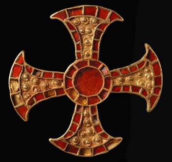
Anglo-Saxon: nucleated settlement, bed burial, religious influence
Medieval Sources
From the Medieval period, the key sources are archives and buildings, with less emphasis on archaeological evidence. There is important primary and secondary material in Cambridgeshire Archives and the Cambridgeshire Collection.
The Medieval timeline page has additional information.
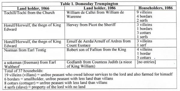
Domesday Book (1087): population and resources
The Domesday Book has limited information about ‘Grentebrige’ (Cambridge), but it was already a substantial town. The men holding ‘Trumpinton’ in 1066 included Tochi and Horwulf, holding land from the church at Ely and the King; by 1086, they had been removed and it was the land of William de Warenne, Sheriff Picot, Count Eustace, the King and Countess Judith, held by William de Callei and others, consisting of 37 households (about 185 people), with a mill, a weir rendering 450 eels and pasture for the cattle of the vill. The majority of the householders were unfree peasants who would have worked for their lord but also had land to farm themselves, including 19 villeins, 6 bordars and 8 cottars. There were also 4 householders who were serfs (Rumble, 1991).
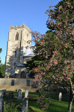
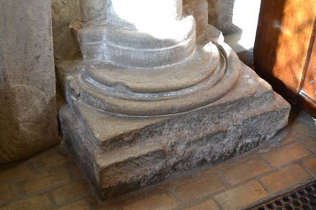
Parish Church: structure, memorials
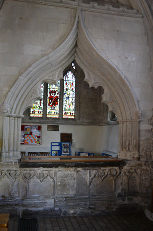
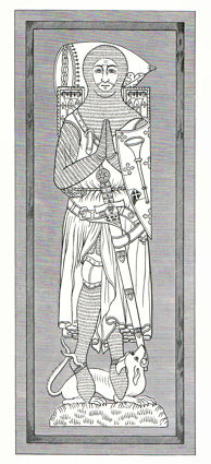
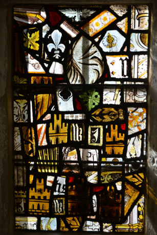
The current church was built from 1200-1300 with later changes and additions. The memorials in the church include the Trumpington family.
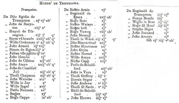
Lay Subsidy (1327): taxation, population, prosperity
In 1086, the population density of the area to the south of Cambridge was around 35-50 per sq mile. It continued to increase until the late 13th century, when this was one of the most densely populated parts of the country. The 1327 Lay Subsidy named 48 Trumpington taxpayers. The average tax across the county was 2s, with 70% of those liable paying less than 2s; in Trumpington, the highest tax was 11s 6d and the average was 2s 7d, with 65% of those liable paying less than 2s. The 1327 taxpayers included three of the manor holders and the vicar. In 1334, Trumpington had the highest rating in Thriplow Hundred. Trumpington had a relatively small spread of wealth in a prosperous part of the county. The names listed on the Lay Subsidy include de Trumpeton and Arnold, both of whom held local manors (Glassock, 1995).
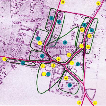
The village of Trumpington gradually developed as a nucleated settlement. It was well established by the 12th century, in the same location as the current village core. Based on the landscape, archival and building evidence, it seems that the village developed close to the river crossing to Grantchester and at the intersection of the main north-south road and an east-west route. In addition to the church, it had number of manors, farms, homes and public houses, with a village green. There was a village cross at the junction of the High Street and Church Lane (the location of the current War Memorial).
1500s-1800s: Sources
From the 1500s, there is a much wider range of sources and Trumpington is literally ‘on the map’.
The Timeline pages have additional information.
Parish Registers and Bishop’s Transcript (from 1563)
Cambridgeshire Archives holds the original of the Parish Register. It also has a bound transcript of the Register, transcribed by David Jordan, Margaret Marrs and members of the Cambridgeshire Family History Society, copies of which are available from the Society. The introduction explains that the Register starts in 1671, but there must have been an earlier volume from 1563. The entries are based in part on the Bishop’s Transcripts held at Cambridge University Library. The Register transcription includes baptisms 1563-2003, marriages 1599- 2003, banns 1754-1953, burials 1600-2003 and a surname index (Cambridgeshire Family History Society, 2010).
As an example, the 1671 transcription of burials includes a member of the Stacey family:
Apr 17 WARD John the young son of Richard
May 11 STACY John son of William
May 30 SKARE Elizabeth the young dau of Charles
Jun 10 JIGNY Sarah dau of the wid
Jun 21 WALLIS John the young son of William
Jun 30 TOKENS Thomas the elder
Dec 17 PRIME Ann of Hauxton dau of John
Feb 2 COLLINS Anne dau of Elizabeth wid
Vestry Audit Book (1602-1753)
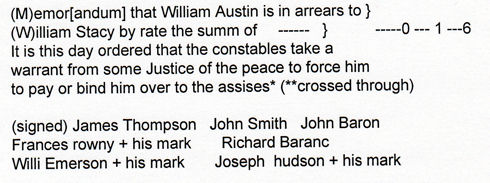
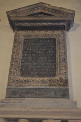
Cambridgeshire Archives also has the original of the Vestry Audit Book (1602-1753) ), with information about the administration of the parish. The Cambridgeshire Family History Society has also published a transcript of this, transcribed in 2002 by David E. Bland (Cambridgeshire Family History Society, 2002). The text has many reference to local individuals whose names will start to be familiar, such as James Thompson (the owner of one of the manors, later Anstey Hall), John Baron (the owner of a manor between the church and the later Trumpington Hall), William Stacey (later generations of the Stacey family with headstones in churchyard) and William Austin (died 1679, left money for education and charities).
Church and churchyard
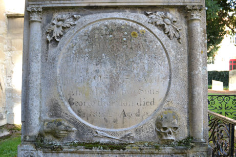
There are a number of commemorative plaques in the church, including ones for John Baron and William Austin, and also some surviving early headstones in the churchyard, including the Stacey family. Surviving information on the later headstones has been transcribed by Stephen Walley and Alan Bullwinkle for the Cambridgeshire Family History Society (1987).

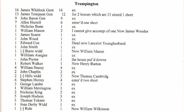
Hearth Tax (1664)
The Hearth Tax was one of the main sources of government revenue during the reigns of Charles II and James II, with four Acts in force from 1662 to 1689. The returns list homes and the number of hearths which they have. The 1664 return has columns for the number of hearths in 1664, the name of the current owner, the number of hearths in 1662, a comment on changes since 1662 and a note of exemptions. The Cambridgeshire entries are available in book form (Evans and Rose, 2000, p. 305). Examples: James Whitlock: 16 hearths (later Trumpington Hall), James Thompson: 13 hearths (later Anstey Hall), John Baron: 9 hearths (a manor, later demolished), William Stacey: 4 hearths, William Austin: 4 hearths.
Manors, homes and public houses
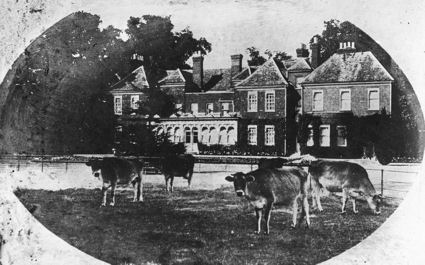
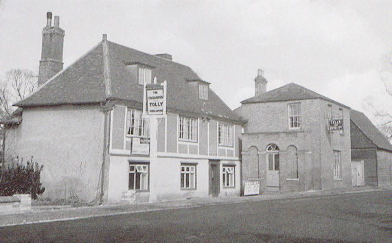
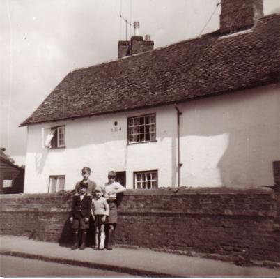
There were a number of manor houses in the village. The current Trumpington Hall dates from c. 1715-35, on the site of an earlier house, with some surviving fittings (the Pemberton family). The current ‘Anstey Hall’ was rebuilt in the 1660s, again on the site of an earlier manor. A number of houses in Grantchester Road and the High Street also date from the 17th century or earlier, as do two of the public houses on the High Street. There is information about buildings in sources including the Inventory of the Historical Monuments in the City of Cambridge (Royal Commission on Historical Monuments, 1959), the Conservation Area Appraisal (City Council, 2010) and The Buildings of England (Pevsner, 1970, and later edition).
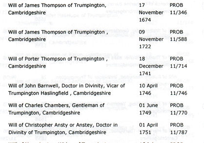
Wills
There are two main sources for the wills of local people. Records of the Prerogative Court of Canterbury, 1384-1858, are held at The National Archives and can be searched online. Records of local wills from the Consistory Court of Ely are part of the Ely Diocesan Records held by Cambridge University Library and Cambridgeshire Archives.
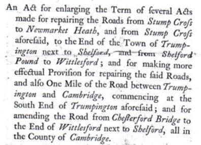
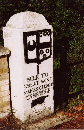
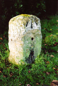
Turnpike roads (1720s)
Two turnpikes ran from Cambridge to Trumpington (Trumpington Road and High Street) where they divided and continued to Barkway (Hauxton Road) and Stump Cross (Shelford Road) and on to London. The Acts governing these roads have survived, as have the local milestones.
Early 1800s
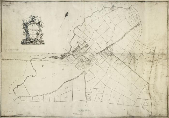
There had been little change in the layout of the village for 100s of years up to the early 1800s, but population growth and the influence of Cambridge would have an increasing impact from this point. There had also been agricultural changes and a consolidation of land ownership, with most land now owned by the two main manors. The enclosure of land was formalised through an Inclosure Act of 1801 which was implemented in 1804-09. The University Library and Cambridgeshire Archives have versions of the enclosure map and Cambridgeshire Archives has a copy of the Act and supporting papers and the schedule.
There is further information about farming and the enclosure process.
Summary: What Sources?
Primary:
Archaeological finds and excavations
Archival resources (Parish Registers, Vestry Audit Book, Enclosure map and schedule, etc.)
Physical evidence (buildings including the parish church; landscape history including road and field patterns)
Secondary:
Local History Web site
Cambridgeshire Historic Environment Record (HER)
Victoria County History (VCH): Trumpington and other chapters
Publications
Summary: Where are the sources?
Archives:
Cambridgeshire Archives (online catalogue)
The National Archive (TNA) (online catalogue, including wills)
Royal Commission on Historic Monuments (Cambridge volume and National Monuments Record, Listed Buildings Record, online)
Cambridge Antiquarian Society (lectures, conferences and proceedings)
Libraries:
Cambridgeshire Collection (online catalogue online)
Trumpington Library (opening in mid 2017)
University Library (online catalogue)
Museums:
Fitzwilliam Museum
University Museum of Archaeology & Anthropology
Sedgwick Museum
Family history resources:
Cambridgeshire Family History Society
Ancestry, Find My Past, etc.
Apprentice records (Ancestry)
Trumpington Local History Group (expertise, meetings and web site)
Starting point
Trumpington Local History Group Timeline
Bryan, Peter (2008). Cambridge. The Shaping of the City . New edition. Cambridge: G. David.
Bushell, W.D. (1938). Hobson’s Conduit. The New River at Cambridge Commonly Called Hobson’s River . Cambridge: CUP.
Carr, Edith (1973). Trumpington: a Cambridgeshire Village . In People and Places. An East Anglian Miscellany. Pages 8-67. Lavenham: Terence Dalton Ltd. SBN 900963-24-7.
Cambridge City Council. Planning Department (2010). Trumpington. Conservation Area Appraisal . Cambridge: City Council.
Cambridgeshire Family History Society (1987). St Mary’s and St Michael’s Parish Church, Trumpington, Cambridgeshire. Monumental Inscriptions . Transcribed by Stephen Walley and Alan Bullwinkle. : CFHS.
Cambridgeshire Family History Society (2002). Trumpington Vestry Audit Book, 1602-1753 . Transcribed by David E. Bland. : Cambridgeshire Family History Society. [Included on CD/012, Miscellaneous Cambridgeshire Documents from 1600. The original document is at Cambridgeshire Archive, reference P158/8/1.]
Cambridgeshire Family History Society (2010). Parish Registers. St Mary’s and St Michael’s Parish Church, Trumpington . Transcribed by David Jordan, Margaret Marrs and members of the Society. : Cambridgeshire Family History Society. CD/PR/10.
Evans, Christopher, with Duncan Mackay and Leo Webley (2008). Borderlands. The Archaeology of the Addenbrooke’s Environs, South Cambridge . CAU Landscape Archives: New Archaeologies of the Cambridge Region, 1. Cambridge: Cambridge Archaeological Unit with Oxbow Books. ISBN 978-0-9544824-7-3.
Evans, Christopher, Lucy, Sam and Patten, Rickie (2018). Riversides: Neolithic Barrows, a Beaker Grave, Iron Age and Anglo-Saxon Burials and Settlement at Trumpington, Cambridge (New Archaeologies of the Cambridge Region). Cambridge: Mcdonald Institute.
Evans, Nesta and Rose, Susan (2000). Cambridgeshire Hearth Tax Returns Michaelmas 1664 . London: British Record Society.
Fox, Cyril (1923). The Archaeology of the Cambridge Region . Cambridge: University Press.
Glassock, Robin E. (1975). The Lay Subsidy of 1335 . Records of Social and Economic History, NSII. Oxford: University Press for the British Academy. Cambridgeshire pages 23-28.
Haigh, David (1975). A Correlation Between Archaeological Sites and Field Names: a Survey of Parishes . Unpublished notes and maps (Cambridgeshire Collection).
Kirby, Tony and Oosthuizen, Susan (eds.) (2000). An Atlas of Cambridgeshire and Huntingdonshire History . Cambridge: Anglia Polytechnic University.
Muir, Richard (2000). The New Reading the Landscape . Fieldwork in Landscape History. Exeter: University of Exeter Press.
Ogilby, John (1675). Britannia , volume the first, or, An illustration of the Kingdom of England and dominion of Wales by a geographical and historical description of the principal roads thereof … John Ogilby … , London.
Pevsner, Nicholas (1970). Cambridgeshire. The Buildings of England . Second Edition. Harmondsworth: Penguin Books. ISBN 0-14-071010-8.
Royal Commission on Historical Monuments (England) (1959). An Inventory of the Historical Monuments in the City of Cambridge. Part II. London: HMSO. ISBN 0-11-300023-5.
Rumble, Alexander (editor) (1981). Domesday Book. A Survey of the Counties of England, compiled by Direction of King William I, Winchester 1086. 18 Cambridgeshire . Chichester: Phillimore. John Morris (general editor).
Taylor, Alison (1999). Cambridge: the Hidden History . Stroud: Tempus. ISBN 0-7524-1436-4.
Taylor, Alison, Browne, David M. and Darby, H.C. (1978). Early Cambridgeshire. Cambridge: Oleander Press.
The Victoria History of the Counties of England (1982a). A History of Cambridgeshire and the Isle of Ely, Volume VIII. Armingford and Thriplow Hundreds.