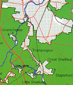
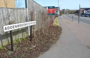
Shelford Road extends just over ½ mile from the Trumpington High Street/Hauxton Road junction to Cambridge Road, Great Shelford. The road is crossed by Addenbrooke’s Road, constructed from 2007-10 and opened in October 2010, connecting Hauxton Road to the Cambridge Biomedical Campus. There are a number of residential side roads, including Cranleigh Close/Craven Close, Bishop’s Road/Lantree Crescent and Exeter Close to the south west and The Brambles and Reed Close to the north east. Less than ¼ mile from the High Street junction, the road is carried by a bridge across the Busway (the former Cambridge-Bedford railway line).
This history of Shelford Road has been developed from a presentation given to the Local History Group in March 2008, updated in March 2017. It describes the early history of the road, its development with homes and gardens, and a brief note of some of the trades and personalities associated with the route.
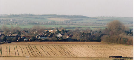
Looking towards Shelford Road from Addenbrooke’s Hospital, with Hobson’s Brook and Clay Farm in the foreground and Haslingfield in the distance. Photo: Andrew Roberts, 6 January 2008.
Shelford Road follows a slight ridge about 17 m above sea level, which runs south east from the centre of Trumpington towards Great Shelford. The surrounding land dips towards the River Cam to the south west and Hobson’s Brook to the north east. The ridge has been a transport link for at least 3000 years. For the great majority of this period, the area was agricultural land, with few houses along the road until the early 1900s.
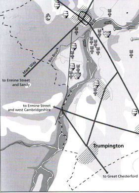
The road may be on the line of a prehistoric trackway which ran between Grantchester, Trumpington, Great Shelford and Great Chesterford, intersecting with another trackway on the line of the current Trumpington-Great Shelford parish boundary. The route was probably used as a Roman road from Ermine Street to Great Chesterford, where there was a Roman military base (Kirby and Oosthuizen, 2000, p. 11; Taylor, 1999, p. 24; VCH, 1978, p. 3, 28, 46).
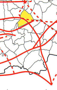
Left: Extract from Tim Malim (2000) ‘Prehistoric Trackways’, in An Atlas of Cambridgeshire and Huntingdonshire History , page 11. Trumpington parish has been highlighted in yellow.
Right: Extract from map of Prehistoric, Roman and early Anglo-Saxon sites in Cambridge, in Alison Taylor (1999), Cambridge: the Hidden History , p. 24.
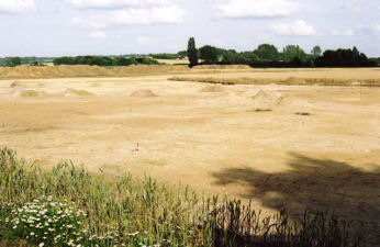
Left: Excavation on the line of Addenbrooke’s Road, Showground site, north east of Shelford Road. Photo: Andrew Roberts, July 2007.
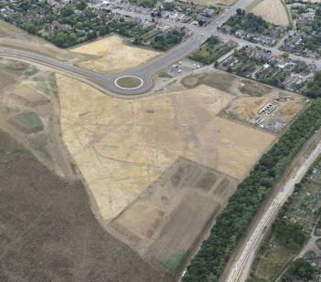
Right: Aerial view of the archaeological investigations on Clay Farm, to the east of Shelford Road, with Addenbrooke’s Road, July-August 2010. Oxford Archaeology East.
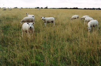
Sheep grazing near Sawston, close to the line of the Stump Cross Turnpike. Photo: Andrew Roberts, August 2008.
The two main roads through Trumpington became turnpikes in the 18th century. The future Shelford Road was a key link in the Stump Cross Turnpike, which ran from Cambridge to Chesterford (Stump Cross). The turnpike started on Trumpington Road, north of Barrow Road, at a point which is still marked by the first milestone. The next milestone is on the west side of Shelford Road, opposite Reed Close, with a benchmark and two holes which must have held a sign. The third and fourth milestones have not survived, but were near the Great Shelford railway bridge and the Stapleford river bridge. The fifth milestone is still in place, on the right hand side of the downhill slope into Sawston, with a sign ‘To Cambridge 6 miles, to London 48 miles’.
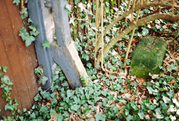
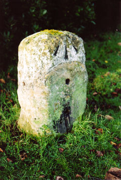
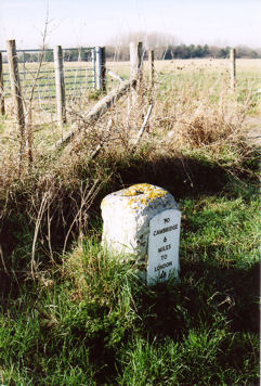
Three surviving milestones on the Stump Cross Turnpike Road. Above left: the first (fallen and damaged) stone on Trumpington Road; above, right: the second on Shelford Road; left: the fifth to the north of Sawston. Photos: Andrew Roberts, January-February 2008.
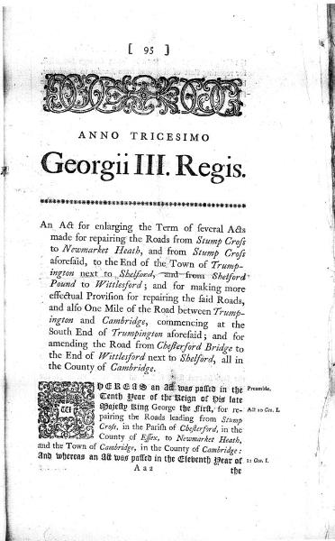
Title page, Act for Road from Stump Cross to Trumpington , Stump Cross Turnpike Trust (Statutes 30 George III, c.94, 1790). Cambridgeshire Archives, P175/28/1.
At the beginning of the 19th century, Trumpington was a small village surrounded by a network of open fields, with farmhouses, coaching inns and houses close to the village centre. Almost all the land in the parish was owned by the Pemberton and Anstey families. The Inclosure Act of 1801-04 led to the enclosure of the open fields either side of Shelford Road: the fields called South Croft to the south west of the road were awarded to the Vicar (the Church); the fields called Moor Field to the north east were awarded to Francis Charles James Pemberton, apart from a small area at the road junction which was awarded to Christopher Anstey and three fields on the east side of the road near the parish boundary which were awarded to the Trumpington Charity, William Dobson and William Stacey. The surveyors prepared a detailed map of the parish, which recorded their decisions (Cambridgeshire Archives 130/01; VCH, 1982, p. 249, 260).
At the beginning of the 19th century, Trumpington was a small village surrounded by a network of open fields, with farmhouses, coaching inns and houses close to the village centre. Almost all the land in the parish was owned by the Pemberton and Anstey families. The Inclosure Act of 1801-04 led to the enclosure of the open fields either side of Shelford Road: the fields called South Croft to the south west of the road were awarded to the Vicar (the Church); the fields called Moor Field to the north east were awarded to Francis Charles James Pemberton, apart from a small area at the road junction which was awarded to Christopher Anstey and three fields on the east side of the road near the parish boundary which were awarded to the Trumpington Charity, William Dobson and William Stacey. The surveyors prepared a detailed map of the parish, which recorded their decisions (Cambridgeshire Archives 130/01; VCH, 1982, p. 249, 260).
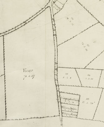
Extract from A Map of the Parish of Trumpington in the County of Cambridge, 1804 . Cambridgeshire
Archives, R60/24/2/70(a).
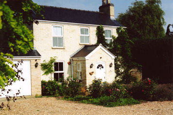
Glebe Farmhouse. Photo: Andrew Roberts, August 2008.
Richard Grey Baker produced maps of Cambridgeshire and Cambridge between 1817 and 1830, which showed the road from Trumpington to Great Shelford and indicated a weighing machine and weighbridge house on the High Street near the road junction. Writing in 1889, Samuel Page Widnall recalled the weighbridge house as it was in the 1840s and the large number of stagecoaches which would pass by (Cambridgeshire Records Society, 1999; VCH, 1982, facing p. 161; Widnall, 1889).
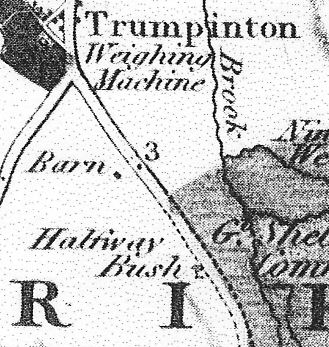
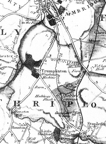
Above and above right: Extracts from Baker’s Map of Cambridgeshire, 1824 (VCH, 1982, facing p. 161).
Below right: Extract from Baker’s Map of Cambridge, 1830 (Cambridgeshire Records Society, 1999).
Left: The Toll House and Weighbridge House, High Street, in the 1920s. Percy Robinson collection.
Right: The Toll House and Weighbridge House from the Shelford Road/High Street junction. Photo: Andrew Roberts, August 2008.
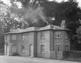
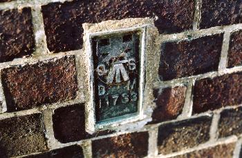
The Shelford Road area was transformed in August 1862, when the Cambridge to Bedford branch of the London & North West Railway opened. Shelford Road was reduced in width either side of the railway and a bridge was constructed to carry the road over the railway cutting. There is an Ordnance Survey bench mark near the south west corner of the bridge parapet, with the bridge marked as 67.4 ft OD on the 1885 map and 20.51 m OD on the 2008 map (a flush bracket, reference 11733).
The cutting was presumably kept free of trees, to reduce the risk of fire. The branch line remained in active use for over 100 years, but closed in 1965 and the track was removed in January 1968. The cutting became an informal nature reserve with trees, blackberries and an open stream. It was then used for the Busway , constructed from 2008-10 and opened in 2011 (VCH, 1982, p. 250).

Above left: The railway bridge from the south, with the cycle and pedestrian crossing. Photo: Andrew Roberts, 26 January 2008.
Above right: Ordnance Survey bench mark on Shelford Road railway bridge. Photo: Andrew Roberts, 17 February 2008.
Left: The removal of the railway track from the cutting to the east of Shelford Road bridge, 1969. Photo: Margaret Marrs.
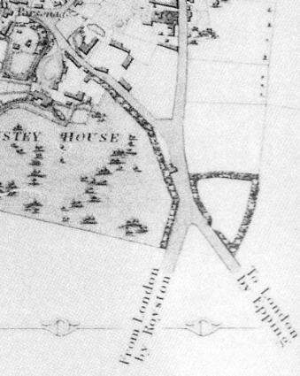
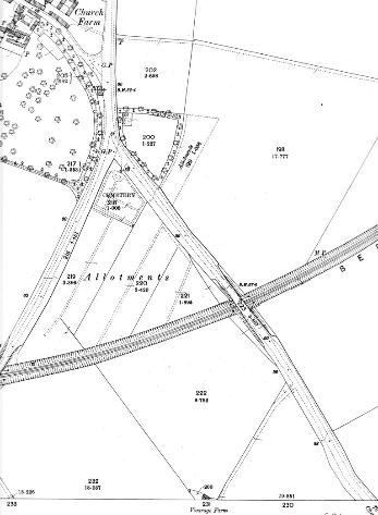
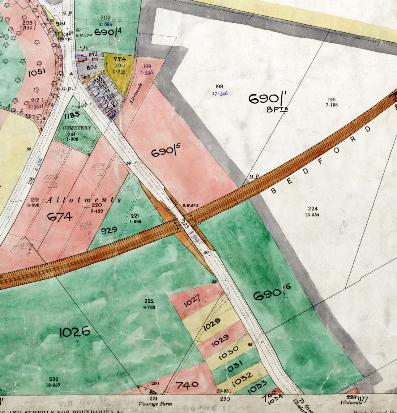
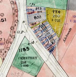
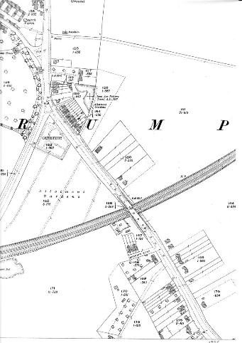
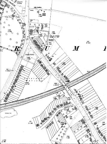
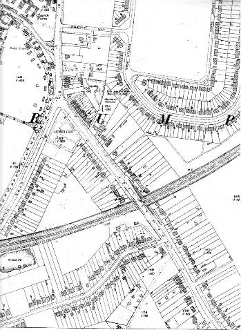
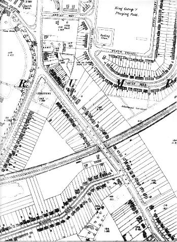
By the 1880s, the triangle of land between Shelford Road, Hauxton Road and the railway had been marked out as allotments and there was a small enclosed area on the east side of the road at the junction with Hauxton Road. The road had not been named and there were no houses along the road other than Glebe Farmhouse. In 1893, the vicar sold 4 a. of his glebe land for a new graveyard, developed as Trumpington Churchyard Extension . This is shown on the 1901 Ordnance Survey map, which also marks an additional block of allotments on the north east side of the road (VCH, 1982, p. 265).
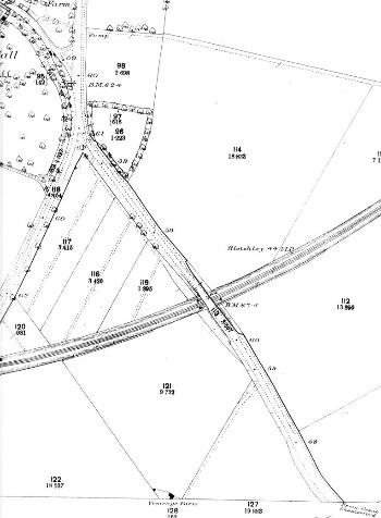
Left: Ordnance Survey map, 1885, showing the route of the railway, the allotments and churchyard, and the absence of houses.
Right: Ordnance Survey map, 1901, showing the churchyard.
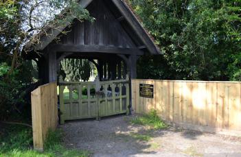
Entrance to Trumpington Churchyard extension, Shelford Road. Photo: Andrew Roberts, 16 May 2014.

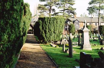
The line of yews along the footpath in the Shelford Road cemetery. Photo: Andrew Roberts, 26-27 January 2008.
In the 1901 census, properties in Trumpington village ended at the weighbridge, with no housing on or near Shelford Road apart from Glebe Farmhouse. Soon after this, ribbon development began in discontinuous blocks along the road. The change is apparent by 1910, when an updated map and schedule were produced for the Inland Revenue (the Land Value map), listing the occupier, owner and status of each plot of land, with the first houses shown on the north east side of the road near the High Street junction and other parcels of land marked out on the south west side of the road near the parish boundary (Inland Revenue, 1910; VCH, 1982, p. 250).
A number of photographs and postcards from the 1910s-20s show the High Street/Shelford Road/Hauxton Road junction and the first houses along Shelford Road. At that time, the access track between numbers 1 and 3 led to a gravel pit, owned by Samuel Gentle. Numbers 3 to 21 are now arranged as a terrace, but were originally in two main groups, numbers 3 to 11 and 15 to 21. The houses had names including Blenheim House, Roseville, West View, The Cottage, St Mabyn, Field View, Woodside and Braceley, with house naming being a common feature at that time. Number 13 was added in 1924, with ‘St Govans 1924’ inscribed on the wall.
Further along Shelford Road, numbers 134 to 148 are one of the early groups of houses. They were built in 1914-15 and have date stones with inscriptions ‘LE 1914’ or ‘LE 1915’. There is comparable evidence on some of the houses in Alpha Terrace which bear the inscription “L.E.”: Louisa Edwards was the widow of brewer Richard Edwards, who lived at The Villa, Trumpington High Street, until her death in 1915.
The first houses on Shelford Road, c. 1910. Extract from the Inland Revenue Land Value map for Trumpington, 1910-11 . Cambridgeshire Archives, file 470/047, sheet XLVII.10.
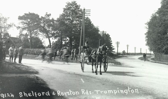
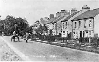
Shelford and Royston Roads, Trumpington (Hauxton Road junction), Ted Mott, number 9124, 1920s. Cambridgeshire Collection.
Shelford Road from the junction with the High Street and Hauxton Road, c. 1914. Cambridgeshire Collection.
Looking across the earliest houses in Shelford Road, numbers 3-17, to the junction with Trumpington High Street, from the west side of the road.
Left: c. 1920. Trumpington in Old Picture Postcards , 24.
Right: Andrew Roberts, 26 January 2008.
As an example of the developments, land fronting a length of Shelford Road on the north east side north of the railway bridge was sold in 1925 by the Pemberton estate to Mrs M.M. Parker (then of 15 Shelford Road), as the Shelford Road Building Estate. A number of detached and semi-detached houses were then built around 1930. A strip of land between numbers 45 and 47 was retained for a proposed new road. This access was instead used as a path to the fields to the rear of the houses. The farmland to the rear of the properties at the north east end of the road was developed as a housing estate in the late 1940s, with allotments behind some of the Shelford Road gardens. When the allotments were developed after the estate was built in 1946-48, the path ran across the allotments, with two side paths to Foster Road and the continuation behind Foster Road, with a connection to the tracks across Clay Farm. In 1993-94, the Allotment Society closed the path after problems on the allotments. Following a local enquiry, the path was declared a public footpath and reopened; it was subsequently re-routed to follow the rear of the gardens on Foster Road and a fence was erected and hedge planted on the allotment side.
Left: Ordnance Survey map, 1925, showing the spread of housing, particularly beyond the railway line.
Right: Ordnance Survey map, 1939, with most plots now in use, both sides of the road and the railway line.
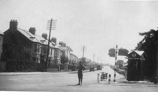
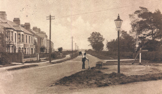
Shelford Road from the junction with the High Street and Hauxton Road, 1930s, with houses on the north east side of the road up to and beyond the railway bridge, an AA box at the junction, a line of telegraph poles but no street lights. Cambridgeshire Collection. Reproduced in Trumpington Past & Present , p. 14.
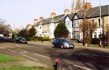
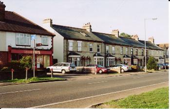
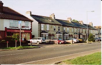
Looking from the former grocer’s (now a local store) to the former butcher’s (now a kitchen design shop) on the west side of Shelford Road, numbers 152-132. Photo: Andrew Roberts, 27 January 2008.
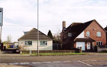
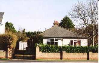
A surviving example of a bungalow (77a Shelford Road), alongside the house which replaced another bungalow in the late 1990s (79 Shelford Road). Photo: Andrew Roberts, 27 January 2008.
From the 1940s, a number of new closes and crescents were developed to the west of Shelford Road, including Exeter Close, built 1962-65. The allotments between Shelford Road and Hauxton Road became largely enclosed by houses before the allotment land was used as a gravel pit. The access route into the land was taken up with a detached house, number 50, built c. 1954, set back from the road, with a curved entrance driveway. Despite being relatively new, the house was demolished before 1968 and the land to the rear was developed as Cranleigh and Craven Close, built by Willett Homes in 1968-69. The narrow strip of land to the right of the original houses at the start of Shelford Road was developed as The Brambles from 1979, built by Melbourn Property Co. Ltd., Potton.
The land to the rear of the south east end of the road, between the railway bridge and the boundary, continued to be used as farmland. The land became known as the Showground after being used for the Cambridge and Ely Agricultural Show in 1949 and the Royal Show in 1951, 1960 and 1961. There were two access tracks to the farmland, one between numbers 95 and 99 known as the Showground track and the other between numbers 125 and 129 (there is no number 97 or 127). A number of residents would allow visitors to park on their driveways when they were going to the shows at the Showground, including the owner of number 151, and some provided bed & breakfast. In 1966, a bungalow was built alongside the Showground track to the rear of number 95, extended in 1976 and 1984. In 2007, planning permission was granted to convert the bungalow into a religious meeting house for the Radgund Trust. In 2011, the Showground track was developed as the access road to new housing in the rear gardens of 99- 105 Shelford Road, adjacent to Addenbrooke’s Road, with the roads named Showground Road and Showground Close.
Ordnance Survey maps, with most plots now in use, left: 1950 and right: 1954.
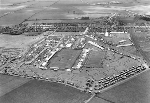
The 1949 Cambridge and Ely Agricultural Show on the Showground site, with Hobson’s Brook in the foreground and Shelford Road in the distance, Bishop’s Road to the upper right and the railway line to the far right. Photograph: Antony Pemberton, reproduced in Trumpington Past & Present , p. 130.
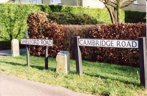
Cambridge Road and Shelford Road signs, memorial plaque to the Coronation and boundary stone, at the boundary between Trumpington and Great Shelford, east side of Shelford Road. Photo: Andrew Roberts, 26 January 2008.
The Cambridge Green Belt, 1990s. Source: Anthony Cooper (Cooper, 2000, fig. 11).
There were additional allotments behind the houses on the east side of the further end of Shelford Road, with access to the right of number 143. Bungalow and houses have been built on this land in stages since the 1960s. Nearer the boundary, Reed Close was built in 1984, named after the local builder, David Reed, after a long argument (the original plan had been for 12 houses, later reduced to 6 houses on a smaller footprint, leaving land to left and right for separate development.
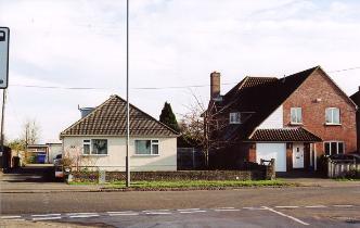
The north east side of Shelford Road seen from the railway bridge, showing the pavement before it was developed as the cycle path and the original bungalow at number 57, later replaced by a house. Source: Anthony Cooper (Cooper, 2000).
Looking along the east side of Shelford Road from north of the railway bridge, with the cycle path and footpath, the new 57 in foreground. Photo: Andrew Roberts, 26 January 2008.
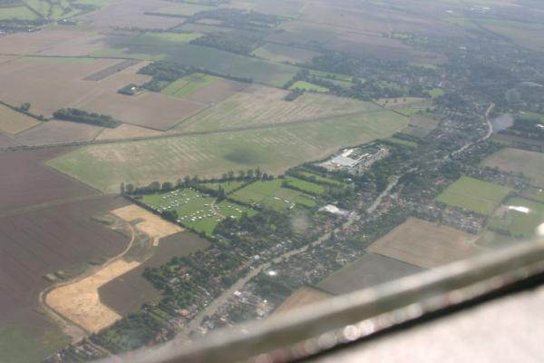
Aerial photo of Shelford Road from the north west, with early work on the route of Addenbrooke’s Road and the camping and caravan site. Photo: Arthur Brookes, August 2007.
Looking north along Shelford Road towards the location of Addenbrooke’s Road junction, from the west side of the footpath, outside 122/120 Shelford Road. Photo: Andrew Roberts, 30 September 2007.
Looking south along Shelford Road towards the location of Addenbrooke’s Road junction, from opposite Exeter Close. Photo: Andrew Roberts, 9 October 2007.
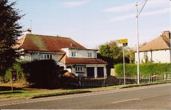
Looking west across Shelford Road at the location of Addenbrooke’s Road junction, towards 110 Shelford Road. Photo: Andrew Roberts, 30 September 2007.
Looking east across Shelford Road at the location of Addenbrooke’s Road junction, from 110 Shelford Road to 109 and 111/113 Shelford Road. Photo: Andrew Roberts, 30 September 2007.
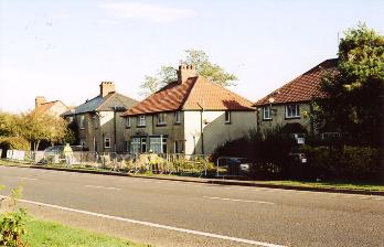
Preliminary work to clear the grounds of 110 Shelford Road, west side of road. Photo: Andrew Roberts, 1 November 2007.
Preliminary work to clear the grounds of 109-13 Shelford Road, east side of road. Photo: Andrew Roberts, 1 November 2007.
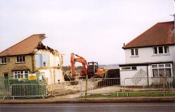
Demolition work on the east side of Shelford Road, 111 and 115 after the removal of 113. Photo: Andrew Roberts, December 2007.
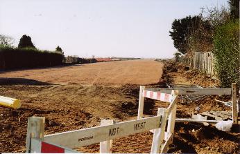
Looking along the line of the new Addenbrooke’s Road, to the west of Shelford Road. Photo: Andrew Roberts, 17 February 2008.
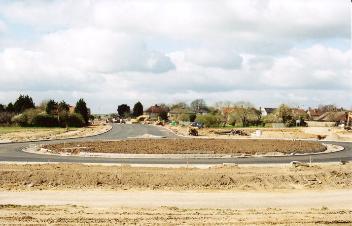
Surfacing the new road and roundabout to the east of Shelford Road. Photo: Andrew Roberts, 5 April 2008.
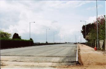
The final stage of surfacing Addenbrooke’s Road, from Shelford Road towards Hauxton Road. Photo: Andrew Roberts, 2 May 2008.
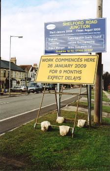
Roadwork sign for the final stage of Addenbrooke’s Road junction with Shelford Road. Photo: Andrew Roberts, 11 February 2009.
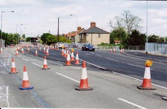
Work on the realignment of Shelford Road at Addenbrooke’s Road junction. Photo: Andrew Roberts, 10 May 2009.
The Shelford Road junction at the opening of Addenbrooke’s Road. Photo: Andrew Roberts, 27 October 2010.
Road sign on Shelford Road, the day of the opening of Addenbrooke’s Road. Photo: Andrew Roberts, 27 October 2010.
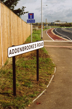
Street sign at the Shelford Road junction, the day of the opening of Addenbrooke’s Road. Photo: Andrew Roberts, 27 October 2010.
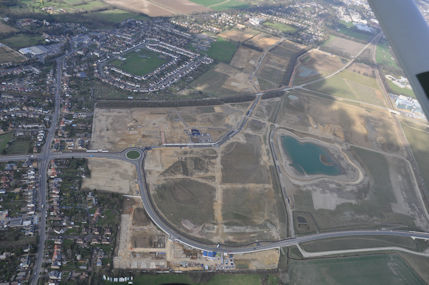
Aerial photograph of Clay Farm from the south, including Shelford Road, Addenbrooke’s Road and the spine road and lake. Countryside/Tamdown, 19 March 2012.
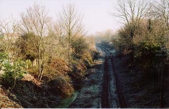
Looking north east from Shelford Road railway bridge, after the clearance of the railway cutting, frosty morning. Photo: Andrew Roberts, 17 February 2008.
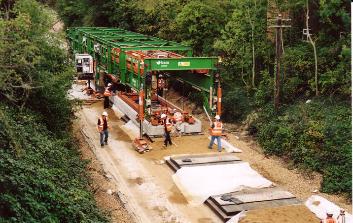
Laying the track for the Guided Busway to the east of Shelford Road bridge. Photo: Andrew Roberts, 21 September 2010.
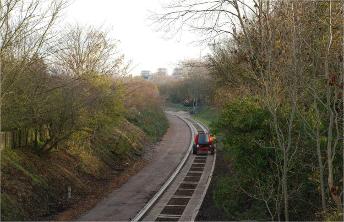
A test run on the guided busway, looking east along the railway cutting from Shelford Road bridge. Photo: Peter Dawson, early 2011.
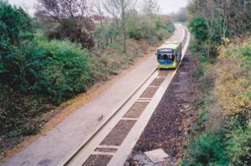
Guided Busway from Shelford Road bridge 24 November 2010. Photo: Edmund Brookes.

The Tour de France peloton coming over the railway bridge on Shelford Road. Photo: Stephen Brown, 7 July 2014.
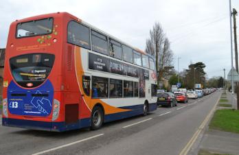
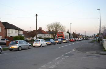
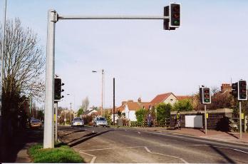
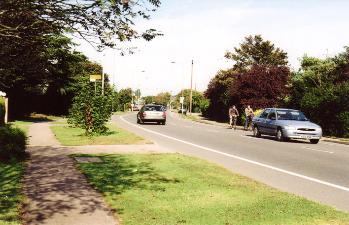
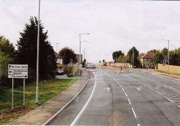
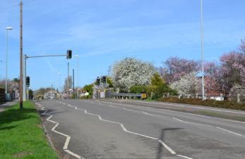
Traffic congestion on Shelford Road, approaching the High Street and Addenbrooke’s Road junction s . Photo: Andrew Roberts, 10 -15 March 2017.
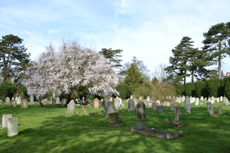
The Trumpington Churchyard Extension with tree in blossom and spring flowers, Shelford Road. Photo: Andrew Roberts, 14 March 2017.
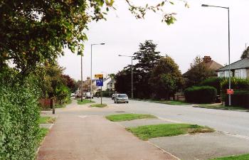
The approach to the railway bridge/busway bridge, Shelford Road. Photo: Andrew Roberts, 13 March 2017.
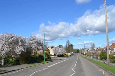
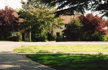
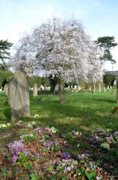
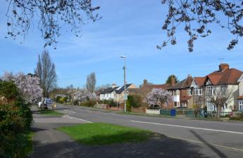
Spring blossom on Shelford Road. Photo: Andrew Roberts, 13 March 2017.
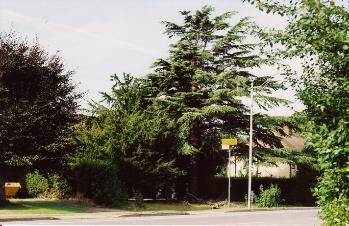
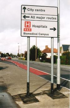
Road sign s at the Shelford Road/ Addenbrooke’s Road junction. Photo: Andrew Roberts, 13 March 2017.
There have been a wide range of trades practiced along Shelford Road, a few of which are noted below. This subject was also discussed by Arthur Brooke’s at a meeting in October 2012 .
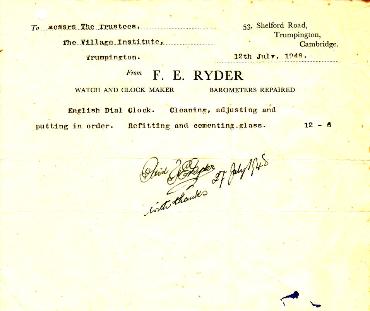
Mrs Florence Mary Charter lived at 39 Shelford Road from the 1930s to the 1970s, where she was a ladies’ hairdresser from the 1930s to the 1950s (the bungalow was demolished and replaced with houses after 2008). Frank Ryder lived at 53 Shelford Road from 1930 to his death in 1952, working as a watch and clock maker and repairer.
A bove: The original bungalow at 39 Shelford Road. Photo: Andrew Roberts, 26 January 2008.
Right: Invoice for the repair of a clock issued to Trumpington Village Hall by Frank Ryder, 1948.
77a Shelford Road, which had the Wedd workshop to the rear. Photo: Andrew Roberts, 27 January 2008.
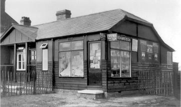
Left: Mrs Richardson’s general store, 4 Bishop’s Road, early 1930s. Cambridgeshire Collection.
Right: The dental surgery at the start of Bishop’s Road. Photo: Andrew Roberts, 27 January 2008.
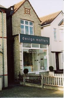
Design Matters, kitchen design shop on the west side of Shelford Road, number 132. Photo: Andrew Roberts, 27 January 2008.
Looking from the former grocer’s ( then a Threshers off-license) to the former butcher’s (Design Matters kitchen design shop) on the west side of Shelford Road, numbers 152-132. Photo: Andrew Roberts, 27 January 2008.
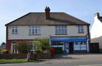
Trumpington Food & Wine shop, Shelford Road. Photo: Andrew Roberts, 13 March 2017.
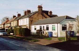
The garage and off-license on the west side of Shelford Road, numbers 158 to 150. Photo: Andrew Roberts, 27 January 2008.
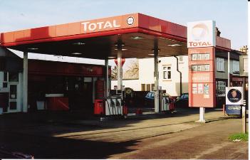
The Buckingham & Stanley garage, Shelford Road. Photo: Andrew Roberts, 13 March 2017.
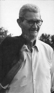
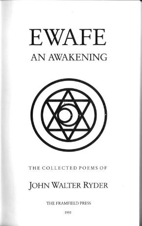
Shelford Road has had many long-term residents with interesting backgrounds and careers in the last 100 years. For example, Jack and Jessie Overhill owned 99 Shelford Road from the 1920s- 80. Jack published a number of books, articles and diaries, and was a dedicated swimmer who would go swimming in the Cam every day. John Ryder lived with his parents at 53 Shelford Road in the 1930s-40s, and published a book of poetry “Ewafe” in 1994. Mary Smith lived at the family home, 36 Shelford Road, from the 1930s to her death in 1993, where she was a talented artist, creating delicate flower paintings. She was a nature lover who collected wild flowers and watercress from Hobson’s Brook. Finally, Herbert Clifford Roads, 58 Shelford Road, had the house designed to his instructions in 1939. A farmer, he had three agricultural patents to his name: animal food appliance, 1945, harrow poles, 1946, and sack grab, 1947.

L eft: Portrait of Jack Overhill, Ramsey & Muspratt Studio Archive deposited in the Cambridgeshire Collection.
Centre: John Ryder.
Right: Title page of Ewafe by John Ryder.


Flower paintings by Mary Smith, cranesbill, oxslip, pansy and pasque flower.
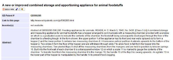
Summary of the patent for and animal food appliance, issued to Herbert Clifford Roads, 1945.
Cambridgeshire Records Society (1999). Baker’s Map of the University and Town of Cambridge, 1830 : with an introduction by Sarah Bendall. : Cambridgeshire Records Society.
Cooper, Anthony J. (2000). Planners and Preservationists. The Cambridge Preservation Society and the City’s Green Belt, 1928-1985 . Cambridge: Cambridge Preservation Society.
Inland Revenue, Commissioners of (1910). Duties on Land Values. Record of Valuations Made by the Commissioners of Inland Revenue … Valuation Book for the Parishes of Coton, Dry Drayton, Grantchester and Trumpington . (Cambridgeshire Archives, file 470/047.)
Kirby, Tony and Oosthuizen, Susan (editors) (2000). An Atlas of Cambridgeshire and Huntingdonshire History . Cambridge: Centre for Regional Studies, Anglia Polytechnic.
Taylor, Alison (1999). Cambridge: the Hidden History . Stroud: Tempus.
The Victoria History of the Counties of England (1978). The History of the County of Cambridge & the Isle of Ely. Volume VII: Roman Cambridgeshire . Edited by J.J. Wilkes and C. R. Elrington. Oxford: Oxford University Press for the Institute of Historical Research.
The Victoria History of the Counties of England (VCH) (1982). A History of Cambridgeshire and the Isle of Ely, Volume VIII. Armingford and Thriplow Hundreds . Edited by C.R. Elrington. Oxford: Oxford University Press for the Institute of Historical Research. Trumpington chapter, p. 248-67. [http://www.british-history.ac.uk/report.aspx?compid=66760]
Widnall, S.P. (1889). Reminiscences of Trumpington Fifty Years Ago . Grantchester: the Author.