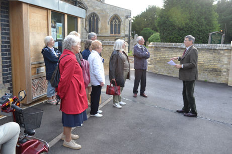
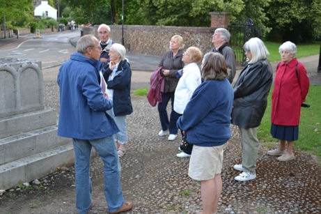
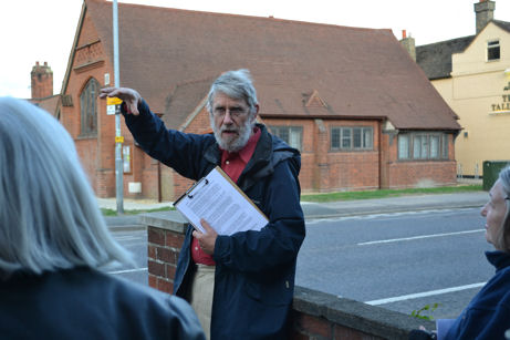
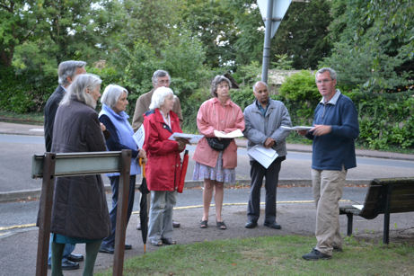
These notes are based on presentations by members of the Local History Group who led a guided walk around the centre of the village on 23 June 2011.
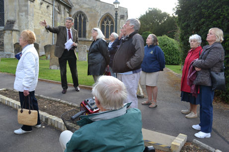
The walk started at the Church Bakehouse in Grantchester Road and went in a clockwise route along Church Lane to the War Memorial then the High Street and Maris Lane .
Grantchester Road
Edmund Brookes
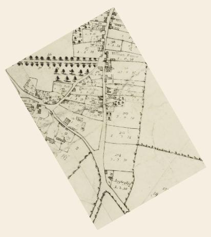
Anstey Hall Farm
Main north end range may be of 17th century, north west wing 18th century. The thatched barn is 17/18th century. In 1881, this was a 380 acre farm, but most of the land went to form the Plant Breeding Institute (PBI) and under Tom Parsons it became a specialist pig farm. The Dovecote 17/18th century on the Grantchester side was restored in 1984, it is interesting that there are no entrances for birds!
The Church
See the History of the Church.
The Vicarage
Sold in 2009, basically a Queen Ann/Georgian building but changed a lot and essentially in 3 parts. 18th Century north wing where kitchen was demolished by Reverend Bury around 1900, when a large part of the Vicarage Garden was sold to Mr Foster of Anstey Hall, also southern block added. Kitchen Garden became new graveyard in early 1990s.
The Bakehouse
This building was outbuildings, garage and small meeting room which was used until 1980’s then in disuse. Probably dates from 19th century. The Church of England Mens’ Society met there. Room refurbished to hold Godly Play in early 2000s. Retained by the Church except two sheds when the Vicarage was sold. Converted to a very high standard as an office and meeting room.
Farm cottages and houses
The large house set back from the road, number 18, is dated 1654, the thatched cottages are 17th century and were restored many years ago. Reverend King lived in the end one.
The Church School
Land bought 1842 for a National School and opened 1843, extended 1868 with a room at the back. Always known as The Church School. Had 1 room divisible in the original building and 1 in the extension. Closed in 1950 after Fawcett School opened in 1949, Mr Youngs, stayed on in the School House. Became Cambridgeshire Farm School until the 1970s when that moved to Milton. Building refurbished and added to in early 1970s when Miss Willers died (new toilets, committee room, and kitchen, one bay reroofed). Kitchen again refurbished in early 1990s, leased to Rainbow Nursery in 2005.
School House
Built in 1857 by L. Gary & Sons to the design of Butterfield (who re-ordered the Church). When the school shut, Mr Youngs the headmaster and Church organist continued to live in the house. Daughter married a Seekings, he went to St Philips as Head and then move to Milton. Owned by the PCC until sold about 1974. See the separate article about the School House and William Butterfield.
The Old House
Original building late 16th century, good example of local brick (not Cambridge Commons). Enlarged in the 17th century and restored in 1924 when extension on south west end entirely rebuilt. It used to be called Lady Southwell’s house (Sir Francis Pemberton’s half-sister). Re-roofed in the early 2000s.
Church Lane
Shirley Brown
We know the Village School (now a Nursery) was built in 1842. I assume the Unicorn was built about the same time, as the two pieces of land were up for sale at the same time.
The Unicorn had stables on the boundary with the school house. The first stable was rented by a butcher for a time, later used as a fish and chip shop. In the 1930s the small building opposite became the fish and chip shop. By the 1970s it was a barber’s. The current Unicorn car park was once a well-used bowling green. There was a hall to the right of the pub used by visiting bowls teams and the Friendly Society known as “The Foresters”.
An old blacksmith’s forge stood on the High Street just beyond the lodge gates. Beside it were the stocks and whipping post and within Trumpington Park, the village pound. The forge was taken down in 1855 when a new forge was built on the High Street.
In 1800 there were several thatched cottages between The Old House and the other end of Church Lane. In one lived Mother Sivill (or Savill), reputed to be a witch and fortune teller. She was frequently in trouble with the law and is said to be the last person to stand on the Cambridge Pillory.
The newer houses were built in the 1960s. Before 1937 Church Lane ran into the High Street between the War Memorial and the park wall. The War Memorial stands on the exact spot as the original Village Cross.
The War Memorial
Arthur Brookes
For details about the War Memorial, see the separate page about its history.
The High Street
Howard Slatter
Smithy
Up to at least 1830 (Baker’s map), the smithy was roughly where the lodge house for the park now stands. A new building was constructed in about 1855 where Bidwells Stone Cross building now stands.
One of the last blacksmiths (1881-1911 at least) was Elijah Lawrence from Haughley, Suffolk. He died in 1931 age 89; confusingly, his daughter married his nephew, another Elijah Lawrence, also a blacksmith. Benjamin Stone and Lewis Andrews were Elijah Lawrence’s assistants in the early 20th century, and by 1939, Andrews & Stone, farriers & engineers, occupied the smithy. By 1962, the premises were used by Donald Ramsey, antique furniture restorer. The village notice board was outside the end wall, facing the war memorial.
1985 proposed demolition, fiercely opposed by people in the village. Decision by City Council was tied, casting vote by mayor Peter Cowell, who described it as a “scruffy place”. Demolished in 1986, only the wall at the end survives.
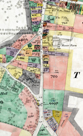
Manor Farm
To north of the present Beverley Way. The milking herd of cows there in the 1940s and 1950s (farmer Bert Cornwell) had to cross the main road to and from pasturing in the Park. The land of the farm extended to the east, over much of the present estate and school land. A drift road went down the line of Beverley Way, through to what is now Paget Road, and on across the fields along the present Addenbrooke’s track, heading for Red Cross farm on Hills Road.
Thatched barn burned down in about 1963 and never rebuilt (Antony Pemberton recalls driving back to Cambridge from London with his father, and seeing the plume of smoke – they feared it might be the Hall itself which was on fire). Some of the farm buildings were demolished in 1968-69, then the farm house and barn by 1971, leading to the building Beverley Way by 1975 and the other houses further north. (Plans for a motel on the site as far as the Villa Service station had been rejected in 1974).
Village Hall
The Village Hall opened in 1908 at a cost of £922 as a Men’s Institute, for playing games and reading (women admitted for whist drives!). In 1924 a billiard room, kitchen and cloakroom were added, and the Jubilee Room in 1978. Used as a schoolroom for evacuees from Muswell Hill in 1939-40. The Local History Group organised an excellent exhibition there for the centenary in October 2008.
Behind, where the doctors’ surgery now stands, were two wooden huts. The first was erected for the Army Cadet Force (ACF) after the War and the second for the Scouts in 1957. The scouts eventually took both over; cubs and scouts finally ended in 1995, after over 80 years in the village.
Tally Ho!
Opened as a pub by at latest 1841, the building appears on the 1809 Inclosure map. Originally also a brewery at the back. Bay window added in about the 1930s.
West side houses
Coming down from the smithy there was a line of 6 houses, occupied in the early 20th century by, among others, Mr Henry Saunders’ Post Office and Mr Albert Day’s bakery. Behind them was a large Mission Hall, marked on the 1885 OS map as a chapel. Mr Day knocked down the three houses next to his shop in the 1930s and built a new shop which later became the Co-op and is now the Hobbies Stores.
The next block of 3 houses was erected in the 1860s; no. 42 was the home of the Matthews family: Mrs Elizabeth Matthews was widowed in 1898 when her husband Ellis Matthews, a shepherd, died. She then set up a laundry using the land behind the houses and brought up her seven children on her own.
Whitlocks
In 1728 George Whitelock willed his house to provide 34 poor households with coal, the coal to be of the cheapest! Coats with brass buttons were also given annually to 6 widowed persons and 8 boys. Whitelock’s house and malting were reconstructed in 1819 to be let as 20 cottages to poor people and the land to be let as allotments. Later in the 19th century they were rebuilt as 13 cottages and 4 almshouses fronting the High Street. Known as “Whitelock’s Yard” or “Workhouse Yard”.
In 1963 the site was sold to the City Council, who by 1968 had built “Whitlocks”, a block with bed-sit accommodation for people over the age of 60 (“White locks”, it was said, might be seen as a derogatory comment on older people). In later years it was used to house student nurses and refugees. The new apartment block was built in the mid 2000s, the 5th use of this site in the last 200 years.
East side houses and Swan’s Yard
In the early 19th century this was still open farmland. The first building here was a terrace of 7 houses, set back at right angles to the road, called “Swan’s Yard”; this survived until at least 1948. Then, in the 1850’s, two pairs of cottages were built, one either side of Swan’s Yard; by 1871 the next pair had filled the gap up to the Tally Ho and by 1881 the next block of four further south had been built. Those have now been converted into just two houses and refurbished.
The former number 89 was occupied by two generations of the Parker family from its construction in the 1850’s right up to 1947. William Parker, a shepherd from Great Wilbraham, and his wife Sophia with their children were succeeded by their son Irwin Parker and his wife Ethel; Ethel died in 1947, age 79. The porch on that pair was knocked off by an articulated lorry and never replaced.
Between 1871 and 1901 the village policeman lived in one or other of these houses, before moving to a police house in Church Lane.
The High Street
Peter Dawson
Thatched cottage
The thatched cottage to the right of the pharmacy was probably built in the late 18th or early 19th century. The 1891 and 1911 censuses record the Gentle family as tenants and in 1939 Herbert Gentle, a tailor, was registered here. Not surprisingly, it became known as Gentle’s Cottage. It was last re-thatched in the 1980s and the inevitable sagging of the roof’s ridge over the years is now disguised by thatch 36 inches thick at the centre. There were grooves in the original brick floor caused by running water which visitors were fooled into believing was the work of “brick-worms”.
In the 1950s, Mr Gentle, who was deaf and dumb, reportedly installed a hi-tec alert system where pressing the door-bell actuated a ping-pong ball which moved across his head. Another, less likely, story suggests the device was actually a string attached to the leg of his caged budgie, causing the unfortunate bird to fly up with an unheard squawk.
In 1977, the cottage was converted into an art gallery and picture framers. The new incumbents had a shock on discovering Mr Gentle’s Colt 45 service revolver in the old bread oven. In 1993, the business relocated to Mitcham’s Corner, Chesterton, but retained the name “Trumpington Gallery”. The cottage has subsequently been used for other purposes including a house hunting service.
Cycle shop/petrol station
There was a brick- and wood-built cycle shop next door to the cottage, run from the 1920s by Harry Newell. It was guarded by his dog when he was out. Moving with the times, Harry extended the building upwards, added a petrol pump and a sign saying “Garage” thus becoming officially a “Motor Engineer and Cycle Agent”. His many activities included a taxi service deploying a series of large cars including, at one time, a Daimler: the uses included transporting cricket teams and as a hearse, although for funerals the coffin would be moved on a handcart pushed by Harry.
There is a pre-War photograph in Trumpington in Old Picture Postcards of a dapper young man having the tank of his very flashy sports car filled. This was Frank Whittle, later Sir Frank, inventor of the turbo-jet engine. In contrast, at an earlier date, Harry Newell would tow his elderly father around in a wheelchair attached to his bicycle, even venturing as far as London.
Lock-up
Adjoining the Newell’s shop was the historic tiny brick-built village lock-up. Comfort was at a premium inside the lock-up as the only source of light and ventilation was a small barred circular window over the door. A single “guest” would be secured by a padlocked iron strap to the primitive pillory post and seat.
The lock-up was last used in the 19th century when a very drunken villager was locked-up overnight to sober him up. The next morning he was found to be in an even worse state, having been supplied with more beer by his mates using a rubber tube passed through the window.
In the early 20th century, the lock-up served as a store for games equipment and, later, Harry Newell’s stock of paraffin.
Wood-yard
There was a wood-yard to the left of the lock-up where, in the early 1900s, the business of E.J. Smith & Sons thrived beneath a large (chestnut?) tree. The Smiths were very versatile, working as carpenters, wheelwrights, cart-builders and undertakers. They made coffins and Selfridges in London sold their wheelbarrows at one time, indicating the quality of their work. The yard closed down in the 1950s and the carpentry business moved to the nearby smithy.
Opposite here, on the east side of the High Street, there was a large Recreation Ground in the area now occupied by the Anstey Way shops and the entrance to the estate. Noble’s small newsagents and confectionery shop was at the corner. There was an area with communal washing lines.
The cricket pitch was well maintained but the outfield was described in Walter Dring’s memoirs of his early 1920s boyhood as “Indian Country” where balls were frequently lost in the very long grass and sometimes conveniently found by fielders just as the batsmen were running mid-way between the creases. Edwin Smith’s sons were excellent cricketers, Gordon, a bowler, and Cliff, a batsman of renown who later played for his county. During village matches, Cliff was expected to wallop the ball for six right across the road and land it on his Dad’s shed roof.
Present day buildings
In 1955, a plan for a modern petrol station which required the demolition of the iconic lock-up was rejected. However, in 1957 the whole area was redeveloped, including the wood-yard, Newell’s garage and, shamefully, the lock-up. The Shell petrol station was constructed and next to it a building comprising a cycle shop and general store for Harry Newell and the adjoining chemist’s shop. The thatched cottage was spared.
Later, Shell installed a giant motorway-sized monolithic sign which they were forced to dismantle and replace with the existing smaller version after the Trumpington Environmental Action Group (TEAG) lodged an objection. It is unfortunate TEAG was not in being when the lock-up and old smithy were so wantonly destroyed.
Until he retired, Harry Newell, ever the entrepreneur, sold a wide variety of goods. Cycles and spares, hardware, ironmongery, seeds, garden tools, stains and polishes were all available to an appreciative local community. After Harry left, the building was used by a string of businesses which had varying success, including an electrical contractor, a haberdashery, an auctioneers and a leisureware outlet. The award-winning fine wine merchant, Noel Young, successfully established his enterprising business in 1992. The first dispensing chemist was Harold Moore, with Jeffrey and Karen Gregory taking over the pharmacy on Mr Moore’s retirement in 1986. Jeffrey Gregory has enhanced Trumpington’s amenities by qualifying as an optician and now has a well-equipped room for sight-testing.
The Village Sign, High Street and Maris Lane
Andrew Roberts
Village Sign
The village sign is in a prominent position on a small green in front of the Bidwells head office, at the junction of the High Street and Maris Lane.
The current sign was erected in 2010 after a project led by Antony Pemberton, with funding from the Local History Group, Trumpington Women’s Institute, Trumpington Parochial Charity, Cambridge City Council and other local sources. Designed by Sheila Betts, the sign shows the figure of Sir Roger de Trumpington on horseback with a shield based on the brass of Sir Roger in Trumpington Church. It replaced an original sign erected in 1987 after a fund-raising campaign led by Councillor Betty Suckling.
North-south and east-west crossing point
The sign is at the junction where the main road from London to Cambridge and King’s Lynn is crossed by a route from Great Chesterford to the ford across the River Cam to Grantchester and further west. These routes have probably been used for over 5000 years, starting as Prehistoric trackways.
The north-south road follows a ridge along the east side of the river valley which provided a natural route from Hauxton Mill and ford through Trumpington village to Trumpington Ford on Vicar’s Brook and eventually Trumpington Gate at the entrance to Cambridge (near the junction of Trumpington Street and Pembroke Street). From the 16th century, regular coach services developed and in the early 18th century the road became an important turnpike marked with a line of milestones, three of which were placed within the parish. The Great Chesterford road also became a turnpike at the same time, marked by a second set of rather plainer milestones. A tollkeeper’s house and weighbridge were built at the then entrance to the village in the early 19th century. The busy roads supported a number of inns, such as The Green Man and the Coach & Horses.
The original village developed in the area around the church, gradually extending to the east and the current main road. The triangle of land between Church Lane, High Street and Maris Lane was gradually encroached on by housing. By the time of enclosure in the early 19th century, it was being used for houses and a farm and it was more densely occupied by the early 20th century. Despite the spread of housing, the village was still dominated by farms and farmland well into the 20th century.
Church Farm
The Church Farm buildings were at the southern end of the triangle of land between Maris Lane and the High Street, with the farm fields across the main road to the east. The farm was run by the Maris family from the 1770s to the 1860s and they built the current Maris House (Church House) around 1800. It was owned by the Pemberton family from 1840. The family gave its name to Maris Lane which in turn gave the name to a number of important crops such as Maris Piper and Maris Guard potatoes. Some of the farm buildings are still in place to the rear, but the junction was transformed in 1967-68 when the Bidwells building was constructed.
East of the High Street
The Church Farm fields were to the east of the road opposite the current village sign. Even in the early 20th century, there were open spaces directly across the road from the junction, with a first group of houses having been built near the junction with Hauxton Road and Shelford Road and another along Shelford Road itself. The cemetery between Hauxton Road and Shelford Road opened in the 1890s, with another farm, Glebe Farm, taking up the land to the south.
Anstey Hall Estate
The land to the south west of Maris Lane formed part of the Anstey Hall estate for over 300 years, one of four manors in the parish. The Medieval manor house was occupied by the Thompson family from 1637-1748 and they rebuilt the house around 1700. It was then owned by the Ansteys from 1748-1838 and the Fosters from 1838-1941 when it was taken over by the government. The hall itself can be seen behind a high wall, while its coach house and a lodge built in 1865 are alongside the road.
Anstey Hall Farm is further along Grantchester Road, with its fields running behind the church, vicarage and hall. After the War, the fields were used by the Plant Breeding Institute and now of course they are gradually disappearing under the Waitrose store, Park & Ride site and the Trumpington Meadows housing development, although some will be retained as a country park.