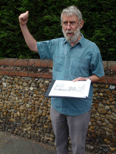
Howard Slatter and Andrew Roberts
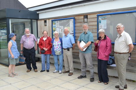
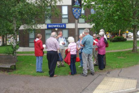
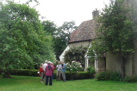
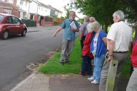
Howard Slatter and Andrew Roberts led a guided walk around the centre of Trumpington on 1 July 2012, starting and finishing at Trumpington Pavilion. These notes describe some of the features on the route, which included Anstey Way, Maris Lane, the Church, Trumpington Hall, the High Street, Alpha Terrace and the Estate.
Trumpington Pavilion and King George V Playing Field
Trumpington Pavilion is a community centre on the edge of King George V Playing Field. The original building was constructed by the City Council in the mid 1950s and replaced by the current building in 2009. It has developed into an active community and youth centre, including changing rooms used by football teams playing on the adjacent pitch. The redevelopment was funded by the City Council and the building is managed by the Trumpington Residents’ Association. With all the housing developments around Trumpington, the Pavilion is a base for the community development activities which support existing and new residents.
The King George V Playing Field was dedicated in January 1951. It is one of a network of playing fields which were established as a memorial to King George V who died in January 1936. The commemorative pillars between the road and the Pavilion predate the original Pavilion. They include heraldic panels, with a lion on the left and a unicorn on the right, both holding a Royal Shield.
Anstey Way
Anstey Way was built in the 1940s as the access road into the new housing estate. The road is on a similar alignment to an earlier farm track which went from Church Farm (on the opposite side of the High Street) to Red Cross (south of Addenbrooke’s Hospital). When walking from the Pavilion to the High Street, the area to the right is the site of the former recreation ground and cricket pitch. Crossways and Crossways Gardens on the left are on the site of a plant nursery, whose house was built c. 1925. In the 1930s, “Crossway Nurseries” specialised in alpine and herbaceous plants and shrubs, issuing catalogues of these items. Arthur Turner Casburn, Richard Alan Bedford and John Page were involved in the business, trading as “Casburn, Bedford and Page” then as “Bedford and Page” when Casburn retired in December 1935. The crescent of shops on the right was built in the mid 1950s, with the flats above the shops first appearing on the electoral register in 1956.
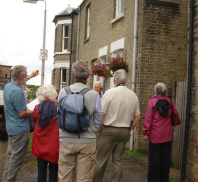
Trumpington Village Sign
The Village Sign at the junction of the High Street and Maris Lane was unveiled in 2010, replacing an earlier sign which had been erected in 1987. It shows a representation of Sir Roger de Trumpington, who died in 1289, with a shield based on the memorial brass in Trumpington Church, dated to the late 1320s. The designer of the sign, Sheila Betts, used the Gill Sans typeface to reflect the local significance of Eric Gill, who sculpted Trumpington War Memorial.
Trumpington village developed from around 700 AD near the site of the current church. It was at the junction of a north-south route from King’s Lynn to London and an east-west route from Great Chesterford to Grantchester. The north-south route became important from the Medieval period as Cambridge developed. It was “turnpiked” in the 1720s, with one turnpike from Cambridge-Barkway (now the High Street/Hauxton Road) and another from Cambridge-Great Chesterford (now the High Street/Shelford Road), both marked by milestones. These two routes divided just to the south of the toll keeper’s house and weighbridge, built in 1812 and 1863.
Trumpington parish was defined before 1000 AD. Its 2200 acres extended from a river crossing at Hauxton Mill in the south to a stream crossing at Trumpington Ford (later the Stone Bridge), now the junction of Trumpington Road and Brooklands Avenue, in the north; and from the River Cam in the west to the Vicar’s Brook, Hills Road and Great Shelford in the east. After the Norman Conquest, the parish was made up of five manors, all focused on the village, two of which developed into Anstey Hall and Trumpington Hall.
The local economy was dominated by agriculture until the 19th century. The Bidwells offices (constructed 1967-68) are on the site of Church Farm’s farmyard and the farm buildings were to the rear, off Maris Lane.
Maris Lane
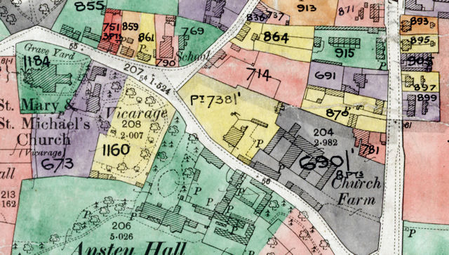
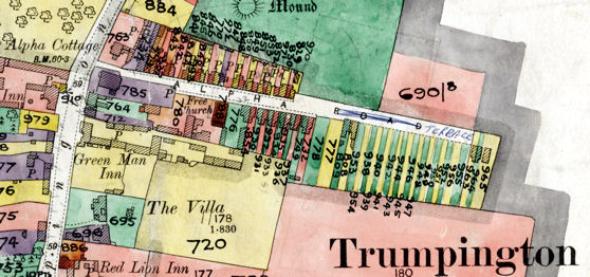
Cambridgeshire Archives, file 470/047, sheet XLVII.10.
Across the road from the village sign, the land was awarded to Christopher Anstey on the enclosure of Trumpington in 1801-09. The Waitrose store opened in 2000. The area beyond this was the site of the Plant Breeding Institute (PBI) and its successors from the 1950s. A large part of the site is now being developed as the Trumpington Meadows housing development and the Trumpington Meadows Country Park.
Walking along Maris Lane from the Village Sign, Church Farm was to the right, followed by the farm house, Maris House. The Maris family lived here from the 1770s to 1860s, with the farm house being bought by the Pembertons in 1840. Maris Lane was named after the family and “Maris” was also used as the name of a number of plant breeds created at PBI, including Maris Piper potatoes.
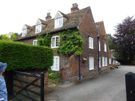
Anstey Hall is partly visible to the left opposite Maris House. The Hall was originally a Medieval manor house, rebuilt in the early 1600s and again by Anthony Thompson c. 1700. It was enlarged in the 19th century and remodelled 1909. It has an impressive symmetrical late 17th century north front with pedimented centrepiece. The Coachman’s House on the road, dated 1865, is dedicated to Charles Finch Foster (1806-1866), who inherited Anstey Hall from his father Ebenezer Foster in 1851. The Hall was owned by the Thompsons from 1637-1748, the Ansteys from 1748-1838 and the Fosters from 1838-1941, when it was taken over by government. It is now owned by John de Bruyne, who showed members of the Group around in May 2012.
Church Lane
The road to the left passing the church continues to the former ford to Grantchester while the road to the right goes to Cross Hill, the site of the early village cross. The triangular area between Church Lane, High Street and Maris Lane was part of the Medieval village green and another probable area of village green is now enclosed within Trumpington Hall park.
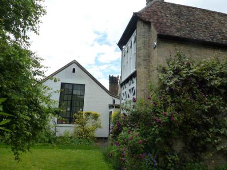
The Old House on the right hand side of Church Lane is a late 1500s building, with narrow red bricks and crow-stepped gables. An extension was added in the 1920s.
The earliest part of the Church School, opposite the junction, was built in 1843, initially with two classrooms to accommodate 100 pupils. It closed in 1950 after the Fawcett schools had opened.
The Schoolmaster’s House to the right of the school was built in 1858. It was designed by William Butterfield (who later renovated the church), one of the leading architects of the Victorian period, and built by L. Gray & Son of Post Office Terrace, Cambridge. It is regarded as an important step in the development of the later vernacular style of English domestic architecture. The tall and narrow shape of the original building is distinctive for a detached house. The main rooms are at the southern end of the house, with windows facing due south.
Grantchester Road and Trumpington Church
Walking along Grantchester Road, the Bakehouse on the left was renovated by the Church in 2010. The Vicarage is behind the Bakehouse, brick built c. 1733, and sold into private hands in 2009. On the opposite side of the road, the house set back used to have a Sun Insurance shield, dated to 1654, and the cottages to its left are dated late 1600s-early 1700s.
Trumpington Church has been the geographic centre of the village for over 1000 years. The current church was built in Barnack stone between 1200 and 1330. It was renovated by Butterfield in 1876, when it was partly refaced with Bath stone.
The churchyard cross is near the north door and there are fascinating memorials and headstones on the south side of the churchyard, including memorials to the Pembertons and Thompsons and Maris family headstones near the south porch. To the right of the south porch, there is the grave of Henry Fawcett, the Postmaster General who died in 1884, and the nearby headstone to William Stacey who died in 1729.
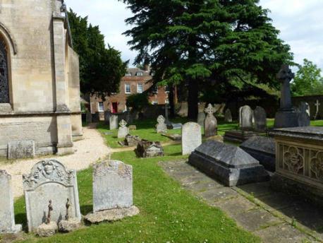
An archaeological excavation in 2010 found evidence of the original Anglo-Saxon settlement of c. 700 AD in the fields beyond the churchyard extension, an area now being developed for housing.
Trumpington Hall and its Park
If you are walking this route, return along Grantchester Road then Church Lane to the War Memorial: Trumpington Hall and park is not open to the public.
During our walk, we had permission to go along the driveway opposite the Church which leads to Trumpington Hall and its park. The estate was purchased by Sir Francis Pemberton in 1675: he paid 1000 guineas for 1000 acres. The earlier Elizabethan manor house was rebuilt c. 1715 and further altered in 1810. The Hall itself has a Grade II listing, while the elaborate wrought-iron gates across the forecourt are Grade II*. The Hall overlooks the river valley, with Grantchester and Grantchester Meadows beyond.
Antony Pemberton mentioned that the Hall is on very dry ground, on a slightly raised ridge with a dip in the avenue which runs to the War Memorial. The avenue is shown on the Inclosure Map, 1804, and Baker’s map of Cambridge, 1830. The earlier elm trees were replaced by limes, planted around 1970. The area near the Hall to the north of the avenue was part of the Medieval village called Dagnell End, Dagling End or Dike Lane End. Antony Pemberton remembered that ridge and furrow was visible in the past and that there was an old water pump. The early maps and census evidence show that the number of homes in the area declined through the 1800s, although one family (Joseph Madlock, a butler then gardener) lived there until the 1890s.
The eastern end of the avenue crosses an area formerly called Camping Close. This was probably part of the village green but had been incorporated in the park before 1800. The name “Camping Close” may indicate that the area was used to play the game of camping (a mixture of football and handball).
Cross Hill and the High Street
Trumpington War Memorial was erected at the junction of the High Street and Church Lane, an area known as Cross Hill. The memorial was unveiled on 11 December 1921. The road configuration at that time was with Church Lane running into High Street at an angle, between the memorial and the park wall. When the memorial was being erected, the base of a much earlier village cross was found in the same location. This base is now in the church and can be dated to c. 1475 by its dedication to John Stokton who died before 1476.
Bidwells Stonecross building is on the site of the village smithy which moved here in the mid 19th century, with the smithy’s southern boundary wall still visible.
Across the High Street, Manor Farm was just to the north of the Village Hall. The farm was sold for development in 1967. There were extensive farm buildings behind, and a drift road along the line of Beverley Way out into the fields, cutting through what is now the Estate and heading towards Red Cross on Hills Road (though maps show different versions of this at different times). The cattle from Manor Farm used to be brought out of the farm, along the High Street and into Trumpington Park by the Coach and Horses, where they were able to graze.
Almost opposite the War Memorial, slightly further north, was the Red Lion, demolished in 1936 to be replaced by a much bigger Red Lion Hotel. It was finally closed in 1975. A track beside the Red Lion used to lead to a meadow behind, where the annual village feast was held; the track was closed when the pub was rebuilt and the meadow was turned into allotments for the residents of Alpha Terrace.
On this side of the road, the earlier site of the smithy was next to 30 High Street, north of where Trumpington Hall lodge now stands (the lodge was first mentioned in the 1881 census, but not in 1871). Samuel Widnall (“Reminiscences of Trumpington 50 years ago”, 1889) shows a picture of it with village stocks beside it, sketched from his memory of the 1830s.
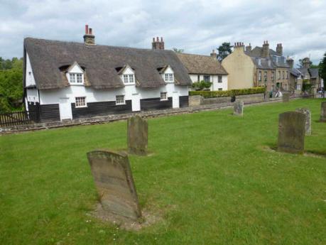
The houses to the north of Cross Hill on this side of the road were built in the 17th and 18th centuries and are all Grade II listed. Number 30 was at one stage the police house before a dedicated house, 103 High Street, was built in the 1920s (demolished recently and replaced with flats). In 1911, the police house was in Church Street and before that the village bobby lived in one or other of the houses south of the Tally Ho. There was probably another small cottage between numbers 28/30 and 24/26 until the 1890s. Number 22 was originally half of a pair; the northern half was demolished during World War II.
In the 1800s, there were up to nine cottages on the far side of the road between Manor Farm and the Red Lion, one of them housing a succession of village blacksmiths. This had been reduced to five by the 1950s.
The former petrol station (the Villa Service Station) stood on the site of “Trumpington Villa” (or “The Limes”), built in the 1840s for Overton Hebblewhite, a retired draper. The Villa was pulled down in 1957. Next to it (to the south) was Lyme Cottage, used as the Post Office from after 1940 to 1967 (postmaster Charles Willson, successor to Henry Saunders, who had operated from south of the smithy), when it moved to what had been Harvey’s Stores further up the road. Lyme Cottage was still there in 1970. The precursor of the petrol station in 1937 was “Dick’s Garage”, run by Douglas Reynolds, who lived in Bishops Road.
The Green Man has at its core a 1400s timber-framed hall house, with a sturdy chimney which would have been liable to the Hearth Tax in 1664. In the early 1900s there was a tea garden with a tree house in it; a postcard shows the landlord from 1906 to 1936, Charles Hering (German by birth) and his family.
The earliest part of the Coach & Horses (now the Wok ‘n’ Grill) was built in the late 1600s, with a 19th century addition coming out towards the road. There was a range of timber outbuildings stretching back from the road (along ‘Back Lane’) to the north, pulled down to make room for Winchmore Drive in the 1970s.
There are two commercial premises opposite the Coach and Horses. The one on the right was a Drapers shop and general stores, run by Mrs Kate Harvey from about 1900 until World War II; from 1967 until recently it was the Post Office. The one on the left was the Holmlea Laundry, run by Thomas White in 1911, and from 1914 onwards by Edward Colbourne (who lived there until 1960).
St Mary’s, on the corner of Alpha Terrace, was built in the 1880s for Robert Sayle’s daughter Frances. This had been the site of the first proper school in the village, run by James Cumming and then his son Charles from 1783 to 1842 (the Church School opened in 1843). According to Widnall, Alpha Cottage was built for Mr Cumming senior about 1820 when he handed the school on to his son; he died in 1838. In the 1841 census, Charles Cumming was living either in Church Lane or on the west of the High Street.
Alpha Terrace
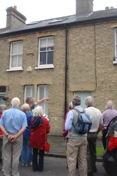
Alpha Terrace was the first conscious expansion of the village since the building of Whitelocks Yard in the early 1800s. It eventually added 75 new households to what had been a parish population of under 1000. The houses were renumbered in 1934, when this part of Trumpington was moved into Cambridge. The first three houses on the left (now numbers 3, 5 and 7) had already been built by 1881, though they appear on the census as being in the High Street. By 1891, old numbers 1 to 22 (the complete row on the left) were occupied. The builder of most of these, we believe, was Charles Scott from Waterbeach, who lived in number 1 in 1881, and by 1891 was landlord of the Coach and Horses while his son Nathan was in number 1. By 1901, Charles had moved to number 26 (now number 22) where he had his builder’s yard round the side and the back, and he lived there until he died in 1917. Before being named “Alpha Row” or “Alpha Terrace”, it is thought this was known as “Scott’s Row”.
Opposite old numbers 5 and 6 (now 11 and 15, there was no number 13 even in 1934!) was the entrance to a saw mill, with two cottages facing away from the road against the garden wall of St Mary’s. Enoch Sheldrick was a carpenter and wheelwright who lived there with his family between 1901 and 1911, and by 1911 was a sawyer and carpenter.
In 1911, George Chapman was a shoemaker, living next door to Charles Scott at number 27 (now 24), but by 1919 he was a sawyer, and in 1934 he and his family were in “Saw Mills Cottage”, which was renumbered that year as number 2. George and his wife continued to live there until 1965, when George died, and the cottages were demolished in 1967. The sawmill itself was shut down by Mr Griffith Todd, a solicitor who was living at St Mary’s in 1911 until he died in 1923, who could not stand the noise next door.
The first houses in Scotsdowne Road were occupied in 1962, but it did not become a through road until Beverley Way was built in 1968.
Trumpington Free Church was completed in 1899.
Numbers 12 and 13 (now 29 and 31) bear the date 1885 and are “Grantchester Cottages”, presumably as the first occupier of number 12 was Stephen Brown who came from Grantchester.
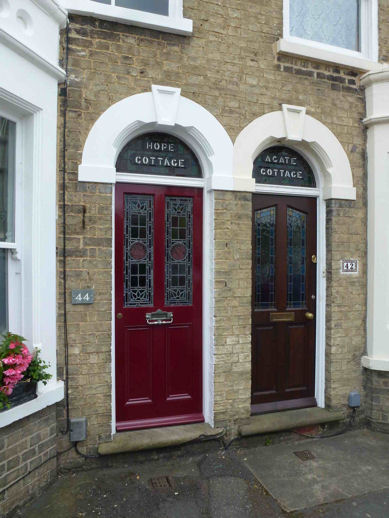
Numbers 36 and 37 (now 42 and 44) are still called Agate and Hope Cottages.
Number 48 was the last house to be built in Alpha Terrace; the Council’s renumbering map of 1934 shows all other sites to be occupied.
Number 43 (now 52), Emmadale, was the home of Cornelius and Sarah Careless, whose wedding photograph in 1903 was taken outside the house. Edwarddale, next door, and Emmadale, were possibly named after Edward and Emma Marshall, whose daughter Rosina lived at Edwarddale in 1911.
Numbers 63-69 were built by Chesterton Rural District Council as council houses, before Trumpington became part of Cambridge.
The date stones on some of the end houses bear the inscription “L.E.”: Louisa Edwards was the widow of brewer Richard Edwards, who lived at The Villa until her death in 1915. There are some houses in Shelford Road with the same inscription, but slightly later dates.
At the very end of the road, there are three houses built about 1902 for Charles Forbes, who had been head gardener at Anstey Hall. Forbes was born in 1850 at Birse, Aberdeenshire, 2 miles from Aboyne, hence the name high up on the wall “Aboyne Cottages”. He lived in the very end one. All three were marked on the large scale 1903 Ordnance Survey map, but not mentioned in the 1901 census. Otherwise in 1903, the houses stopped at Agate and Hope cottages, except for Edwarddale and Emmadale.
Fawcett School(s)
This was built as two separate schools, Fawcett Junior School on the left and Fawcett Infant School on the right. They opened in 1949 and 1950 respectively, to take the larger numbers of children in the village because of the building of the estate. In 1989, they were combined into Fawcett Primary School. The former infant school was converted into the Cambridgeshire Professional Development Centre (CPDC) in 1991. This is used by the county to provide training and non-residential conference facilities. There is a footpath from Alpha Terrace through the grounds of Fawcett Primary School and CPDC. Ely Place and Salisbury Place on the right were built in the 1980s on the remaining half of the Alpha Terrace allotment site; Monkswell had been built earlier on the rest of the site. The school has extensive playing fields.
The Estate
The footpath from Alpha Terrace goes to the Estate built in the 1940s.
At the exit into Paget Close, the track which goes to the left is the one that originated at Manor Farm, along a line through what are now the back gardens of Paget Road. Until recently, the track continued across fields to the east (now part of the Clay Farm development).
The roads of the estate are Foster Road, Paget Road, Paget Close, Byron Square and Anstey Way. These were named after the Foster family of Anstey Hall (bankers, from 1838 to the 1940s); Sir George Edward Paget 1809-92, on the staff of Addenbrooke’s, Regius Professor of Physic, who established the Natural Sciences tripos at the University, but with no known Trumpington connection; Lord Byron, who was an undergraduate at Cambridge and reputedly swam in Byron’s Pool on the edge of the parish; and Christopher Anstey of Anstey Hall.
The estate represented another huge expansion of the village, almost doubling the population with 360 new dwellings. Although planned before World War II, construction of the estate for the Cambridge Borough Council did not begin until 1945. The first houses were built at the far end of Foster Road, and in 1946-47 the prefabricated houses were put up scattered through the estate. The City Council re-clad their remaining “steel houses” in the 1990s, so those where the original upper storey is still visible are in private ownership.
Four of the phases of the development are visible from Paget Close. The left hand side of Paget Road contains prefabricated steel framed houses; on the right hand side numbers 121-127 are part of the third allocation (1947-48) built by R. Thompson; both sides of Foster Road (numbers 170-180 and 171-179) are from the final allocation (1947-48) built by Thompsons and Sindalls; Paget Close and the very ends of Paget and Foster Roads are flats for older people, built by Rattee and Kett and Coulsons in 1947-48, which had several existing Trumpington residents among their early tenants.
All the surface drainage from the roads on the estate flows under the track from Paget Close straight down into Hobson’s Brook.
A short distance along Foster Road, there is a footpath through to Byron Square. The playground on King George V Playing Field was originally opened by Cambridge mayor John Woodhouse in 1986, then its replacement by mayor David White in 2003. Trumpington Pavilion can be seen across the playing field.