Post-War Trumpington, 1945-1980: Fawcett Schools and Allotments

Andrew Roberts

This page summarises the development of Fawcett Infant and Junior Schools and local allotments in the period from 1945 to 1980, based on a talk given to the Local History Group meeting about Post-War Trumpington on 29 September 2023.

Fawcett Infant and Junior Schools

The evolution of state schools in the village. I would like to thank Ken Fletcher, Peter Dawson and Shirley Brown for information they have given about this in previous talks.

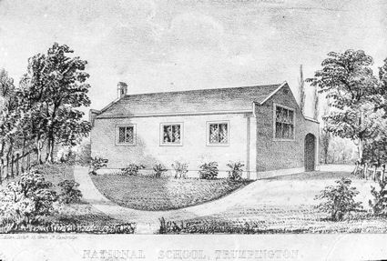
Before the 1940s, the local school was the Church School, founded in 1843 in Grantchester Road, close to the parish church. We are fortunate to have a print of the school in the Percy Robinson collection. Percy was the head teacher from 1908 to 1943 and very influential in the village.

Print of the National School, built 1843. Percy Robinson collection.
The former Church School (later the Church Hall then a nursery) from Grantchester Road. Photo: Andrew Roberts, 1 August 2008.

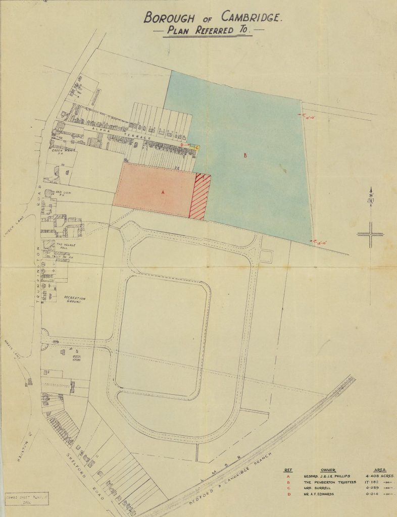
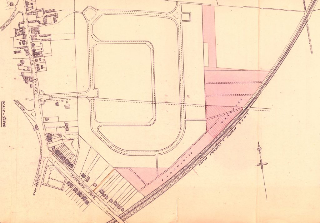
After the War, the local population began to grow, particularly with the building of the Estate to the east of the High Street. The County Council committed to building a new school and purchased land at the east end of Alpha Terrace in 1947, shown in blue on this plan. The High Street is to the left, with Alpha Terrace running from the High Street to the right. The layout of the new housing estate is below the school and Shelford Road is lower left. The Council then built two separate schools on the site, Fawcett Infant and Fawcett Junior Schools. The Junior School opened in 1949, with 320 places, and the Infant School opened in 1950 with 190 places. After a short overlap, the Church School closed in July 1950.

Land at the east end of Alpha Terrace purchased by the County Council in 1947 to build Fawcett Schools (blue shading) and allotments (pink shading).

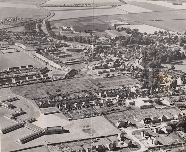
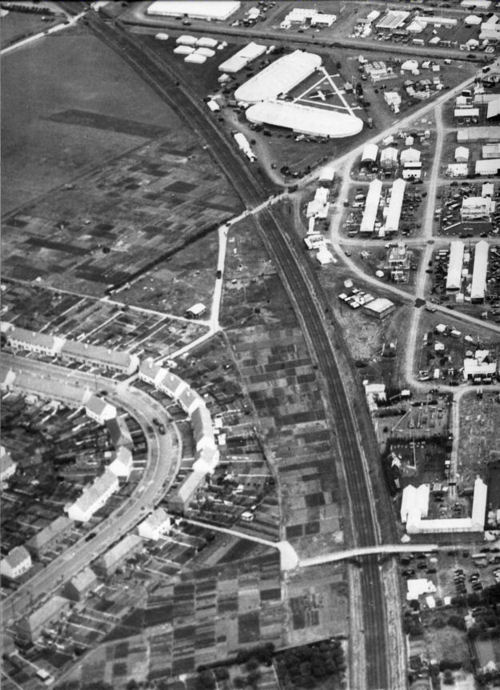
The layout of the schools and the surrounding area is shown in this aerial photograph from 1955. This shows the spacious plan of the schools and their playing fields, bottom left. The new Estate has now been constructed, centre left, including King George V playing field and the bowling green. The crescent of shops and flats on Anstey Way is in the middle of the view.

Aerial view of Trumpington from the north east, 1955. Includes the village core, High Street, Church Lane, Shelford Road, Bishop's Road, Hauxton Road, Anstey Hall, Church, PBI headquarters and grounds, Cambridge-Bedford railway line, Anstey Hall Farm shepherd's cottage and hay stacks, former PoW Camp, the Estate and King George V recreation ground, Anstey Way with shops under construction, Alpha Terrace, Fawcett School, allotments, Wingate Way under construction, The Red Lion, Manor Farm with hay ricks, Village Hall, blacksmiths. Cambridgeshire Collection.
Aerial view of Trumpington from the north east, 1955. Includes the village core, High Street, Church Lane, Shelford Road, Bishop’s Road, Hauxton Road, Anstey Hall, Church, PBI headquarters and grounds, Cambridge-Bedford railway line, Anstey Hall Farm shepherd’s cottage and hay stacks, former PoW Camp, the Estate and King George V recreation ground, Anstey Way with shops under construction, Alpha Terrace, Fawcett School, allotments, Wingate Way under construction, The Red Lion, Manor Farm with hay ricks, Village Hall, blacksmiths. Cambridgeshire Collection.

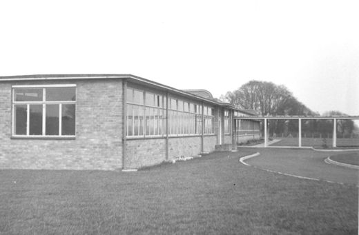
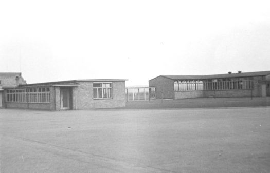
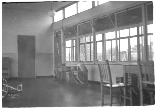
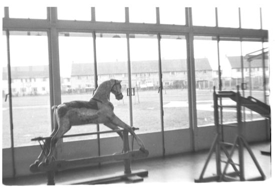
The Cambridgeshire Collection has a few photographs from the early 1950s showing the new school buildings in rather stark surroundings. The photograph with the rocking horse looks out onto the rear of the houses on Paget Road.

Fawcett School, exterior, 1950s. Photograph: Cambridgeshire Collection.
Fawcett School, exterior buildings and playground, 1950s. Photograph: Cambridgeshire Collection
Fawcett School, interior with stacked chairs, 1950s. Photograph: Cambridgeshire Collection.
Fawcett School, class room with rocking horse, looking out onto the rear of the houses on Paget Road, 1950s. Photograph: Cambridgeshire Collection.

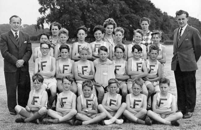
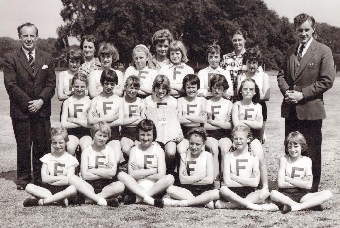
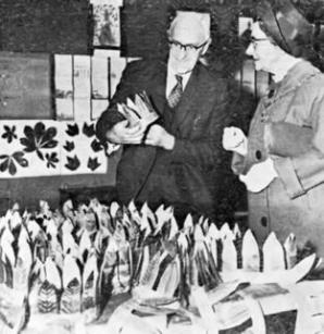
The school was very successful in sports. For example, the boys and girls teams were the Cambridge School Junior Athletic Champions in 1962.

Fawcett School team, the Cambridge School Junior Athletic Champions, Boys, 1962. Photo: Fawcett School (Ken Fletcher).
Fawcett School team, the Cambridge School Junior Athletic Champions, Girls, 1962. Photo: Fawcett School (Ken Fletcher).

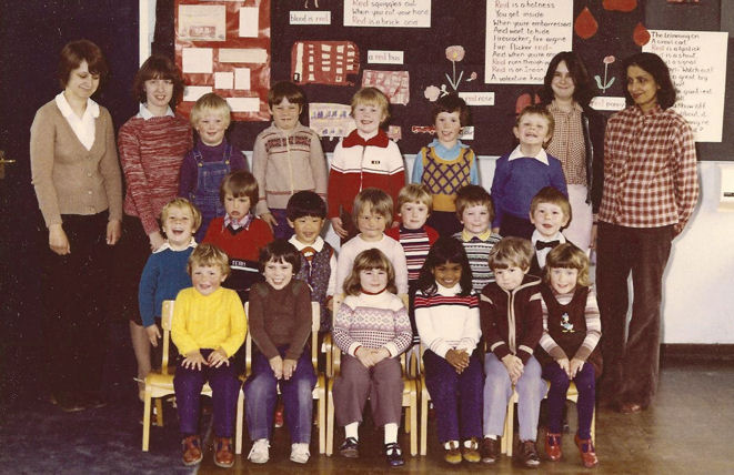
Ken Fletcher has a newspaper cutting of one of the Heads of the Junior School, C.R. Duckerling, who was in post in the 1960s. Peter Dawson has a photograph of the Infants School teachers and pupils in the 1970s, with his daughter, Kristina, in the front row, right hand side.

The Head of Fawcett Junior School, C.R. Duckerling, November 1963. Photo: from a newspaper cutting, Ken Fletcher.
Fawcett Infants School teachers and pupils, 1970s. Photo: Peter Dawson.

To bring the school story up to date, the separate infant and junior schools were combined into Fawcett Primary School in 1989. With the latest growth in population, the school expanded considerably in 2015, with new buildings to the rear of the original site.

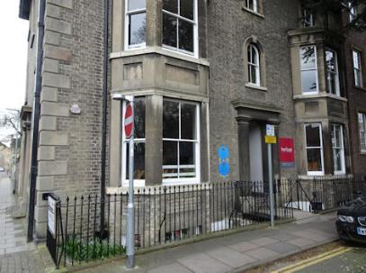
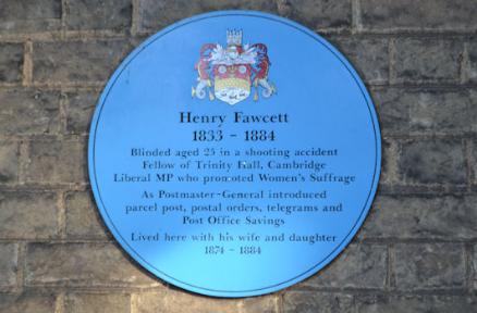
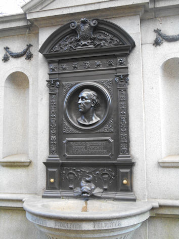
One question is why were the schools named ‘Fawcett’. This was in honour of Henry Fawcett, who lived from 1833 to 1884. Despite being blinded in a shooting accident at the age of 24, he was a highly regarded economist, academic and politician, including being Professor of Political Economy at Cambridge and Postmaster General. He and his wife and daughter lived at 18 Brookside from 1874 to 1884, where there are blue plaques to Henry and his wife. Brookside is parallel with Trumpington Road, opposite the Leys School.

The Blue Plaques to Millicent Fawcett and Henry Fawcett, 18 Brookside. Photo: Andrew Roberts, 4 April 2018.
Blue plaque to Henry Fawcett, 18 Brookside, Trumpington Road. Photo: Andrew Roberts, 15 October 2011.

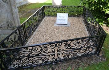
Henry Fawcett died on 6 November 1884 and was buried in Trumpington churchyard. A large number of people attended the funeral and there was a riot as people pressed to get into the churchyard. A newspaper reported: “A special train came from London carrying dignitaries and MPs. The funeral procession route from his home in Brookside to Trumpington was lined by thousands of people. The church could accommodate only 400 people. There was a great crush of people outside. A group opened the Vicarage gate adjoining the churchyard and crowds rushed across to the churchyard gate – in the process destroying shrubs and damaging tombstones. The small force of police were unable to stem the tide of people – making the passage for mourners difficult.” (Cambridge Chronicle and University Journal, 14 November 1884, p. 8.)

'Some Trumpington inscriptions, with special reference to the base of the old village cross', [photograph of the grave of Henry Fawcett], Cambridge Chronicle, 31 May 1922, p. 8. [Cambridgeshire Collection].
‘Some Trumpington inscriptions, with special reference to the base of the old village cross’, [photograph of the grave of Henry Fawcett], Cambridge Chronicle, 31 May 1922, p. 8. [Cambridgeshire Collection].
The refurbished grave of Henry Fawcett, Trumpington Church. Photo: Andrew Roberts, 6 April 2018.

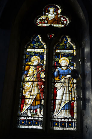
There are memorials to Henry Fawcett in Trumpington Church, in London and in Salisbury.

The memorial window to Henry Fawcett (1833-84), on the south side of the Chancel, Trumpington Church. Photo: Andrew Roberts, 18 October 2011.
Memorial to Henry Fawcett, Victoria Embankment Gardens, London. Photo: Andrew Roberts, 19 January 2015.

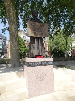
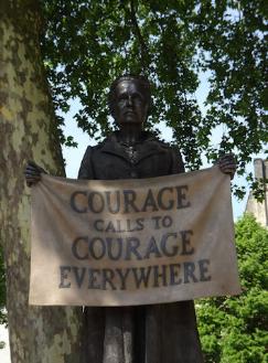
It is worth stressing that Henry Fawcett’s wife, Millicent Garrett Fawcett, would now be regarded as a more significant figure. She was one of the leaders of the women’s suffrage and education movements.

Portrait of Millicent Fawcett, 1892. Newnham College Archives.
The blue plaque to Millicent Fawcett, 2 Gower Street, London. Photo: Andrew Roberts, 18 May 2018.

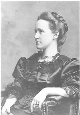
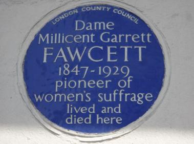
There are memorials to Millicent Fawcett, including the statue in Parliament Square erected in 2018. There is a joint memorial to Henry and Millicent Fawcett in Westminster Abbey.

The statue of Millicent Fawcett in Parliament Square. Photo: Andrew Roberts, 18 May 2018.

Alpha Terrace and Foster Road Allotments

The allotments off Alpha Terrace and Foster Road, from the late 1940s to 1980. My thanks to Shirley Brown and to Howard Slatter who did research into their history. First, the Alpha Terrace allotments.

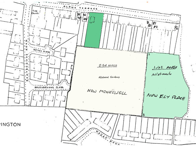
There had been allotments to the south of Alpha Terrace since the 1920s but these had been privately owned by the Red Lion Inn on the High Street and did not have a statutory status. When the County Council purchased land for Fawcett Schools in 1947, they also purchased this allotment area, shown in pink on the plan. The Trumpington Horticultural Society agreed to form a registered allotment society and took over the Alpha Terrace site.

Land at the east end of Alpha Terrace purchased by the County Council in 1947 to build Fawcett Schools (blue shading) and allotments (pink shading).

The aerial photograph from 1955 shows the neatly organised allotment site between Alpha Terrace and the Estate.

Aerial view of Trumpington from the north east, 1955. Includes the village core, High Street, Church Lane, Shelford Road, Bishop's Road, Hauxton Road, Anstey Hall, Church, PBI headquarters and grounds, Cambridge-Bedford railway line, Anstey Hall Farm shepherd's cottage and hay stacks, former PoW Camp, the Estate and King George V recreation ground, Anstey Way with shops under construction, Alpha Terrace, Fawcett School, allotments, Wingate Way under construction, The Red Lion, Manor Farm with hay ricks, Village Hall, blacksmiths. Cambridgeshire Collection.
Aerial view of Trumpington from the north east, 1955. Includes the village core, High Street, Church Lane, Shelford Road, Bishop’s Road, Hauxton Road, Anstey Hall, Church, PBI headquarters and grounds, Cambridge-Bedford railway line, Anstey Hall Farm shepherd’s cottage and hay stacks, former PoW Camp, the Estate and King George V recreation ground, Anstey Way with shops under construction, Alpha Terrace, Fawcett School, allotments, Wingate Way under construction, The Red Lion, Manor Farm with hay ricks, Village Hall, blacksmiths. Cambridgeshire Collection.

This arrangement continued until the 1970s and 1980s, when the County Council decided to sell the land to the City Council for housing, first to build Monkswell and then Ely Place. The allotment users who wished to continue moved over to the Foster Road site.

Plan of allotments showing area where Monkswell was built and smaller area taken for Ely and Salisbury Places. Source: Cambridge City Council.

The Foster Road allotment site was earmarked by the City Council when it was planning the housing development of the Estate. Howard Slatter has done detailed research into the evolution of the site, from the initial layout in 1947. It wrapped around the outer perimeter of Foster Road, between there and Shelford Road and the railway line. As you can see, the original site was much more extensive than the current allotments. The additional area is shown in dark red, in the land now developed as part of the Clay Farm housing, while the current area is shown in brown.

Map showing the extent of Foster Road allotment plots. Howard Slatter.

This plan shows the layout of the site as it was in 1957. It included 116 plots and extended to 9.4 acres, including 1.7 acres which later became the chicken plots and community orchard. The northernmost plots were handed back to the Council in 1957 and 1970. Users from the Alpha Terrace allotments who wanted to continue to have an allotment moved onto the main site after 1973.

Plan of Foster Road allotment site in 1957.

One of the highlights in the history of the allotments was the use of the paths through the site as an access route to the Royal Show in 1951, 1960 and 1961. For the 1951 Show, the track from Foster Road was extended to a pedestrian bridge over the railway cutting (now used by the guided busway), to give access to the showground. The same technique was used in 1960 and 1961. Here you can see Foster Road to the left, the allotments, and the bridge across the railway to the showground.

Aerial view of the Royal Show and Trumpington Allotments, 1960 or 1961. Source: Antony Pemberton.

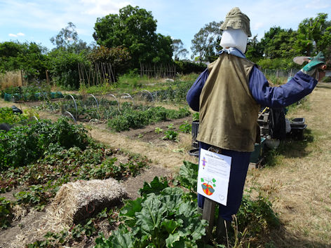
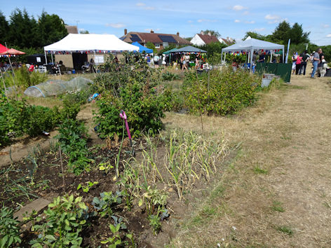
To bring this up to date, it is worth stressing that the Foster Road allotments are still thriving, 75 years after they were established. There were anniversary celebrations on the site in 2022.

Trumpington Allotment Society, 75th Anniversary Open Day. Photo: Andrew Roberts, 9 July 2022.