Edmund Brookes
This page discusses the Royal Shows that were held in Trumpington in the 1950s and 1960s and transport developments in the period from 1945 to 1980, based on a talk given to the Local History Group meeting about Post-War Trumpington on 29 September 2023.
Introduction
The two subjects may seem strange bedfellows but I can assure you there is a connection even if it is tenuous. If you have only lived in Trumpington for the last 15 years, it is probably hard to visualise what Trumpington was like in the decades immediately after the end of World War 2. As someone who has lived here for nearly 70 years since we moved here in 1955 when our father transferred from Barclays Bank Downham Market to their Bene’t Street branch, I have witnessed what we thought then were considerable changes and which were in reality nothing compared with what has happened in the last decade.
The Royal Show
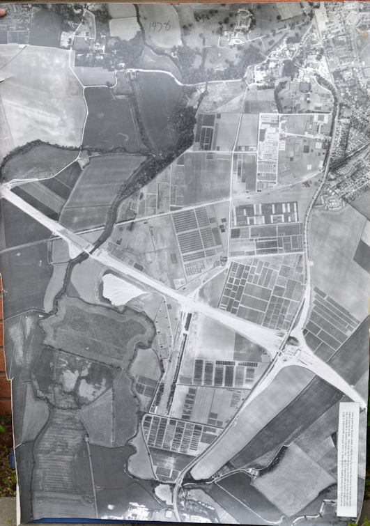
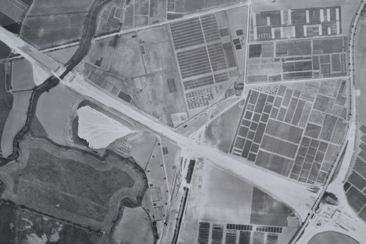
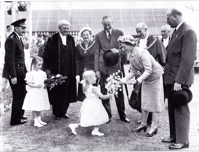
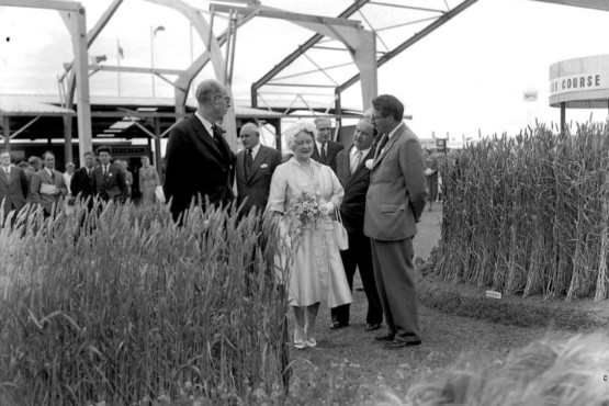
The Royal Show, arranged by the Royal Agricultural Society, traditionally was very peripatetic, moving round the country. It was staged on what is now effectively Clay Farm in 1951, 1960 and 1961, courtesy of Sir Francis Pemberton, who was President of the Royal Agricultural Society. The Show was an extremely large event staged over 4 days usually each July (except during the war years).
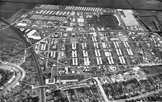

Temporary housing was provided for key staff and this was erected and dismantled each year. Not the large mobile homes you see being transported on lorries these days. It may surprise you that at times the land was grazed by sheep. After 1951 the electricity supply to the housing (roughly behind 121-179 Shelford Road) was left in place, and removed after 1962. However, changes were afoot and doubtless to cut costs the 1960 and 1961 shows were the first to be staged at the same location over 2 years. In 1962, the Show was held on the Town Moor at Newcastle and this was the last annual move as it then settled on a permanent site at Stoneleigh in Warwickshire.
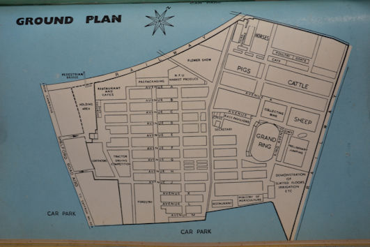
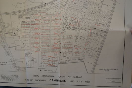
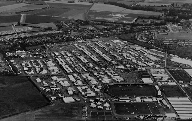
Today it is perhaps hard to realise how big it was. There were something like 1000 stands, several rings and no permanent roads, and the event encompassed all aspects of farming, food and rural life, from the best of British livestock to the latest business and technological innovations in the farming industry. World-class livestock and equine classes, as well as show jumping and other demonstrations attracted visitors from many countries.
On the Sunday evening before the show the Bishop of Ely led an ecumenical church service in the main grandstand, and I could be distracted to watch the trains go by on the main London railway line. The main entrance was Showground Road and policemen guarded other minor entrances, and various fields were used as car parks. In 1960 we had a ½ holiday from school to visit the show and in 1961 I remember my mother talking to the policeman at the then track between 125 and 129 Shelford Road to sneak me in to take some emergency supplies to the Barclays Bank branch. I of course wandered around a little and did not go straight home. But my abiding memory (apart from giving up my bedroom to lodgers) was the traffic jams, such as I had never seen before. They were worse than anything we had seen and gridlock was almost total as there was no escape to the M11. The field opposite our house was used as a temporary car park. I had to stay at school for lunch as the buses were delayed and on the Wednesday my bus to the Leys School for our weekly swimming sessions as heavily delayed. Fortunately, the weather was fine.
The last Royal Show was held in 2009, though Stoneleigh remains the headquarters of the Royal Agricultural Society. Agricultural shows have changed; if you go to the Suffolk Show still held each year at Ipswich on a permanent site with tarmacked roads, you can get a taste as to what it was like at the Royal Show, but here it was on a much grander scale.
Transport changes
If you are wondering what the transport connection was, it was this, apart from the traffic jams. Until 1960 the Shelford Road was not curbed, well it was completed for the show that year and the road resurfaced ahead of July. Our Father had a bit of a row with the council as they were not going to put a dropped kerb for our main entrance, he saw to it that they did. Let us first look briefly at the railways – even though we had no station in the parish – then the road infrastructure and finally how the roads were used. Remember that the 1947 Transport Act nationalised not only the railways (from 1 January 1948), but also long distance road haulage (including Welch’s) and most bus companies including Eastern Counties.
The Railways
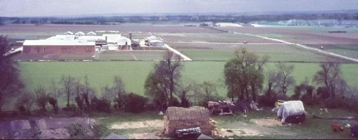
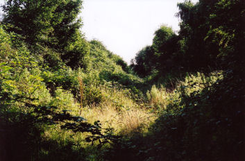
Though we have never had a permanent station until the current project to construct Cambridge South station, a short note is necessary, as one railway ran through and one still runs though the parish. At the end of World War 2, most long-distance freight was still handled by rail, even though the railways were very run down and exhausted by their massive contribution to the War effort and there was a nationwide speed limit of 60 mph. (Trains regularly ran at up to 90/100 mph before August 1939.) Though the London & North Eastern Railway still operated 5 of the 6 routes out of Cambridge and the London Midland and Scottish Railway operated the sixth (the Bedford line), they were a shadow of their former self. Road transport was denationalised in the early 1950s and rapidly expanded and coupled with the centralisation of electricity generation by coal and the reduction in the use of household coal this changed the shape of Britain’s railways, though the Beeching Report was not responsible for some closures. Consequently, the Bedford line was closed to freight in 1966 and then passengers in 1968. The track was lifted soon afterwards and gas and water irrigation pipes were laid through the cutting between Hauxton Road and Shelford Road. The cutting soon became very overgrown. The potential re-opening of the Bedford route, though not through the parish, will cost billions. The further use of the original track-bed will only be marginally referred to, as it falls outside the 1980s.

Road Infrastructure
Looking at Bartholomew’s Survey Atlas of 1903, the basic through road layout of the parish and the historic central triangle (apart from roads to service housing developments) was still the same in 1979. The only major event was the rebuilding of the 1790 Brasley Bridge over the River Cam in 1954. It only lasted just over 60 years while the ancient bridge by Grantchester Mill remains in use. Beverley Way was a mud track past Manor Farm until the 1960s. In the second half of the 1970s the M11 was slowly being built north from London, but only as a two-lane motorway north of Bishop’s Stortford. By 1975 the Bishop’s Stortford bypass (Junctions 7-8) were open, then to Junction 9 in early 1980 and finally from there to Girton (Junctions 14) later that year. Consequently, throughout the period under review, the increasingly heavier and frequent lorries drove down the A604, as it then was, from Alconbury, round the Backs, Trumpington Road and finally onto the A130 Shelford Road to access the A11 at Chesterford heading for the still busy London Docks. This kept some of us awake, especially for me when they stopped to buy cigarettes from Mr Pitman’s two cigarette machines. They preferred this route from Alconbury to the A14/A10. Felixstowe as a port was still in its infancy.
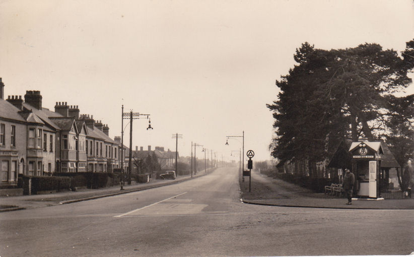
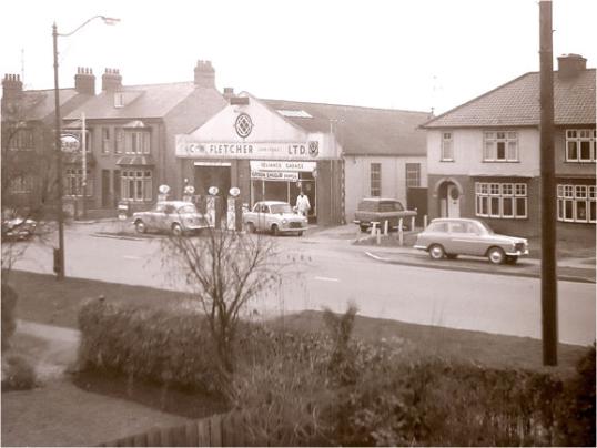
Street lighting was still gas mantles on Shelford Road, with only the lights at corners being on all night. These lights were converted to electricity using sodium bulbs which lasted until quite recently. At the time Cambridge Road, Shelford, was not lit, as that was not in Cambridge (which had its own police force). Grantchester Road beyond the church was unlit. AA Box No 1 was on the triangle of grass at the junction of Hauxton Road and Shelford Road. It was subsequently moved to a small lay by adjacent to where the entrance to Waitrose was constructed. The universal speed limit was 30 mph, until the limits on Hauxton Road, Long Road, Shelford Road and Trumpington Road were raised to 40 mph. Mr Wilson was the road sweeper for many years. Before the Esso and Shell petrol stations were built in the High Street there was just one pump at H.J. Newell’s shop, where the arm swung out over the road. Bert Carter’s Esso Garage at 158 Shelford Road had the pumps right up to the footpath. I remember him shouting and sending cars away during the Suez Crisis in 1956. Outside the Esso Station on the High Street there was a nasty kink in the road to catch the unwary where the old Post Office had been before you passed the Red Lion.
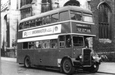
In 1955, there was only a set of traffic lights at the Hauxton Road junction, none at Long Road until the late 1950s when they put a set of bollards at the exit from Long Road. Mr Stanley could safely park his British Racing Green Jaguar, registration BRM 10, outside The Old Mill House on Long Road every day. At 3.20 pm a Police Constable safely saw Perse Preparatory School pupils across the road to catch the 115 bus into town. I walked home on my own.
Road Use
On this road network, Eastern Counties (nationalised and part of the Tilling Group) and private enterprise Premier Travel (who had very old Leyland Atlantean buses) ran their fleets. We had the following services:
Eastern Counties
103: Drummer Street – Pampisford (White Horse)
112: Drummer Street – Saffron Walden
115: Bishop’s Road – King Hedges Road (every 15 minutes) via Great St Mary’s Church and the Milk Bar (in Market Street), 5d adult fare to the Milk Bar in 1958
United Counties (Green):
141: Hitchin – Drummer Street (once a day in the afternoon) (our grandfather came on it to visit us one day from Letchworth – it went all through the villages to Royston before coming up the A10.)
Premier Travel: 9: Drummer Street to Chrisall
During the Summer of 1959, British Railways rebuilt the bridge over the Royston Line in Great Shelford to take future electrification. Traffic was single file for cars only. The 103 and 112 were diverted from Shelford over to the Babraham Road and then to Drummer Steet. However they ran a special extra 103 ½ hr service from the Trumpington side of the bridge with a single decker to the city. This was very useful to get back to school after lunch for 1½d.
The buses were red with some cream and some of their low-deckers had a sunken gangway on the right hand side of the upper deck. You had to mind your head downstairs. Norwich being the home of Easter Counties always seemed to have the new buses. Cambridge ones were old, built on Bristol chassis by Eastern Coach Works at Lowestoft.
With no parking restrictions we had a choice of 3 milk deliveries a day, bread three times a week and fish twice, plus soft drinks in season. The Dustman collected our metal bin from right outside our back door.
It goes without saying that traffic levels, especially cars as ownership expanded, increased significantly. Traffic engineers had a field day adding traffic lights and street furniture to control the traffic. Bus frequencies decreased to match usage and eventually routes amalgamated.
One of the sights I distinctly remember were petrol-engine Bedford 3-ton chassis with just an open seat for the driver being driven from Dunstable to Marshalls to have their bodies fitted, often for the MOD.
At the end of the period under review, the M11 was opening through to Girton, and – as the Addenbrooke’s site expanded – plans to by-pass Trumpington were afoot. There have been three distinct plans for a Southern By Pass, with the first proposal in 1982, culminating in Addenbrooke’s Road opening in the 21st century.