Howard Slatter
This paper describes the way maps can be used to help understand Trumpington in the early 1920s, explaining the sources of information available online on this web site. It was presented at the Local History Group meeting on 12 March 2020.
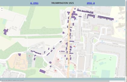
Extract from the 1921 map of Trumpington, highlighting the village centre.
Howard Slatter began his presentation with a photograph of Trumpington village taken in 1919 (as shown in the display “ The Changing Face of Trumpington ” at the Clay Farm Centre). The photo was taken from the north-east, with the High Street running across the centre of the frame from left (south) to right (north). Church Lane runs away from us on the right hand side, with the tower of the parish church visible above it. Maris Lane completes the triangle of roads, with Anstey Hall above it. The top left corner shows the route of the (then) LNWR railway line from Cambridge to Bedford, some of which is still visible on the ground today in Trumpington Meadows Country Park. With the exception of the Manor Farm buildings on the right hand side, the foreground is almost all farmland – later to be developed as the council estate, Anstey Way, Beverley Way, Monkswell and other residential roads.
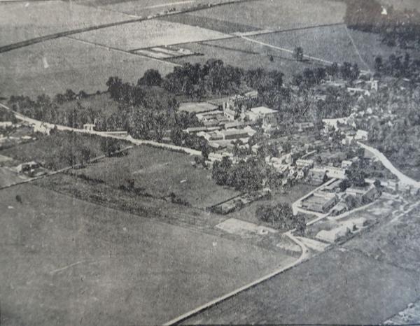
Trumpington from the air, Cambridge Chronicle , 6 August 1919, p. 9.
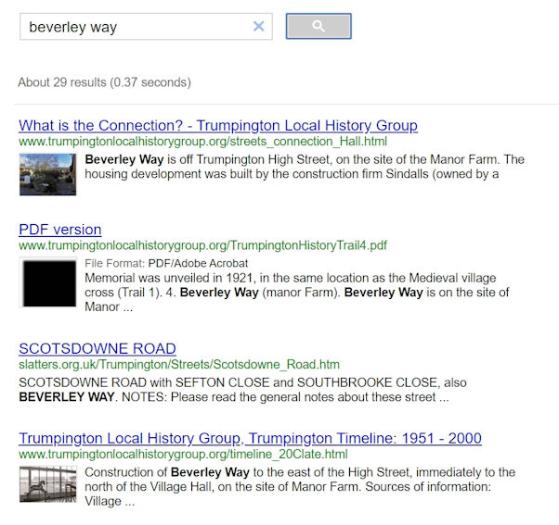
Howard then introduced another way of viewing the parish, using online resources on this Trumpington Local History Group web site. He used the year 1921 as the basis for his review. Starting at the home page, follow the “Resources” link on the left hand side. (Howard also pointed out the “Search” link in the top right hand corner: this leads to a “custom search” box where search words can be entered and relevant pages on the TLHG site will appear – see example for “Beverley Way” search and results).
The ”Resources” page includes an entry “Trumpington Maps: Decade by Decade, 1861-2011”.
Following that link leads to an introductory page, which includes a further link near the top to the resource itself. A list of years then appears. These years are at ten-yearly intervals, all ending with a “1”, to correspond to the years in which censuses were taken; the census data helps provide a good snapshot of who was living where in Trumpington at the time.
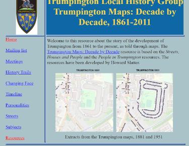
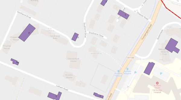
Clicking on “1921” leads to a map for that year. The initial map has two immediately obvious features. The red outline shows the ancient parish boundary, which ran from the “stone bridge” on Trumpington Road at the north almost to Hauxton Mill at the south. The western boundary is formed by the River Cam, and the eastern by Hills Road. The modern ecclesiastical parish stops short at the railway line. The (slightly faint) background map is from OpenStreetMap. This sets all older features in a modern context.
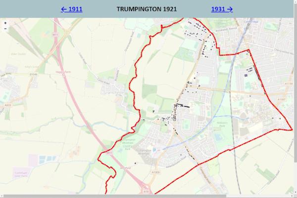
The map can be scrolled in all directions by dragging it with the left mouse button held down. It can also be enlarged by zooming, either with the + and – buttons in the top left corner, or by rolling the mouse wheel. A third feature, less obvious at first sight, is a scattering of dark objects. On zooming in, these become purple buildings. Not every building for that year appears – only those which were occupied by people. For instance, the churches do not appear in purple, though they are visible on the OpenStreetMap background layer.
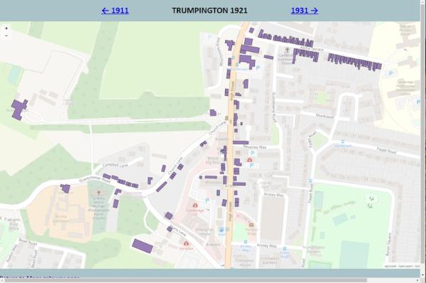
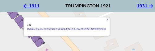
As an example, zooming in to the southern end of Shelford Road shows the houses that were occupied there in 1921. Note that now individual house numbers become visible. A single left click on a house brings up a “dialogue box”. The box for 146 Shelford Road shows a clickable link. Following that link leads to a page showing who is known to have lived at that address over time. Note that in this example, the records (as is typical) only go up to 1970; information beyond that date often includes people who are still alive today, and we have attempted not to include any such records.
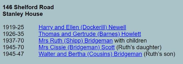

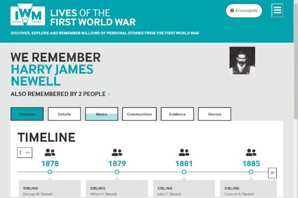
Clicking on one of these entries leads to a further page showing a very simple life story for those people. In this case, Harry and Ellen Newell and their children (some of whom are alive today, so appear only as “Living”). Harry was later well known in Trumpington as the proprietor of the cycle shop and garage in High Street where the Shell filling station now stands.
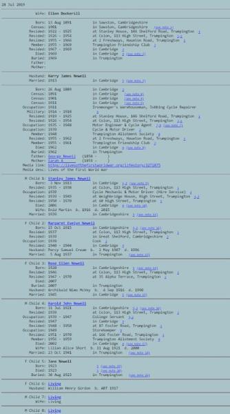
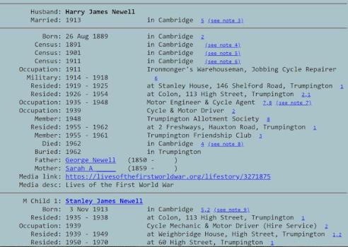
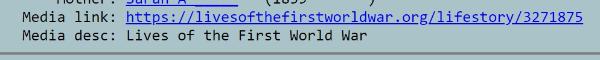
Within Harry Newell’s entry, there is a link to a “Lives of the First World War” web page, where much more information can be found about his wartime service. Well over 200 entries have such a link, with the information contributed mainly by our members.
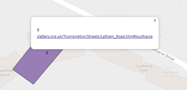
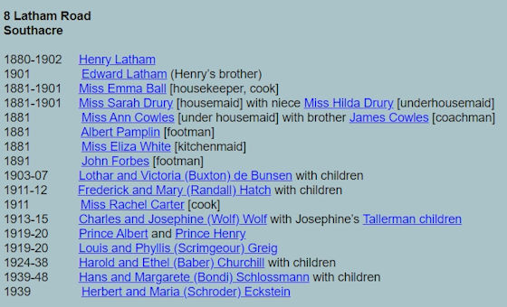
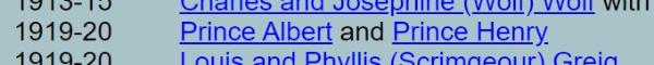
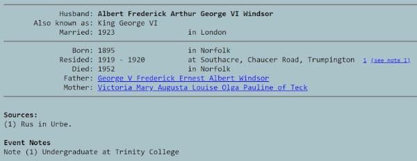
Returning to the map page, Howard showed a final example, this time following the same process with “Southacre”, 8 Latham Road. The residents there in 1920 included the brothers Prince Albert and Prince Henry, the future King George VI and Duke of Gloucester, who were undergraduates at Trinity College from 1919 to 1920.