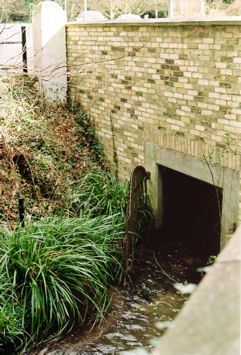
The Vicar’s Brook originally flowed from its spring-line source at Nine Wells, in the parish of Great Shelford, through Trumpington and then into the River Cam at its present-day outflow near River Farm. In the early 17th century, the University and town of Cambridge diverted this stream near “Trumpington Ford” (where the London Road crossed the brook) with a newly created drain that ran, and still runs, into Cambridge. The watercourse is now named Hobson’s Brook from Nine Wells to the point where it divides into the stream, still called Vicar’s Brook , and the artificial channel, called Hobson’s Conduit .
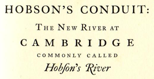
Extract from title page of Bushell’s 1938 book about Hobson’s Conduit.
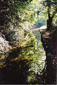
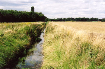
Left: Looking south along Hobson’s Conduit, on the path from Brooklands Avenue to Long Road. Photo: Andrew Roberts, October 2007.
Right: Vicars’ Brook and the milestone at the corner of Trumpington Road and Brooklands Avenue. Photo: Andrew Roberts, March 2008
The original purpose of this “new river” was to flush out the ancient Kings Ditch that had, over the centuries, become a significant health risk. Once the water was flowing into Cambridge though, it was used for other purposes: a fountain on Market Hill, feeding ponds and swimming baths in Pembroke, Emmanuel and Christ’s Colleges, and the pond in the University Botanic Garden, originally on its old site north of Pembroke Street, and latterly on its modern site alongside the brook.
The original ‘Hobson’s Conduit’ fountain was removed from Cambridge market in 1849, and rebuilt in its present position on the corner of Lensfield Road and Trumpington Road.
The Brook and Conduit are named after Thomas Hobson, the well known (and wealthy) carrier of Cambridge, also known today for the phrase Hobsons choice . He was probably at least partly instrumental in bringing the water to Market Hill, and certainly left land in his will (in 1631) for the benefit of maintaining the watercourse.
Hobson’s Brook, looking north near the track from the allotments to Addenbrooke’s Hospital and Nine Wells, Clay Farm. Photo: Andrew Roberts, August 2007
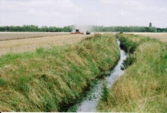
Harvesting the Showground fields, Clay Farm, with Hobson’s Brook in the foreground, looking north towards the shelter belt. Photo: Andrew Roberts, August 2007
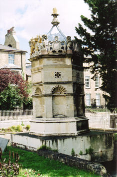
Left: The Hobson’s Conduit monument, now at the junction of Lensfield Road and Trumpington Road. Photo: Andrew Roberts, July 2008.
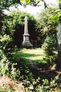
Right: Hobson’s Monument, Nine Wells, erected by public subscription in 1861. Photo: Andrew Roberts, August 2008.
Sources
Bushell, W.D. (1938). Hobson’s Conduit. The New River at Cambridge Commonly Called Hobson’s River . Cambridge: CUP. The history and course of Hobson’s Conduit, from Nine Wells through Trumpington into Cambridge, with maps and illustrations.
Gray, E.A. (1977). Hobson’s Conduit, the Story of a Cambridgeshire Chalk Stream . Barton, Cambridgeshire: Bird’s Farm Publications. ISBN 0-905232-03-8. The story of the valley to the east of Trumpington, following the route of Hobson’s Brook.