King George V Playing Field

Andrew Roberts
May 2011

A brief history of the King George V Playing Field in the centre of the Estate. This is based on a contribution given at the On the Street Where You Live meeting of the Local History Group on 31 March 2011. See also the introduction to The Estate .

Looking across the playing field to the east side of Byron Square, May 2011. Photo: Andrew Roberts.

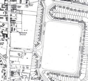
Before the building of the Estate, there had been a Recreation Ground to the east of the High Street (north of the current Anstey Way). David Stubbings talks about how the Recreation Ground was still in use in the 1940s and early 1950s until the main area was replaced with the shops and flats on Anstey Way. In the meantime, the Council had been committed to constructing a new playing field as part of the Estate.

Howard Slatter describes the decision of the Council in 1936 to build houses, a recreation ground and allotments. The plan for the area drawn up on 12 January 1940 showed the road layout and the central rectangular playing field. The Council decision coincided with the death of King George V on 20 January 1936 and the subsequent formation of a King George’s Fields Foundation to establish a national network of playing fields as a memorial to the King. Howard Slatter has traced information in the minutes of the Housing Committee that the Council made an application for a grant towards the playing field in the 1930s, but the War led to a long delay in the process.

National Playing Fields Association cartoon (reproduced from Wikipedia ).

Looking across the playing field to the east side of Byron Square, May 2011. Photo: Andrew Roberts.
National Playing Fields Association cartoon.
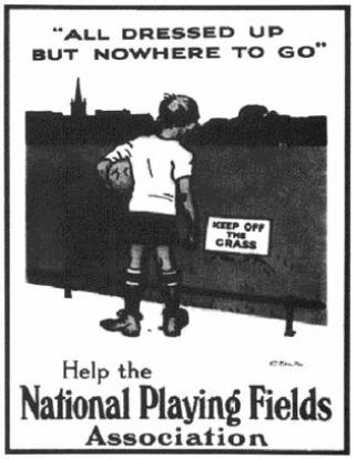
The King George’s Fields Foundation continued to operate until 1965, by which point nearly 500 playing fields had been set up in memory of the King. After it had been purchased, land was passed to the National Playing Fields Association and this organisation has continued the work of the Foundation since 1965.
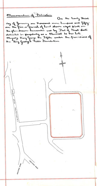
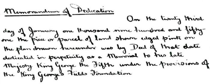
On 23 January 1951, Cambridge Council added a hand-written map and Memorandum of Dedication to the overall Conveyance Document for the Estate, saying “the piece of parcel of land shown edged pink on the plan drawn hereunder was by Deed of that date dedicated in perpetuity as a memorial to his late Majesty King George the Fifth under the provisions of the King George’s Fields Association”.
Memorandum of Dedication, page 8 of the Conveyance Document for the Estate, 1951. Cambridge City Council/Trumpington Residents’ Association.

Memorandum of Dedication, page 8 of the Conveyance Document for the Estate, 1951. Cambridge City Council/Trumpington Residents’ Association.

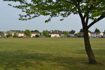
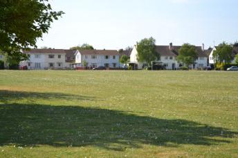
The initial appearance of the playing field must have been much starker than its atmosphere today, with an open area surrounded by the new houses of Paget Road and Byron Square. Maps from 1950 and 1954 show the appearance of the first structures on the field, two memorial columns, the bowling green and a rectangular area (cricket pitch?). An aerial photograph from c. 1956 shows the scale of the field within the housing development.
Ordnance Survey maps of the area, 1950.
Ordnance Survey maps of the area, 1954.

Ordnance Survey maps of the area, 1950 and 1954.

Aerial view of the Playing Field from the north, late 1950s. Mr W. Stanion: included in Trumpington Past & Present , p. 65.

Aerial view of the Playing Field from the north, late 1950s.
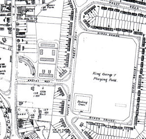
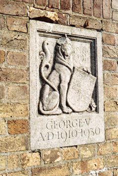
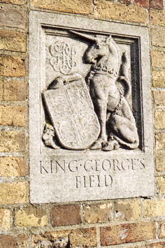
The erection of a memorial entrance with heraldic panels was one of the conditions required by the King George’s Fields Foundation. The Trumpington field has two brick columns with stone heraldic panels at the entrance to the Estate immediately opposite Anstey Way. As required by the Foundation, the panels are a lion holding a Royal Shield on the left and a unicorn holding a similar shield on the right.
Left hand heraldic panel, September 2008. Photo: Andrew Roberts.
Right hand heraldic panel, September 2008. Photo: Andrew Roberts.
The memorial entrance with heraldic panels, September 2008. Photo: Andrew Roberts.

The memorial entrance with heraldic panels, with the original Pavilion building to the rear, September 2008. Photos: Andrew Roberts.

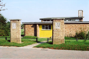
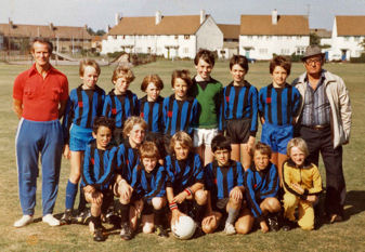
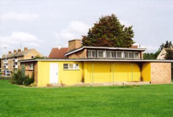
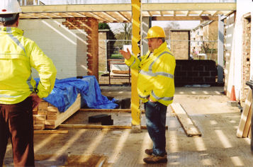
In the late 1950s, the Council built a Pavilion immediately to the east of the columns, with the gap between the columns providing the entrance pathway. The new building was well used for many years, both as changing rooms and a youth club, but had become semi-derelict by the mid-2000s. The field was also well used, including by the Trumpington Tornadoes football team.
Fallen leaves and the Pavilion, King George V Playing Field, November 2007. Photo: Andrew Roberts.
The Pavilion, from Anstey Way, February 2008. Photo: Andrew Roberts.
The rear of the Pavilion, before the start of renovation work, August 2008. Photo: Andrew Roberts.
Trumpington Tornadoes: A leading team in the 1980s.

Trumpington Tornadoes, 1980s.
The King George V Playing Field and the Pavilion, 2007-08. Photos: Andrew Roberts.

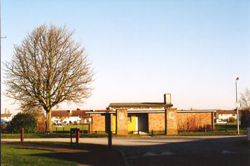
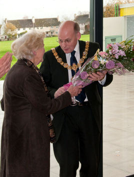
In 2009, the City Council rebuilt the Pavilion and the Council and the Trumpington Residents’ Association signed an agreement for the Association to take responsibility for the building on a long-term lease. The new Trumpington Pavilion community centre was formally opened in November 2009.
Progress with the work on the new Pavilion, March 2009. Photo: Andrew Roberts.
Opening of the new Pavilion, 14 November 2009. Photo: Stephen Brown.

Progress with the work on the new Pavilion, March 2009. Photo: Andrew Roberts.
Opening of the new Pavilion, 14 November 2009. Photos: Stephen Brown.

Celebrating the Royal Wedding of the Duke and Duchess of Cambridge at Trumpington Pavilion, 29 April 2011. Photos: Andrew Roberts.
Celebrating the Royal Wedding of the Duke and Duchess of Cambridge at the playing Field, 29 April 2011. Photos: Andrew Roberts.

Celebrating the Royal Wedding of the Duke and Duchess of Cambridge at Trumpington Pavilion and the playing field, 29 April 2011. Photos: Andrew Roberts.

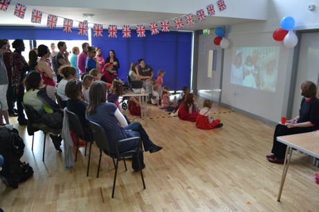
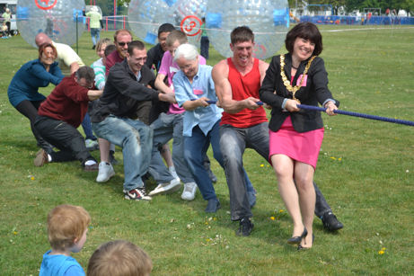
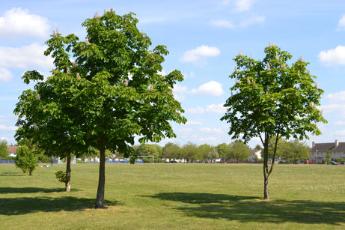
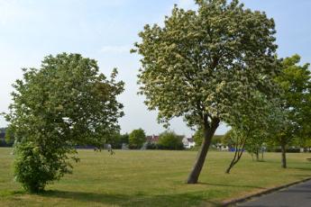
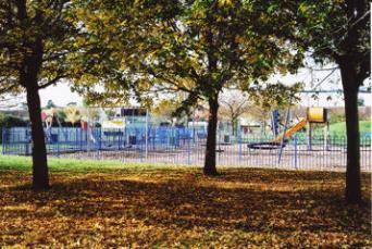
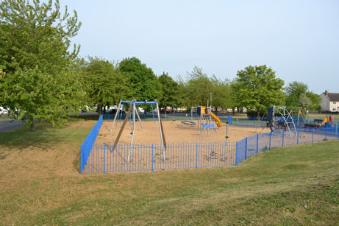
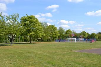
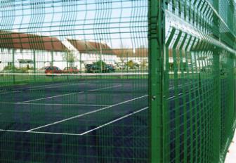
The rest of the playing field has also changed in the last 60 years, with many mature trees around the perimeter and across the northern part of the site, plus a play area, tennis court and multi-use area.
The playing field from the south side of Byron Square. Photo: Andrew Roberts.
Bryon Square from the playing field, May 2011. Photo: Andrew Roberts.
Looking across the playing field to the north side of Byron Square, May 2011 Photo: Andrew Roberts.
Looking across the playing field to the east side of Byron Square, May 2011 Photo: Andrew Roberts.

The playing field and Byron Square, May 2011.
Photos: Andrew Roberts.

Play area, King George V Playing Field, November 2007. Photo: Andrew Roberts.
The playing area in the north east corner of the playing field, May 2011. Photo: Andrew Roberts.
Trees across the playing field, May 2011. Photo: Andrew Roberts.
The new tennis court, King George V Playing Field, November 2007. Photo: Andrew Roberts.

The playing field and play area and tennis court, November 2007 and May 2011.
Photos: Andrew Roberts.