Peter Dawson, August 2008
The Chaucer Road and Latham Road area is bounded by Trumpington Road to the east, Coe Fen and the Vicar’s Brook to the north east, the River Cam to the north west and River Farm to the west.
I have drawn extensively on information in Rus In Urbe. Chaucer Road and Latham Road: the History of Two Rural Roads in Cambridge , by Jane Renfrew, Magnus Renfrew and John Rose, published by the Southacre, Latham and Chaucer Residents’ Association (SOLACHRA) in 1996. This is a valuable source about the development of the area (full details in the bibliography ). For more information, contact the SOLACHRA Secretary, Ian Gaseltine .
The Chaucer Road and Latham Road area is in the northern part of Trumpington. This history of the area is based on a presentation given at the On The Street Where You Live meeting, 13 March 2008. It is divided into three pages:

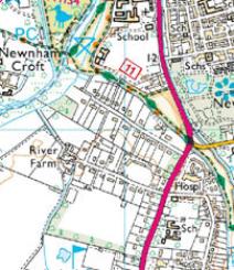
Image produced from the Ordnance Survey Get-a-map service. Image reproduced with kind permission of Ordnance Survey and Ordnance Survey of Northern Ireland .
Early History of the Chaucer Road and Latham Road Area
Developing Chaucer Road and Latham Road
Post-War Changes in Chaucer Road and Latham Road
Developing Chaucer Road and Latham Road
Post-War Changes in Chaucer Road and Latham Road