Post-War Trumpington, 1945-1980: Housing Developments

Howard Slatter

This page summarises the development of local housing in the period from 1945 to 1980, based on a talk given to the Local History Group meeting about Post-War Trumpington on 29 September 2023.

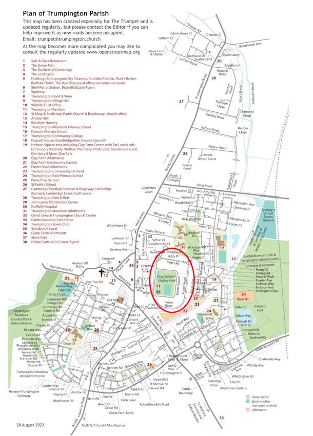
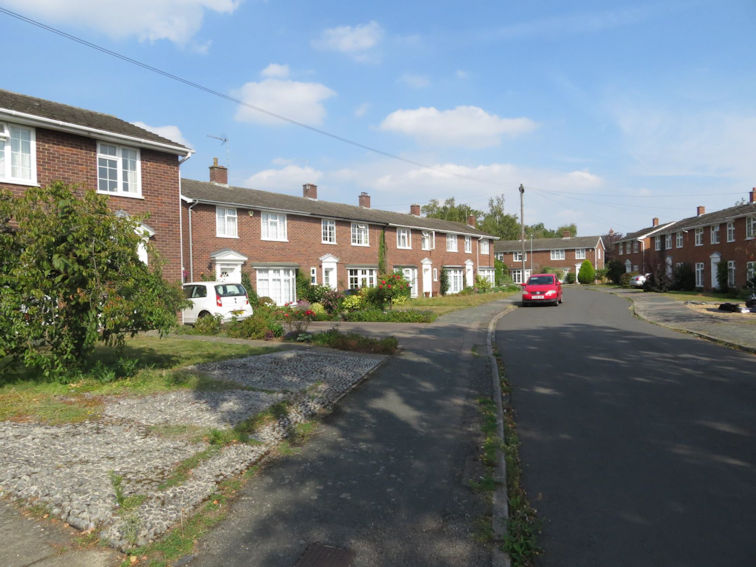
The first major housing development was the building of the council estate, with three roads, Byron Square Foster Rd Paget Rd and Paget Close. The estate is outlined in red on this map taken from The Trumpet, the parish magazine, drawn by Sheila Betts, showing the whole of the ecclesiastical parish, the church parish as it is nowadays. This excludes some former parts of the parish such as the Addenbrooke’s area and Red Cross Lane. I am very grateful to Sheila that she has made this available.

Trumpington with the post-war Council Estate outlined, based on The Trumpet map, August 2023. Sheila Betts and Howard Slatter.

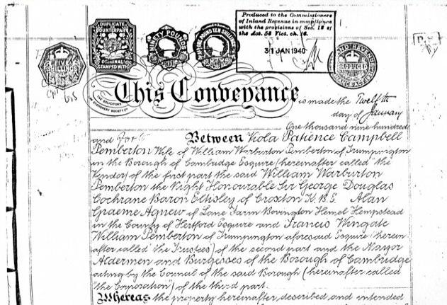
The first idea of the estate was mooted in 1936 by the Cambridge Borough Council, just two years after it had absorbed Trumpington into Cambridge. The proposal grew quite rapidly and by 1939 the Council was getting ready to start building, but the war got in the way. This document is a copy of the conveyance in 1940 from the Pemberton trustees, who owned the land, to the Borough Council. The principal signatory at the top is Viola Pemberton wife of William Warburton Pemberton. The second schedule attached to this conveyance contains the following words: “the council are not to use the property hereby conveyed for any other purpose than for housing of the working classes”.

The Conveyance of the land from the Pemberton Trustees to the Council, January 1940: front page. Source: Antony Pemberton.

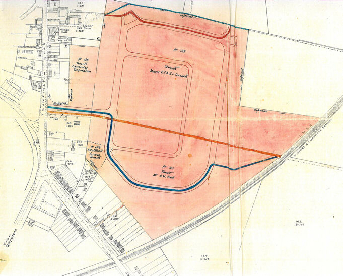
This is the land that the working classes were to be housed on. It includes the allotment land discussed by Andrew Roberts at the meeting in September 2023.

The Conveyance of the land from the Pemberton Trustees to the Council, January 1940: plan. Source: Cambridge City Council.

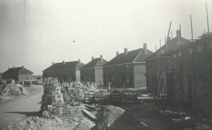
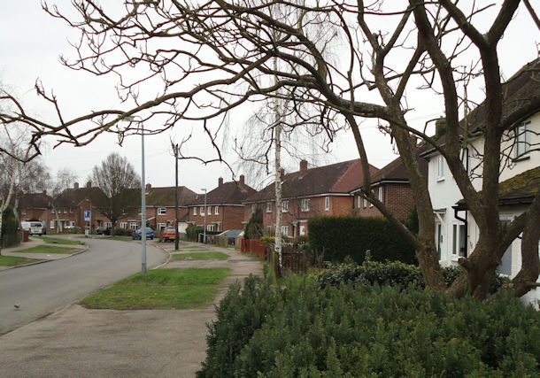
Here are some of the first houses being built in Foster Road in 1946 and the same view in September 2023.

Construction of homes in Foster Road, c. 1946. Cambridgeshire Collection.
Foster Road in September 2023. Photo: Howard Slatter.

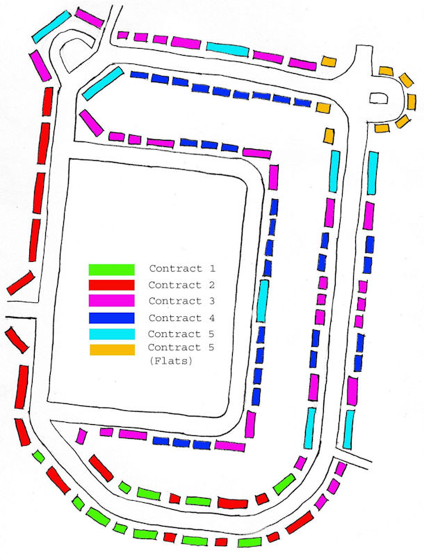
The website has a lot of detail about the building of the estate and maps showing how it developed. There were several different phases, different builders and different designs of houses and this shows you all of those different phases once the estate was complete.

The five contracts for house building on the Estate, 1946-48. Plan by Howard Slatter.

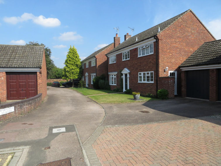
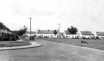
The first photograph was taken after completion of Paget Road and Byron Square, in something like 1950, with a comparable view in 2023.

Paget Road in the 1940s. Source: Brenda Bass.
Paget Road and Byron Square, September 2023. Photo: Howard Slatter.

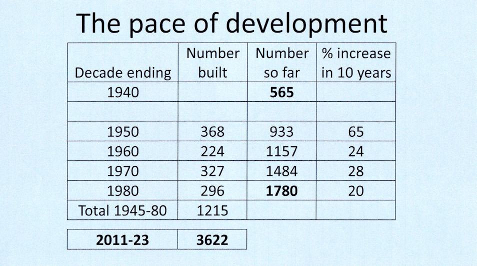
I would now like to look at how fast things moved on during the period that we are talking about. In 1940 at the start of the war there were 565 dwellings in the parish. The building of the estate added 360 to that number. There were a few more elsewhere, so by 1950 the number of dwellings had increased by nearly two thirds (65%). In the subsequent decades, it kept climbing but not as dramatically as it did in those first years after the war. By 1980, the total number of dwellings was 1722. This is not perfectly accurate as there was some demolition and rebuilding and little bits of in-filling.

We are not discussing the period after 1980 but note that during the 1980s and the 1990s and the first decade of the 21st century the number really did not grow very much, as there was not much land left to build on. However, since 2010 there has been an enormous increase in the number of houses and flats, as a consequence of the land that formerly being Green Belt in the Cambridge Southern Fringe becoming available for development.

Statistics of housing developments in Trumpington, 1940s to 2023. Howard Slatter.

I will now review some of these developments in the village and parish, decade by decade.

1950s

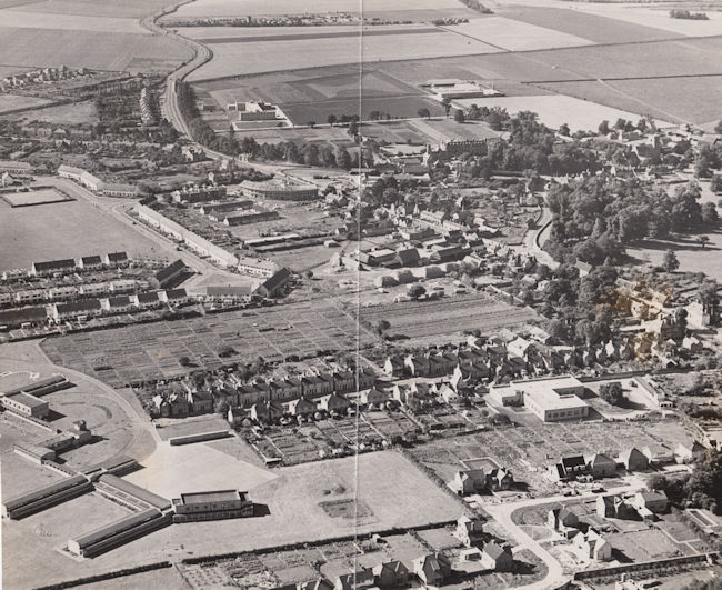
An aerial photograph dating from 1955 shows the new estate. Anstey Way is now being built, with no glass in the windows as yet.

Aerial view of Trumpington from the north east, 1955. Includes the village core, High Street, Church Lane, Shelford Road, Bishop's Road, Hauxton Road, Anstey Hall, Church, PBI headquarters building and grounds, Cambridge-Bedford railway line, Anstey Hall Farm shepherd's cottage and hay stacks, former PoW Camp, the Estate and King George V recreation ground (with bowling green), Anstey Way with shops under construction, Alpha Terrace, Fawcett School, allotments, Wingate Way under construction, The Red Lion, Manor Farm with hay ricks, Village Hall, blacksmiths. Cambridgeshire Collection.
Aerial view of Trumpington from the north east, 1955. Includes the village core, High Street, Church Lane, Shelford Road, Bishop’s Road, Hauxton Road, Anstey Hall, Church, PBI headquarters building and grounds, Cambridge-Bedford railway line, Anstey Hall Farm shepherd’s cottage and hay stacks, former PoW Camp, the Estate and King George V recreation ground (with bowling green), Anstey Way with shops under construction, Alpha Terrace, Fawcett School, allotments, Wingate Way under construction, The Red Lion, Manor Farm with hay ricks, Village Hall, blacksmiths. Cambridgeshire Collection.

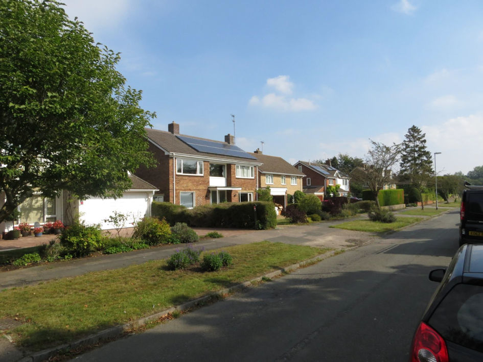
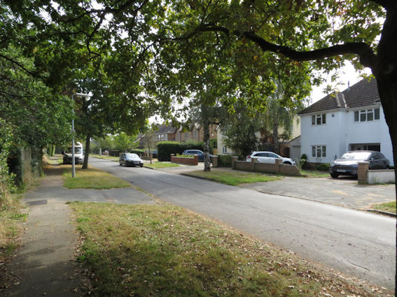
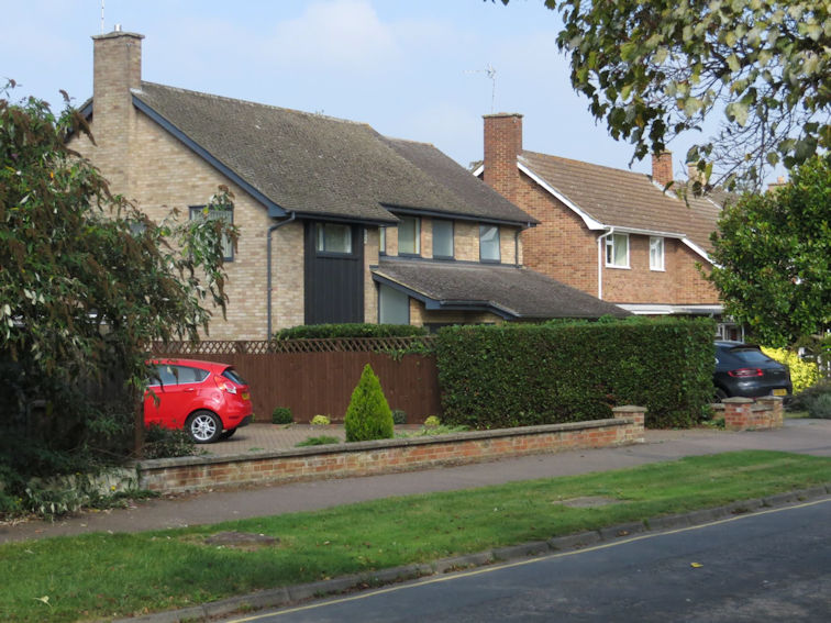
This table summarises the main new developments in the 1950s. Anstey Way is the biggest and others include Porson Road and Wingate Way. The location of the 1950s developments has been highlighted on the map. Notice that most of these are on former green field sites, away from the main built up areas of the village. One exception is Anstey Way itself but even that of course was built on a recreation ground.

Housing developments in Trumpington, 1951-1960. Howard Slatter.
Trumpington with 1950s housing developments outlined, based on The Trumpet map, August 2023. Sheila Betts and Howard Slatter.

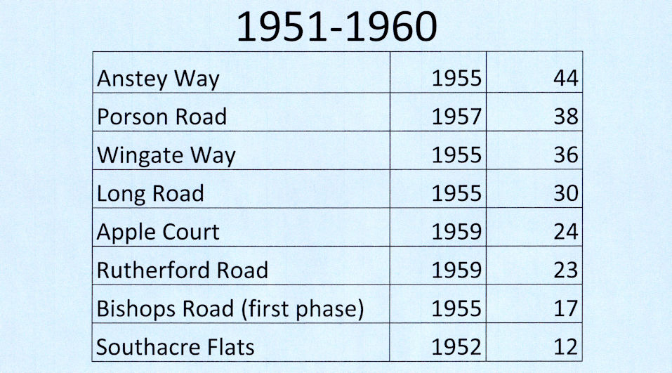
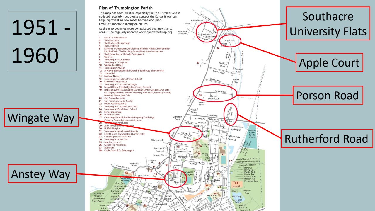
Porson Road: Richard Porson was a fellow of Trinity College and this road was built on Trinity land.

Wingate Way: named after William Warburton Wingate, who married Viola Pemberton, one of the signatories of the conveyance. This was Pemberton land.

Porson Road, September 2023. Photo: Howard Slatter.
Wingate Way, September 2023. Photo: Howard Slatter.

Rutherford Road on Trinity land again. Lord Rutherford, Ernest Rutherford, was a pioneering researcher in atomic and nuclear physics.

Apple Court in Newton Road, on Trinity land again, commemorating Newton’s apple.

Rutherford Road, September 2023. Photo: Howard Slatter.
Apple Court, September 2023. Photo: Howard Slatter.

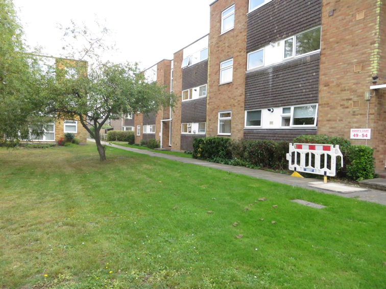
The University’s Southacre flats were built in the grounds of Southacre House which was still standing at this time, before it was demolished in about 1980.

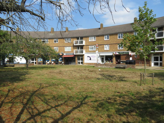
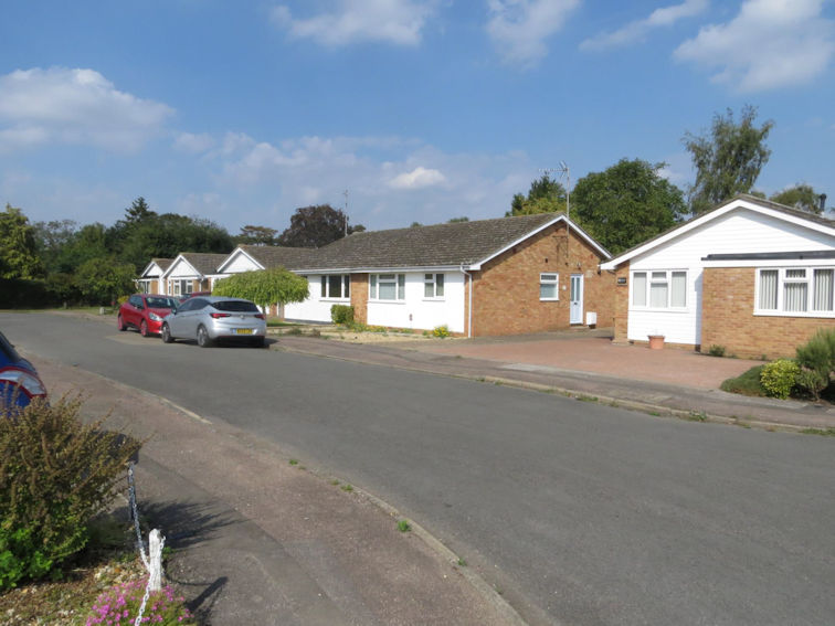
Anstey Way named after Christopher Anstey of Anstey Hall, a Council development of shops, flats and old people’s bungalows.
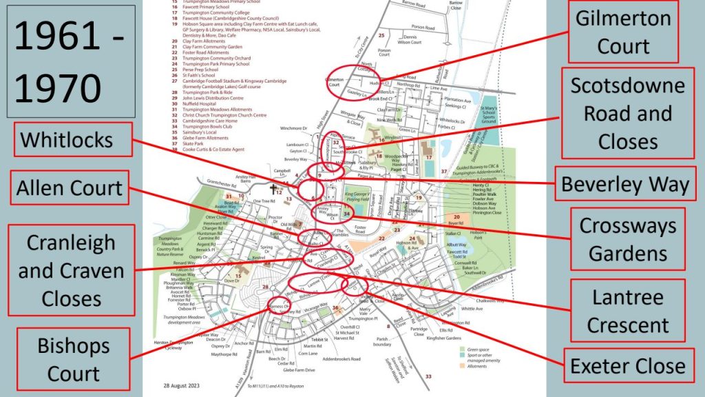
Southacre, September 2023. Photo: Howard Slatter.
Anstey Way, September 2023. Photo: Howard Slatter.

1960s

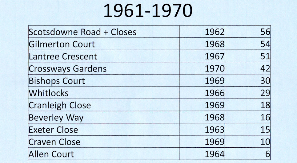
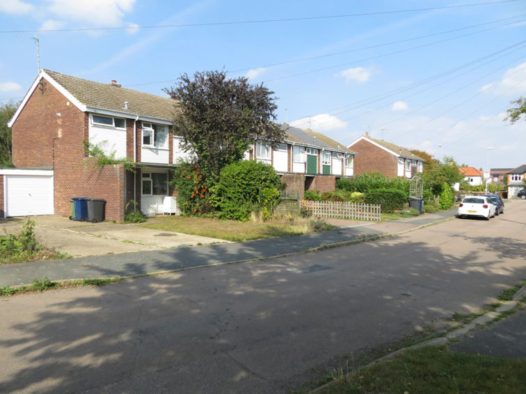
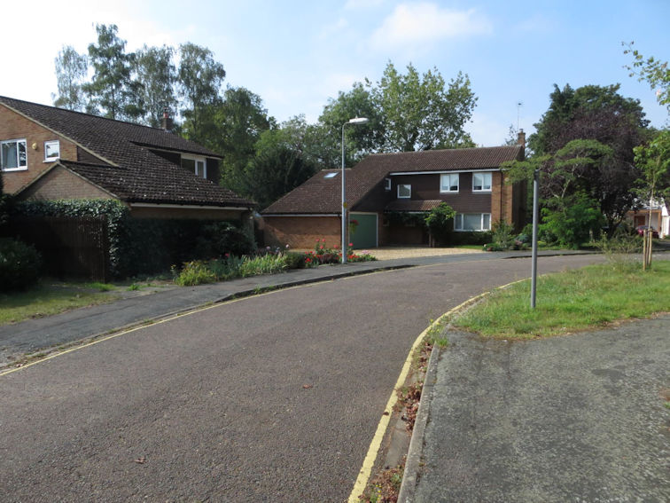
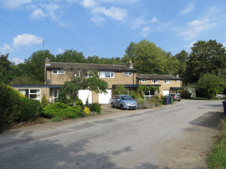
This table and map summarise the main developments in the 1960s. Nearly all of the development is taking place within the existing village, on smaller bits of land.

Housing developments in Trumpington, 1961-1970. Howard Slatter.
Trumpington with 1960s housing developments outlined, based on The Trumpet map, August 2023. Sheila Betts and Howard Slatter.

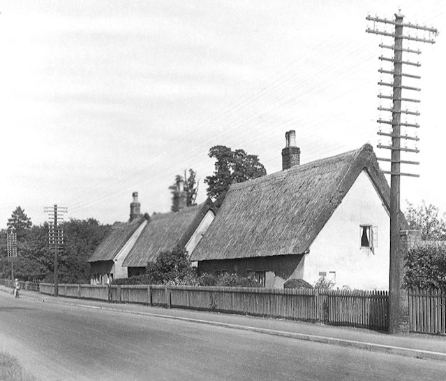
Three double cottages stood in the High Street north of Alpha Terrace. They were demolished in 1963 to make room for a number of houses, 37-43 High Street.

Thatched cottages in the High Street, between Wingate Way and Alpha Terrace, before 1963 when the houses were demolished and replaced with 37-43 High Street. Photo: Josephine Kitson. Reproduced in Trumpington Past & Present, p. 66.
39A-43 High Street, September 2023. Photo: Howard Slatter.

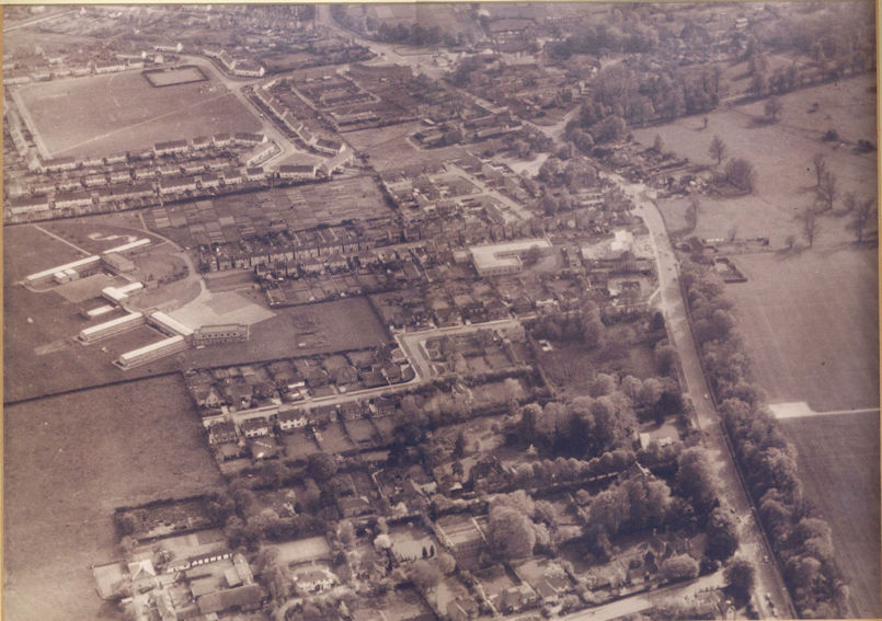
This aerial photograph dates from 1964. Notice the new roads, Scotsdowne Road and Wingate Way. Thanks to Barry and Joy Thompson for this particular photograph.

Aerial view of Trumpington from the north, 1964. Includes the village core, High Street, Church Lane, the Estate and King George V recreation ground, Anstey Way, Alpha Terrace, Fawcett School, allotments. Source: Barry Thompson.

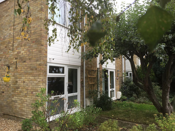
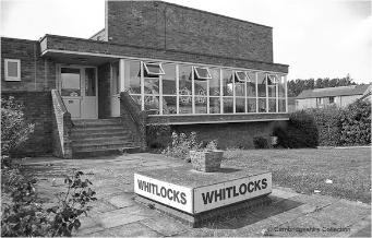
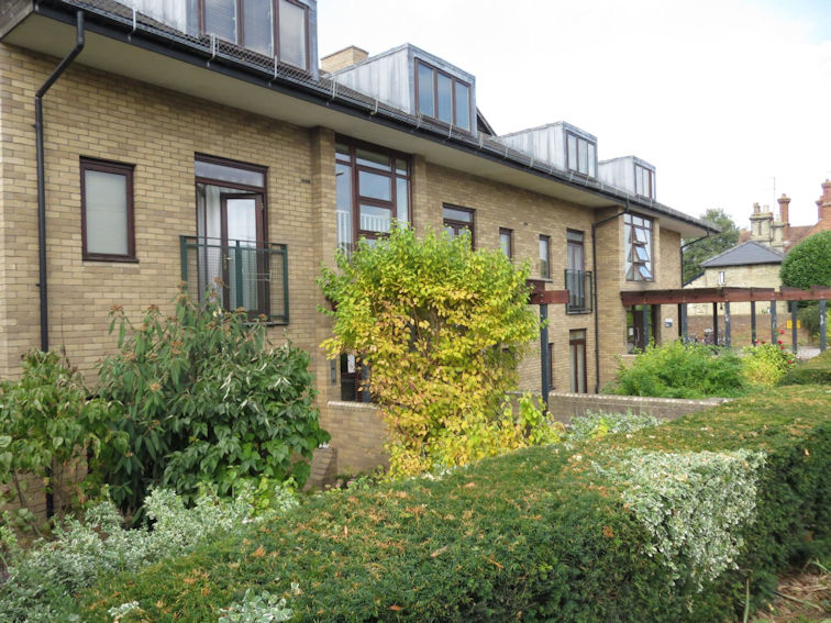
Whitlocks on the High Street was built in 1966, as flats for older people. It replaced Whitelocks Yard, which had stood in various forms on this site, on land that had been left to the parish by George Whitelock in his will in 1724. It was again rebuilt in 2004.

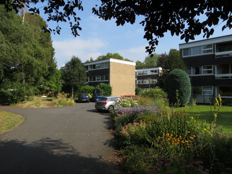
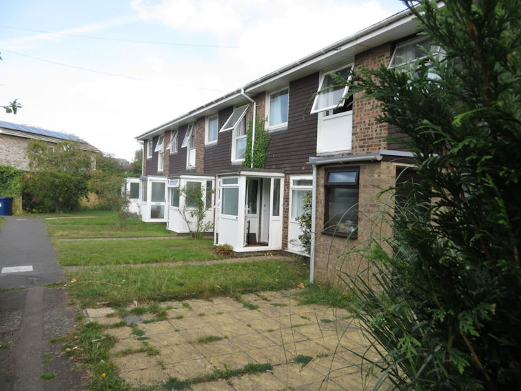
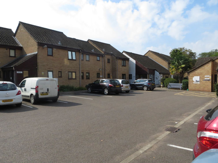
Crossways Gardens was built in 1970, in the gardens of Crossways House. Crossways House itself was just off to the left of this picture and all the land attached to it was a nursery garden. Crosswords House is now gone and the new second phase of flats, also called Crossways House, visible on the left, has now been replaced.

Whitlocks, c. 2000. Photograph: Jo Elliot (Stephen Brown).
Whitelock's Yard, c. 1880. Cambridgeshire Collection.
Whitelock’s Yard, c. 1880. Cambridgeshire Collection.
Aerial photograph with Crossways Gardens to the right and Crossways House to the left, off Anstey Way, in the 1990s. Cambridge Evening News. Source: Sheila Betts (Trumpington Past and Present, p. 84-85.

Gilmerton Court on Trumpington High Street was built on the site of an early 20th century house called Gilmerton.

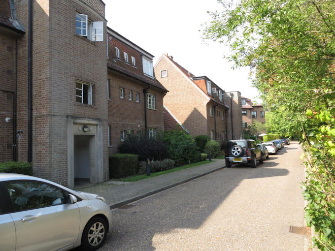
Lantree Crescent, off Bishop’s Road, was named after the developers of the road.

Gilmerton Court, September 2023. Photo: Howard Slatter.
Lantree Crescent, September 2023. Photo: Howard Slatter.

We are not sure of the source of the name Scotsdowne Road but it may have been named after the Scott family who built much of Alpha Terrace. Scotsdowne Road joins Alpha Terrace.

Bishop’s Court was built at the end of Bishop’s Road. We are not absolutely sure about why it is Bishop’s Road and Bishop’s Court but probably after a man called Arthur Bishop who died in 1919 who was a great benefactor to the church and to the village. Bishop’s Road is built on church land.

Scotsdowne Road, September 2023. Photo: Howard Slatter.
Bishop’s Court, September 2023. Photo: Howard Slatter.

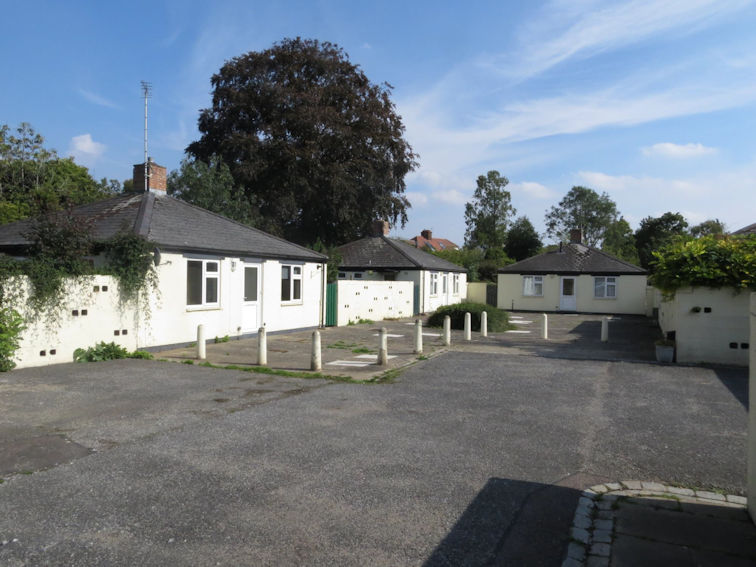
Allen Court, Hauxton Road, was built on more church land and named after Thomas Allen who was a benefactor of the parish in the 17th century. These bungalows were built for retired clergy.

Craven Close and Cranley Close were built off Shelford Road. We do not know why they are called what they are.

Allen Court, September 2023. Photo: Howard Slatter.
Craven Close, September 2023. Photo: Howard Slatter.

There are also queries about the names of Exeter Close, off Shelford Road, and Beverley Way, off the High Street (possibly Exeter Cathedral and Beverley Minster?).
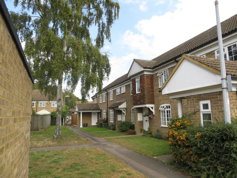
Exeter Close, September 2023. Photo: Howard Slatter.
Beverley Way, September 2023. Photo: Howard Slatter.

1970s

Now the final decade.

Housing developments in Trumpington, 1971-1980. Howard Slatter.
Trumpington with 1970s housing developments outlined, based on The Trumpet map, August 2023. Sheila Betts and Howard Slatter.

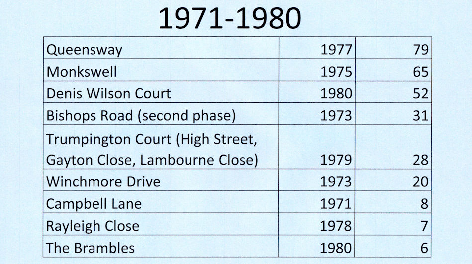
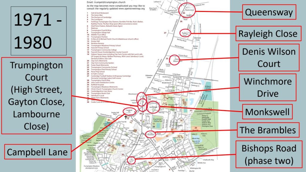
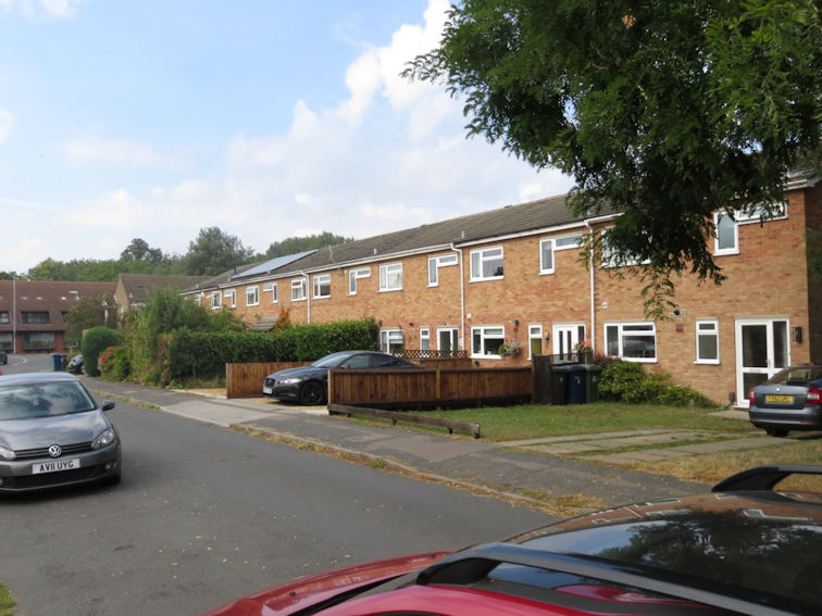
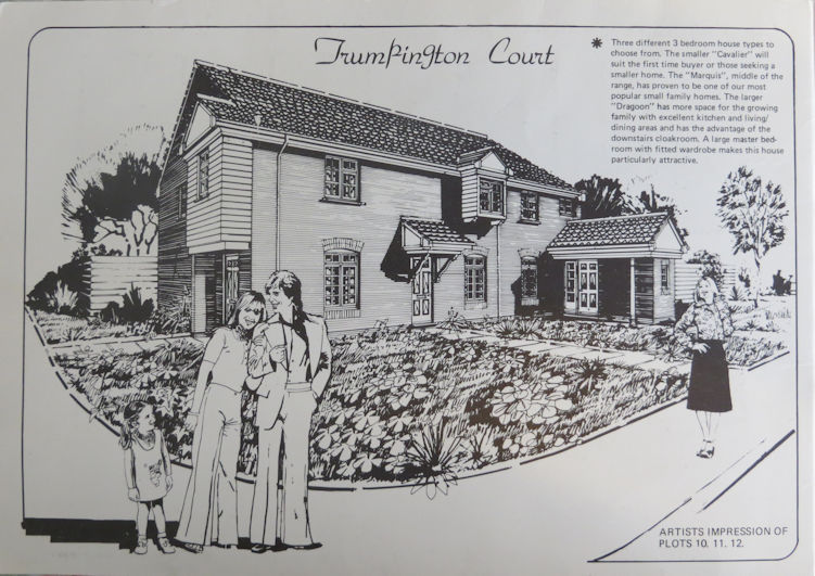
Trumpington Court was new houses built in 1979, partly in the High Street but also two new roads behind, Gayton Close and Lambourne Close. These were built mainly on the site of the former pub the Red Lion, which was almost opposite the War Memorial.

Artist’s impression of Trumpington Court, sales brochure, 1971. Pam Ford.
Trumpington War Memorial and the Red Lion, 1969. Cambridgeshire Collection. Frith Collection, TM.30.

Queensway was named after the Queen’s Silver Jubilee in 1977, when the flats were built off Trumpington Road.

Rayleigh Close was built off Newton Road. Lord Rayleigh was another Trinity fellow and physicist, with discoveries to his name in many branches of the science.

Queensway, September 2023. Photo: Howard Slatter.
Rayleigh Close, September 2023. Photo: Howard Slatter.

Campbell Lane was built off Grantchester Road. Patience Campbell was the mother of Viola Pemberton.

Monkswell was built on former allotment land off Paget Road. We do not know the origin of the name.

Campbell Lane, September 2023. Photo: Howard Slatter.
Monkswell, September 2023. Photo: Howard Slatter.

Bishop’s Road was extended at this time.

Denis Wilson Court, Porson Road, was planned. Denis Wilson was the national treasurer of the Royal British Legion in 1980 when these were built, originally for ex-servicemen and service women.

Bishop’s Road, September 2023. Photo: Howard Slatter.
Denis Wilson Court, Porson Road, September 2023. Photo: Howard Slatter.

Gayton Close is part of Trumpington Court, with Gayton a developer’s name.

Winchmore Drive was built off the High Street. We do not know the origin of that name.

Gayton Close, September 2023. Photo: Howard Slatter.
Winchmore Drive, September 2023. Photo: Howard Slatter.

Finally, the Brambles was built off Shelford Road. Again, we do not know the origin of that name, it may have just been a pretty name chosen by the builders or may be because this land was neglected and overgrown covered in brambles!

The Brambles, September 2023. Photo: Howard Slatter.