Edited by Andrew Roberts
Trumpington’s history in the second half of the 20th century, including the development of Fawcett School and local community facilities. One of a series of pages with Trumpington’s timeline.
January 1951
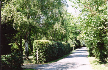
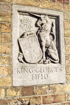
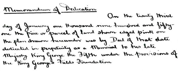
The King George’s Playing Field was dedicated in 1951, as part of a network of playing fields established by the King George’s Fields Foundation as a memorial to King George V (1865-1936). In the late 1950s, a Pavilion was built to provide changing rooms and refreshments for local cricket and football teams. This was rebuilt in 2009.
Sources of information: History of Trumpington Pavilion (TRA).
Local History Group web page: King George V Playing Field.
July 1951
The Royal Show was held from 3-6 July 1951 on land between Shelford Road and the Bedford-Cambridge railway line, which became known as the Showground site. The Royal Agricultural Society of England had been organising an annual Royal Show since 1839, with the venues moving from place to place.
Sources of information: Trumpington Local History Group (2000). 20th Century Trumpington, page 29. Trumpington Local History Group (2003). Trumpington Past & Present, page 131.
Local History Group web page:
1952-55
Development of the Plant Breeding Institute (PBI): this had been established in 1912 as part of the Cambridge University School of Agriculture. It moved to a site off Maris Lane to the south of Anstey Hall in 1954 and was officially opened in 1955.
Sources of information: Trumpington Local History Group (2000). 20th Century Trumpington, page 29.
Local History Group web page: Notes on the History of the Plant Breeding Institute.
1954
The Perse Preparatory School moved from Bateman Street, Cambridge, to Leighton House, Trumpington Road (the former home of Robert Sayle).
Sources of information: Mitchell, S.J.D. (1976). A History of the Perse School, 1615-1976 .
Local History Group web page: Reminiscences of the Perse Preparatory School.
mid 1950s
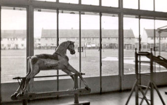
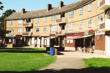
Construction of the shops and flats on Anstey Way. The shops were built on the former Recreation Ground which continued in use for some years after the construction of the Estate and the opening of the new playing field.
Sources of information:
Local History Group web page: The Estate.
1957-
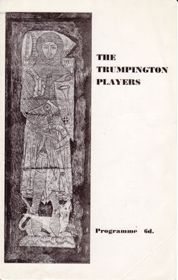
A local group called the Trumpington Players gave a series of performances (including 1957, 1958 and 1960) in aid of local charities.
Sources of information: Trumpington Local History Group (2000). 20th Century Trumpington , page 33.
1960-61
The Royal Show was again held on the Showground site between Shelford Road and the Bedford-Cambridge railway line (the second and third instances after the initial event in 1951). From 1963-2009, the Show as held at Stoneleigh Park, Warwickshire.
Sources of information: Royal Show web site. Trumpington Local History Group (2000). 20th Century Trumpington, page 36.Trumpington Local History Group (2003). Trumpington Past & Present, page 131.
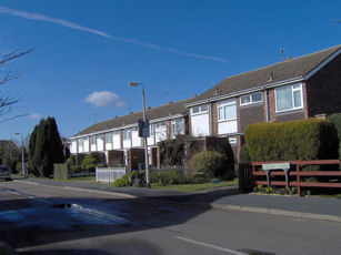
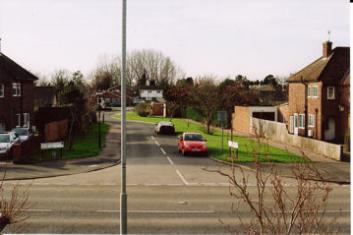
1960s
Another phase of extensive house building changed the layout and feel of the village. This included old properties being demolished and replaced and new developments being constructed. The affected areas included the original Whitelock’s Yard on the west side of the High Street (demolished c. 1963 and replaced by Whitlock’s [sic] social housing c. 1968); cottages between Wingate Way and Alpha Terrace (demolished 1964 and replaced by a terrace); Allen Court built in 1964 on glebe land to the west of the Hauxton Road cemetery; Lantree Crescent built from 1963 on a field to the north of Bishop’s Road; Exeter Close built from 1962 off Shelford Road; and Cranleigh Close and Craven Close built in 1968 on a former quarry site to the west of Shelford Road.
Sources of information: Trumpington Local History Group (2000). 20th Century Trumpington, page 37-38.
Local History Group web page: What is the Connection? (Beverley Way and Exeter Close).
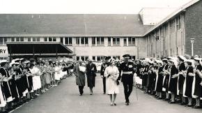
1961-62
Stage I in the redevelopment of Addenbrooke’s Hospital on a new site off Hills Road to the east of Trumpington. The hospital first identified a long-term plan to acquire land in Trumpington in 1948. Building work was completed in 1961 and Phase I was opened by the Queen in 1962.
Sources of information: Rook, Arthur, Carlton, Margaret and Cannon, W. Graham (1991). The History of Addenbrooke’s Hospital Cambridge . Cambridge: CUP. Pages 401, 425.
Local History web page: Addenbrooke’s Hospital: Yesterday and Today.
1968-69
Closure of the Bedford-Cambridge railway line in January 1968 and the removal of the track through Trumpington in 1969. The line was subsequently filled in to the south west of Hauxton Road and reused as agricultural land. The cutting between Hauxton Road and Shelford Road and a short distance to the north east and the remaining route to the north of Long Road was used as a nature reserve and footpath until the late 2000s, when it was converted into the route for the Cambridgeshire Guided Busway from the Park & Ride site to Cambridge railway station.
Sources of information: Trumpington Local History Group (2000). 20th Century Trumpington, page 38.
Local History Group web page: Introduction to Railways and The Railways of Trumpington, 1845-2010.

1968
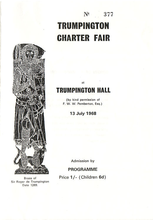
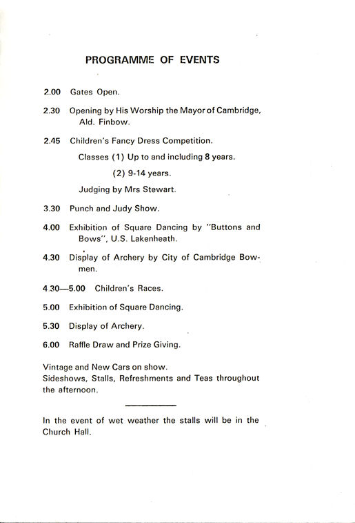
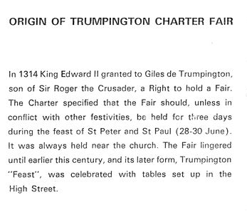
A modern version of Trumpington Charter Fair was held in July 1968.
Sources of information: Trumpington Local History Group (2000). 20th Century Trumpington, page 33.
Local History Group web page: Trumpington Charter Fair, 1968.
1968-
Construction of Beverley Way to the east of the High Street, immediately to the north of the Village Hall, on the site of Manor Farm.
Sources of information: Village Hall archive.
Local History Group web pages: What is the Connection? (Beverley Way). History of the Village Hall, 1960s.
1969
Initial designation of a Conservation Area in the centre of the village on 25 February 1969 (extended in 1998).
Sources of information: Cambridge City Council web site.
Local History Group web page:
1969-70
Stage II in the development of Addenbrooke’s Hospital on the new site, including the main ward block and the staff recreation centre (the Frank Lee Centre). The Frank Lee Centre was funded by the Development Trust chaired by Sir Francis Pemberton who also donated the land.
Sources of information: Rook, Arthur, Carlton, Margaret and Cannon, W. Graham (1991). The History of Addenbrooke’s Hospital Cambridge. Cambridge: CUP. Pages 437-38.
1975
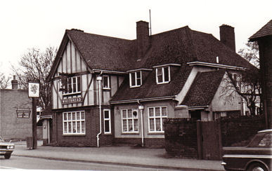
Closure and demolition of the Red Lion public house on the east side of the High Street near the War Memorial. The original Red Lion had been demolished in 1936, this version had a shorter history. The site was used for housing.
Sources of information:
Local History Group web page: The Red Lion public house.
1977
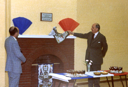
The 1920s extension of the Village Hall was rebuilt as the Jubilee Room, including a new kitchen and cloakroom, opened in June 1977. The name commemorates the Silver Jubilee (1952-77) of Queen Elizabeth II.
Sources of information: Village Hall archive.
Local History Group web page: History of the Village Hall, 1970s.
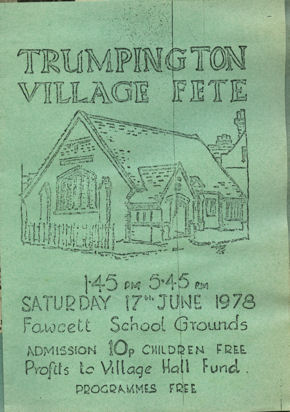
1977-79
Councillor Jane Brookes, Shirley Brown and others arranged a series of village fetes, partly to raise funds towards the cost of the Jubilee Room.
Sources of information: Trumpington Local History Group (2000). 20th Century Trumpington, page 47.
Local History Group web page: History of the Village Hall, 1970s.
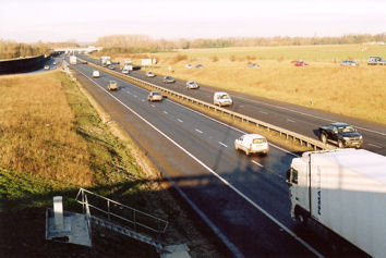
1977-80
Construction of the M11 motorway to the south west of the village. A Public Inquiry into the route of the Cambridge Western Bypass (the M11) and the Northern Bypass (now the A14) was held in 1972 and the local route was built between summer 1977 and February 1980. The road crossed the southwestern side of the parish, with a roundabout at the junction with the A10 and a cutting between there and the river bridge. A metal fence was erected to the south west of the cutting, to screen the radio telescopes at Lord’s Bridge. The road bisected the farmland used by the Plant Breeding Institute, near the area dug for coprolites in World War I. The river crossing was close to the former railway bridge on the Bedford-Cambridge line. Prior to the opening of the bypass, there had been heavy congestion in the morning rush-hour on routes into Cambridge such as Shelford Road, with cars often queuing as far as Cambridge Road, Great Shelford.
Sources of information: Cooper, Anthony J. (2000). Planners and Preservationists. The Cambridge Preservation Society and the City’s Green Belt, 1928-1985.
1982
Publication of the Trumpington entry in The Victoria History of the Counties of England.
Sources of information: The Victoria History of the Counties of England (1982). A History of Cambridgeshire and the Isle of Ely, Volume VIII. Armingford and Thriplow Hundreds. Trumpington.
1985-86
Demolition of the village blacksmiths which had been at the junction of the High Street and Church Lane overlooking Cross Hill and the War Memorial for many years. It was replaced by Bidwell’s estate agency (now Ashcroft’s).
Sources of information: Trumpington Local History Group (2000). 20th Century Trumpington, page 53.
Local History Group web page: Walk around the village centre, 2011.
1986
Publication of Shirley Brown’s Trumpington in Old Picture Postcards , with over 75 reproductions of postcards of Trumpington from 1880 to 1930.
Sources of information: Brown, Shirley (1986). Trumpington in Old Picture Postcards.
1986
Formation of the Trumpington Environmental Action Group (TEAG), with Mrs Jane Brookes (County Councillor at the time), Ken Fletcher, Cynthia and Ian Levine, Robert Hall and Hiltrud Hall as founder members and Professor Glanville Williams as Chairman. Plans to create a Southern Relief Road were successfully fought by TEAG, in the 1980s and again in the early 1990s. The Group wound up in 2007.
Sources of information: TEAG members. Trumpington Local History Group (2000). 20th Century Trumpington, page 54.
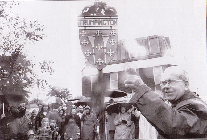
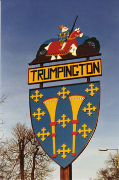
1987
Erection of the first village sign, at the junction of the High Street and Maris Lane. The project was the inspiration of Councillor Betty Suckling, who organised the fund-raising. The sign was designed by Philip Jordan and made by Stephen Harris, both local residents. The sign was renovated in 1998 and replaced in 2010.
Sources of information: Trumpington Local History Group (2000). 20th Century Trumpington, page 54.
Local History Group web page: The original Village Sign.
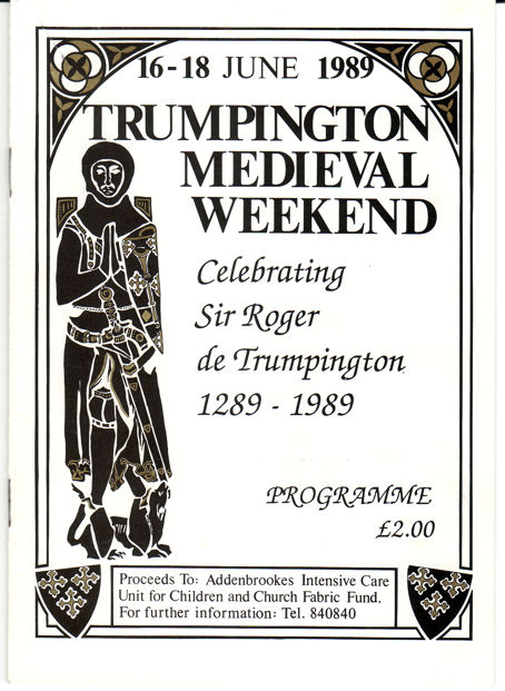
1989
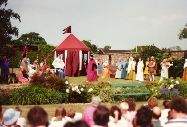
The Trumpington Medieval Weekend was held on 16-18 June 1989, in celebration of Sir Roger de Trumpington, who died in 1289. There were events over three days in the Parish Church and Trumpington Hall.
Sources of information: Trumpington Local History Group (2000). 20th Century Trumpington, page 56.
Local History Group web page: Trumpington Medieval Weekend, 1989.
1989
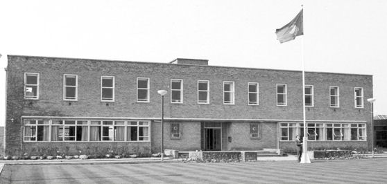
Merger of infant and junior schools to form Fawcett Primary School from September 1989.
Sources of information: Trumpington Local History Group (2000). 20th Century Trumpington, page 56.
Local History Group web page: History of Fawcett School.

1992
Formation of The Trumpington Residents’ Association (TRA). The original aim was to represent the views of people living in the area of Paget Road, Foster Road, Byron Square and Monkswell. With the growing development pressures, the remit was subsequently extended to the whole parish.
Sources of information: TRA Web site and members.
1992-93
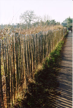
Diversion of the footpath between Shelford Road and Foster Road to go along the edge of the Trumpington Allotment site rather than through the centre of the site, after a public inquiry about the long-established use of the path. The initial fencing was supplemented by a hedgerow in the mid-2000s.
Sources of information: Trumpington Local History Group (2000). 20th Century Trumpington, page 60.
1995
Formation of the Trumpington Local History Group (TLHG). The then Vicar, Nicholas Thistlethwaite, had a visit from Reginald Robinson, who was born in the School House in 1909. Reginald brought with him his late father’s magic lantern slides and lecture notes. Reginald’s father, Percy, was the village schoolmaster from 1908 until his sudden death in 1943. The vicar, with Edmund and Arthur Brookes, re-created one of his lectures as a A Trip Through Trumpington. Seeing the interest generated by this show, Arthur Brookes suggested forming a History Group and the group has met regularly ever since.
Sources of information: TLHG Web site and members. Trumpington Local History Group (2000). 20th Century Trumpington, page 62.
Local History Group web site.
1997
Trumpington became part of the South Cambridgeshire parliamentary constituency, Andrew Lansley (Conservative) elected MP.
Sources of information: Parliamentary Constituencies in Cambridgeshire (Wikipedia).
1998
Extension of the Conservation Area (original designation in 1969). The area includes the triangle formed by the High Street, Maris lane and Church Lane, Anstey Hall and Trumpington Hall. There was a further revision in 2010.
Sources of information: Cambridge City Council. Planning Department (1998). Trumpington. Conservation Area Appraisal. Cambridge City Council Web site.
Local History Group web page:
1998
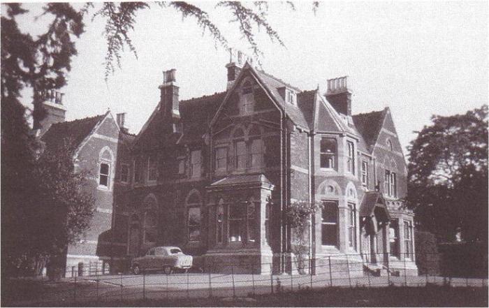
Purchase of Anstey Hall by John de Bruyne.
Sources of information: Trumpington Local History Group (2000). 20th Century Trumpington, page 63.
2000
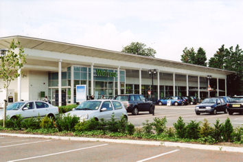
Construction of a Waitrose food store on part of the Monsanto (PBI) site, in the former grounds of Anstey Hall. The store opened on 24 October 2000 and was extended in 2005.
Sources of information: Cambridge 2000 Web site. Trumpington Local History Group (2000). 20th Century Trumpington, page 63.
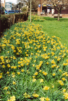
2000
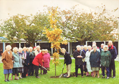
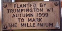
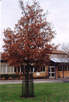
The new millennium was commemorated by a series of activities. 5000 daffodils were planted by the Trumpington Tuesday Group in front of the shops on Anstey Way and the verge by the cemetery on Shelford Road. The Trumpington Charity donated a seat on the green in front of the shops. The Women’s Institute planted an oak sapling in the grounds of Fawcett School. The Local History Group published 20th Century Trumpington.
Sources of information: Plaques about the daffodils and the tree. Trumpington Local History Group (2003). Trumpington Past & Present. Page 119.
2000
The Southacre conservation area was designated by the City Council in February 2000, with support from Southacre, Latham Road and Chaucer Road Residents ‘ Association (SOLACHRA). Bordered by the River Cam and Trumpington Road, the area covers Chaucer Road and Latham Road. It was revised in 2013.
Sources of information: Cambridge City Council conservation areas: Southacre Appraisal and Map.