South West Trumpington: 5000 Years from Prehistory to Trumpington Meadows

Andrew Roberts, April 2024

This page is about the south west part of the historic parish of Trumpington. It is based on a presentation given at the Local History Group meeting about South-West Trumpington: 5000 Years from Prehistory to Trumpington Meadows, held on 29 February 2024.

Where?

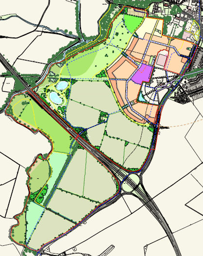
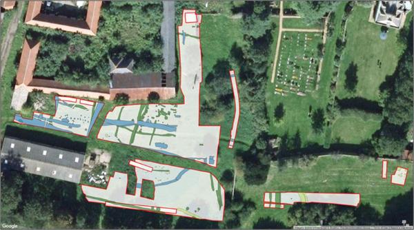
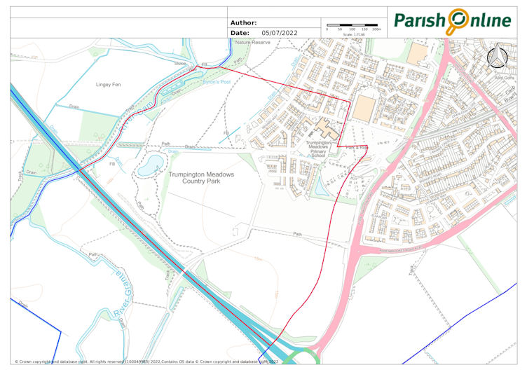
Up to 1934, the parish extended south to the river bridge near Hauxton Mill. The focus of this page is on the land from Grantchester Road and the village to Hauxton Mill, with the river to the west and Hauxton Road to the east. Most of this area is the land purchased by Grosvenor in 2004, shown on their masterplan before work began on the development of Trumpington Meadows.

Trumpington Meadows Combined Masterplan, June 2007. Source: Grosvenor.

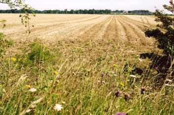
The land slopes up from the river to a ridge. The river and the ridge have provided a north-south communication route for thousands of years. There has also been a crossing point over the river between Grantchester and Trumpington, part of an east-west communication route. The fertile land has been well used for farming throughout the 5000 years.

When?

The scope is 5000 or more years:

c. 4000 BC – c. 50 AD: Neolithic, Bronze Age, Iron Age: farming, industry, monuments, burials

c. 50 – c. 1000 AD, Romano-British, Anglo-Saxon: farming, settlement and burials, village and parish

c. 1000 – 1500 AD, Medieval: village, church, manors

c. 1500 – 2000 AD: farming, manor, railway, coprolites, plant breeding, M11

c. 2000 AD – present: Park & Ride, Waitrose, John Lewis, housing, school, country park

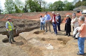
We know far more about the early history of the area than was the case 30 years ago, because of the extensive archaeological surveys and excavations carried out in advance of the housing developments. The Local History Group was fortunate to have a series of visits while the archaeological work was underway and talks by a number of the team leaders. In addition to the primary reports, the Cambridge Archaeological Unit has published a detailed survey of the results: Christopher Evans, Sam Lucy and Rickie Patten (2018). Riversides: Neolithic Barrows, a Beaker Grave, Iron Age and Anglo-Saxon Burials and Settlement at Trumpington, Cambridge (New Archaeologies of the Cambridge Region). Cambridge: McDonald Institute.

Neolithic (c. 4000-2400 BC)

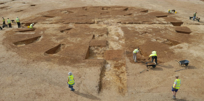
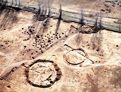
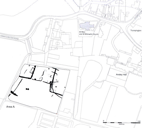
In the Neolithic period, there was a farming community living in an arable landscape. Domestic animals (including cattle) made up the main part of the diet, together with wild animals (including red and roe deer). The people built two circular ring-ditch burial monuments in a prominent position on the ridge and these may have been the focus for community gatherings and feasts. There were the remains of 3 or 4 individuals in the centre of the larger monument, buried at different times from the Early Neolithic (c. 3600 BC). These monuments were in the area to the west of the Park & Ride site, between the School and the Country Park, centred on the school playing field and the green space leading down to the park.

Work underway on one of the Neolithic monuments excavated near the Park & Ride site in 2010. Source: © Cambridge Archaeological Unit.
One of three Neolithic burial monuments being excavated on the Trumpington Meadows site (in the area of the future school playing field), with burials marked by white posts, burials in rectangular area, blue pegs marking earlier inner ring, red pegs outer ring with pottery dating from c. 3500BC, with Trumpington Church and Anstey hall in the distance. Photo: Andrew Roberts, 3 October 2010.
Looking from the Park & Ride site over the playing field at Trumpington Meadows Primary School, the area where Neolithic to Iron Age finds were identified during the archaeological excavation. Photo: Andrew Roberts, 1 February 2024.

Bronze Age, c. 2400-800 BC

The larger monument continued in use in the Bronze Age, when an outer ditch was added (Early Bronze Age, c. 2100 BC), with pottery, antler picks and an arrow head.

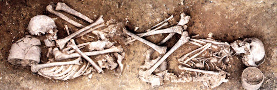
In the excavated area near the northern boundary of the site, there was a burial of a young female and a male, buried with Beaker pottery, dated to c. 2000 BC. This location was adjacent to Anstey Hall Farm, now crossed by Bead Road.

Bronze Age Beaker burial found during the Trumpington Meadows excavation. Cambridge Archaeological Unit. In Riversides, page 48, Figure 2.13.
Looking along Bead Road towards the trees along the boundary of Anstey Hall Barns. Photo: Andrew Roberts, 1 February 2024.

Iron Age, c. 800 BC – 50 AD

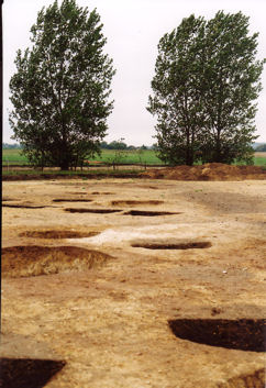
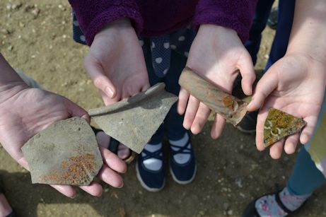
When the Park & Ride site was excavated in 2001 and again during the excavation of the Trumpington Meadows area in 2010, around 1500 pits were identified to the east of the circular monuments. There was a ditch dividing the monuments from the majority of the pits and the monuments must still have been visible and had significance to the Iron Age community. The pits were arranged in groups and were typical of those for domestic use. They were probably for grain storage and would have been sealed and the grain would have been preserved so that it could be eaten or used as seed. They were part of an extensive settlement site with enclosures and cult activity.

A reminder that this is the area now occupied by the Park & Ride site and the School playing field. At the time of the excavation, the route of the old railway line was bordered by trees.

Aerial photograph of the Trumpington Meadows excavation, with Neolithic/Bronze Age monuments and Iron Age pits and the route of the former railway line. Paul Bailey for the Cambridge Archaeological Unit. In Riversides, page 37, Figure 2.4.
A series of Iron Age pits being excavated on the Trumpington Meadows site, with the trees on the line of the old railway in the background. Photo: Andrew Roberts, 3 October 2010.
Looking from Dove Drive over the fields at Trumpington Meadows Primary School, the area where Neolithic to Iron Age finds were identified during the archaeological excavation. Photo: Andrew Roberts, 1 February 2024.

There were also Iron Age enclosures near the northern boundary, with pottery from 500-300 BC.

Romano-British, c. 50-400 AD

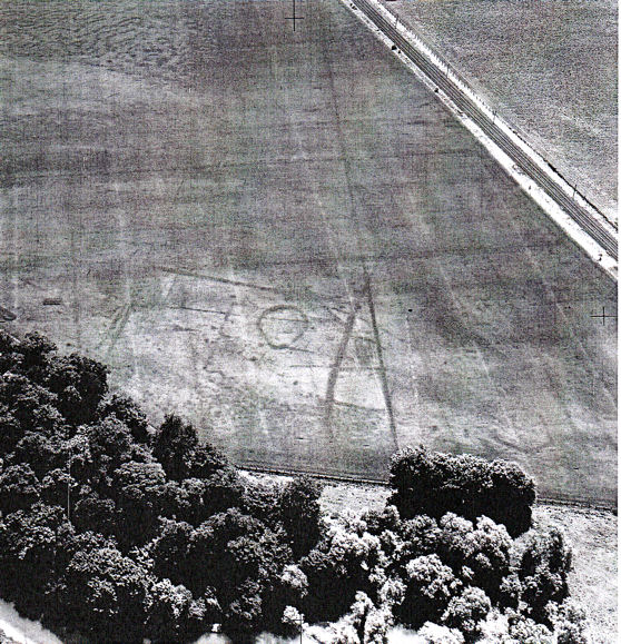
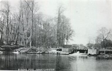
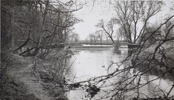
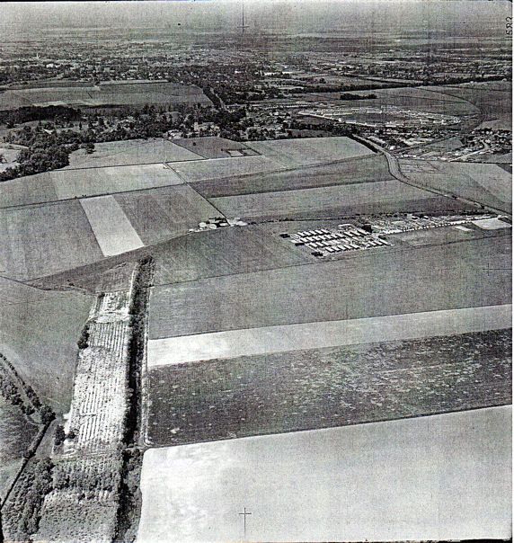
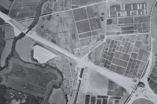
There were a number of Romano-British farms near river. Crop-mark evidence of one of these farms is shown on a 1960 aerial photograph. This is close to the river, between Byron’s Pool and the old railway embankment which can be seen to the right of the aerial photograph. Today, you can look across the site from the railway embankment.

Aerial photograph looking to the north east across the PBI fields, with the field beside the river lower centre, the Cambridge-Bedford railway line and embankment diagonal from centre right to upper right. There are crop-marks in the field known to include a Roman settlement, including a circle and rectangular enclosures. Cambridge University Collection of Aerial Photographs, ABE15, 17 June 1960.
The site of the Romano-British farm upstream from Byron’s Pool, seen from the old railway embankment. Photo: Andrew Roberts, 24 February 2024.

Early Anglo-Saxon, c. 600-700 AD

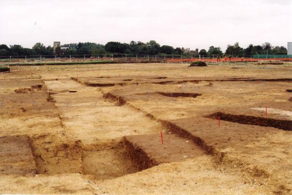
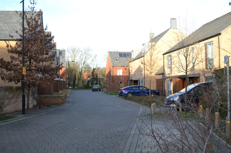
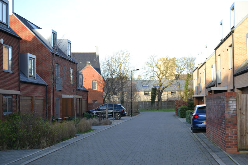
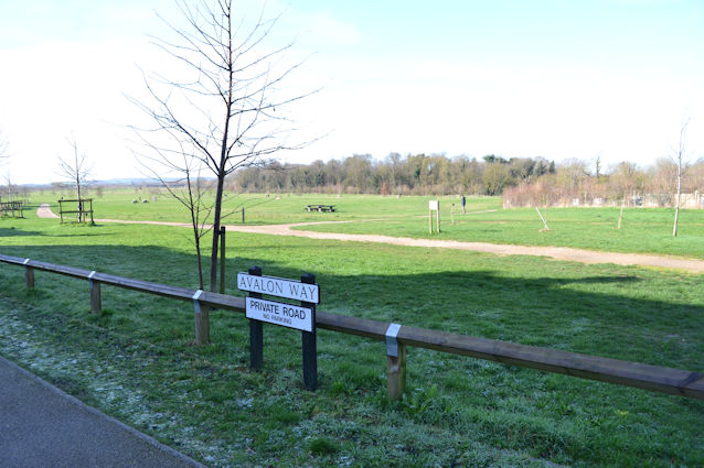
When the archaeologists excavated the northern part of the site in 2011, they found evidence of an Anglo-Saxon settlement dating from c. 600-700 AD, the precursor to Trumpington village. This was close to the boundary with Anstey Hall Farm and Barns, just to the south west of the current church. The area has since been developed, with housing along Bead Road, One Tree Road, Avalon Way and Piper Road.

Anglo-Saxon features in the northern part of the Trumpington Meadows excavation. Cambridge Archaeological Unit. In Riversides, page 308, Figure 5.1.
Looking along One Tree Road towards the trees along the boundary of Anstey Hall Barns. Photo: Andrew Roberts, 1 February 2024.

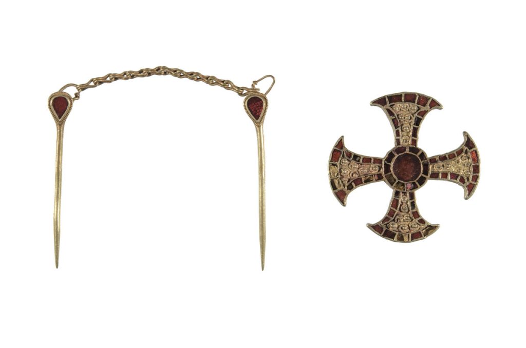
We were fortunate to have a site visit in May 2011. The area included a number of sunken structures which could have been workshops, a larger rectangular hall with evidence of metalworking, deep wells and four burial pits, one of which held a bed burial with the body of a young girl.

Participants looking at one of the Late Saxon/Early Medieval sunken structures on the Trumpington Meadows archaeological site, with the river valley in the background. Photo: Andrew Roberts, 24 May 2011.
Participants looking at one of the Late Saxon/Early Medieval sunken structures with trees marking the northern site boundary in the background, Trumpington Meadows archaeological site. Photo: Andrew Roberts, 24 May 2011.
Looking from Avalon Way over the Country Park to Byron’s Pool. Photo: Andrew Roberts, 24 February 2024.
Looking from One Tree Road to Bead Road and the trees along the boundary of Anstey Hall Barns. Photo: Andrew Roberts, 1 February 2024.

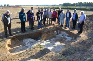
The body was lying on a bed and accompanied with grave goods, including a chain with linked pins and a beautiful solid gold pectoral cross inlaid with garnet, the Trumpington Cross. In 2024, the burial and finds are the focus of an exhibition in the Museum of Archaeology and Anthropology.

Four Anglo-Saxon burial pits, Trumpington Meadows archaeological site. Photo: Andrew Roberts, 24 May 2011.
The Trumpington Cross and chain. Photograph from Museum of Archaeology and Anthropology accession record (https://collections.maa.cam.ac.uk/objects/567097/).

Middle and Late Saxon, c. 750-900 AD

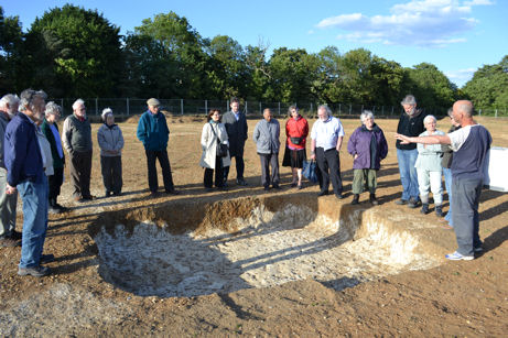
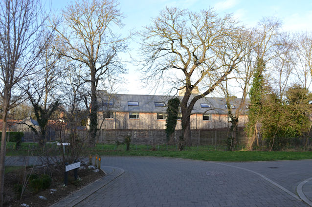
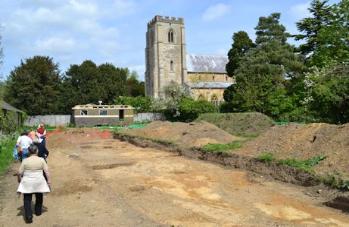
In the subsequent centuries, the settlement focus moved to the north, closer to the site of the current church. In 2015, there was an excavation by Oxford Archaeology East in the grounds of Anstey Hall Farm and we again had a site visit.

Poster for the Anstey Hall Farm open day, 10 May 2015. Oxford Archaeology East.

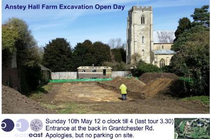
The excavated area was to the south of the farm buildings and the west of the church, where Anstey Hall Barns have now been built.

Late Saxon settlement, Anstey Hall Farm excavation (blue coloured features): structures and fences (centre left), ditch replacing earlier boundary (centre). Oxford Archaeology East.
Looking from Bead Road to Anstey Hall Barns and the church tower. Photo: Andrew Roberts, 1 February 2024.

The excavation identified a Middle and Late Saxon settlement and industrial area, including metalworking and a series of ovens, the presence of livestock, and an eastern boundary which may have continued in use up to the present day. There may have been a north-south road close to the current boundary of the church and Anstey Hall. The Late Saxon village was developing near the site of the current church.

Walking past the excavated area towards the church, Anstey Hall Farm. Photo: Andrew Roberts, 10 May 2015.
Medieval ovens, Anstey Hall Farm. Photo: Andrew Roberts, 10 May 2015.
Medieval pottery sherds from the ovens, Anstey Hall Farm. Photo: Andrew Roberts, 10 May 2015.

Trumpington Parish and Village

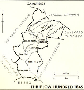
In the Saxon and early Medieval periods, Trumpington was in the boundary zone between Mercia and the Angles. The administrative structure within the county became more established in the 10th century when parishes were named and grouped into Hundreds and nucleated villages began to develop. Trumpington is one of a number of parishes to the south of Cambridge with names that are probably formed from a personal name and ‘ton’ (‘Farm/settlement connected with *Trump(a)’.; -ingtūn (Old English) A settlement called after, or connected with).

Map of the Thriplow Hundred. From The Victoria History of the Counties of England (1982). A History of Cambridgeshire and the Isle of Ely, Volume VIII. Armingford and Thriplow Hundreds. Page 253.

Medieval, c. 1000 – c. 1500 AD

In the Domesday book, Trumpington consisted of 37 households (about 185 people including 33 peasants and 4 slaves).

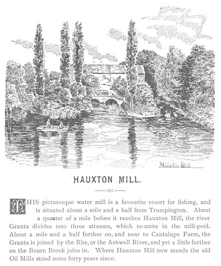
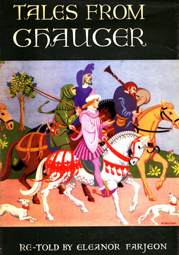
There were a number of water mills along this part of the river, including one at Hauxton Mill and another at Byron’s Pool. The Domesday book refers to a mill held by William de Warenne. Geoffrey Chaucer’s Reeve’s Tale is based on the local mills, opening with “There was once a miller whose mill stood by the brook at Trumpington”.

Hauxton Mill, 1892. Illustration by John S. Clarke, in An Artist's Rambles in Cambridgeshire: a Series of Sketches. Source: Cambridgeshire Collection.
Hauxton Mill, 1892. Illustration by John S. Clarke, in An Artist’s Rambles in Cambridgeshire: a Series of Sketches. Source: Cambridgeshire Collection.
Front cover of Tales from Chaucer, Eleanor Farjeon, 1959.

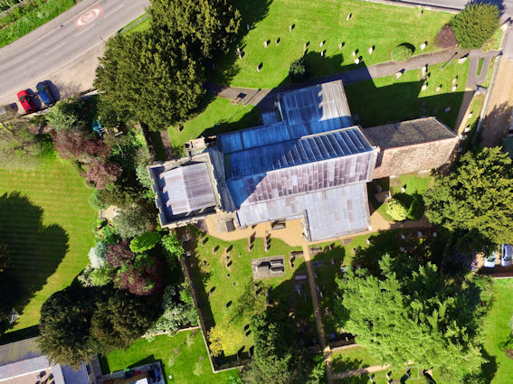
The current church building dates from c. 1200 AD, with its cemetery enclosed by a curved boundary, in the centre of the village and close to the north-south and east-west roads. Jo Sear gave us a history of the Medieval church at our meeting in November 2023.

Aerial photograph of Trumpington Parish Church and churchyard, vertical perspective. Photo: Jo Sear, 2018.

1500s-1700s

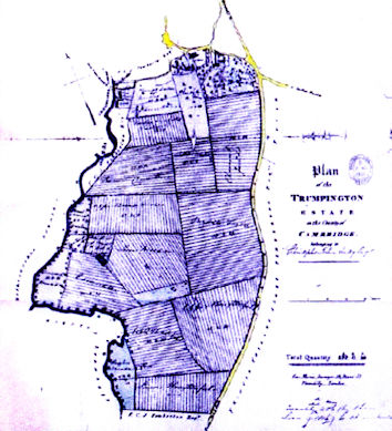
The Domesday Book refers to four manors in Trumpington. One of them, then called Crouchmans or Huntingdons, evolved into what we now think of as ‘Anstey Hall’, including manorial land and an early manor house on the site of the current hall. There was another manor with its house near the river crossing, which was incorporated into the Anstey Hall holdings in 1667.

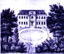
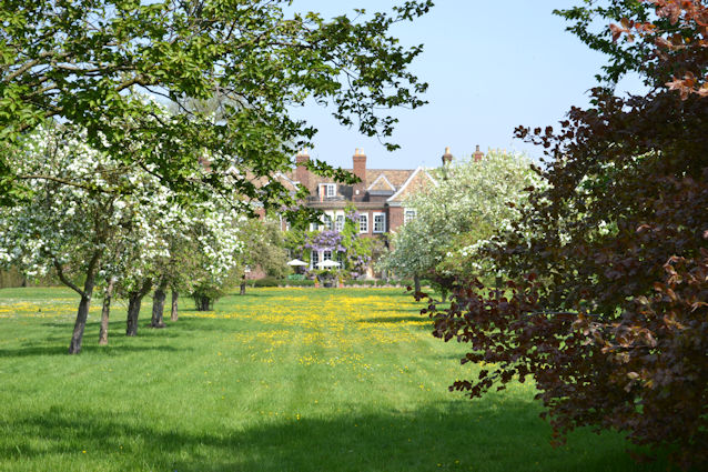
The manor now known as Anstey Hall descended through a number of families until it was purchased by James Thompson in 1637. It then remained in the Thompson family until 1748, when it was acquired by Dr Christopher Anstey. In the 1660s hearth tax records, the hall was listed with 13 hearths or fireplaces. The hall was rebuilt on the same site at around this time and then re-cased in red brick.

Anstey Hall. Illustration in Plan of the Trumpington Estate in the County of Cambridge, 1829. Anstey Hall and estate sales plan. Included in Fairbairn, James (2015). Anstey Fall Farm. Historic Building Survey. September 2015. Oxford Archaeology East. Report 1802. Figure 5, page 37.
The south front of Anstey Hall. Photo: Andrew Roberts, 27 September 2009.

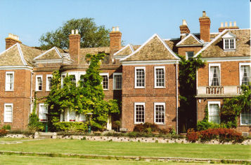
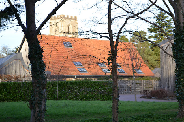
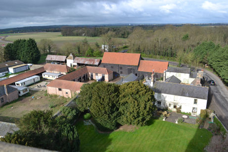
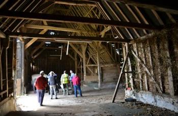
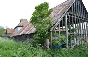
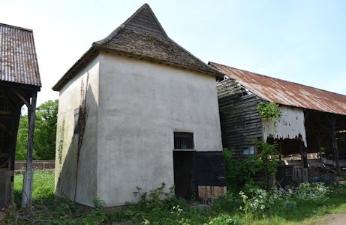
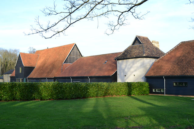
The Anstey Hall Estate included the hall, farm and farmland. Anstey Hall Farm is to the west of the church. The farmhouse and outbuildings date from the 1600s or earlier, including a dovecote and threshing barn. When we visited the archaeological site in 2015, we saw the interior of the farm buildings before work began on their renovation as the basis for the ‘Anstey Hall Barns’ housing development.

Looking from Trumpington church tower south west over Anstey Hall Farm towards Byron’s Pool, with Trumpington Meadows park to the left and the grounds of Trumpington Hall to the right, towards Haslingfield. Photo: Andrew Roberts, 7 April 2012.
Looking from Trumpington church tower south over the outbuildings of Anstey Hall Farm, across Trumpington Meadows, with the field examined during the archaeology excavation in the foreground, the first homes to the left, the John Lewis building, the area for the primary school and the higher part of the park, towards the motorway and Hauxton. Photo: Andrew Roberts, 7 April 2012.
The interior of the main barn, Anstey Hall Farm. Photo: Andrew Roberts, 10 May 2015.
The barns and dovecote at Anstey Hall Farm. Photo: Andrew Roberts, 10 May 2015.
The dovecote, Anstey Hall Farm. Photo: Andrew Roberts, 10 May 2015.
Anstey Hall Barns, including the renovated dovecote. Photo: Andrew Roberts, 1 February 2024.

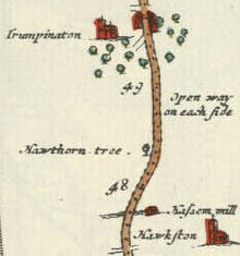
The road from the south to the village became increasingly important in the 1600s, as part of the route between London and Cambridge and King’s Lynn. In 1675, John Ogilby published Britannia, with strip maps showing routes from one part of the country to another. Route 43 from Puckridge to Cambridge and King’s Lynn includes the journey through Trumpington. Approaching from the south, the road goes past ‘Hawkston’, ‘Has… mill’ and a ‘hawthorn tree’ with an ‘open way on each side’.

Extract from Route 43 in Britannia, Volume the First, or an Illustration of the Kingdom of England and Dominion of Wales: by a Geographical and Historical Description of the Principal Road Thereof, 1675. (Ogilby’s Britannia, 1675).
Looking north along Hauxton Road from near the M11 roundabout. Photo: Andrew Roberts, 24 February 2024.

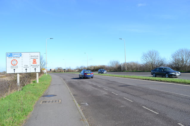
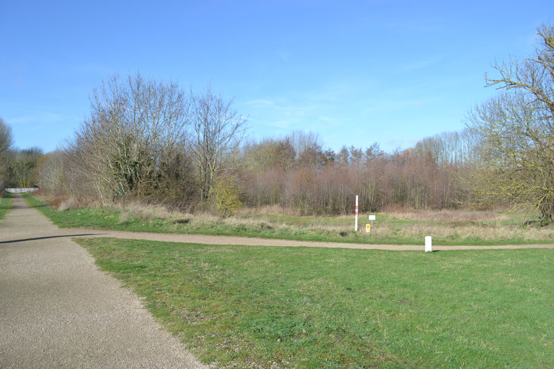
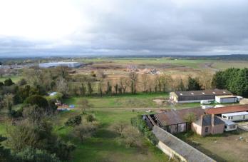
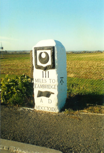
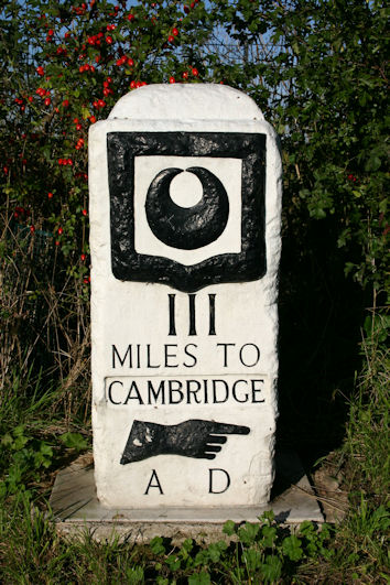
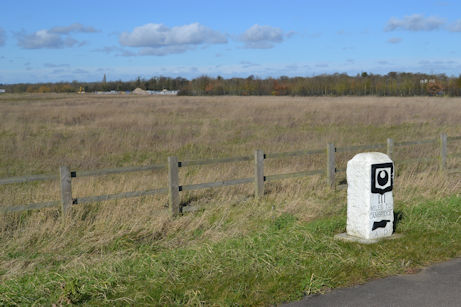
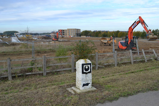
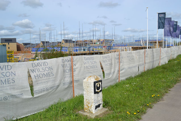
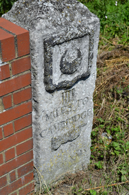
The Fowlmere to Cambridge Turnpike Road was constructed in 1724-25, with a series of milestones added in 1728. The third milestone from Great St Mary’s Church is now at the junction of Hauxton Road, Addenbrooke’s Road and Osprey Drive. The milestone was in countryside until the construction of the Park & Ride site and then the approval of the Trumpington Meadows development, when it was slightly reposition and renovated in 2011.

The third milestone on Hauxton Road, before the growth of the hedgerow, c. 1996. Photo: Ken Fletcher.
The third milestone on Hauxton Road, July 2007. Photo: Arthur Brookes.
The third milestone on Hauxton Road before it was removed in preparation for road widening, with the slip road into the Park & Ride site and the John Lewis building in the distance. Photo: Andrew Roberts, 27 June 2008.
The third milestone after its repositioning on Hauxton Road, looking towards the Park & Ride site. Photo: Andrew Roberts, 4 May 2011.
Howard Slatter, Professor Sir Roy Calne and Ken Fletcher at the unveiling of the renovated third Trinity Hall milestone. Photo: Andrew Roberts, 26 May 2011.

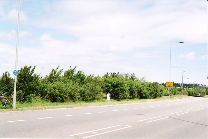
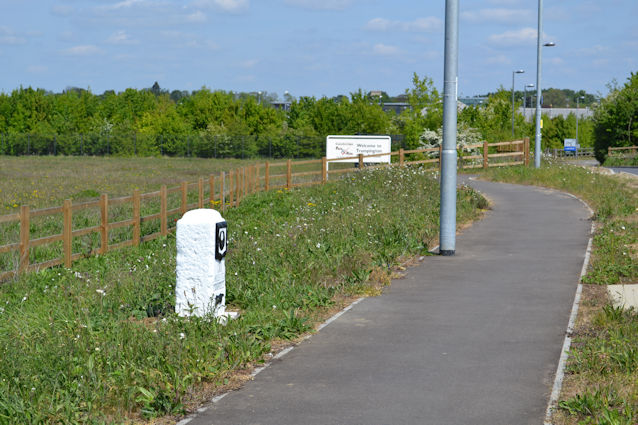
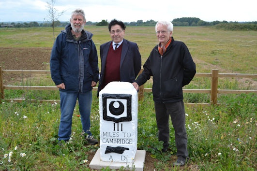
Since the repositioning in 2011, the milestone has been a useful marker while there has been construction work nearby on the Trumpington Meadows development.

The land to be used for the final phases of the Trumpington Meadows development, with the third milestone, at the Hauxton Road junction. Photo: Andrew Roberts, 4 March 2016.
Further stages of development at Trumpington Meadows, from Hauxton Road beside the third milestone. Photo: Andrew Roberts, 23 October 2019.
Progress with homes on Anchor Road, Trumpington Meadows, from the third milestone on Hauxton Road. Photo: Andrew Roberts, 18 April 2022.
Anchor Road and the third milestone from the Hauxton Road junction, Trumpington Meadows. Photo: Andrew Roberts, 23 December 2023.

The fourth milestone is in the road verge on the A10, beside the Hauxton Mill river crossing. This would have been at the southern end of Trumpington parish when the milestone was erected.

The fourth Trinity Hall milestone, beside the A10 and the river bridge at Hauxton Mill. Photo: Andrew Roberts, 26 June 2011.

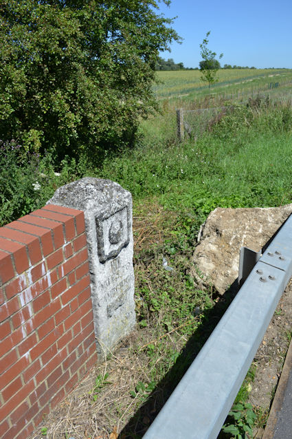
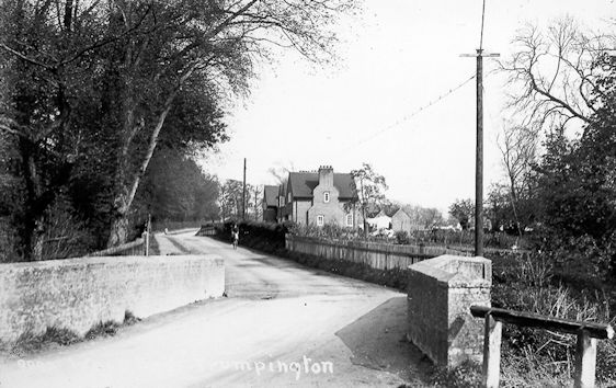
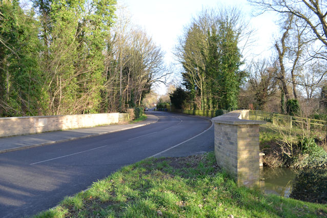
The road from Trumpington to Grantchester crossed the river at a ford until 1790 when the original Brasley Bridge was constructed. The bridge was rebuilt in 1952 and again in 2015.

Brasley Bridge, Grantchester Road, thought to be in the 1920s. Cambridgeshire Collection. Source: Stephen Brown.
Brasley Bridge, Grantchester Road, looking towards Wood End Cottages. Photo: Andrew Roberts, 1 February 2024.

1800s-1900s

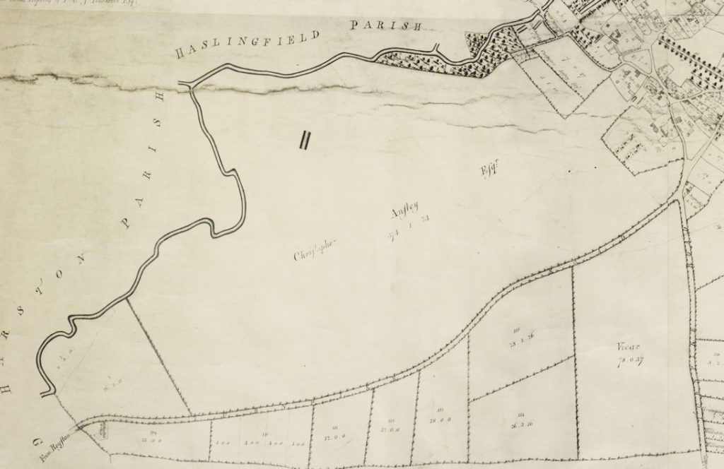
The inclosure of the parish was instigated by F.C.J. Pemberton in 1801. In the Inclosure Award, Christopher Anstey was allocated 378 acres (c. 20% of the parish). This included most of the land in the south west area, apart from the southernmost fields and land along the river that was awarded to F.C.J. Pemberton and now forms the woodland beside the river at Byron’s Pool.

Anstey Hall and Anstey Hall Farm continued to be owned as a single unit until the late 1930s. The Estate was put up for sale in 1829 and 1837 and purchased by Ebenezer Foster in 1838. The Fosters had tenant farmers, who probably grew wheat, barley, oats, fodder roots for livestock, possibly a few potatoes, plus a significant livestock enterprise as one third of the farm was down to grass or clover pastures. The Estate remained in the Foster family until c. 1938, when the farm and farmland were sold to Henry Parsons, who was the tenant farmer.

Extract from A Map of the Parish of Trumpington in the County of Cambridge, 1804. Cambridgeshire Archives, R60/24/2/70(a).
Plan of the Trumpington Estate in the County of Cambridge, 1837. Anstey Hall estate sales plan. Included in Fairbairn, James (2015). Anstey Fall Farm. Historic Building Survey. September 2015. Oxford Archaeology East. Report 1802. Figure 6, page 37.

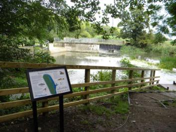
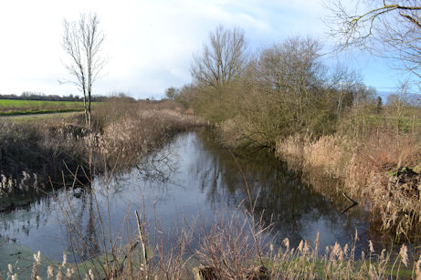
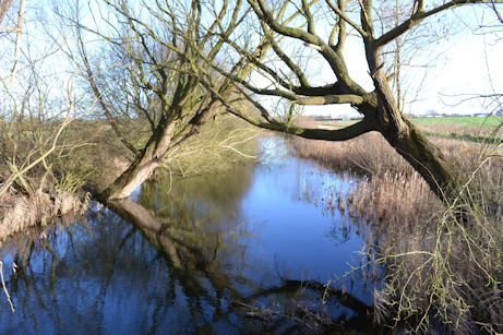
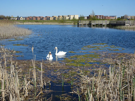
There was a mill and pool along this part of the river, where Lord Byron is said to have swum, c. 1805 (now called Byron’s Pool). The weir at this location was reconstructed in c. 1949. The area included fish ponds, presumably used by Trumpington Hall. The fish pass to avoid the weir was improved in 2011 and the fish ponds can still be seen today.

Byron’s Pool, photograph by R.E. Ruh, c. 1934. Cambridgeshire Collection (stop 4).
W.I. report on The Countryside, 1970: By Shank's Pony, photograph of Byron's Pool. Trumpington Women’s Institute Archive.
W.I. report on The Countryside, 1970: By Shank’s Pony, photograph of Byron’s Pool. Trumpington Women’s Institute Archive.
Byron’s Pool and the outflow of the fish pass, during the opening of the fish pass, 25 August 2011. Photo: Ellis Selway.
Fish ponds near Byron’s Pool. Photo: Andrew Roberts, 24 February 2024.

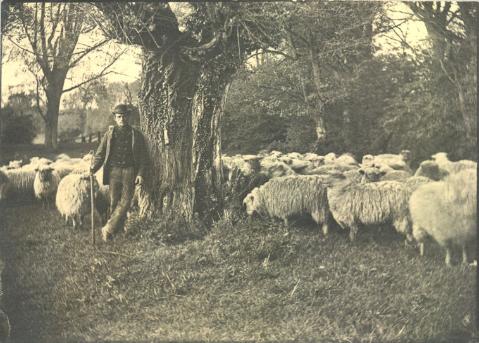
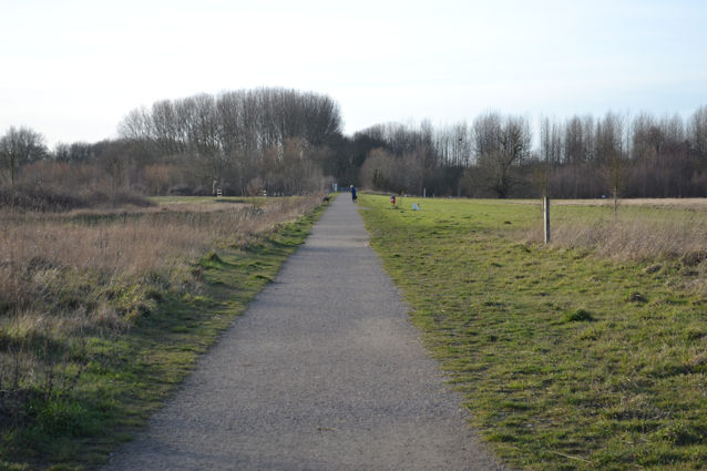
In 1862, the farmland was cut by the Cambridge-Bedford railway, running in a straight line from Hauxton Road to a bridge over the river. Michael Hendy talked about the farming history in 2016 when he said that there was a single crossing over the railway and this restriction may have encouraged the building of the ‘Shepherd’s Cottage’, as it is likely that the majority of the grazing land was south of the railway. Today, there is a small copse marking the location of the cottage. One of the local shepherds was photographed with his sheep by the river in the 1890s. The railway closed in 1968 and the track was removed, as was the bridge. Part of the railway route is now one of the main paths across the country park, from Mardler Close to the river. In commemoration of the railway and the shepherd’s cottage, the green corridor from Osprey Drive to the Country Park (between Mardler Close and Britannia Walk) is called Railway Green and the green corridor from Osprey Drive to the Country Park (between Oxbow Place and Jupiter Way) is called Shepherd’s Way.

Shepherd and flock on Pemberton’s side of the Byron’s Pool stream, c. 1885, by L. Cobbett. Photograph: Cambridgeshire Collection. The shepherd may be Ellis Matthews.
The copse marking the former location of the Shepherd’s cottage. Photo: Andrew Roberts, 24 February 2024.
Looking along Mardler Close, on the alignment of the old railway, with Railway Green to the left, near the area where Neolithic to Iron Age finds were identified during the archaeological excavation. Photo: Andrew Roberts, 1 February 2024.
Looking along the route of the old railway towards the river, Trumpington Meadows Country Park. Photo: Andrew Roberts, 1 February 2024.

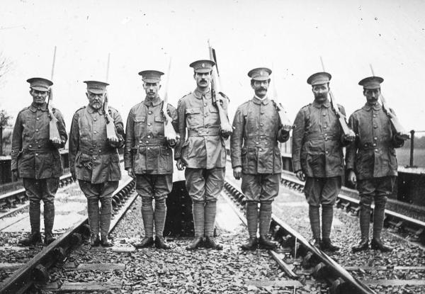
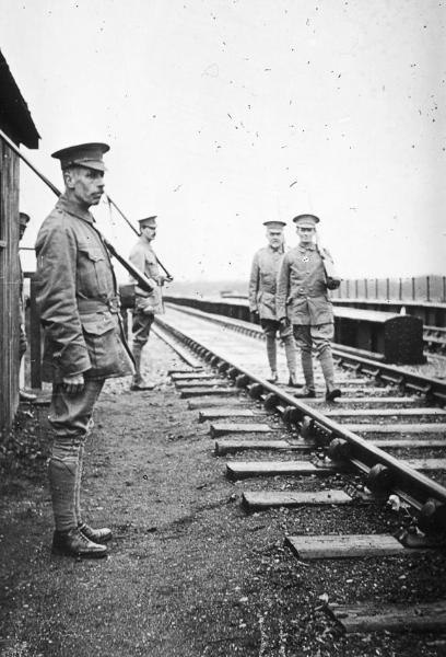
During World War 1, the local Volunteer Training Corps guarded the river bridge. They were photographed on the railway line, standing to attention.

Trumpington Volunteer Training Corps standing at attention, guarding the railway line “Somewhere in Cambs.”, November 1915. Percy Robinson Collection.
Trumpington Volunteer Training Corps guarding the railway line over the river bridge “Somewhere in Cambs.”, November 1915. Percy Robinson collection.
Looking along the route of the old railway towards the site of the river bridge, Trumpington Meadows Country Park. Photo: Andrew Roberts, 1 February 2024.
Looking from the site of the river bridge along the route of the old railway, Trumpington Meadows Country Park. Photo: Andrew Roberts, 1 February 2024.

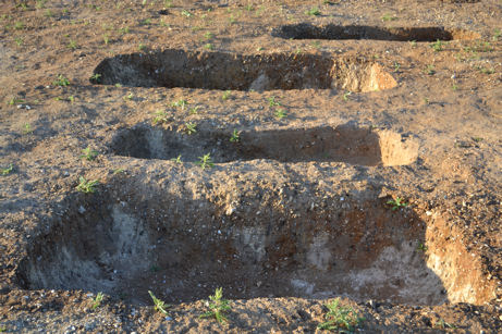
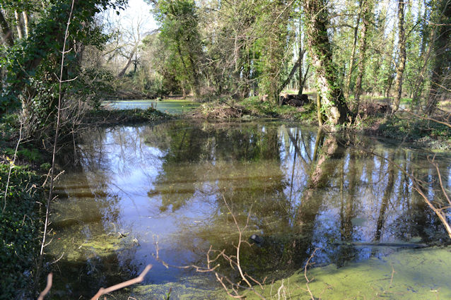
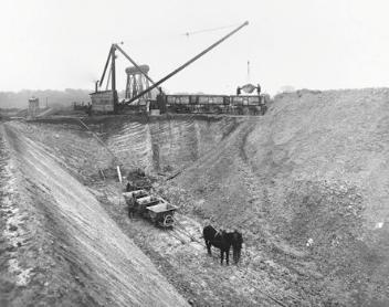
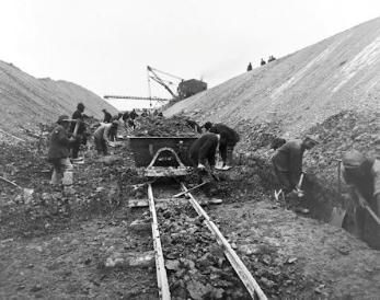
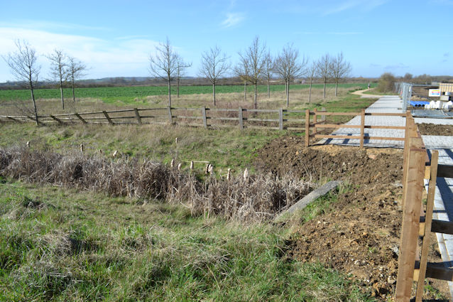
From the 1860s and during World War 1 in 1914-18, there were attempts to excavate coprolites from the land. Coprolites are phosphatic nodules which are the fossilised remains of animals. They are found in narrow horizons in Cretaceous rocks and can be used as fertiliser or for munitions. You can still see the evidence of the war-time coprolite pits, now full of water and lined by shrubs and trees, in the Country Park over the M11 agricultural bridge.

Coprolite digging in Trumpington during World War I, deep pit and trucks, c. 1917-18. Photo: Courtesy of Henry Boot and Son.
Coprolite digging in Trumpington during World War I, hand loading coprolites into trucks, c. 1917-18. Photo: Courtesy of Henry Boot and Son.
Looking north east over Anstey Hall farm towards Trumpington village, with the World War 1 coprolite workings and channels in foreground lower left, shepherd’s cottage and World War 2 Prisoner of War Camp centre right, Hauxton Road to the right and crossed in the distance by the Cambridge-Bedford railway. Cambridge University Collection of Aerial Photographs, EW4, 3 June 1950.
The eastern end of the coprolite pond, Trumpington Meadows Country Park. Photo: Andrew Roberts, 7 February 2016.
The western end of the coprolite pond, Trumpington Meadows Country Park. Photo: Andrew Roberts, 7 February 2016.

In the late 1920s and 1930s, there was ribbon development of housing along Hauxton Road, mainly between the junction with Shelford Road and the railway cutting.

In 1934, the core of Trumpington parish was transferred into the borough of Cambridge, while 382 acres of “virtually uninhabited” land in the south west part of the parish was transferred to Haslingfield parish. This administrative division between what became Cambridge City Council and South Cambridgeshire District Council (Haslingfield parish) continued until 2017.

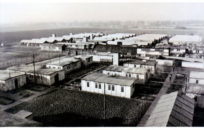
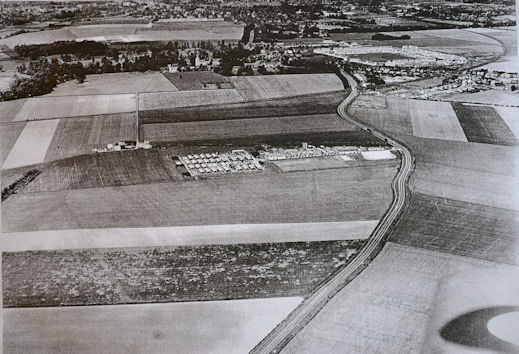
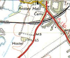
In the 1940s during World War 2, a Prisoner of War (PoW) Camp was built in the fields near the third milestone. The buildings continued in use as a hostel into the early 1950s. This was in the area immediately to the south of Osprey Drive, between the shepherd’s cottage copse and Hauxton Road.

Trumpington Prisoner of War Camp, 1940s, looking west from Hauxton Road. Brother Herbert Kaden.
Aerial photograph from the south of Anstey Hall farm (later the Plant Breeding Institute (PBI) site), including Hauxton Road, the PoW Camp, shepherd's cottage, village centre and the new housing estate, c. 1950. Source: Michael Hendy.
Aerial photograph from the south of Anstey Hall farm (later the Plant Breeding Institute (PBI) site), including Hauxton Road, the PoW Camp, shepherd’s cottage, village centre and the new housing estate, c. 1950. Source: Michael Hendy.
Ordnance Survey map, 1954, PoW camp marked as 'Hostel'.
Ordnance Survey map, 1954, PoW camp marked as ‘Hostel’.
Looking from Hauxton Road across the former location of the Prisoner of War (PoW) camp. Photo: Andrew Roberts, 24 February 2024.

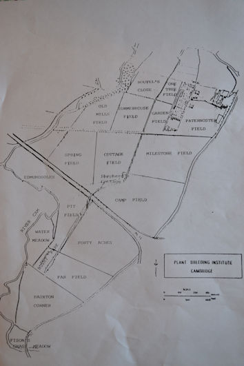
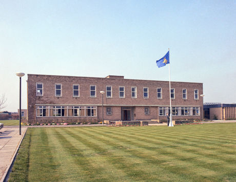
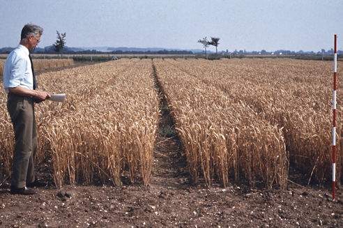
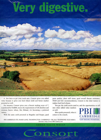
The Parsons family or their relations had farmed the land from the 1870s. The farmland and hall continued to be owned by the Foster family to 1941, when Anstey Hall was purchased by the Government and used as offices during the War. From 1950, the Plant Breeding Institute (PBI/Monsanto), took over most of the farmland, while the Parsons family continued to farm parts of the land and live in the farmhouse which they purchased in 1971. PBI was an important agricultural research centre which developed many varieties of crop, including wheat and potatoes. John de Bruyne purchased the Hall from the Government in 1998.

Map with Plant Breeding Insitute (PBI) field pattern and field names. Source: Michael Hendy.
Aerial photograph of the Plant Breeding Institute (PBI) site, 1975: detail of land including the former railway line, PBI buildings, to Hauxton Road. Source: Michael Hendy.
The front entrance to the Plant Breeding Institute headquarters building in Trumpington, Cambridge. Source: Plant Breeding Institute.
Growing semi-dwarf wheats at the Plant Breeding Institute (PBI), with Dr Francis Lupton. Source: Plant Breeding Institute, John Innes Archive.
Advertisement for Consort wheat. Source: Plant Breeding International Cambridge.

In 1949, the weir at Byron’s Pool was reconstructed.

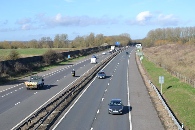
The next major impact on the area was the construction of the M11 motorway from 1977-80, including a new river bridge, the junction on the A10 and an agricultural bridge within the PBI land. In 2024, the agricultural bridge was in use as a footbridge and cycle route and was due to become part of the busway between the South West Travel Hub and the Park & Ride site.

Aerial photograph of the Plant Breeding Institute (PBI) site, 1978: detail of M11 construction and the spoil being spread near the river. Source: Michael Hendy.
Work on the M11 across the PBI land, Plant Breeding Institute, 1978. Source: Plant Breeding Institute, negative number 12845, Michael Hendy.
Flooded fields, with the M11 river bridge being constructed, Plant Breeding Institute, May 1978. Source: Plant Breeding Institute, negative number 12801, Michael Hendy.
The eastern approach to the agricultural bridge over the M11. Photo: Andrew Roberts, 24 February 2024.
Looking north along the M11 from the agricultural bridge. Photo: Andrew Roberts, 24 February 2024.

2000s

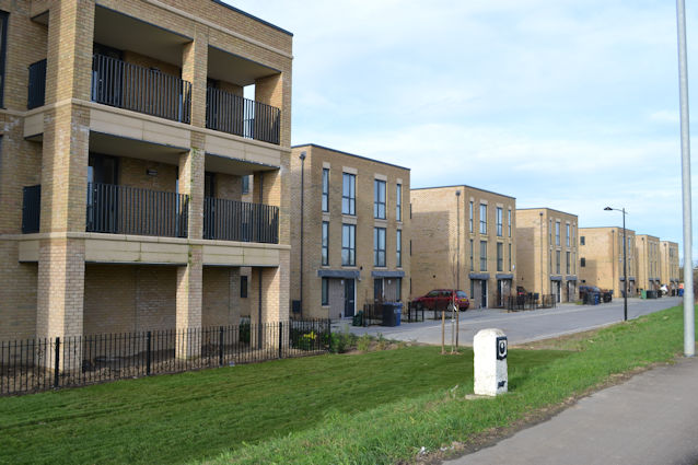
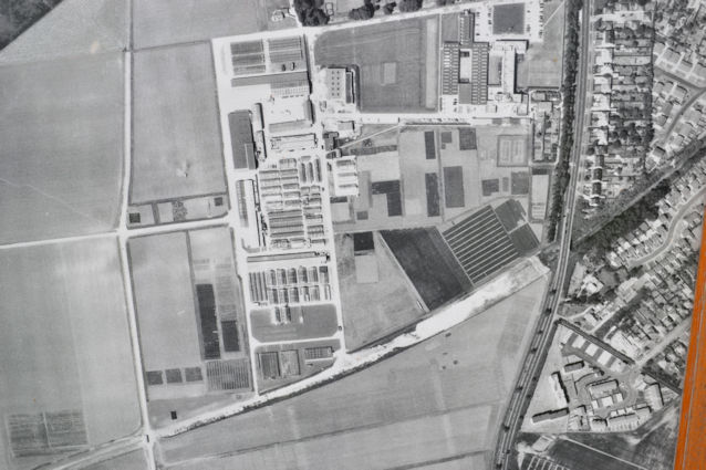
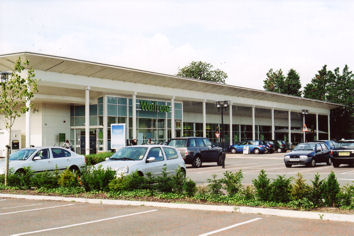
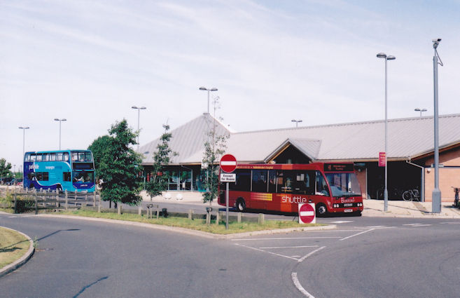
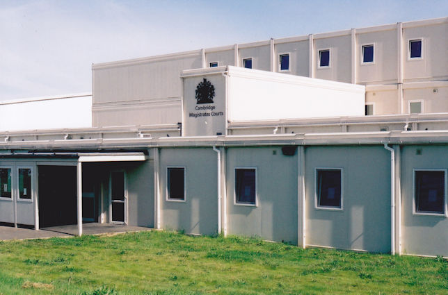
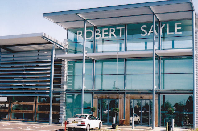
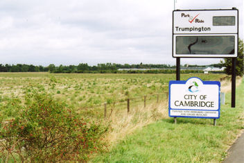
The Plant Breeding Institute was privatised in 1987 and purchased by Unilever plc and continued as ‘Plant Breeding International Cambridge’ (PBIC). In 1998, this was sold to Monsanto and by the early 2000s crop breeding had ended and the land was sold for development. As the area close to the village had been used for commercial purposes, it was categorised as ‘brownfield’ land rather than being part of the Green Belt. This was followed in the early 2000s by the use of land for Waitrose, the Park & Ride site, temporary Magistrates Courts and the Robert Sayle (John Lewis) building.

The Waitrose store, Hauxton Road, Trumpington. Photo: Andrew Roberts, 13 August 2008.
Trumpington Park & Ride site, with a P&R bus and an Addenbrooke’s shuttle. Photo: Andrew Roberts, August 2007.
The temporary Magistrates Courts, adjacent to the Park & Ride site (used while the city centre courts were being reconstructed). Photo: Andrew Roberts, August 2007.
Robert Sayle (John Lewis) service building, adjacent to the Park & Ride site. Photo: Andrew Roberts, August 2007.

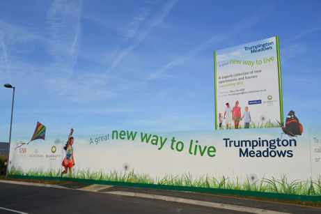
The former Anstey Hall farm (Plant Breeding Institute) land was purchased by a partnership between Grosvenor and the Universities Superannuation Service (USS) in 2004. When a new Local Plan was approved by the City Council in 2006, part of the land was allocated for housing. The development was given the name ‘Trumpington Meadows’ by Grosvenor.
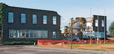
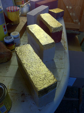
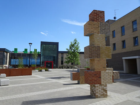
Trumpington Meadows Combined Masterplan, June 2007. Source: Grosvenor.
Looking across the former PBI/Monsanto fields towards the Trumpington Park & Ride site and Trumpington Church, from the M11 roundabout. Photo: Andrew Roberts, August 2007.
The Trumpington Meadows site, looking across the former PBI fields towards the Park & Ride site, with signs for Cambridge and the P&R site. Photo: Andrew Roberts, 20 September 2007.

The developed received outline planning permission from Cambridge City Council and South Cambridgeshire District Council in October 2009. The site was cleared of the PBI buildings, including the headquarters and extensive greenhouses. One of the public art projects has placed golden bricks in the walls of homes, to mark the footprint of the PBI buildings.

Demolition of the main building of the former Plant Breeding Institute in Trumpington, Cambridge, March 2009. Photo: Stephen Brown.
A group of golden bricks in the studio, to be installed in the exterior walls of homes that are built on the line of demolished PBI buildings. Photo: Caroline Wright, 2 February 2012.
Preparing to place one of the golden bricks on a Trumpington Meadows home, marking the layout of the PBI site, with Caroline Wright, April 2012. Photo: Nick Milne, Cambridge City Council.

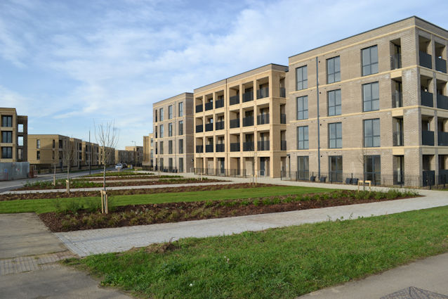
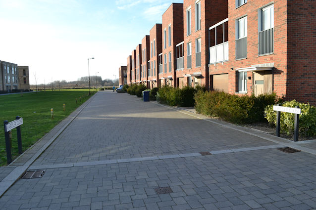
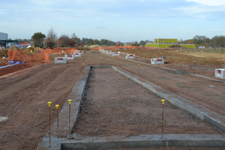
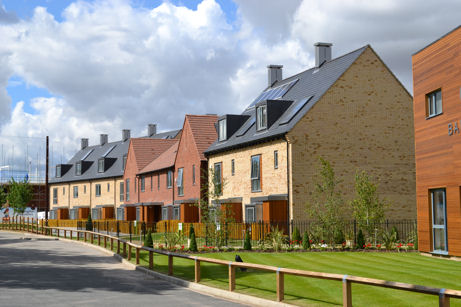
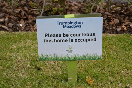
Work began on the infrastructure and the construction of 1200 homes on Trumpington Meadows in 2010. Barratt Homes was responsible for the majority of homes completed in the main phases of work, with David Wilson Homes becoming responsible for construction in later phases. 40% of the homes are so-called affordable housing, developed by BPHA (the Bedfordshire Pilgrims Housing Association). Building work was completed in spring 2024.

Construction work on the Trumpington Meadows access road from the Hauxton Road junction, with the John Lewis building to the left. Photo: Andrew Roberts, 24 November 2011.
Marketing signs for the Barratt Homes development at Trumpington Meadows, at the road to the John Lewis building. Photo: Andrew Roberts, 10 December 2011.
Construction work on the Trumpington Meadows access road from the Hauxton Road junction, with the John Lewis building to the left. Photo: Andrew Roberts, 24 November 2011.
The first homes nearing completion on Trumpington Meadows, Spring Drive, off Hauxton Road. Photo: Andrew Roberts, 29 July 2012.
‘Home occupied’ sign on Spring Drive, Trumpington Meadows. Photo: Andrew Roberts, 18 October 2012.

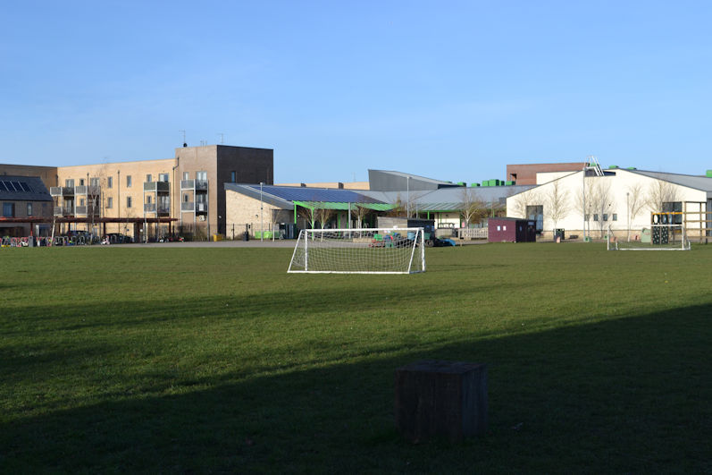
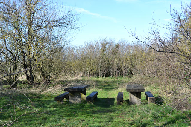
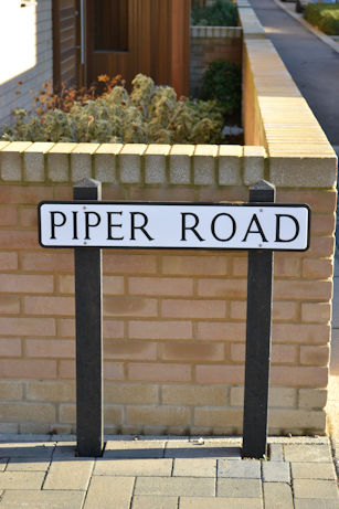
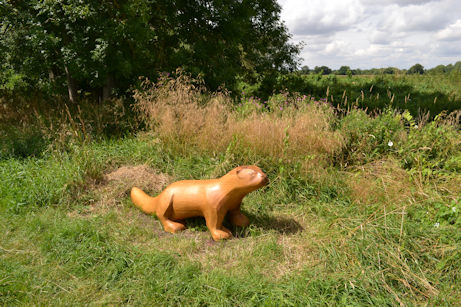
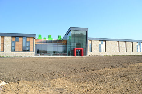
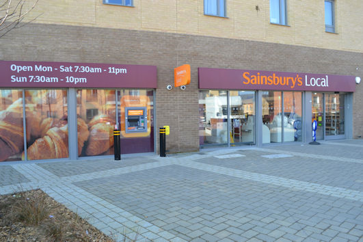
The Trumpington Meadows development includes: an internal road network, with street names based on PBI field names and crop names, proposed by Stephen Brown on behalf of the Local History Group and Residents’ Association; 1200 homes; Trumpington Meadows Country Park/Nature Reserve (Wildlife Trust); local play areas; Trumpington Meadows Primary School, part of the Trumpington Federation with Fawcett Primary School, with community rooms; a local centre with a few shops; and public art features including the Hopscotch artwork in the local centre.

Piper Road street sign at the Consort Avenue junction, Trumpington Meadows. Photo: Andrew Roberts, 6 December 2014.
Cowslips in Trumpington Meadows Country Park. Photo: Andrew Roberts, 12 May 2016.
Swans on the pond, Trumpington Meadows Country Park. Photo: Andrew Roberts, 23 April 2021.
Wood carving of an otter in Trumpington Meadows Country Park. Photo: Andrew Roberts, 30 July 2016.
The frontage of Trumpington Meadows school, shortly after the handover from the builders. Photo: Andrew Roberts, 8 July 2013.
The square in front of Trumpington Meadows Primary School on Osprey Drive, with the Sainsbury's Local store. Photo: Andrew Roberts, 24 February 2019.
The square in front of Trumpington Meadows Primary School on Osprey Drive, with the Sainsbury’s Local store. Photo: Andrew Roberts, 24 February 2019.
Hopscotch artwork, by Keith Wilson, in the local centre in front of Trumpington Meadows Primary School. Photo: Andrew Roberts, 22 May 2020.

In 2017, the Haslingfield parish boundary was revised by South Cambridgeshire District Council. South Trumpington parish was established for the area between the City boundary and the M11, while the land to the south of the M11 was incorporated in Harston parish. From 2017, the overall area of Trumpington Meadows has therefore been divided between Cambridge City Council and South Cambridgeshire District Council (South Trumpington parish). South Trumpington parish is administered by a parish meeting.

South Trumpington parish boundary. Source: South Trumpington Parish Meeting, July 2022.

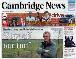
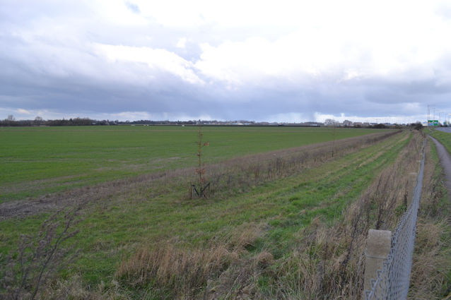
Since the approval of the Trumpington Meadows development, there have been a number of further proposals which would have a major impact on the Green Belt to the north and south of the M11. In the 2010s, Grosvenor put forward planning applications for a football stadium for Cambridge United then a Sporting Village with 700 more homes, in the gap between the approved development and the M11, both against the Local Plans and withdrawn before they came to the Planning Committee. The County Council has plans for a Travel Hub (a second park & ride site) on land immediately to the south west of the motorway, with a link road to the original Park & Ride site, and this development is expected to proceed from 2025. There are also proposals for a retirement development in the grounds of Anstey Hall, with a revised application before the Planning Committee in 2024.

“Stay off our turf”, Andrew Roberts protesting on behalf of Trumpington residents about the threat to construct a football stadium. News items in Cambridge News, 30 December 2011.
Looking from Hauxton Road across the field that may be used as a Park & Ride site, near M11 Junction 11. Photo: Andrew Roberts, 15 February 2016.
The grounds to the rear of Anstey Hall. Photo: Andrew Roberts, 12 May 2016.

In early 2024, the construction of the Trumpington Meadows development was nearly complete, with the final homes being finished and the spine road open at last. It was good to be reaching the end of building work, with the community becoming well established as an integral part of Trumpington, with its school, park, play areas, shops and other facilities of benefit to all of Trumpington.

Looking along Osprey Drive from the Hauxton Road junction, Trumpington Meadows. Photo: Andrew Roberts, 23 December 2023.